Hanoi and the Northeast · Hai Phong
Cat Ba Island and Lan Ha Bay: kayaking, park hikes, how to get there
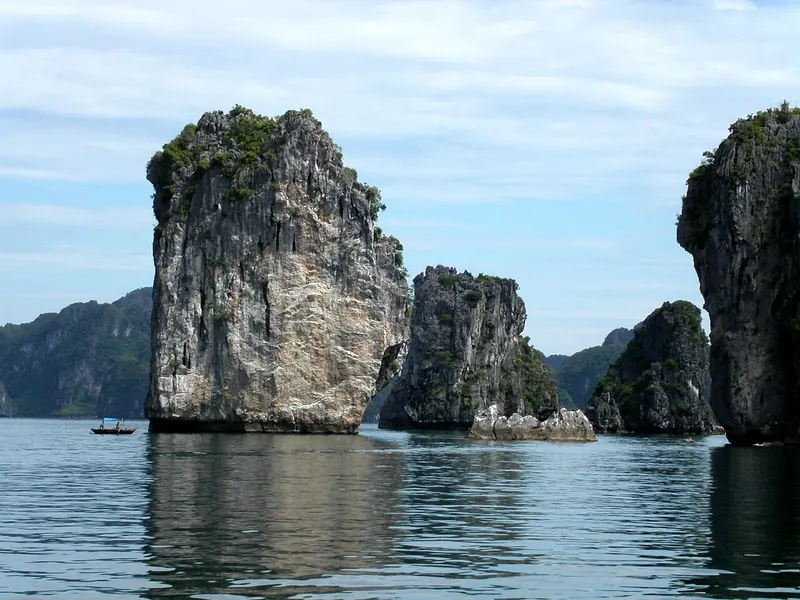
Cat Ba is the largest island of the Cat Ba Archipelago, the Hai Phong part of the Ha Long Bay – Cat Ba Archipelago World Heritage site inscribed by UNESCO in 2023. Many travellers see these karsts only from the deck of a Ha Long cruise. Sleeping on Cat Ba gives you a different trip: mornings on the water in Lan Ha Bay, which lies off the island's east side with more than 400 islands, and afternoons in a national park that the park itself calls the only place in the world where the Cat Ba langur still survives in the wild.
- Suggested time
- 2–3 nights
- Where to stay
- Cat Ba Town (harbour and Cat Co beaches); a homestay in Viet Hai village for a quieter night
- Season and timing
- The national tourism site describes the Ha Long – Cat Ba area as cool and clear from September to November, misty from December to March, sunny in April and May and unpredictable in the June-to-August monsoon. Summer is also Cat Ba's domestic peak: July 2026 brought more than 875,000 visitors.
The short answer
Give Cat Ba two or three nights. Sleep in Cat Ba Town, near the harbour and the Cat Co beaches, so boats from the town and Ben Beo pier are a short ride away. Spend one day on a Lan Ha Bay boat that includes kayaking and swimming, and one on the national park: the 1.5-kilometre Kim Giao – Ngu Lam – Trung Trang route if you have a morning, the long Frog Pond (Ao Ech) – Viet Hai trek with a guide if you have a full day. Get there from Hai Phong by the Dong Bai – Cai Vieng ferry or the cable car to Phu Long, or arrive by boat from Ha Long on one of the shared routes opened in 2026. Avoid summer weekends and holidays if you want the bay quiet.
Why stay on the island instead of passing on a cruise
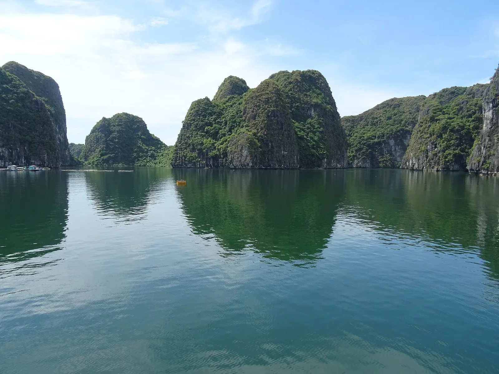
Cat Ba is not a stop on the way through Ha Long Bay but a base in its own right. The national park's overview puts the island about 45 kilometres east of Hai Phong, about 25 kilometres south of Ha Long City and about 150 kilometres southeast of Hanoi. Hai Phong's city newspaper describes Lan Ha Bay, off the east side of the island, as having more than 400 islands and a quieter, calmer character than Ha Long Bay, suited to gentle stays and exploring by kayak.
What a night or two on land adds is choice. From the town you can take a half-day or full-day boat into Lan Ha Bay, walk a forest trail in the national park the next morning, eat seafood on the harbour in the evening and still catch the sunset from a viewpoint above town. A Ha Long cruise that only passes the archipelago gives you the view; the island gives you the forest, the villages and the time to wait for good weather.
Cat Ba Town is where nearly everything happens: the harbour, the hotels and restaurants, and the three Cat Co beaches next to it, which the city newspaper calls the signature of summer on the island. When we checked on 2026-10-03, the newspaper reported 351 accommodation establishments with 6,951 rooms in the Cat Hai special zone by July 2026, so outside summer weekends and public holidays there is plenty to choose from.
Lan Ha Bay by boat and kayak: what has changed
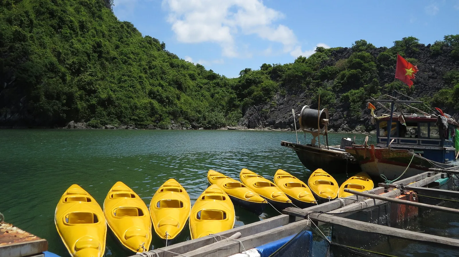
Kayaking is the reason many people come, and it has a recent history worth knowing. On 15 November 2024 the Cat Hai authorities stopped all kayak services on the bays of the Cat Ba archipelago, saying the activity had grown up informally without meeting legal operating conditions; Hai Phong's tourism department said kayaking would return once water-recreation zones were designated and licensed. By summer 2026, reports from the bay again showed kayaks and stand-up paddleboards in use around tour boats, and the city newspaper wrote that operators were building two- and three-day programmes combining caves, kayaking, swimming, fishing villages and nights on the bay.
The usual pattern, as described in June 2026, is a boat from Cat Ba Town or Ben Beo pier with lunch on board, then time to kayak or paddleboard and swim at stops set in the itinerary. Places that often appear include the Sang – Toi (Bright and Dark) caves, Van Boi, Monkey Island (Cat Dua) and Ba Trai Dao, but the exact stops depend on the weather, the tide and safety conditions on the day. Before you book, ask the operator whether kayaking is included, how long you actually spend on the water, which stops are planned and how many passengers the boat carries.
Lan Ha is not always empty. The same June 2026 report described one popular stop crowded with kayaks, paddleboards and swimmers on a summer day, and the bay recorded more than 740,000 visitors and overnight guests in the first seven months of 2026. For a quieter bay, go on a weekday, avoid Vietnamese holidays, and consider an overnight boat: the bay's management board told the city newspaper that overnight cruises have become Cat Ba's signature product, and the evening and early morning are the calmest hours.
Wear the life jacket you are given, stay close to the boat and do not swim in channels used by boats or in heavy rain or strong wind. Monkey Island, which the national tourism site places about a kilometre from Cat Ba Town and reachable only by boat, has beaches and trails; Hai Phong's city portal warns that the monkeys can be aggressive, so keep your distance.
- Half or full day from town: the simplest way to kayak; check the time on the water.
- Overnight on the bay: quieter evenings and mornings; check the cancellation terms for weather.
- From Ha Long: since late April 2026, routes VHL3 to VHL6 link Ha Long Bay and Lan Ha Bay; ask which one your boat follows.

Make time for the local food
What to eat and where to look
Tu hai (snout otter clam)
A large clam raised in the sheltered lagoons (tung and ang) of the archipelago. Hai Phong's city newspaper calls it Cat Ba's best-known speciality and the first thing visitors order, with crisp, sweet flesh.
- Where to look
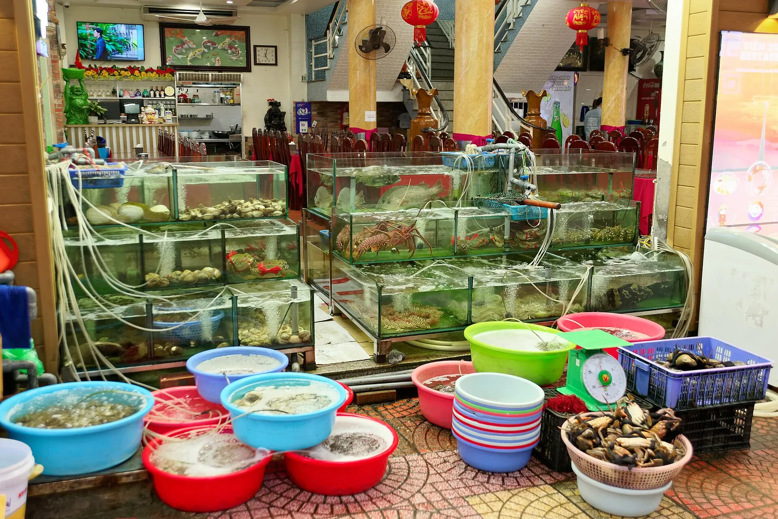
- Seafood restaurants on the harbour in Cat Ba Town and near Ben Beo, where the catch is kept alive in tanks.
- Fit it into your day
- The centrepiece of a shared seafood dinner after a day on the bay.
Shellfish. Prices are by weight: agree the price per kilogram and see the weight before it is cooked.
Be be (mantis shrimp)
Mantis shrimp, which the city newspaper lists among the island's signature seafood alongside clams, crab and oysters.
- Where to look
- The same live-seafood restaurants in Cat Ba Town; often on boat-trip menus too.
- Fit it into your day
- Order a plate to share alongside clams and fish.
Crustacean with a sharp, spiny shell; ask for it to be cut open if you are unsure how to eat it.
Farmed fish from the bay: grouper and cobia
Ca song (grouper) and ca gio (cobia) are among the fish the city newspaper names on Cat Ba menus; the bay is dotted with floating seafood farms, which some boat trips visit.
- Where to look
- Harbour restaurants in Cat Ba Town; some bay tours stop at fish farms.
- Fit it into your day
- Share one whole fish between several people at dinner rather than ordering one each.
Whole fish are sold by weight; confirm the price before it is killed and cooked.
Cat Ba National Park: choose the trail by the time you have
Cat Ba National Park was established on 31 March 1986 and now covers 17,362.96 hectares, of which 6,450.65 are sea, according to the park; it was the first park in Vietnam to protect both land and marine ecosystems, and it is the core of the Cat Ba Archipelago Biosphere Reserve. It is also home to the Cat Ba langur (golden-headed langur), which survives in the wild only here. Do not plan your day around seeing one. The national tourism site suggests hiking with a guide, who can explain the plants, animals and history of the island as you walk.
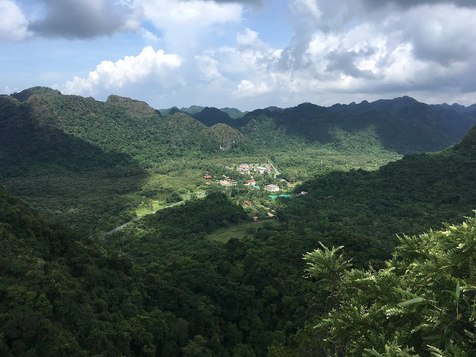
The park divides its walks into short routes of one to two hours and long treks of four to seven. The easiest is Kim Giao – Ngu Lam – Trung Trang, about 1.5 kilometres: it starts by a semi-wild enclosure where rescued animals such as green peafowl and sika deer are kept before release, climbs to Ngu Lam Peak (273 metres) for a view over the archipelago, passes through a forest of kim giao (Podocarpus neriifolius) and ends at Trung Trang Cave, which sheltered soldiers and residents during the American War. It fits into a morning.
With a full day and good fitness, the Frog Pond (Ao Ech) – Viet Hai trek, about 12 kilometres, crosses the heart of the forest to a seasonal pond that dries out in the dry season to leave a springy forest floor, and finishes in Viet Hai, an old village cut off by the hills. Other routes climb steeply from Ninh Tiep to Hai Quan Peak (259 metres), an old military lookout, or take you by kayak or boat through the Phu Long mangroves to Thien Long Cave. The park also lists night walks to watch reptiles, amphibians and insects on the May Bau – Frog Pond route.
When we checked on 2026-10-03, the park's fee notice, issued under Hai Phong People's Council Resolution 47/2025, listed 160,000 dong per adult for the whole park, 120,000 dong for the short Kim Giao – Ngu Lam – Trung Trang route, and 80,000 dong each for the Ninh Tiep – Tien Duc Cave route (including Hai Quan Peak) and the Phu Long – mangrove – Thien Long Cave route. Children aged 6 to 14, or taller than 1.2 metres, paid half; children under six or under 1.2 metres entered free. The park listed opening hours of 7:00 to 17:00.
Hospital Cave, Cannon Fort and Viet Hai village
Cat Ba's war history is close to the road. Hospital Cave, which the national tourism site calls the most interesting cave on the island, sheltered soldiers during the American War and keeps its medical rooms with their equipment; Hai Phong's city portal describes it as a three-level complex where the wounded were treated for more than ten years. The portal suggests that a visit takes about half an hour, and that a guide brings the history to life.
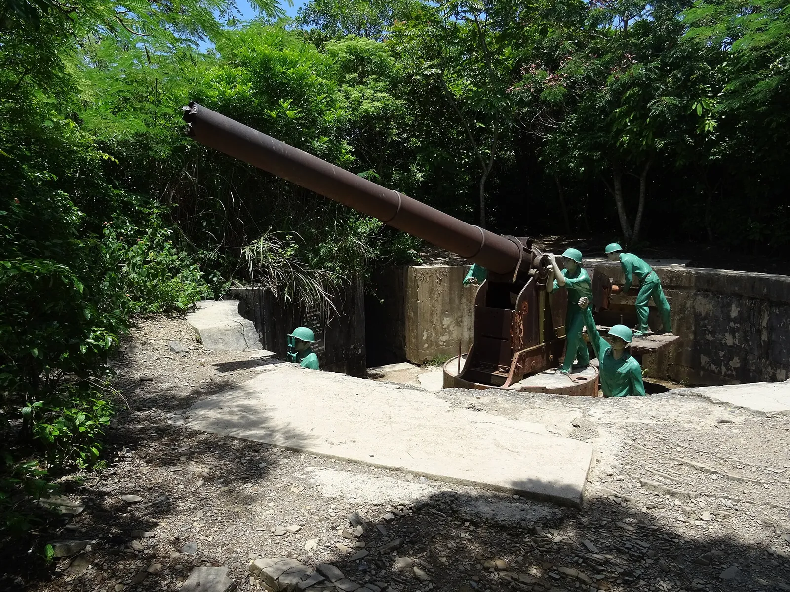
Cannon Fort sits on a 177-metre hilltop near the town. The city portal says the Japanese built tunnels and trenches linking its guns during the Second World War, and that Vietnamese forces later used it as a defensive post in the wars against the French and the Americans. Most people come for the view over the bay at sunset; go up a little before, so you have time to look at the gun emplacements in daylight.
Viet Hai lies deep in the forest. Hai Phong's city newspaper describes tiled houses, gardens and fish ponds, and suggests arriving by boat or on foot through the forest, then cycling around the village and eating a family meal. It is the natural end of the Frog Pond trek and a stop on some Lan Ha boat trips that combine the bay with the village. The park also promotes one- or two-night homestays in buffer-zone villages for travellers who want to stay longer.
To move around town, the Cat Hai authorities allow electric tourist carts to run from 5:00 to 23:00 on set roads in the Cat Ba tourist area; in 2026 their area was extended to the Ben Beo car park, where many bay boats leave.
Getting to Cat Ba
From Hai Phong there are two main ways onto the island, according to the city newspaper. The traditional route crosses by the Dong Bai – Cai Vieng ferry and then continues by road across the island to the town; it is the choice for cars and motorbikes. The faster route is the cable car that lands at Phu Long station on Cat Ba, which also gives a view over the sea and the bay. The newspaper's 2022 report also described a high-speed boat from Ben Binh in central Hai Phong taking about 45 minutes; check current departures with the operator before relying on it.
From Hanoi, about 150 kilometres away according to the park, you first reach Hai Phong and then cross by ferry or cable car. We found no official timetable for through buses or transfers to quote, so if you book one, confirm the departure point, which crossing it uses and where it drops you in Cat Ba Town. From the Ha Long side, tourist boats can now sail between the two bays on the four shared routes Quang Ninh and Hai Phong opened in late April 2026.
Weather can close the water. On the Ha Long side, Quang Ninh suspended overnight and evening boat permits ahead of Storm Maysak in July 2026; keep a spare day in summer and early autumn, and do not book a tight onward flight on the day you leave the island.
Practical questions
How many days do I need on Cat Ba?
Two or three nights: one full day on a Lan Ha Bay boat with kayaking and swimming, and one in the national park. The journey from Hanoi takes much of a day, so do not count arrival and departure days as full days.
Can you still kayak in Lan Ha Bay?
Kayak services were suspended on 15 November 2024 pending licensing. By summer 2026, kayaking and paddleboarding from tour boats were again being reported. Check with your operator that kayaking is included and licensed, and wear a life jacket.
Is Lan Ha Bay better than Ha Long Bay?
It is different rather than better. Hai Phong's city newspaper describes Lan Ha as quieter and calmer, and better suited to kayaking, but its popular stops can still be crowded on summer weekends. If you want caves like Sung Sot and Ti Top, Ha Long's near-shore routes have them. Since April 2026, shared routes let some boats visit both bays.
How much is the Cat Ba National Park entrance fee?
When we checked on 2026-10-03, the park listed 160,000 dong for the whole park, 120,000 dong for the Kim Giao – Ngu Lam – Trung Trang route and 80,000 dong for each of two shorter routes, with half price for children aged 6 to 14. It was open from 7:00 to 17:00.
Will I see the Cat Ba langur?
Probably not. The park describes it as critically endangered and found in the wild only on Cat Ba. A guide improves your chances of seeing wildlife, but do not choose a trek on that basis alone.
How do I get from Hai Phong to Cat Ba?
Take the Dong Bai – Cai Vieng ferry and then the road across the island, or the cable car to Phu Long station. Many Hanoi buses and transfers include one of these crossings; confirm which when you book.
Sources and checks before you travel
Reference sources for the version dated 3 October 2026. Confirm opening times, access, transport and conditions for your travel dates.
- Cat Ba National Park: overview ↗ — opens in a new tab
- Cat Ba National Park: tourist programmes ↗ — opens in a new tab
- Cat Ba National Park: Kim Giao – Ngu Lam – Trung Trang route ↗ — opens in a new tab
- Cat Ba National Park: Frog Pond – Viet Hai route ↗ — opens in a new tab
- Cat Ba National Park: Ninh Tiep – Hai Quan Peak route ↗ — opens in a new tab
- Cat Ba National Park: Phu Long mangroves and Thien Long Cave ↗ — opens in a new tab
- Cat Ba National Park: entrance fees and opening hours ↗ — opens in a new tab
- Bao Hai Phong: Cat Ba, a harmony of forest and sea ↗ — opens in a new tab
- Bao Hai Phong: Cat Ba's breakthrough summer (2026) ↗ — opens in a new tab
- Bao Hai Phong: joint management of Ha Long Bay and the Cat Ba Archipelago ↗ — opens in a new tab
- Bao Hai Phong: two routes to Cat Ba Island ↗ — opens in a new tab
- Bao Hai Phong: Cat Ba, pearl of the Gulf of Tonkin (2022) ↗ — opens in a new tab
- Bao Hai Phong: electric carts extended to Ben Beo ↗ — opens in a new tab
- Dan Tri: Hai Phong tourism department on the kayak suspension (November 2024) ↗ — opens in a new tab
- Afamily: crowds on Lan Ha Bay (June 2026) ↗ — opens in a new tab
- Vietnam Tourism: what to do in Ha Long Bay ↗ — opens in a new tab
- Vietnam Tourism: Ha Long ↗ — opens in a new tab
- Hai Phong city portal: things to do on Cat Ba ↗ — opens in a new tab
- Thanh Nien: boats suspended on Ha Long Bay ahead of Storm Maysak (July 2026) ↗ — opens in a new tab
- Vietjet: Cat Bi Airport guide ↗ — opens in a new tab
Does this experience fit your route?
A day on a Lan Ha Bay boat from Cat Ba is the easiest way to kayak among the karsts. Before you book, check the time on the water, the planned stops, the group size and the weather terms.
Check dates and details on Viator ↗ — opens in a new tabAffiliate link · Book with ViatorPhoto credits
Calm water among the karst islands of Lan Ha Bay, off the east side of Cat Ba
Photograph: Christophe95 — opens in a new tab · CC BY-SA 4.0 — opens in a new tab
Changes: Resized and converted to WebP; displayed with responsive crops. · Original photograph and licence details ↗ — opens in a new tab
Floating fish farms and houses in Lan Ha Bay
Photograph: Christophe95 — opens in a new tab · CC BY-SA 4.0 — opens in a new tab
Changes: Resized and converted to WebP; displayed with responsive crops. · Original photograph and licence details ↗ — opens in a new tab
The view from Ngu Lam Peak over the forest of Cat Ba National Park
Photograph: Christophe95 — opens in a new tab · CC BY-SA 4.0 — opens in a new tab
Changes: Resized and converted to WebP; displayed with responsive crops. · Original photograph and licence details ↗ — opens in a new tab
Kayaks waiting at a jetty on the bay, Cat Ba
Photograph: Tuyencabr — opens in a new tab · CC BY-SA 4.0 — opens in a new tab
Changes: Resized and converted to WebP; displayed with responsive crops. · Original photograph and licence details ↗ — opens in a new tab
A live-seafood shop in Cat Ba Town, where dishes are priced by weight
Photograph: Jakub Hałun — opens in a new tab · CC BY 4.0 — opens in a new tab
Changes: Resized and converted to WebP; displayed with responsive crops. · Original photograph and licence details ↗ — opens in a new tab
A gun emplacement at Cannon Fort above Cat Ba Town
Photograph: Christophe95 — opens in a new tab · CC BY-SA 4.0 — opens in a new tab
Changes: Resized and converted to WebP; displayed with responsive crops. · Original photograph and licence details ↗ — opens in a new tab