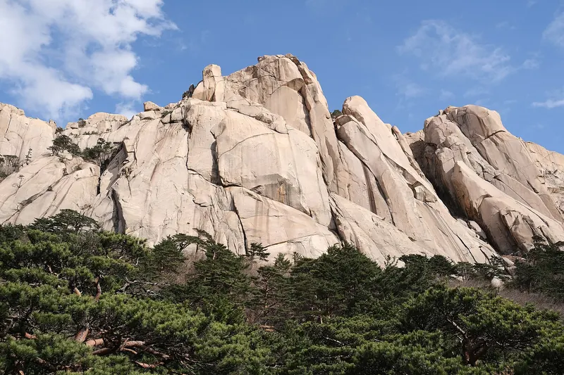
Jeju · Jeju
Hallasan guide: summit booking, Seongpanak or Gwaneumsa, Yeongsil walk
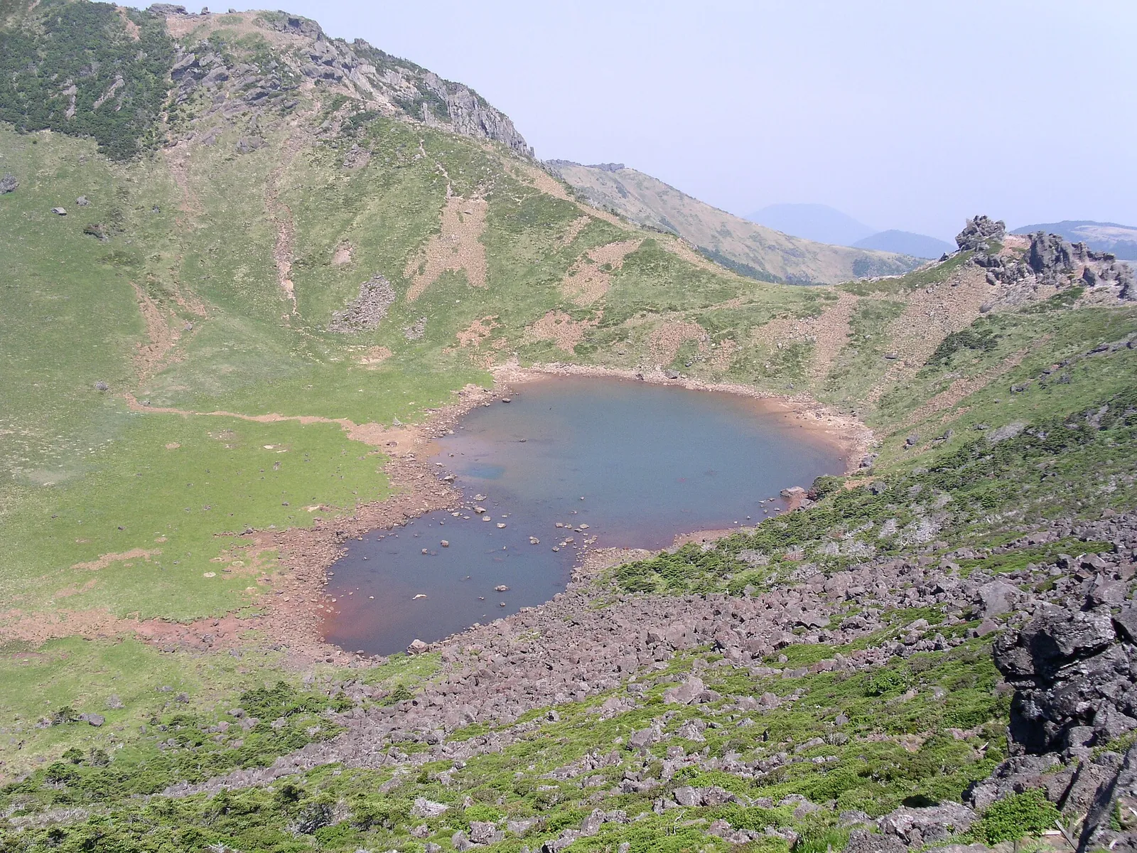
Hallasan is the dormant volcano at the centre of Jeju Island. At 1,950 metres it is the highest mountain in South Korea, and VisitKorea notes that it holds three UNESCO designations: Biosphere Reserve, World Natural Heritage Site and Global Geopark. There are really two different Hallasan days. The first is the summit day to the crater lake of Baengnokdam: a full day of 9 to 10 hours on foot, on one of only two trails, with a reservation and a strict cut-off time. The second is the half-day walk from Yeongsil or Eorimok to the 1,700-metre plateau at Witse-oreum. You get the crater wall and the open highland without a booking, and the park itself recommends this option if you have not hiked recently. Decide which day you want before you book anything else on Jeju.
- Suggested time
- 1 hiking day, plus a spare day for weather
- Where to stay
- Jeju City near Jeju Bus Terminal for Seongpanak, Gwaneumsa and the bus 240 trailheads; central Seogwipo for the southern side
- Season and timing
- The park uses two timetables: a winter schedule from October to March and a summer schedule from April to September. The winter cut-offs are an hour earlier on the summit trails. In VisitKorea's 2026 forecast, Hallasan's first autumn colour was due on 31 October and the peak around 13 November, the latest of Korea's major mountains. In winter the park asks hikers to carry crampons, warm clothing and gloves. Trails are partly or fully closed during official heavy-rain, typhoon and heavy-snow advisories and warnings, so check the park website on the morning you go.
The short answer
Give Hallasan one hiking day and keep a second day free in case the weather closes the mountain. Stay in Jeju City near the bus terminal, or in Seogwipo if you are hiking from the south side. For the summit, book a Seongpanak or Gwaneumsa slot on the official reservation system. Bookings open at 09:00 on the first business day of the month before your hike. Take the first buses and start at 05:00, when the trails open. From October to March you must pass the Jindallaebat or Samgakbong checkpoint by 11:30, and you must leave the summit by 13:30. Seongpanak is the gentler way up. Gwaneumsa is steeper, with deeper valleys, so the classic plan is up Seongpanak and down Gwaneumsa. If you do not need the crater, walk up Yeongsil to Witse-oreum and down to Eorimok. That takes about half a day and needs no reservation.
Summit or plateau: choose your Hallasan first
Only two trails reach the summit, Seongpanak on the east side and Gwaneumsa on the north. Both are long. The reservation system gives Seongpanak as 9.6 km and about 4 hours 30 minutes one way, or 9 hours there and back. Gwaneumsa is 8.7 km and about 5 hours one way, 10 hours there and back. The summit trails end at Dongneung, the east peak above the Baengnokdam crater. The park warns that the air thins near the top. It says heart problems and other health emergencies happen often on the summit routes.
The other trails stop below the summit, at the 1,700-metre Witse-oreum shelter and the Nambyeok junction under the crater's south wall. The park recommends Yeongsil and Eorimok to anyone without recent hiking experience or with an existing health condition. These are the routes this guide recommends to most first-time visitors who are not set on standing on the summit. They are shorter, need no reservation and still put you on the open highland with the crater wall above you. The short Eoseungsaengak climb next to the Eorimok visitor centre is the option for a single free hour.
- Summit, fit hikers, booking needed: Seongpanak (9.6 km, about 4 h 30 min one way) or Gwaneumsa (8.7 km, about 5 h one way).
- Half day, no booking: Yeongsil rest area to Witse-oreum (3.7 km) and on to the Nambyeok junction (5.8 km, about 2 h 30 min one way).
- Half day, no booking: Eorimok to Witse-oreum (4.7 km, about 2 h) and the Nambyeok junction (6.8 km, about 3 h one way).
- One hour: Eoseungsaengak, 1.3 km and about 30 minutes one way to a 1,169 m summit.
How the summit reservation works
Since 2025 the reservation has covered only the top sections: Jindallaebat shelter to the summit on Seongpanak, and Samgakbong shelter to the summit on Gwaneumsa. The park's English notice says the Eorimok, Yeongsil, Donnaeko, Seokguram and Eoseungsaengak trails need no booking. You can also walk Seongpanak as far as Jindallaebat, or Gwaneumsa as far as Samgakbong, without one.
When we checked on 2026-10-03, the official reservation system ([visithalla.jeju.go.kr](https://visithalla.jeju.go.kr/)) said that bookings open at 09:00 on the first business day of the previous month and run to the end of the following month. Weekends and public holidays move the opening day back, so check that month's calendar. You may hold one booking a week, for up to four people. There is no waiting list. The park sends each hiker a QR code, and at the checkpoint you must show that code with a passport or other ID. The system can queue users on opening day and hides the availability page that day. It also closes for maintenance from 20:00 to 22:00 on opening day and the evening before.
Cancel before your entry window ends if your plans change. The system treats a no-show without cancellation as a penalty: you cannot book for three months after the first and for a year after the second. If bad weather causes a partial closure on the day, the park says you must cancel and book again for the trail that is open. The fee page listed parking charges at the trailheads but no trail admission charge when we checked. Since 1 September 2026 you can get a summit certificate through the reservation website on the day of your climb, using your booking number and a photo.
Make time for the local food
What to eat and where to look
Gimbap for the trail
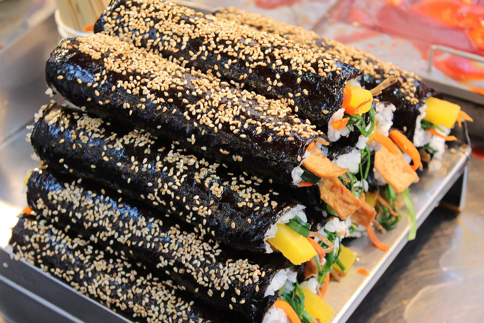
A roll of gimbap at the top is, in VisitKorea's words, an unmissable pleasure for Korean hikers. It is also one of the two foods the park explicitly allows while banning single-use lunch boxes. VisitKorea singles out Oneunjeong Gimbap in Seogwipo, whose original roll is filled with deep-fried bean curd.
- Where to look
- Oneunjeong Gimbap in Seogwipo; VisitKorea says to visit the day before and arrange a pickup time. Otherwise, buy rolls in Jeju City the evening before.
- Fit it into your day
- Lunch at Jindallaebat or Samgakbong shelter on a summit day, or at Witse-oreum on the Yeongsil walk.
VisitKorea says reservations are essential at Oneunjeong, and the summit trails have no shops. Eat it the same day.
Snacks at the Yeongsil and Gwaneumsa rest stops
The park lists simple food, drinking water and crampons for sale at the Yeongsil rest area, and a privately run rest stop at the Gwaneumsa trail entrance with water, snacks, cotton gloves, raincoats and crampons. Eorimok has drink vending machines at the trailhead.
- Where to look
- The Yeongsil rest area at 1,280 m and the Gwaneumsa trail entrance.
- Fit it into your day
- Top up water and snacks before you start; these are not places for a full meal.
Seongpanak, Eorimok, Donnaeko and Eoseungsaengak have no shop on the trail, and the springs on Eorimok and Yeongsil can dry up.
Jeju black pork and dombegogi
VisitKorea names Jeju black pork among the island's signature foods. It also highlights dombegogi, black pork steamed and sliced at the table on a wooden board.
- Where to look
- Black pork restaurants in Jeju City near your hotel, or in Seogwipo if you hiked the southern side.
- Fit it into your day
- The dinner after a summit day. Book it close to your hotel, as you will not want a long journey.
Contains pork; grilled versions are cooked at smoky table grills.
Pork noodle soup (gogi guksu)
VisitKorea lists rich pork noodle soup, alongside hallabong citrus and black pork, as one of Jeju's signature dishes. It is a warming bowl after a cold day on the plateau.
- Where to look
- Noodle restaurants in Jeju City.
- Fit it into your day
- An early lunch after a Yeongsil–Eorimok morning, or a quick supper.
Pork broth; ask before ordering if you avoid pork.
Seongpanak or Gwaneumsa
Seongpanak starts at 750 m by the 5.16 road. The trail passes the Sokbat shelter and the side path to Saraoreum, then reaches the staffed Jindallaebat shelter at 7.3 km, about 3 hours one way. From there the park's hardest-graded section climbs 2.3 km to the summit. The park describes the route as mostly gentle and almost entirely in forest, and the park says it passes the most extensive Korean fir forest on Hallasan. Its difficulty comes from the length: 19.2 km there and back. At 5.8 km a 600-metre side trail climbs to Saraoreum, a cone with a crater lake. VisitKorea recommends it for its view towards Baengnokdam and Yeongsil.
Gwaneumsa starts at the Gwaneumsa campground on the north side. It climbs past the Gurin cave and through Tamna Valley to the staffed Samgakbong shelter, 6 km and about 3 hours 20 minutes from the start. It then drops into the Yongjingak valley and climbs about 1 hour 40 minutes to the summit. The park calls it the trail where the valleys are deepest and the mountain is at its most dramatic, with a large difference in height. It notes that many Seongpanak hikers come down this way. VisitKorea's suggested summit course goes up Seongpanak and down through Tamna Valley to Gwaneumsa. It mentions suspension bridges on the descent, which becomes gentle below Tamna Valley. Note that the Samgakbong-to-summit section was closed for rockfall-protection and boardwalk work from 1 August to 30 September 2026. The park announced on 18 September that it would reopen on 24 September.
Entry times decide the day. When we checked on 2026-10-03, both summit trails opened at 05:00. On the winter schedule (October to March), the trailhead and the Jindallaebat and Samgakbong checkpoints closed to summit hikers at 11:30, and you had to leave the summit by 13:30. On the summer schedule (April to September) those times were 12:30 and 14:30. Neither trail has a shop, though a privately run rest stop at the Gwaneumsa entrance sells water, snacks, rain gear and crampons. Carry all your water and food from the start.
Yeongsil and Eorimok: the plateau without a booking
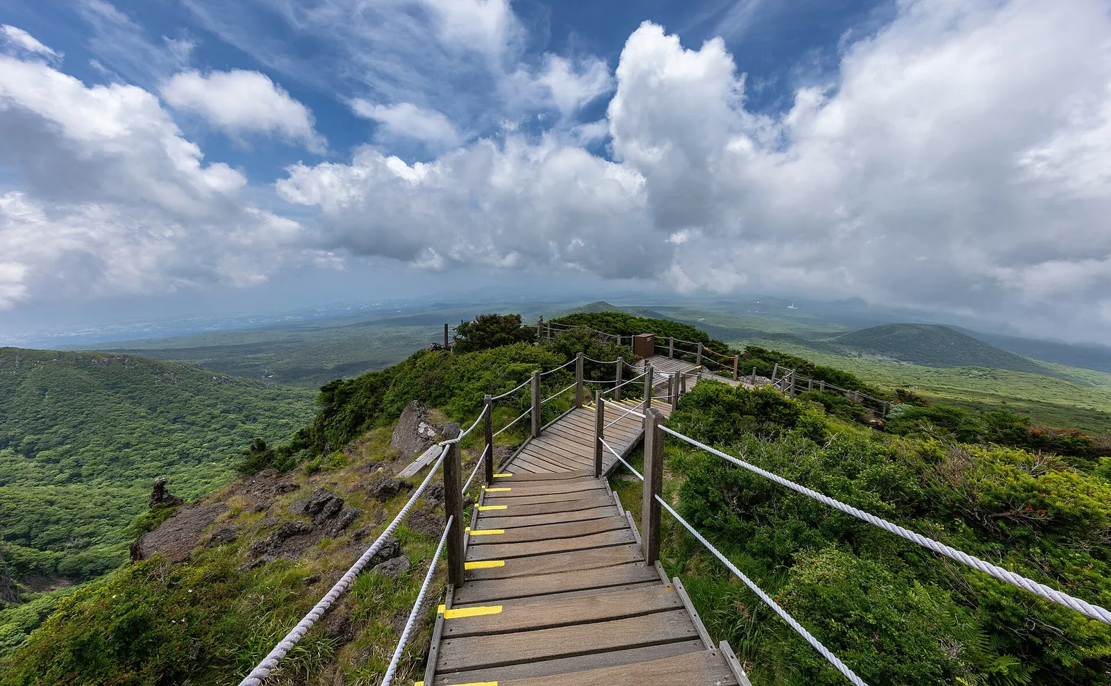
Yeongsil is the quickest way onto the highland. From the Yeongsil rest area at 1,280 m it is 3.7 km to the Witse-oreum shelter at 1,700 m. The park says the route is mostly easy, apart from the steep ridge along the Yeongsil crater between about 1,300 and 1,550 m. That ridge passes the Yeongsil Giam rock pinnacles and Byeongpungbawi, the 'folding-screen' cliff. Above it you cross Seonjakjiwat, a high plain of alpine plants. The park says Yeongsil is also where you can see Hallasan's roe deer at the closest range. The rest area sells simple food, water and crampons. Do not leave the path at the top of Byeongpungbawi: the park warns of rockfall and falls there.
Getting to the start is the awkward part. The road from the Yeongsil ticket office at 1,000 m up to the rest area is 2.5 km. Only vehicles with 12 seats or fewer may use it, and VisitKorea says there is no parking for private cars. Bus 240 from Jeju Bus Terminal takes about 50 minutes to the ticket office, then you face a walk of about 40 minutes uphill. VisitKorea's advice is to take a taxi to the trailhead.
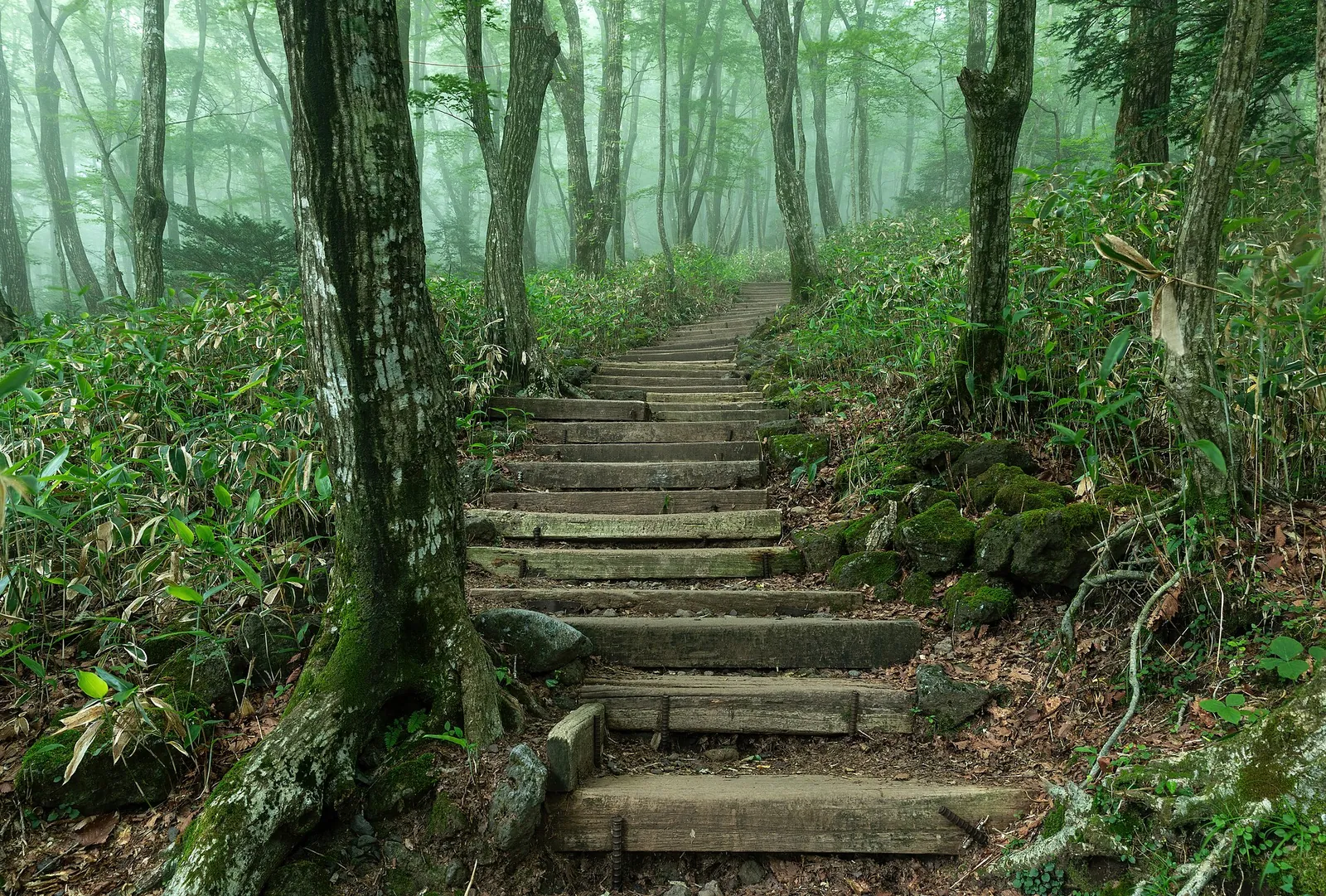
Eorimok starts at 970 m beside the park's main visitor centre. The steep climb to Sajebi-dongsan (1,423 m) is the hard part. After that the path is fairly level past Manse-dongsan to Witse-oreum: 4.7 km and about 2 hours. You can continue along the Nambyeok circuit, which stays almost level beneath the vertical south wall of the summit, to the Nambyeok junction, 6.8 km from the start. Eorimok has no shop. The spring at Sajebi can dry up, so take water. Bus 240 stops at the Eorimok entrance about 35 minutes from Jeju Bus Terminal, then it is a 15-minute walk.
VisitKorea's suggested course goes up Yeongsil and down to Eorimok, then takes a taxi from Eorimok. This gives you the rock scenery on the way up and the forest on the way down. You can add the walk from Witse-oreum to the Nambyeok viewpoint and back, which VisitKorea says adds about 4.2 km. Respect the cut-offs here too. When we checked, the Yeongsil and Eorimok trailheads closed at 12:00 on the winter schedule and 15:00 in summer. The Witse-oreum checkpoint towards the Nambyeok junction closed at 13:00 and 14:00, and you had to leave Witse-oreum by 15:00 and 17:00.
Short walks: Eoseungsaengak, Seokguram and Donnaeko
Eoseungsaengak is a 1.3 km climb, about 30 minutes one way, starting beside the Eorimok visitor centre. It reaches a 1,169 m summit. The park says that on clear days you can see Chujado, Biyangdo and Seongsan Ilchulbong from the top, along with a pillbox the Japanese military built in 1945. It stays open long after the summit trails close: when we checked, the trailhead closed at 17:00 in both seasons. That makes it a good option for an afternoon or for the spare day if the upper trails are closed.
Seokguram is a forest walk of 1.5 km, about 50 minutes one way, from the parking area of the Jeju National Cemetery off the 1100 road to a small hermitage in the Aheunahopgol valleys. The park lists it as about 20 minutes by car from Jeju City. Donnaeko, above Seogwipo, is the long southern approach: 7 km and about 3 hours 50 minutes one way from 500 m to the Nambyeok junction. It has no spring water at all, and its entry cut-off is the earliest in the park: 10:00 in winter and 11:00 in summer when we checked.
Rules, weather and safety on the mountain
Hallasan is managed as a day-hike mountain. Entry hours are set so that everyone is down before sunset, and camping and cooking are allowed only at the Gwaneumsa campground. The park bans single-use lunch boxes, anything flammable, alcohol and smoking, with fines under the Natural Parks Act. It specifically allows gimbap and hamburgers. Take all your rubbish down with you.
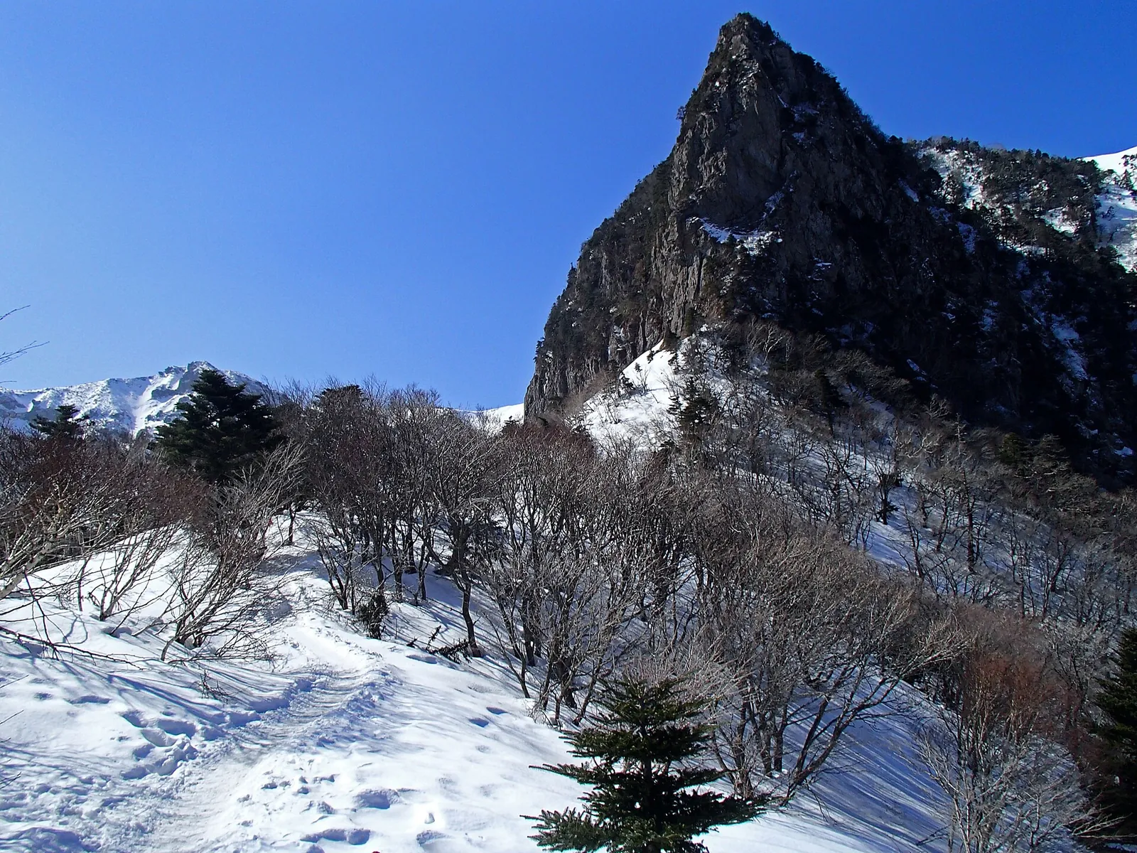
The weather changes quickly on the upper plateau. The park names fog, lightning, hypothermia and 'ring wandering' (walking in circles in poor visibility) as hazards around Witse-oreum and Seonjakjiwat. Carry emergency food such as sweets, chocolate and salt, and a spare layer. In winter add crampons, warm clothes, gloves and a hot drink. In an emergency, call 119 and give the number on the nearest trail position marker. The summit trails are long enough that the park recommends hiking in a group, and it warns that injuries and exhaustion on the descent are common.
Getting to the trailheads
Seongpanak is the easiest trailhead to reach without a car. When we checked, the reservation system listed bus 281 from Jeju Bus Terminal along the 5.16 road, first bus 06:00, every 10–14 minutes, about 45 minutes to Seongpanak. From the Seogwipo side, the same route takes about 50 minutes from Seogwipo Bus Terminal. Bus 181 runs from Jeju International Airport in about 35 minutes. The trailhead car park has 156 spaces and the park says it often fills before the trail opens in busy seasons. There is a free park-and-ride car park on the 5.16 road near Jeju International University.
Gwaneumsa has no direct bus from the airport or the terminals. The reservation system says to take bus 281 to Sancheondan and change to bus 475. When we checked it ran from 06:20 to 19:45, but only every 45–90 minutes. If you go up Seongpanak and down Gwaneumsa, a taxi from Gwaneumsa is the simple way back. Yeongsil and Eorimok are on the 1100 road, served by bus 240 from Jeju Bus Terminal. Check current times on the Jeju bus information system (bus.jeju.go.kr) the night before.
Practical questions
Do I need a reservation to hike Hallasan?
Only for the summit. The reservation covers the Jindallaebat-to-summit section of Seongpanak and the Samgakbong-to-summit section of Gwaneumsa. The park's English notice says Eorimok, Yeongsil, Donnaeko, Seokguram and Eoseungsaengak need no booking.
When do Hallasan summit reservations open?
When we checked on 2026-10-03, the official reservation system opened bookings at 09:00 on the first business day of the month before your hike. One booking per person per week, for up to four people. Each hiker needs the QR code and a passport or other ID at the checkpoint.
Is Seongpanak or Gwaneumsa better for the summit?
Seongpanak is longer (9.6 km) but mostly gentle forest, and buses 281 and 181 stop at the trailhead. Gwaneumsa is shorter (8.7 km) but steeper, with deeper valleys and better views, and harder to reach by bus. Many hikers go up Seongpanak and down Gwaneumsa, as VisitKorea also suggests.
What time do I have to start the Hallasan summit hike?
The summit trails open at 05:00. When we checked, on the October-to-March schedule you had to pass the Jindallaebat or Samgakbong checkpoint by 11:30 and leave the summit by 13:30. From April to September those times are 12:30 and 14:30.
Can I see Hallasan without going to the summit?
Yes. Walk up Yeongsil to the Witse-oreum shelter at 1,700 m, 3.7 km from the Yeongsil rest area, and come down to Eorimok. You see the crater's south wall and the highland plain, and no reservation is needed. The park recommends these trails if you have not hiked recently.
Can I bring food up Hallasan?
Yes, but not in single-use lunch boxes, which the park bans. It explicitly allows gimbap and hamburgers. Alcohol, smoking and flammable items are banned too, and most trails have no shop, so bring all your water and food.
Sources and checks before you travel
Reference sources for the version dated 3 October 2026. Confirm opening times, access, transport and conditions for your travel dates.
- Hallasan National Park: trail overview ↗ — opens in a new tab
- Hallasan National Park: Seongpanak trail ↗ — opens in a new tab
- Hallasan National Park: Gwaneumsa trail ↗ — opens in a new tab
- Hallasan National Park: Yeongsil trail ↗ — opens in a new tab
- Hallasan National Park: Eorimok trail ↗ — opens in a new tab
- Hallasan National Park: Eoseungsaengak trail ↗ — opens in a new tab
- Hallasan National Park: Donnaeko trail ↗ — opens in a new tab
- Hallasan National Park: Seokguram trail ↗ — opens in a new tab
- Hallasan National Park: history ↗ — opens in a new tab
- Hallasan reservation system: reservation guide and entry hours ↗ — opens in a new tab
- Hallasan reservation system: Seongpanak ↗ — opens in a new tab
- Hallasan reservation system: Gwaneumsa ↗ — opens in a new tab
- Hallasan reservation system: usage fees ↗ — opens in a new tab
- Hallasan reservation system: adjustment of the reservation section (English notice) ↗ — opens in a new tab
- Hallasan reservation system: booking-day restrictions ↗ — opens in a new tab
- Hallasan reservation system: Gwaneumsa reopening ↗ — opens in a new tab
- Hallasan reservation system: Gwaneumsa works closure ↗ — opens in a new tab
- Hallasan reservation system: online summit certificate ↗ — opens in a new tab
- VisitKorea: Best hiking trails in Korea's national parks ↗ — opens in a new tab
- VisitKorea: 2026 Fall Foliage Forecast ↗ — opens in a new tab
- VisitKorea: Jeju Island, a Picturesque Paradise for a Peaceful Retreat ↗ — opens in a new tab
Photo credits
Baengnokdam, the crater lake at the 1,950 m summit of Hallasan, reached only by the reserved Seongpanak and Gwaneumsa trails
Photograph: Yoo Chung — opens in a new tab · CC BY-SA 2.5 — opens in a new tab
Changes: Resized and converted to WebP; displayed with responsive crops. · Original photograph and licence details ↗ — opens in a new tab
The Yeongsil Trail on Hallasan's south-west flank, the shortest walk to the 1,700 m plateau below the summit
Photograph: Basile Morin — opens in a new tab · CC BY-SA 4.0 — opens in a new tab
Changes: Resized and converted to WebP; displayed with responsive crops. · Original photograph and licence details ↗ — opens in a new tab
Forest steps on the Eorimok Trail, which climbs from the visitor centre towards Witse-oreum
Photograph: Basile Morin — opens in a new tab · CC BY-SA 4.0 — opens in a new tab
Changes: Resized and converted to WebP; displayed with responsive crops. · Original photograph and licence details ↗ — opens in a new tab
Hallasan in winter: snow and ice are common on the upper trails, so carry crampons
Photograph: Lcarrion88 — opens in a new tab · CC BY-SA 4.0 — opens in a new tab
Changes: Resized and converted to WebP; displayed with responsive crops. · Original photograph and licence details ↗ — opens in a new tab
Gimbap, the seaweed rice roll Korean hikers carry up mountains; single-use lunch boxes are banned on Hallasan but gimbap is allowed
Photograph: junho306 — opens in a new tab · CC0 — opens in a new tab
Changes: Resized and converted to WebP; displayed with responsive crops. · Original photograph and licence details ↗ — opens in a new tab