Lombok and Nusa Tenggara · West Nusa Tenggara
Mount Rinjani trek or Senaru waterfalls: routes, permits and closures
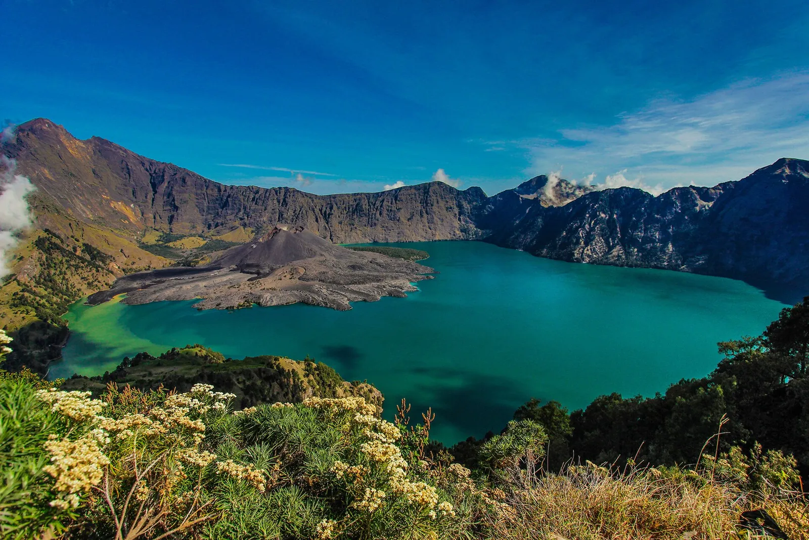
Mount Rinjani, 3,726 metres high, towers over the island of Lombok. Inside its caldera lies Segara Anak, a crescent-shaped crater lake about 600 metres below the rim, with a young cone, Barujari, rising from its shore. The classic trek links the two trailhead villages, Sembalun in the east and Senaru in the north, over two to four days on the mountain, and it is hard. It is not the only way to see Rinjani. Senaru has two waterfalls fed by the mountain's springs and one of Lombok's oldest mosques, and the Sembalun valley spreads out below the peak. Rinjani is also an active volcano in a national park that closes trails for the wet season, for fire risk and after accidents. Check the park's current status before you plan anything else.
- Suggested time
- 3–4 days for the full trek (2 days and 1 night for the summit only); 1–2 nights in Senaru without trekking
- Where to stay
- Sembalun Lawang (start of the summit route) or Senaru (end of the trek, waterfalls); Mataram for the night of arrival
- Season and timing
- The park closes every trail at the start of each year for the wet season. In 2026 the closure ran from 1 January to 31 March. In the dry months, fires can bring a limited opening: from 1 September 2026 new online bookings were suspended, and after a fire on 22 September the Torean and Senaru trails were closed until further notice.
The short answer
Commit to the trek only if you have climbed mountains before and can give it three or four days. The national park requires previous hiking experience and a guide or an experienced hiker in every group of at least two. Book through the park's eRinjani app, directly or with one of the trekking organisers the park lists, and sleep in Sembalun or Senaru the night before. The Ministry of Tourism puts the summit at two days and one night from Sembalun. Continuing down to Segara Anak and out through Senaru makes three to four days. If that is too much, or the trails are shut, stay a night or two in Senaru for the Sendang Gile and Tiu Kelep waterfalls and the old mosque at Bayan, and see the mountain from the Sembalun valley. In October 2026 the park had suspended new eRinjani bookings because of fire risk, and the Senaru and Torean trails were closed after a forest fire. Check the park's news page before you book anything.
Should you commit to the Rinjani trek?
Rinjani is the second-highest volcano in Indonesia, and the trek is a real expedition, not a long day walk. The Ministry of Tourism says reaching the summit from Sembalun usually takes two days and one night. A full crossing goes down to the crater lake and out through Senaru, which takes three to four days in total. The ministry's older route notes describe the same shape: a three-day trek from Senaru to the crater rim, down to the lake and on to Sembalun Lawang. A four-day version, best started at Sembalun Lawang, adds the summit.
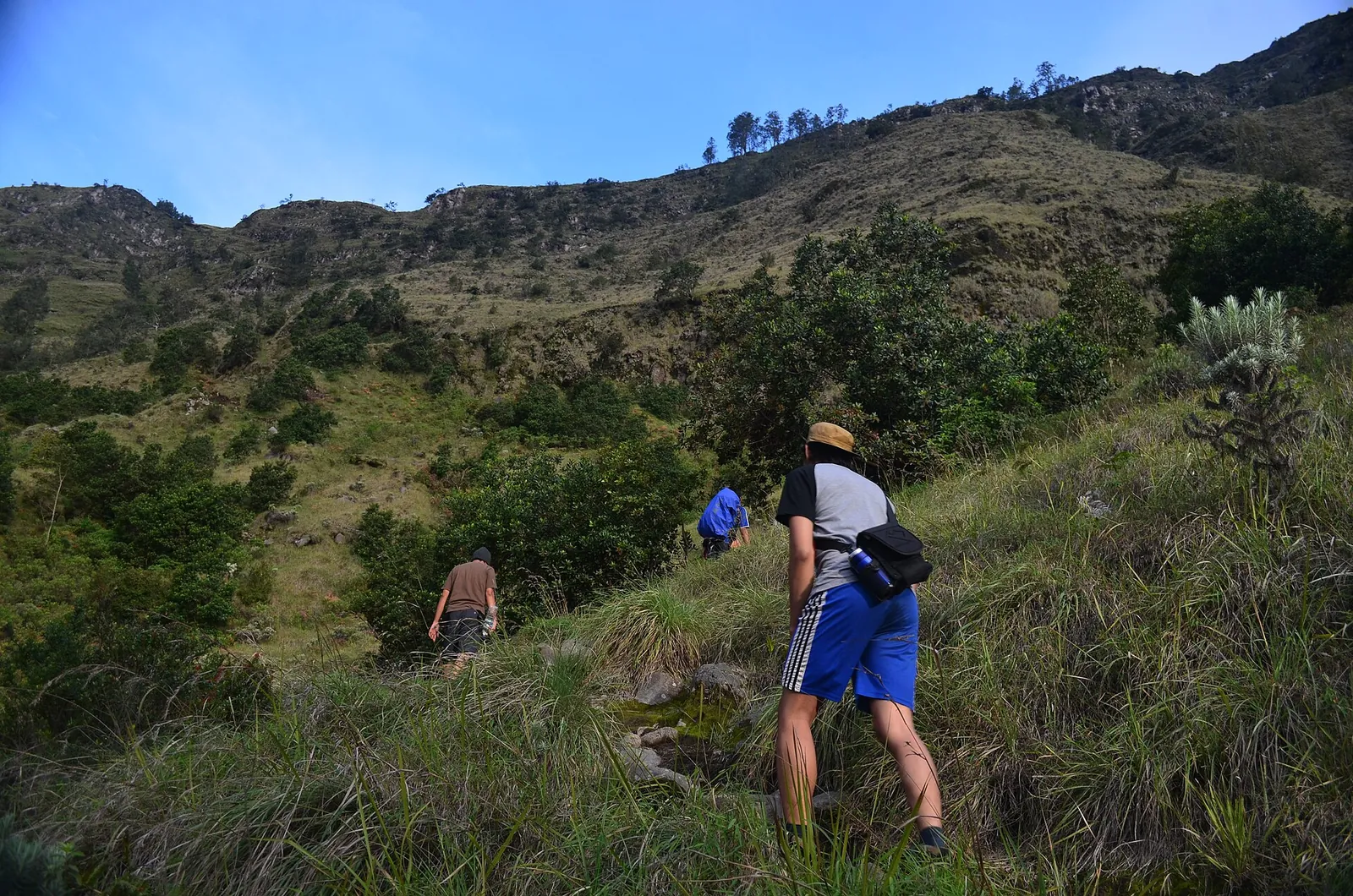
The two main routes feel very different. The Sembalun trail starts gently across open savanna and then gets long and hard towards the summit. Its campsite, Plawangan Sembalun, sits at about 2,639 metres, and from there the summit attempt starts. The Senaru trail climbs through dense forest. It is steeper and shorter, and the ministry puts the climb from Senaru village to the Senaru crater rim at about 8 to 10 hours. Even the rim alone is a full day's climb with a night at a campsite, so neither side offers a short rim walk.
The park's own rules decide whether this trip is for you. Every group must have at least two people. Each group must go with a guide or an experienced hiker, and every hiker must have climbed other mountains before and be able to prove it with photos, a certificate or an interview. Hikers under 17 must be accompanied and carry a letter from a parent or guardian. If you have never camped at altitude or walked steep, loose ground, the Senaru-only plan below is the better trip, not a lesser one.
Booking, fees and the rules on the mountain
All hiking permits go through the park's eRinjani app, which the park says is on Google Play and now also the App Store. The park's site lists recommended trekking organisers. When the park reopened in August 2025 after a temporary closure that followed accidents on the trails, it revised the hiking SOP. The revision included reclassifying the trails as grade IV, a guide ratio, a new insurance system and safety contingency plans. The full SOP can be downloaded in the eRinjani app.
When we checked on 2026-10-03, the park's official site listed entry for foreign nationals at Rp 250,000 per day on the Sembalun, Senaru and Torean trails. The less-used Timbanuh, Tetebatu and Aik Berik trails cost Rp 200,000 per day. Insurance was listed at Rp 10,000 (regular) or Rp 290,000 (premium). These are park fees only; check what any trekking package adds on top.
The park enforces its rules with a public blacklist. When we checked, it named hikers banned for four years for carrying wet wipes up the mountain, and others banned for five years for coming down with less rubbish than they took up. You must carry reusable food and drink containers. In the dry season, rangers search bags for anything that could start a fire, and the park asks hikers not to burn rubbish, to put out every cigarette and to cook only on a stove well away from dry grass.
- Book through eRinjani; reschedules are possible only once per ticket, and the hiker's name cannot be changed.
- Bring your passport; the park's registration requirements list it for foreign hikers.
- Check closures on rinjaninationalpark.id the week you travel, not only when you book.
Make time for the local food
What to eat and where to look
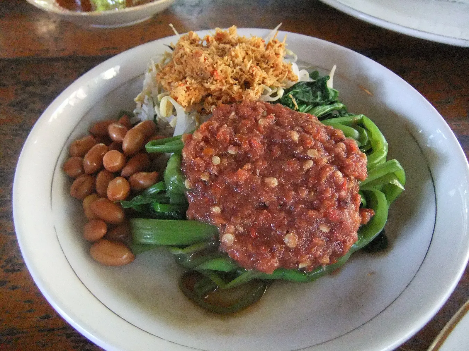
Plecing kangkung
Blanched water spinach under a raw sambal of chilli, shallot, garlic, tomato, shrimp paste, tamarind and lime, often topped with grated coconut or fried peanuts. The Ministry of Tourism calls it one of Lombok's most iconic dishes.
- Where to look
- Warungs and markets all over Lombok. The ministry suggests Pasar Kebon Roek in Mataram.
- Fit it into your day
- A light lunch or a side dish in Mataram on the way to or from the mountain.
The sambal is raw and very hot, and usually contains shrimp paste; ask for it without terasi if you avoid seafood.
Ayam taliwang
Young free-range chicken grilled until half-cooked, then coated in chilli, shallot, garlic, shrimp paste, palm sugar and coconut milk and grilled again while being basted. It comes from Taliwang on Sumbawa and is eaten across West Nusa Tenggara.
- Where to look
- Specialist ayam taliwang restaurants in central Mataram.
- Fit it into your day
- A proper dinner on your first or last night in Mataram, around the trek.
The spice level varies, so ask for it mild if needed. It contains shrimp paste.
Beberuk terong
A raw salad of diced eggplant and tomato tossed in a fiery sambal with shrimp paste and lime or tamarind. It is served beside grilled chicken or fish to cut the richness.
- Where to look
- Warungs that serve ayam taliwang or grilled fish, and the markets of Mataram and Cakranegara.
- Fit it into your day
- Order it with ayam taliwang or grilled fish.
Raw vegetables: choose busy places where food is freshly made, especially before a trek.
Sate rembiga
Beef satay from Rembiga village near Mataram, marinated in shallot, garlic, candlenut, coriander, turmeric, tamarind, chilli and palm sugar, then grilled over charcoal. It is spicy and slightly sweet rather than peanut-sauced.
- Where to look
- The well-known eateries in Rembiga village near Mataram, and satay stalls in Lombok's markets.
- Fit it into your day
- A filling meal in Mataram on arrival or before your flight.
Often eaten with ketupat or nasi puyung, which is also spicy.
Closures, fires and the volcano: what to check first
Rinjani's season is set by the park, not by the calendar alone. The park closes all hiking trails at the start of every year because heavy rain makes the trails slippery, brings thick fog and raises the risk of hypothermia. In 2026 that closure ran from 1 January to 31 March, and the last bookings for the 2025 season closed on 28 December 2025.
The dry season brings fire risk. From 1 September 2026 the park opened only on a limited basis: patrols and bag checks were stepped up, and new eRinjani bookings were suspended until fire risk is judged safe again. Bookings already paid before that date are still honoured. On 22 September 2026 a forest fire broke out at Bukit Setampol in the Torean sector, and the Torean trail was closed from 23 September. In its update of 29 September, the park said about 1,098.75 hectares were affected and that the Torean and Senaru trails remained temporarily closed as entry and exit points. They will reopen only after the trail, the slopes and any burnt trees have been assessed. If you hold a Torean ticket, the park asks you to reschedule or switch to another trail.
Rinjani is also an active volcano. When we checked on 2026-10-03, Indonesia's volcanology agency (PVMBG, on MAGMA Indonesia) listed Rinjani at Level II (Waspada). Its daily report allowed hiking, but no activity or camping anywhere on Barujari or within 1.5 kilometres of its crater, because the lava there is still hot and unstable. The agency also advised visitors to carry a mask and eye protection in case of ash. Check the level again before you go.
Senaru without the summit: waterfalls, the old village and Bayan
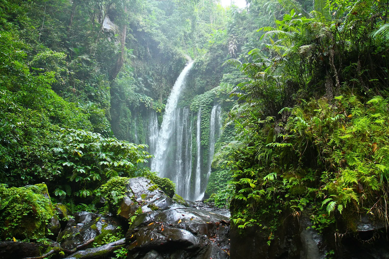
Senaru is a tourism village in Bayan district, North Lombok, at the northern foot of the mountain. You can spend a rewarding day here without setting foot on the trekking trail. Sendang Gile waterfall is about a 15-minute walk down a flight of steps, according to the Ministry of Tourism, and Tiu Kelep is another 30 to 45 minutes beyond it. Both are fed by springs on Rinjani, and the ministry recommends them for travellers who are not hiking. The park's October 2026 closure notices concern the Senaru hiking trail. They do not mention the waterfalls, but ask in the village before you set out.
The village also has one of Lombok's oldest groups of traditional houses: bamboo walls and pillars on stone or clay foundations, under alang-alang thatch, with a small gazebo (beruga) for receiving guests. Nearby Masjid Kuno Bayan Beleq dates from the 16th century and is one of the oldest mosques on Lombok. It is built of timber under a thatched roof, still hosts annual customary ceremonies and is used for Eid prayers. Dress modestly and ask before entering.
Senaru has homestays as well as lodges, so you can sleep in the village and see its daily life. The ministry mentions weaving and traditional dances such as Bisoq Menik, which is inspired by the rice-washing ritual of Bayan's customary ceremonies.
Sembalun: the eastern trailhead and its valley
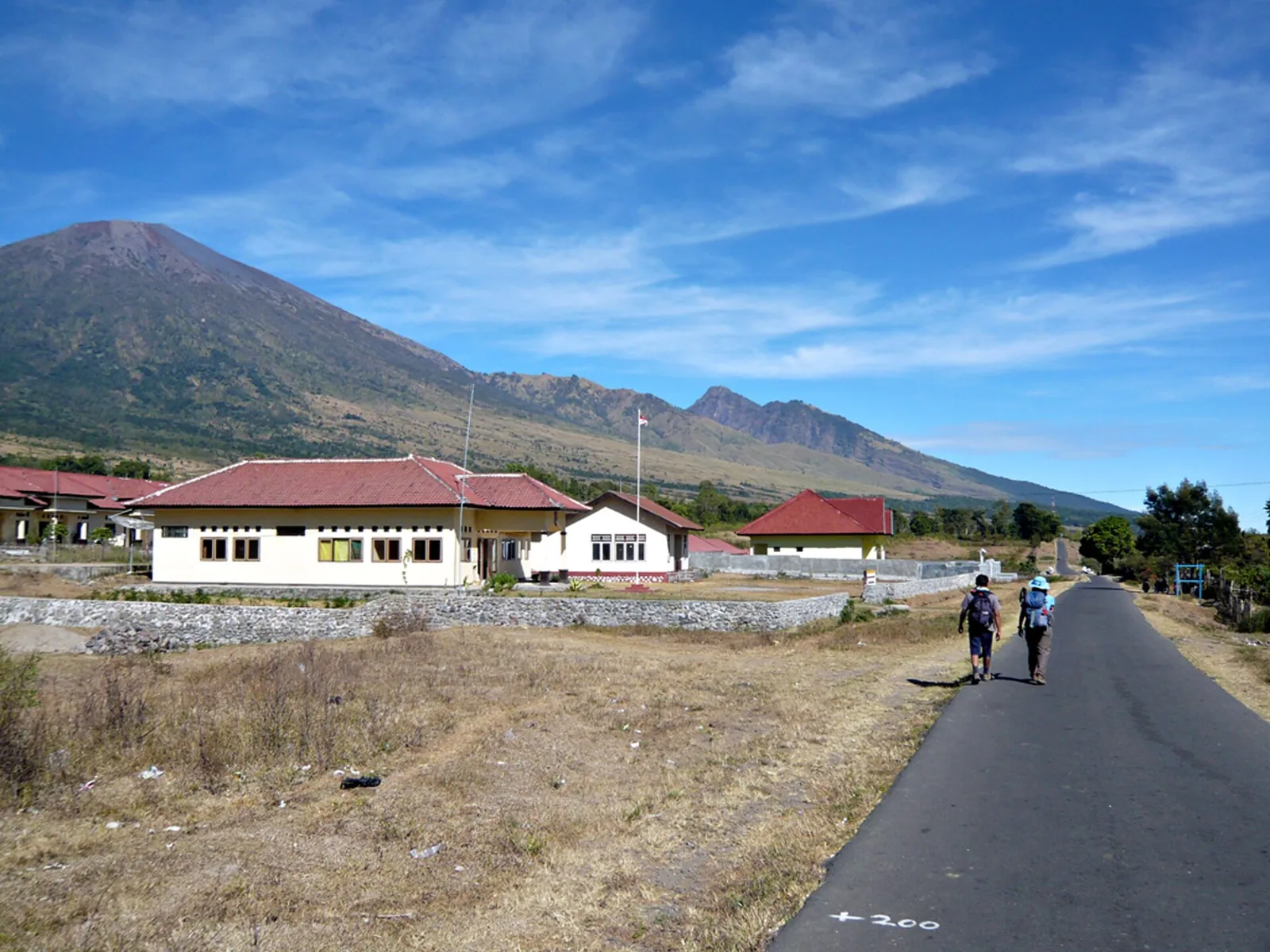
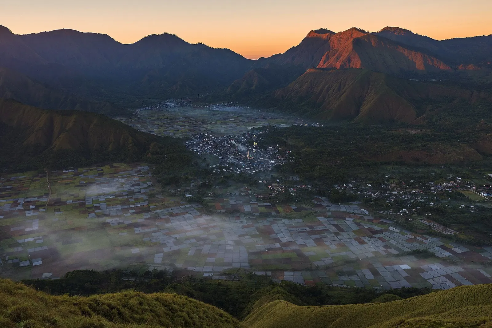
Sembalun Lawang, in a high valley on the east side of the mountain, is where most summit treks begin. The Ministry of Tourism says Senaru and Sembalun both have plenty of hotels, lodges, local eateries, guides, porters and operators. That makes Sembalun the sensible place to sleep before an early start, meet your organiser and sort out gear.
Even if you do not climb, the valley is worth the drive. The national park lists the Propok savanna and Bukit Kondo in Sembalun among Lombok's newest popular viewpoints, for the scenery they open up below the mountain. The road in is long. The ministry estimates about four hours from Mataram, or four to five hours by car from the airport or Mataram, so do not plan Sembalun as a quick detour.
Segara Anak and Barujari: what is inside the crater
Segara Anak, 'child of the sea', lies at about 2,010 metres in the caldera. The Ministry of Tourism gives its area as 11 square kilometres and its depth as up to 230 metres. From the Senaru rim it is a sharp descent of about 600 metres to the shore. The lake water stays at about 20–22°C because hot water seeps in from the volcanic system under Barujari. Hot springs by the lake draw hikers who believe in their healing powers. Tilapia and carp have been bred in the lake since 1985, and fishing is popular.
The lake is sacred. The ministry notes that Balinese Hindus hold an annual ceremony here for the mountain's spirit, and that Wetu Telu followers pray by the lake on full-moon nights. The park also notes that indigenous communities use the Senaru trail for rituals at the summit and the lake. Behave at the shore as you would at a shrine.
Barujari is the active cone on the east side of the caldera; the Ministry of Tourism says it rose from a series of eruptions in the 1990s. You see it from the rim and the lake, but you may not climb it. At Level II, the volcanology agency keeps everyone off its slopes and out of a 1.5-kilometre radius around its crater.
Practical questions
Can I climb Mount Rinjani in October 2026?
Only with a booking made earlier, and only on the open trails. From 1 September 2026 the national park suspended new eRinjani bookings because of fire risk, while honouring bookings paid before that date. After a fire on 22 September, the Torean and Senaru trails were temporarily closed. Check rinjaninationalpark.id for the latest notice.
How many days does the Rinjani trek take?
The Ministry of Tourism says the summit from Sembalun usually takes two days and one night. Going on to the Segara Anak crater lake and coming out through Senaru makes three to four days in total.
Do I need a guide to climb Rinjani?
The park requires every group to be at least two people, with a guide or an experienced hiker. Every hiker must have climbed other mountains before and be able to show it. Permits are booked in the eRinjani app, and the park's website lists recommended trekking organisers.
How much is the Rinjani entry fee?
When we checked on 2026-10-03, the park listed Rp 250,000 per day for foreign nationals on the Sembalun, Senaru and Torean trails, and Rp 200,000 per day on Timbanuh, Tetebatu and Aik Berik. Insurance was listed separately, and guides, porters and gear are not part of the park fee.
When is Mount Rinjani closed?
The park closes every trail at the start of each year for the wet season. In 2026 the closure ran from 1 January to 31 March. It can also close or limit hiking at short notice, for example after accidents or during fire risk in the dry season.
Can I see Rinjani without trekking?
Yes. In Senaru, Sendang Gile waterfall is about 15 minutes' walk from the village and Tiu Kelep another 30 to 45 minutes. The Sembalun valley gives you the mountain from below. Neither involves the multi-day trail.
Is Mount Rinjani erupting?
When we checked on 2026-10-03, MAGMA Indonesia listed Rinjani at Level II (Waspada). Hiking was allowed, but not on Barujari or within 1.5 km of its crater. Check the level again shortly before you go.
Sources and checks before you travel
Reference sources for the version dated 3 October 2026. Confirm opening times, access, transport and conditions for your travel dates.
- Gunung Rinjani National Park (BTNGR): Rinjani opened on a limited basis (1 September 2026) ↗ — opens in a new tab
- BTNGR: Torean hiking trail temporarily closed ↗ — opens in a new tab
- BTNGR: Handling the forest fire at Bukit Setampol (29 September 2026 update) ↗ — opens in a new tab
- BTNGR: Closure of hiking destinations, 1 January – 31 March 2026 ↗ — opens in a new tab
- BTNGR: Hiking closed for safety and conservation ↗ — opens in a new tab
- BTNGR: Mandatory rules for hikers ↗ — opens in a new tab
- BTNGR official website (home page: ticket prices, blacklist, trekking organisers) ↗ — opens in a new tab
- BTNGR: Reopening of nature tourism, August 2025 ↗ — opens in a new tab
- BTNGR: Temporary closure of hiking, 1–10 August 2025 ↗ — opens in a new tab
- BTNGR: Rinjani hiking season agenda 2026 ↗ — opens in a new tab
- BTNGR: Frequently asked questions ↗ — opens in a new tab
- BTNGR: Watch out for fire on the trails in the dry season ↗ — opens in a new tab
- BTNGR: Tourism objects (Senaru trail, Sembalun, Barujari) ↗ — opens in a new tab
- MAGMA Indonesia (PVMBG): volcano activity levels ↗ — opens in a new tab
- Indonesia Travel (Ministry of Tourism): Gunung Rinjani ↗ — opens in a new tab
- Indonesia Travel: Mount Rinjani (Lombok) ↗ — opens in a new tab
- Indonesia Travel: Gunung Rinjani (routes and villages) ↗ — opens in a new tab
- Indonesia Travel: Danau Segara Anak ↗ — opens in a new tab
- Indonesia Travel: Senaru Crater Rim ↗ — opens in a new tab
- Indonesia Travel: Pelawangan Sembalun ↗ — opens in a new tab
- Indonesia Travel: Senaru Tourism Village ↗ — opens in a new tab
- Indonesia Travel: Masjid Kuno Bayan Beleq ↗ — opens in a new tab
- Indonesia Travel: Lombok ↗ — opens in a new tab
- Indonesia Travel: Plecing kangkung ↗ — opens in a new tab
- Indonesia Travel: Ayam taliwang ↗ — opens in a new tab
- Indonesia Travel: Beberuk terong ↗ — opens in a new tab
- Indonesia Travel: Sate rembiga ↗ — opens in a new tab
Does this experience fit your route?
If you book a Rinjani trek or a Senaru day through a tour site, confirm that the operator is a registered trekking organiser and that the park's eRinjani booking is included. Then check the park's closure notices again the week you travel.
Browse relevant experiences on Viator ↗ — opens in a new tabAffiliate link · Book with ViatorPhoto credits
Segara Anak, the crater lake of Mount Rinjani, with the young Barujari cone rising from its shore
Photograph: Aldoarianto.87 — opens in a new tab · CC BY-SA 4.0 — opens in a new tab
Changes: Resized and converted to WebP; displayed with responsive crops. · Original photograph and licence details ↗ — opens in a new tab
Tiu Kelep, the waterfall beyond Sendang Gile above Senaru village
Photograph: Jordy Meow — opens in a new tab · CC BY 3.0 — opens in a new tab
Changes: Resized and converted to WebP; displayed with responsive crops. · Original photograph and licence details ↗ — opens in a new tab
Sembalun Lawang, the eastern trailhead village, with Rinjani on the skyline
Photograph: Tanti Ruwani from Jakarta, Indonesia — opens in a new tab · CC BY 2.0 — opens in a new tab
Changes: Resized and converted to WebP; displayed with responsive crops. · Original photograph and licence details ↗ — opens in a new tab
Hikers on the steep trail from Segara Anak lake up towards Plawangan Sembalun
Photograph: Chafidwahyu — opens in a new tab · CC BY-SA 4.0 — opens in a new tab
Changes: Resized and converted to WebP; displayed with responsive crops. · Original photograph and licence details ↗ — opens in a new tab
The Sembalun valley and its farmland, seen from Pergasingan hill
Photograph: Focusfeel — opens in a new tab · CC BY-SA 4.0 — opens in a new tab
Changes: Resized and converted to WebP; displayed with responsive crops. · Original photograph and licence details ↗ — opens in a new tab
Plecing kangkung, Lombok's water spinach with raw chilli sambal
Photograph: Midori — opens in a new tab · CC BY 3.0 — opens in a new tab
Changes: Resized and converted to WebP; displayed with responsive crops. · Original photograph and licence details ↗ — opens in a new tab