Northern Thailand · Mae Hong Son
Pai travel guide: canyon sunsets, hot springs and the valley
Pai is a small former Shan town on the banks of the Pai River, in a valley ringed by hills between Chiang Mai and Mae Hong Son. TAT describes its laid-back, new-age scene of guesthouses, cafés and craft shops, with rafting, trekking, cycling and hot springs close by. Many visitors stay longer than they planned.
- Suggested time
- 3–4 days
- Where to stay
- Pai town, near the walking street or by the river
- Season and timing
- TAT recommends the cooler months of November to January; mornings can be cold and misty in the valley.
The short answer
Give Pai three or four nights. Watch sunset at Pai Canyon, walk the evening market, soak in the hot springs, cross the bamboo Bridge of Merit over the rice fields and eat Yunnanese food at Ban Santichon. Get there by minivan from Chiang Mai — about three hours on a famously winding road — or by car. Rent a scooter only if you are experienced.
Getting there: the road from Chiang Mai
TAT notes that the road from Chiang Mai to Mae Hong Son is so winding that T-shirts celebrate its 1,864 curves. From Chiang Mai International Airport, a minivan takes about three hours to Pai's bus station. If you are prone to travel sickness, sit near the front and take something beforehand.
Pai is also a stop on the Mae Hong Son Loop, a route of some 600 kilometres starting and finishing in Chiang Mai that TAT describes as a three- or four-day trip by car or motorbike. Only ride the loop on a motorbike if you have real mountain-road experience and proper insurance.
Pai Canyon and the sunset
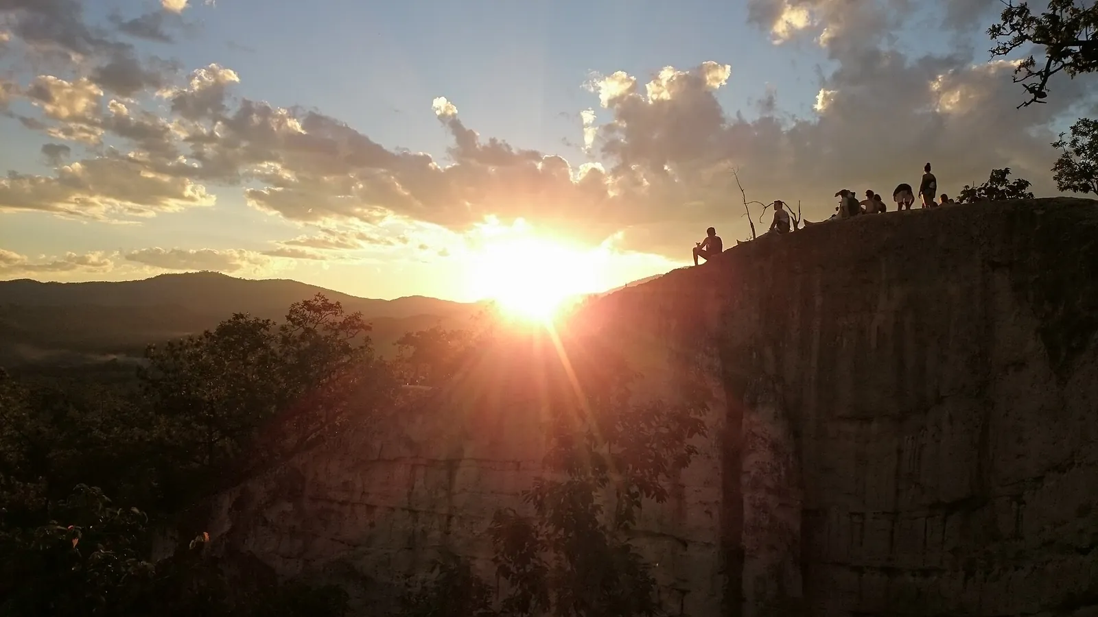
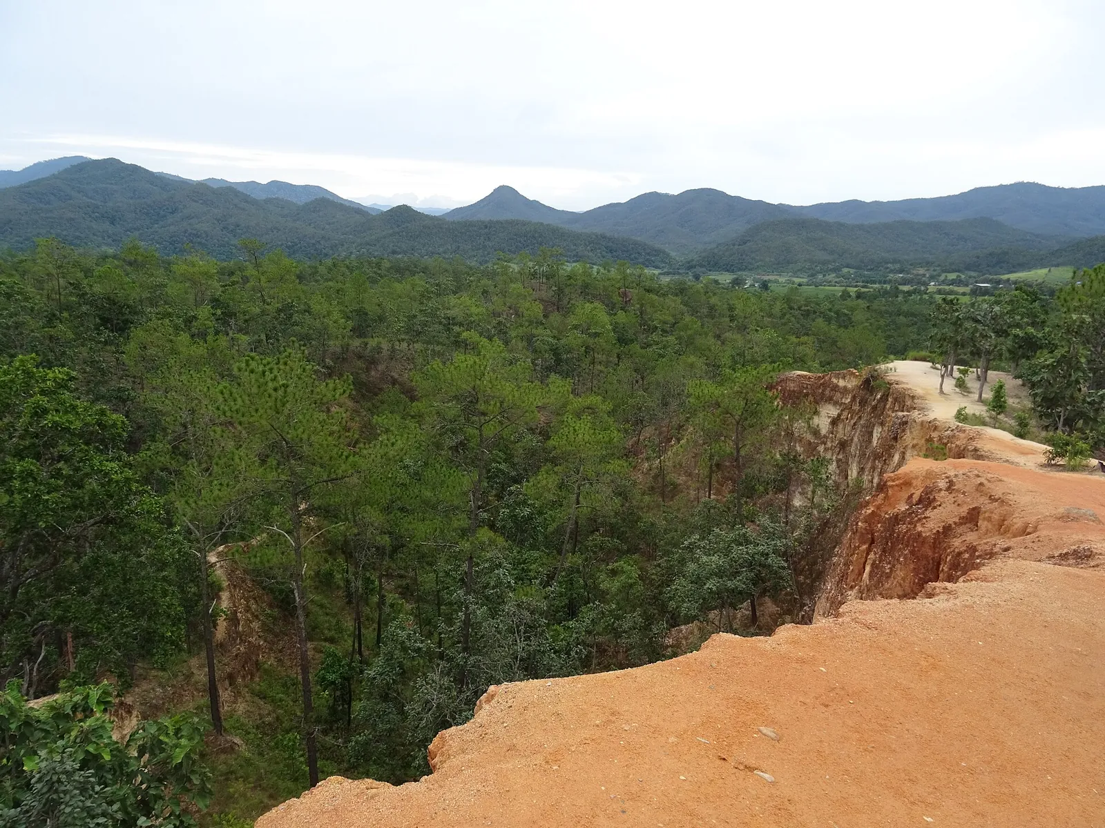
Pai Canyon, about 8 kilometres from town, is an area of eroded red sandstone with gullies and narrow ochre ridges dotted with pines. TAT recommends arriving a little before sunset, when the sun sinks behind the hills.
The ridges are narrow and unfenced, with steep drops on both sides. Wear shoes with grip, stay on the wider paths and do not walk the ridges in the dark or after rain.
Make time for the local food
What to eat and where to look
Khao soi
Egg noodles in coconut curry broth with chicken or beef, topped with crispy noodles — TAT's recommendation for anyone in the north.
- Where to look
- Restaurants in town and stalls on the walking street.
- Fit it into your day
- Lunch after a morning at the Bridge of Merit.
Contains coconut and wheat noodles.
Yunnanese pork hock and buns
Slow-braised pork leg served with soft steamed buns, a speciality of the Yunnanese village of Ban Santichon.
- Where to look
- Restaurants in Ban Santichon.
- Fit it into your day
- A long lunch with Chinese tea.
Rich and fatty; pork.
Walking-street snacks
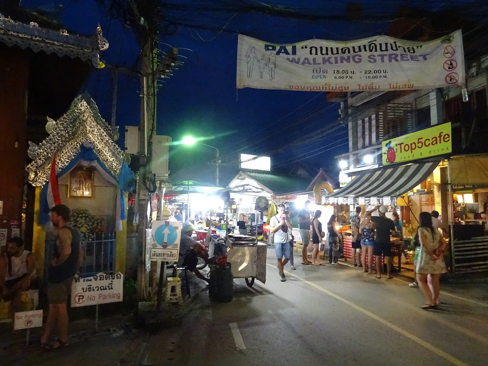
From grilled skewers and pad thai to international street food, the evening market has a wide choice.
- Where to look
- Pai Walking Street every evening.
- Fit it into your day
- Graze through dinner as you walk.
Busy in high season.
Around the valley
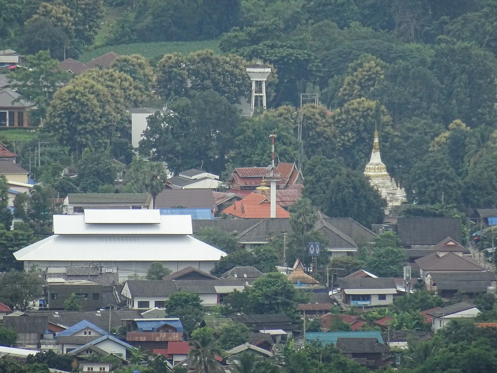
The Memorial Bridge across the Pai River, originally built by the Japanese during the Second World War, is near the canyon. The white Big Buddha on the hill of Wat Phra That Mae Yen looks over the valley; climb the steps in the early morning or late afternoon.
About 8 kilometres out of town, the bamboo Bridge of Merit (Kho Ku So) stretches more than 800 metres across rice fields to a temple; TAT explains it was built so that monks would no longer have to walk six kilometres to the village for alms. Tha Pai Hot Springs has pools of warm water and spots where the water reaches about 80°C, hot enough to boil eggs.
Ban Santichon and the walking street
Ban Santichon, about 5 kilometres from town, is a Yunnanese Chinese village of clay houses with restaurants serving pork hock with buns and herbal black chicken, tea tastings and costume photos. It can feel staged, but the food is good.
Every evening from about 18:00, Pai Walking Street fills Chaisongkran and Rungsiyanon Roads with food stalls, crafts and clothes. TAT singles out khao soi as the northern dish to try at least once.
Staying safe and getting around
Scooters are the usual way around the valley, and accidents are common among inexperienced riders. Wear a helmet, carry your licence and check that your travel insurance covers motorbikes; otherwise hire a car with a driver or use local taxis.
Pai is small and walkable in the centre. Choose a guesthouse a short walk from the walking street for convenience, or by the river for quiet nights.
Practical questions
How long does it take from Chiang Mai to Pai?
About three hours by minivan from Chiang Mai International Airport to Pai's bus station, according to TAT. The road is very winding.
When is the best time to visit Pai?
The cool months of November to January, when mornings are crisp and often misty.
Is Pai Canyon safe?
The ridges are narrow and unfenced with steep drops. Stay on wide paths, wear good shoes and avoid the ridges in the dark or after rain.
Do I need a scooter in Pai?
Not if you are not an experienced rider. The town centre is walkable, and taxis or drivers can take you to the sights.
How many days should I stay in Pai?
Three or four nights lets you see the canyon, hot springs and bamboo bridge without rushing.
Sources and checks before you travel
Reference sources for the version dated 1 October 2026. Confirm opening times, access, transport and conditions for your travel dates.
Does this experience fit your route?
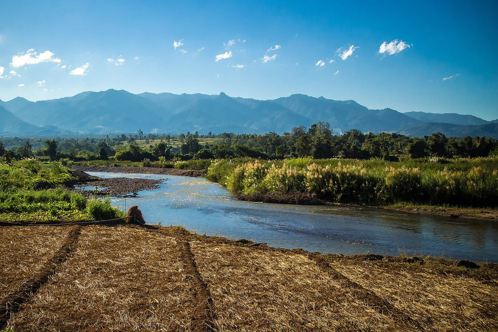
A rafting day shows the Pai River beyond the town. Check the water level for your dates and the safety briefing.
Check dates and details on Viator ↗ — opens in a new tabAffiliate link · Book with ViatorPhoto credits
Sunset at Pai Canyon.
Photograph: Sgroey — opens in a new tab · CC BY-SA 4.0 — opens in a new tab
Changes: Resized and converted to WebP; displayed with responsive crops. · Original photograph and licence details ↗ — opens in a new tab
The ridges of Pai Canyon by day.
Photograph: Christophe95 — opens in a new tab · CC BY-SA 4.0 — opens in a new tab
Changes: Resized and converted to WebP; displayed with responsive crops. · Original photograph and licence details ↗ — opens in a new tab
Pai town from the hill of Wat Phra That Mae Yen.
Photograph: Christophe95 — opens in a new tab · CC BY-SA 4.0 — opens in a new tab
Changes: Resized and converted to WebP; displayed with responsive crops. · Original photograph and licence details ↗ — opens in a new tab
The Pai River north of town.
Photograph: Lestermandersson — opens in a new tab · CC BY-SA 3.0 — opens in a new tab
Changes: Resized and converted to WebP; displayed with responsive crops. · Original photograph and licence details ↗ — opens in a new tab
Pai Walking Street in the evening.
Photograph: Christophe95 — opens in a new tab · CC BY-SA 4.0 — opens in a new tab
Changes: Resized and converted to WebP; displayed with responsive crops. · Original photograph and licence details ↗ — opens in a new tab