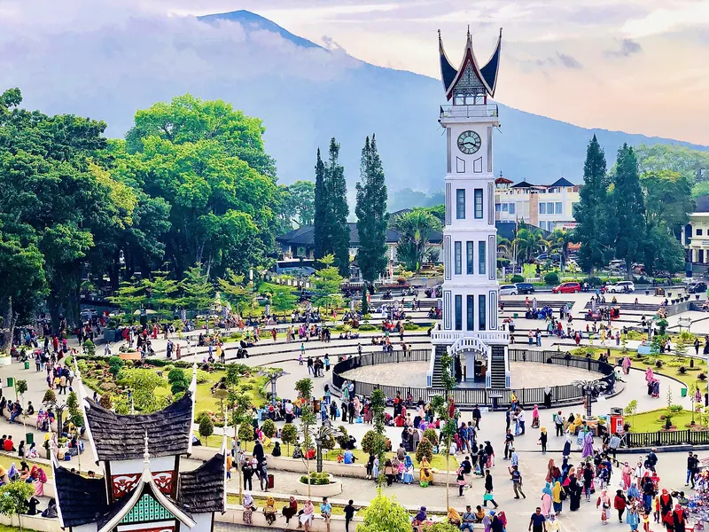
Sumatra · North Sumatra
Lake Toba and Samosir guide: Tuktuk, Batak villages and getting there
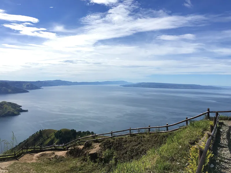
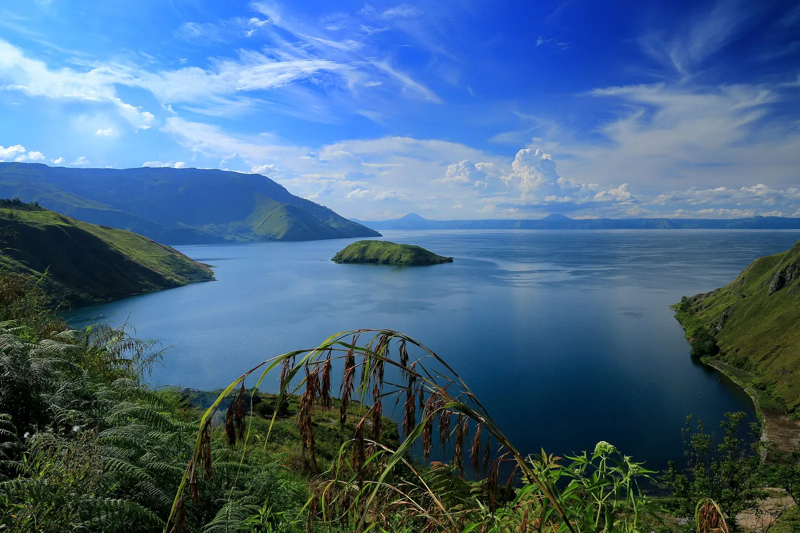
Lake Toba fills the caldera of a supervolcano in the highlands of North Sumatra: a lake about 100 kilometres long and up to 505 metres deep, at roughly 900 metres above sea level, with an island in the middle that the Ministry of Tourism describes as almost the size of Singapore. That island, Samosir, is the heartland of the Toba Batak, and most travellers come for the combination of the two: cool air and wide water views, plus stone-walled villages, carved boat-shaped houses and a living culture of ulos weaving, tortor dance and Batak cooking. Getting there takes a day from Medan, so the real decisions are where on the lake to sleep, how many days to give it and which boat or road to use.
- Suggested time
- 3–4 nights, plus a travel day each way
- Where to stay
- Tuktuk on Samosir; Parapat for a late arrival or an early departure; Balige near Silangit airport
- Season and timing
- The Ministry of Tourism names April to October as the dry season and the best time for boating, hiking and viewpoints; from November to March heavy rain and strong winds can disrupt plans. At about 900 metres the lake is cooler than Medan all year. Wikivoyage notes that rooms become scarce and expensive around Chinese New Year.
The short answer
Give Lake Toba three to four nights, not counting the travel day in. Sleep on the Tuktuk peninsula on Samosir's east coast, where most of the lake's guesthouses are, and use it as a base: one day for the Batak villages on the east shore (Huta Siallagan in Ambarita, Tomok and the Huta Bolon museum at Simanindo, where a tortor dance with the sigale-gale puppet is listed at 10:30 and 11:45), one day by rented motorbike or car to the west side (Pangururan, the Tano Ponggol bridge and Bukit Holbung), and one day to do very little. Reach the lake from Kualanamu (KNO) in Medan by road to Parapat, about 4 to 5 hours according to the Ministry of Tourism, then take a passenger boat across to Tuktuk or Tomok. Alternatively fly to Silangit (DTB), the lake's own airport near its southern shore, about 76 kilometres from Parapat. Cross only in daylight and good weather, on a boat that carries life jackets.
Where to stay: Tuktuk, Parapat or the south shore
Most visitors sleep on Tuktuk (Tuktuk Siadong), a small peninsula on the east coast of Samosir. English Wikipedia notes that the island's tourist accommodation is concentrated here, a ferry ride of about an hour from Parapat. The Ministry of Tourism describes walking the main street at an easy pace as the best way to get around it. Tuktuk is also known for its woodcarving, as Indonesian Wikipedia notes.
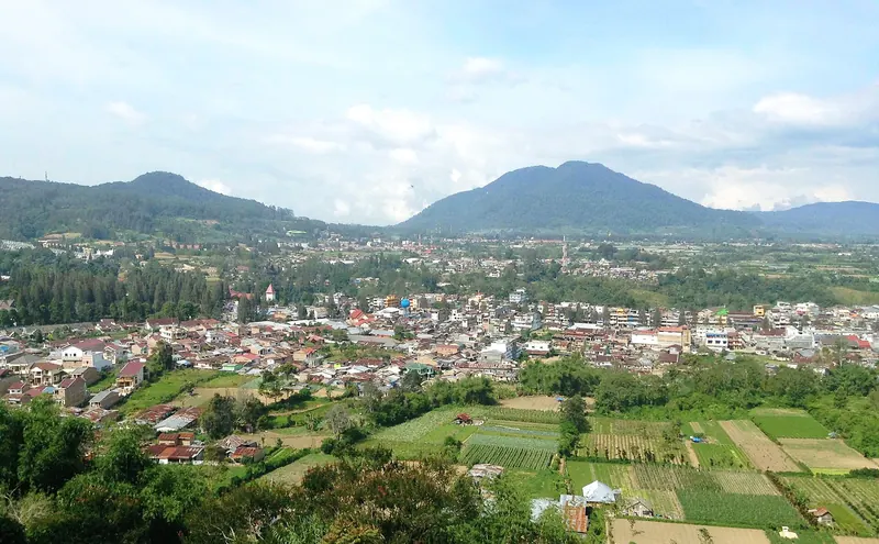
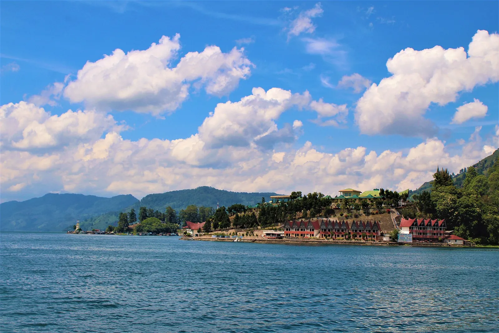
Parapat, on the eastern mainland shore, is the transit town. It is where buses from Medan arrive and where the boats to Samosir leave from Tigaraja and nearby Ajibata harbours. Sleep here if you arrive after dark or need to leave early, but it is not the place to spend your lake days.
The south shore, around Balige, is closer to Silangit airport. Wikivoyage says it is becoming increasingly popular, and the Ministry of Tourism lists Parapat, Tuktuk and Balige as the main places to stay. Choose Balige if you are flying in and out of Silangit and want to save driving time, and accept that you will be further from the Samosir villages.
- First visit, three or more nights: Tuktuk.
- Late bus or an early start: one night in Parapat.
- Flying via Silangit with little time: Balige or the south shore.
- Around Chinese New Year: book early, as Wikivoyage warns that availability drops sharply.
Batak villages on the east shore: Ambarita, Tomok and Simanindo
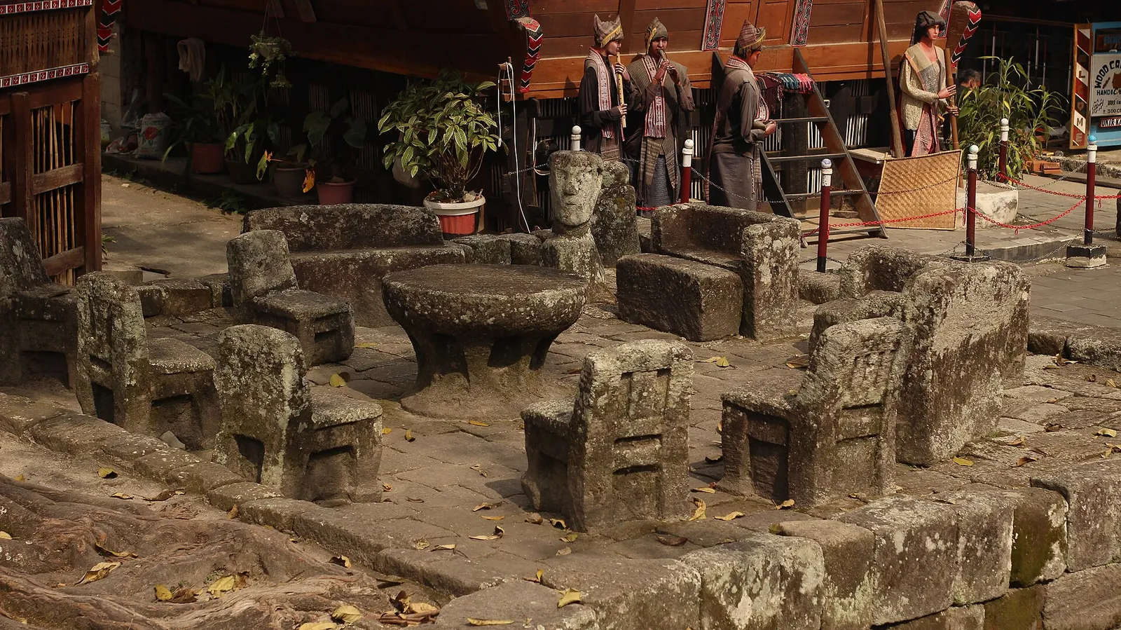
The east coast of Samosir, within easy reach of Tuktuk, holds the island's best-known Batak heritage sites. Huta Siallagan at Ambarita is a walled village of about 11,000 square metres. Indonesian Wikipedia describes stone walls 1.5 to 2 metres high, rumah bolon (traditional houses) and a circle of carved stone chairs around a stone table, the Batu Parsidangan, where the village held its meetings and trials. The stones are believed to be more than 200 years old. A sacred hariara tree stands in the centre. The site was restored between 2020 and 2021 and reopened in February 2022.
Tomok, south of Tuktuk, sits right beside the boat landing from Parapat. Indonesian Wikipedia lists the large stone tomb of King Sidabutar and his family, a Batak museum, a sigale-gale statue and stone chairs here. The Ministry of Tourism says the Tomok Museum, opened in 2005, is built in the style of a rumah bolon and shows gorga carvings, old weapons, farming tools, kitchenware, wooden statues and ulos textiles.
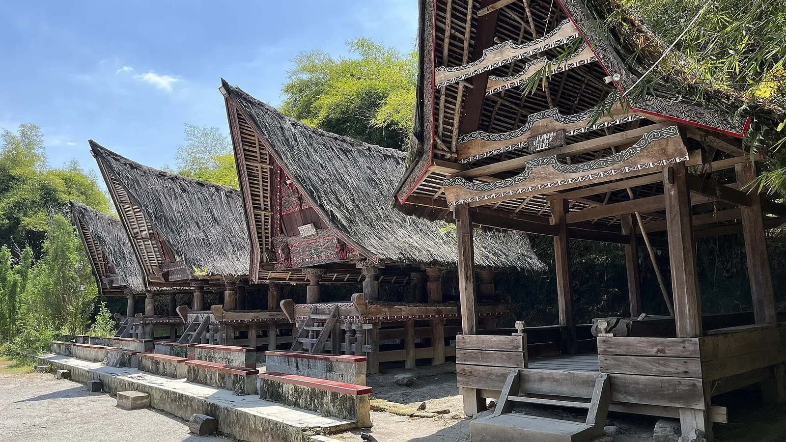
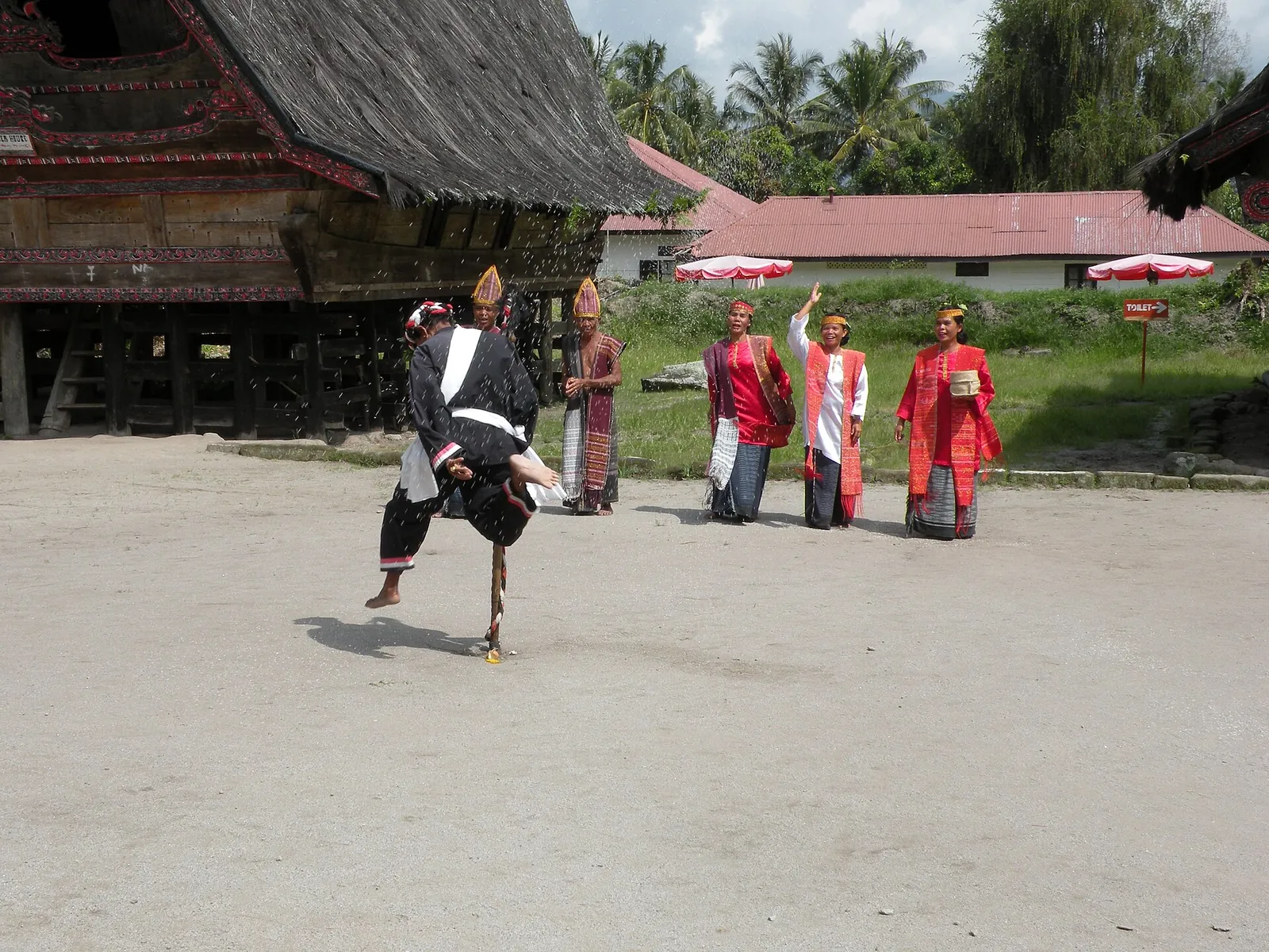
On the northern side of the island, Museum Huta Bolon Simanindo was once the home of King Sidauruk and, according to the Ministry of Tourism, his 14 wives. It opened as a museum in 1969, with two facing rows of Batak houses and collections that include pustaha laklak (bark books) and a tunggal panaluan (a carved ritual staff). When we checked on 2026-10-03, the Ministry of Tourism listed the museum as open daily from 10:00 to 17:00 and a tortor dance performance with the sigale-gale puppet at 10:30 and 11:45. Indonesian Wikipedia gives different opening hours, so confirm locally. Wikivoyage puts Simanindo about 30 minutes' drive from Tuktuk, so time your morning around the dance.
Sigale-gale is a life-sized wooden puppet worked by strings from behind. English Wikipedia explains that it was traditionally danced at the funeral of a person who died without children, to stand in for the descendants who would normally perform the rites. The Ministry of Tourism describes tortor itself as a dance for harvests and weddings with older ritual roots.
- A good order from Tuktuk: Simanindo for the late-morning dance, Ambarita (Huta Siallagan) on the way back, Tomok in the afternoon.
- Dress modestly; the Ministry of Tourism asks visitors to respect the customs of traditional communities.
- The Batak greeting horas, which Wikivoyage notes is used for welcome, good morning and farewell, is always well received.
Make time for the local food
What to eat and where to look
Arsik (spiced carp)
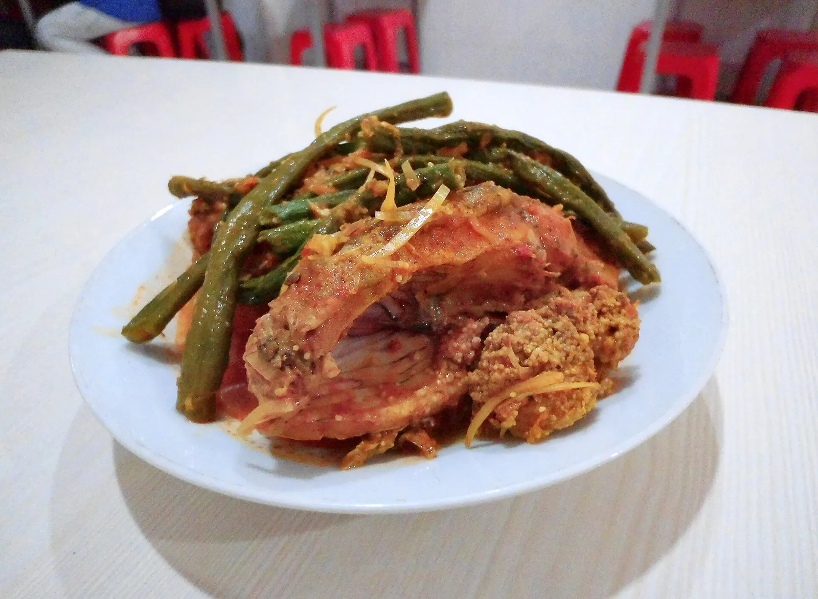
The signature Batak Toba dish: carp cooked with turmeric, ginger, shallots, chilli, torch ginger and andaliman, a citrusy, tongue-tingling pepper that English Wikipedia says grows only in the Batak highlands of North Tapanuli and Samosir. Wikivoyage describes it as savoury, spicy and slightly sour.
- Where to look
- Batak restaurants (lapo) in Tuktuk, Tomok, Pangururan and Parapat; ask for ikan mas arsik.
- Fit it into your day
- A shared lunch or dinner with rice.
Freshwater fish with many small bones; andaliman numbs the mouth slightly.
Naniura
Carp cured raw in lime juice and salt, then coated with spices, as Wikivoyage describes it.
- Where to look
- Batak restaurants around the lake; ask whether it is available.
- Fit it into your day
- A small shared dish alongside cooked food.
The fish is not cooked by heat; skip it if you are pregnant or have a sensitive stomach.
Babi panggang Karo (BPK) and Batak pork dishes
Fatty marinated roast pork, which Wikivoyage calls a favourite of the Batak peoples of North Sumatra. Most Toba Batak are Christian, and pork is central to their cooking.
- Where to look
- Batak eateries in Parapat and on Samosir.
- Fit it into your day
- A filling lunch on a driving day.
Contains pork; if you avoid pork, ask before ordering in Batak eateries.
Tipa-tipa, itak gurgur and Mandheling coffee
Wikivoyage describes tipa-tipa as a snack of soaked, roasted old rice and itak gurgur as hand-moulded rice cakes filled with palm sugar. The Ministry of Tourism recommends Sumatran Mandheling arabica coffee as a souvenir.
- Where to look
- Souvenir stalls in Tomok and Parapat, and coffee shops in Tuktuk.
- Fit it into your day
- An afternoon coffee break with a view of the lake.
Tuak, the palm wine you may be offered, is alcoholic; Wikivoyage notes that some locals disapprove of it.
Around Samosir by bike: the west side, Pusuk Buhit and the viewpoints
Samosir is far bigger than it looks from Tuktuk: English Wikipedia gives it an area of 630 square kilometres. The Ministry of Tourism suggests hiring a motorbike and following the road around the edge of the island, which is rough and unpaved in places but gives spectacular views from its high points. Wikivoyage adds that most Tuktuk guesthouses rent bicycles, and that there are no taxis around the lake. If you are not a confident rider on poor roads, hire a car and driver for the day.
On the west side, Pangururan is where Samosir meets the mainland. The island was once joined to the caldera wall by a narrow isthmus, which was cut by the Tano Ponggol canal in 1906 and widened in 2019. A bridge crosses it to Tele, which English Wikipedia says has one of the best views of the lake and the island. Wikivoyage mentions the Tele observation tower among the area's landmarks.
South-west of Pangururan, Bukit Holbung is a grassy hill above the lake in Sitiotio district. Indonesian Wikipedia gives the distance from Pangururan as about 22 kilometres, under an hour, on a narrow road along the hillside. Also on the west side, partly in Pangururan district, rises Pusuk Buhit, a 1,972-metre peak on the western edge of the lake that Batak mythology names as the birthplace of Si Raja Batak, the ancestor of the Batak people.
On any day out, start early, carry water and cash, and be back before dark. Wikivoyage warns that clinics are scarce around the lake and an ambulance can take hours.
Getting there: Medan by road, or Silangit by air
Most international travellers land at Kualanamu International Airport (KNO) near Medan and continue by road. The Ministry of Tourism puts Parapat 176 kilometres from Medan and says public buses take under six hours, on the direct road or via Berastagi; its trip-planning article gives about four to five hours by road. Wikivoyage describes the route via Pematang Siantar and the toll road as the usual one from Kualanamu, about three to four hours by car to Parapat, and notes that buses leave from Amplas terminal in Medan. Travel agents in Medan can also arrange a car with driver, the ministry says. There is no direct train to the lake.
The lake's own airport is Sisingamangaraja XII International Airport (DTB), still widely called Silangit, at Siborong-Borong in North Tapanuli near the southern shore. English Wikipedia says it is about 76 kilometres from Parapat. When we checked on 2026-10-03, Wikipedia listed flights from Jakarta and Batam, and the Ministry of Tourism mentioned connections from Kualanamu and direct flights from Jakarta. Despite the name, Wikipedia reports that the airport lost its international status in April 2024, so you cannot fly here directly from abroad. Check current routes with the airlines.
From Parapat, passenger boats cross to Tuktuk and Tomok, and Wikivoyage says you can ask to be dropped at your guesthouse's own jetty in Tuktuk. Larger car ferries run from Ajibata to Tomok and to Ambarita. Take safety seriously: in June 2018 the overloaded MV Sinar Bangun capsized in rough weather and 167 people died, as English Wikipedia records. Do not board an overloaded boat, make sure life jackets are on board, and wait if the wind is up. Wikivoyage advises the same, and suggests taking a boat with at least two engines.
Coming from the north, the Berastagi road reaches the lake at Merek; Wikivoyage puts this about 2.5 hours from Medan, with Tongging and the Sipiso-piso waterfall close by. The Ministry of Tourism describes the waterfall as about 120 metres high. From the south, the ministry says public buses run from Bukittinggi via Tarutung.
Swimming, the lake and how to spend a slow day
Lake Toba is the largest volcanic lake in the world, according to English Wikipedia. It formed after a supereruption about 74,000 years ago, the largest known explosive eruption on Earth in the last 25 million years. Samosir itself is a resurgent dome pushed up from the caldera floor. In July 2020 the Toba Caldera was recognised as a UNESCO Global Geopark.
You can swim, but choose your spot. Wikivoyage warns that water quality varies around the lake and that some areas are not recommended because of pollution from intensive fish farming; ask your guesthouse where people swim. For more active days, the Ministry of Tourism describes kayak routes from Tongging, from an easy 12 kilometres to Silalahi to a demanding 175-kilometre northern circuit.
Leave room in the plan to do nothing. The Ministry of Tourism calls Toba a place to sit back and take in the view, and the cool, clear air at 900 metres is a real break after Medan. Use the time for the things you would otherwise rush: shopping for ulos, the handwoven Batak cloth given at births, weddings and funerals, and for woodcarvings and Sumatran Mandheling arabica coffee, which the ministry recommends as souvenirs.
Practical questions
How many days do I need at Lake Toba?
Three to four nights on Samosir, plus a day to get there from Medan and a day to get back. That gives you one day for the east-shore Batak villages, one for the west side by motorbike or car, and one to relax.
Where should I stay, Tuktuk or Parapat?
Tuktuk on Samosir, where most guesthouses are and where the Batak villages are close by. Parapat, on the mainland, is the bus and ferry town: use it for a late arrival or an early departure.
Should I fly to Silangit or to Medan?
From abroad you will land at Kualanamu (KNO) in Medan, because Wikipedia reports that Silangit lost its international status in 2024. From Medan, either drive to Parapat or take a domestic flight to Silangit (DTB), about 76 km from Parapat. Silangit makes the most sense if you are already flying from Jakarta or Batam.
Are the boats to Samosir safe?
Use them in daylight and calm weather, and never board an overloaded boat. A ferry disaster in 2018 killed 167 people. Check that there are life jackets on board, and wait if the wind and waves pick up.
When can I see the sigale-gale dance?
When we checked on 2026-10-03, the Ministry of Tourism listed tortor performances with the sigale-gale puppet at Museum Huta Bolon Simanindo at 10:30 and 11:45. Confirm with your guesthouse before you set out.
Can I swim in Lake Toba?
Yes, but not everywhere. Wikivoyage warns that fish farming has polluted some parts of the lake. Ask locally where people swim.
Sources and checks before you travel
Reference sources for the version dated 3 October 2026. Confirm opening times, access, transport and conditions for your travel dates.
- Indonesia Travel (Ministry of Tourism): Lake Toba ↗ — opens in a new tab
- Indonesia Travel (Ministry of Tourism): 6 important things to know before exploring Lake Toba ↗ — opens in a new tab
- Indonesia Travel (Ministry of Tourism): 5 Batak museums around Lake Toba ↗ — opens in a new tab
- Indonesia Travel (Ministry of Tourism): Museum Huta Bolon Simanindo ↗ — opens in a new tab
- Indonesia Travel (Ministry of Tourism): 7 activities at Lake Toba ↗ — opens in a new tab
- Wikivoyage: Lake Toba ↗ — opens in a new tab
- Wikipedia: Lake Toba ↗ — opens in a new tab
- Wikipedia: Samosir ↗ — opens in a new tab
- Wikipedia: Sisingamangaraja XII International Airport ↗ — opens in a new tab
- Wikipedia (Indonesian): Huta Siallagan ↗ — opens in a new tab
- Wikipedia (Indonesian): Tomok, Simanindo, Samosir ↗ — opens in a new tab
- Wikipedia (Indonesian): Pusuk Buhit ↗ — opens in a new tab
- Wikipedia: Sigalegale ↗ — opens in a new tab
- Wikipedia: Arsik ↗ — opens in a new tab
- Wikipedia (Indonesian): Bukit Holbung ↗ — opens in a new tab
- Wikipedia (Indonesian): Tuktuk Siadong ↗ — opens in a new tab
- Wikipedia (Indonesian): Museum Huta Bolon Simanindo ↗ — opens in a new tab
Photo credits
Lake Toba seen from the hills of Samosir Island
Photograph: PL 05 SIGIT — opens in a new tab · CC BY-SA 4.0 — opens in a new tab
Changes: Resized and converted to WebP; displayed with responsive crops. · Original photograph and licence details ↗ — opens in a new tab
Traditional Batak houses at Museum Huta Bolon Simanindo on Samosir
Photograph: Nafisathallah — opens in a new tab · CC BY-SA 4.0 — opens in a new tab
Changes: Resized and converted to WebP; displayed with responsive crops. · Original photograph and licence details ↗ — opens in a new tab
The stone meeting chairs (Batu Parsidangan) at Huta Siallagan, Ambarita
Photograph: Nafisathallah — opens in a new tab · CC BY-SA 4.0 — opens in a new tab
Changes: Resized and converted to WebP; displayed with responsive crops. · Original photograph and licence details ↗ — opens in a new tab
A tortor dance performance at Huta Bolon, Simanindo
Photograph: Reskihasan — opens in a new tab · CC BY-SA 4.0 — opens in a new tab
Changes: Resized and converted to WebP; displayed with responsive crops. · Original photograph and licence details ↗ — opens in a new tab
Parapat on the eastern shore of Lake Toba, seen from Ajibata
Photograph: ButetSinaga — opens in a new tab · CC BY-SA 4.0 — opens in a new tab
Changes: Resized and converted to WebP; displayed with responsive crops. · Original photograph and licence details ↗ — opens in a new tab
Arsik, the Batak carp dish of the Lake Toba region
Photograph: Gunawan Kartapranata — opens in a new tab · CC BY-SA 4.0 — opens in a new tab
Changes: Resized and converted to WebP; displayed with responsive crops. · Original photograph and licence details ↗ — opens in a new tab