Pokhara and the Annapurnas · Gandaki
Annapurna Base Camp trek: days, permits, altitude and season
Annapurna Base Camp asks for more than Poon Hill and gives more back: a walk that ends inside a ring of snow peaks at 4,130 m. The Nepal Tourism Board describes the trek as leading into the heart of the Annapurna Sanctuary, with Annapurna I, Machhapuchhre (Fishtail) and Hiunchuli around you. It is a guided trek in a protected area, and it climbs far above the height where altitude illness begins. This guide helps you decide whether to book it, which of the two usual shapes of the walk fits your days, what to arrange in Pokhara before you set out and when to go.
- Suggested time
- 7 to 8 days on the trail for the direct walk, 10 to 12 with Poon Hill, plus a night in Pokhara before and after
- Where to stay
- Pokhara (Lakeside) before and after the trek; lodges in the villages and at Annapurna Base Camp on the trail
- Season and timing
- The Nepal Tourism Board names spring, when the rhododendrons bloom, and autumn as the best times, with the clearest skies after the monsoon in October and November. Read the season section for rain and road conditions.
The short answer
Book a registered trekking agency first: it supplies the licensed guide and buys your TIMS card, NPR 2,000 (NPR 1,000 for SAARC nationals), and you also need the Annapurna Conservation Area permit, NPR 3,000 for foreigners; both fees were checked on 17 October 2026. Plan seven or eight days for the direct walk in from Ghandruk and ten to twelve if you add Poon Hill, plus a night in Pokhara before and after. Base camp is at 4,130 m; the altitude section explains the pacing rule and the caution for day 5. Spring and autumn are the two trekking seasons.
Annapurna Base Camp or Poon Hill: which trek fits your days
The choice comes down to time and height. The Poon Hill trek tops out at the 3,210 m sunrise viewpoint and fits into a few days; Annapurna Base Camp climbs to 4,130 m and needs a week at the least. The Nepal Tourism Board treats the two as neighbours: its TIMS list names a combined Poon Hill-ABC route, and it says the base camp trek offers sunrise views if combined with Poon Hill.
Book Annapurna Base Camp if you can give it at least a week with a day spare, you are in good health and you want to stand inside the Sanctuary rather than look at it from a ridge. Add Poon Hill if you have ten to twelve days. Choose Poon Hill alone if your time is short or you have never slept above 3,000 m; it is the easier way to learn how your body reacts to height.
This is a walk on a trail with lodges and a guide, not a mountaineering expedition, but nothing about the route lowers the altitude risk, and a bad-weather day can close a stage. The days below therefore carry a margin.
Inside the Sanctuary: Annapurna I, Fishtail and the hill villages
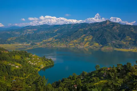
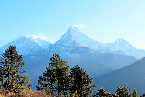
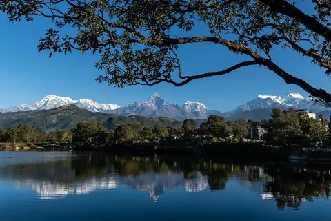
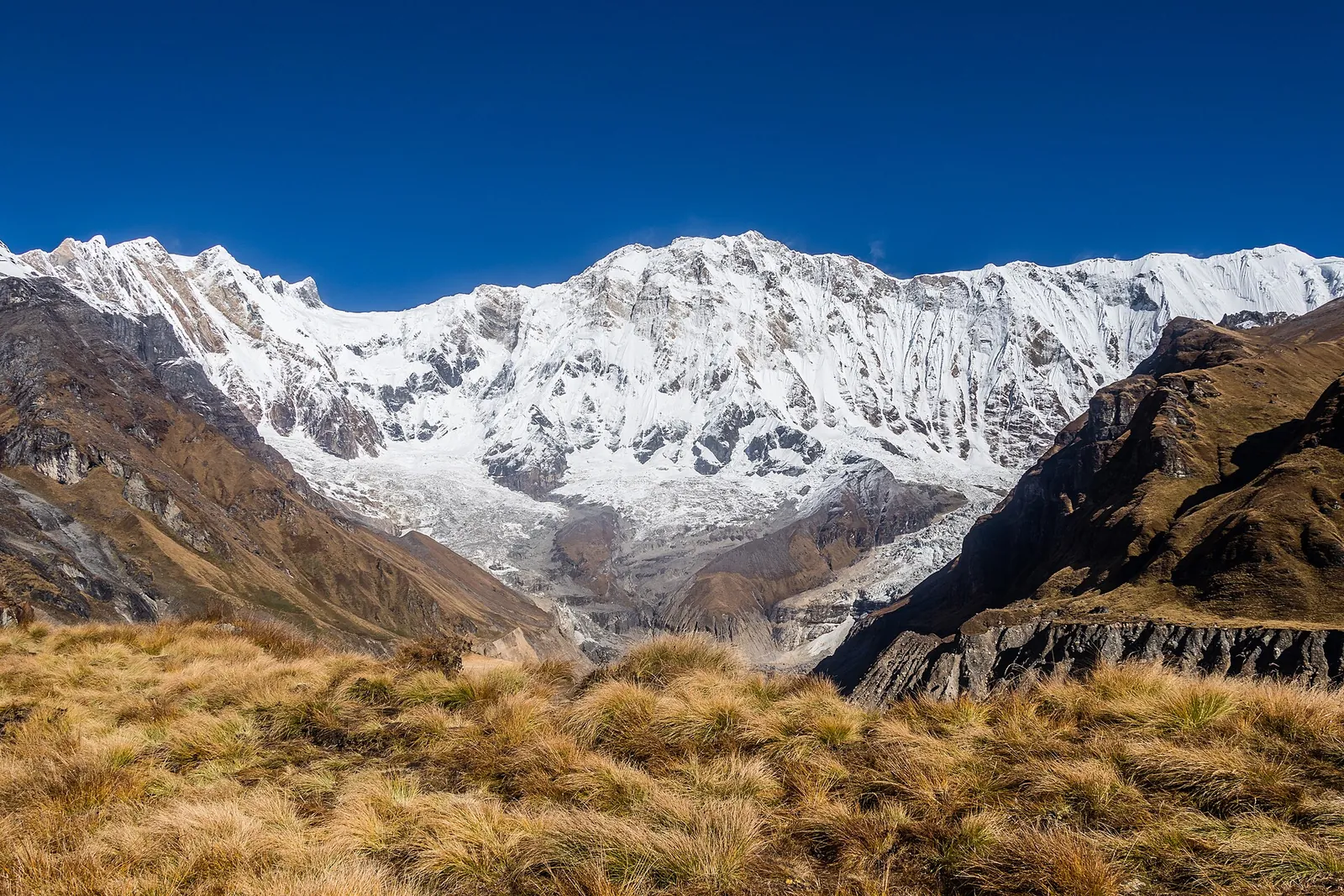
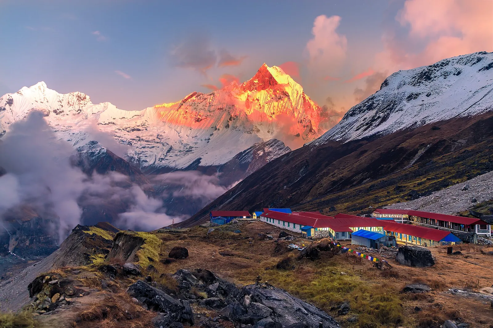
The payoff is the amphitheatre at the top. The Nepal Tourism Board puts the Sanctuary at 4,130 m and names the peaks around it: Annapurna I at 8,091 m, Machhapuchhre, the Fishtail, and Hiunchuli. Annapurna I is the tenth highest mountain in the world, the board says, and the Annapurna range stretches 55 km; Annapurna South, at 7,219 m, is one of the three other peaks that carry the name. Machhapuchhre is the razor-edged peak you will already know from Pokhara, where the board calls its Fish Tail the most lasting impression many visitors take home; at Machhapuchhre Base Camp, the last stop below the Sanctuary, you stand beneath it.
Sleep at base camp rather than turning round at midday. Sunrise is the reason: the first light falls on the ring of peaks around the lodges, and that is the view the climb is for.
The villages below are part of the walk. Ghandruk, the board says, is a traditional Gurung village with a Gurung museum and one of the best views of Annapurna South, Gangapurna, Annapurna III, Hiunchuli and Machhapuchhre; the conservation area project itself began there as a pilot programme in 1986, according to the National Trust for Nature Conservation. The trust, which runs the Annapurna Conservation Area, says it covers 7,629 square kilometres and is home to over 100,000 residents; Gurung and Magar communities are the dominant groups in the south, where the trek starts. If you take the Poon Hill variant, you also pass the rhododendron forest at Ghorepani, which the trust counts among the largest in the world.
Route and stages from Ghandruk or Birethanti to base camp
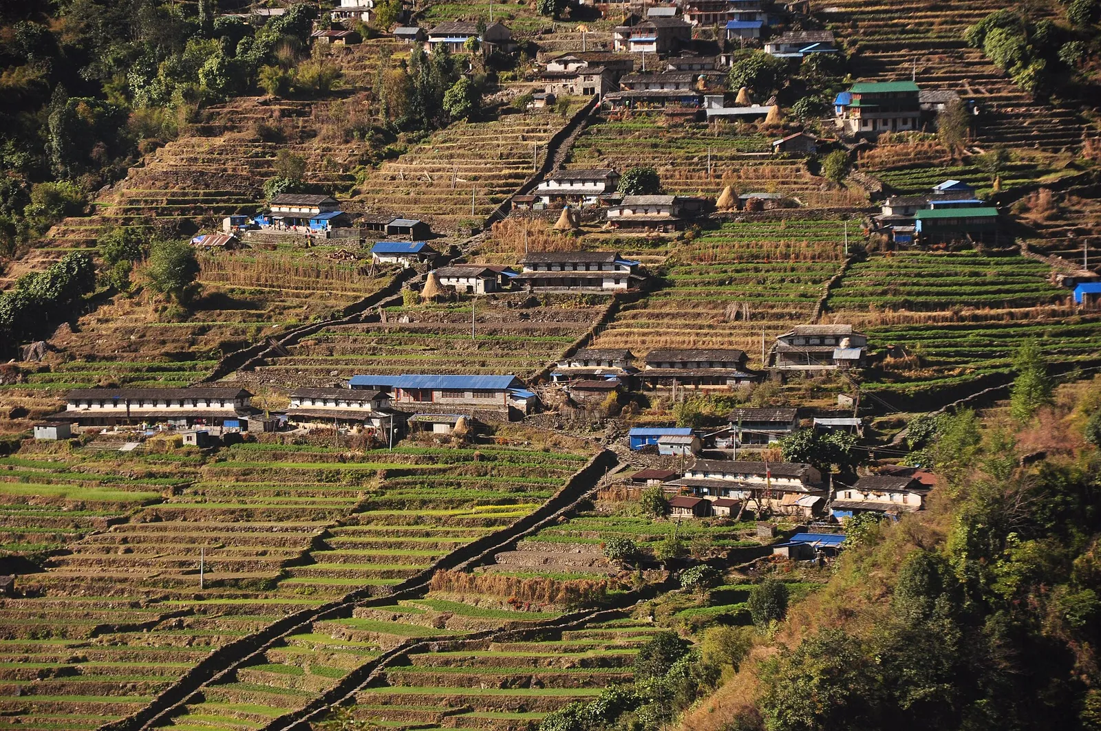
The Trekking Agencies' Association of Nepal prints the normal route on its TIMS overview page. For the Poon Hill-ABC trek it reads Pothana or Birethanti, Poon Hill, Chhomrong, Dobhan, Annapurna Base Camp, with the TIMS check post at Birethanti and the exit check post at Birethanti or Pothana. The tourism board adds that you can also start the Annapurna trek at Ghandruk, which a road reaches from Pokhara. That gives two shapes of the walk: the direct one goes in at Ghandruk and on to Chhomrong; the longer one starts at Birethanti, crosses Poon Hill and joins the same valley at Chhomrong. Above Chhomrong both share the climb through Dobhan to Machhapuchhre Base Camp and Annapurna Base Camp, and the walk back down. Return to the road at Ghandruk; the tourism board also names Kimche among the trails around the village.
The days below are our plan for each shape, one night's stop per day; your agency fixes the final stops. The official pages used here do not give the intermediate sleeping heights or describe the stages through Himalaya and Deurali; have your agency set these out before you book.
- Direct walk, day 1: road transfer from Pokhara to Ghandruk, the afternoon in the village and its Gurung museum, and the night there.
- Day 2: Ghandruk to Chhomrong, the village on the association's route before the Sanctuary.
- Day 3: Chhomrong up the valley to Dobhan.
- Day 4: Dobhan through Himalaya to Deurali.
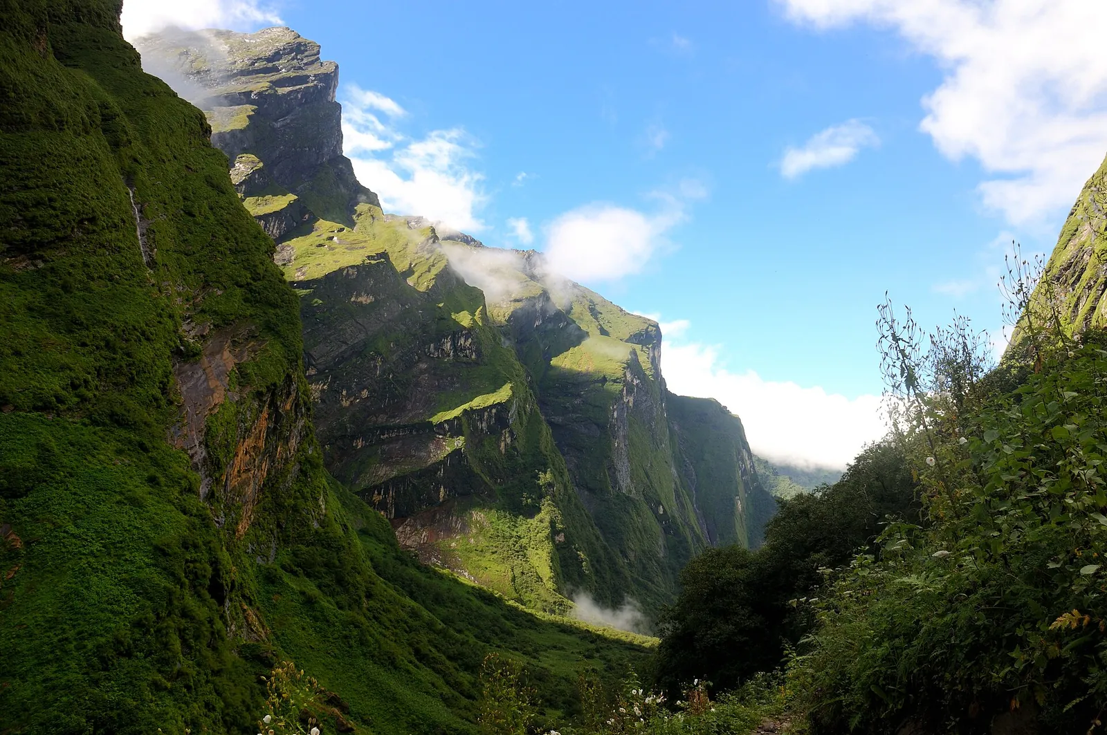
- Day 5: Deurali to Machhapuchhre Base Camp and on to Annapurna Base Camp at 4,130 m, for the night and the sunrise. This is a large sleeping-height gain, so have your agency explain its acclimatisation plan before you book and tell your guide at once if you feel unwell.
- Day 6: back down the valley to Dobhan.
- Day 7: down to Chhomrong and out to the road at Ghandruk, then the drive to Pokhara.
- Day 8: the spare day, for snow, rain or a slower climb.
- With Poon Hill, days 1 to 4: transfer to Birethanti, register at the TIMS check post, climb to Ghorepani for the Poon Hill sunrise at 3,210 m and cross the hills to Chhomrong; from there the plan follows the direct walk from day 3, which brings the total to ten to twelve days and the exit at Birethanti or Pothana.
Licensed guide, TIMS card and conservation area permit
Foreign trekkers may not walk this route alone. The Nepal Tourism Board says that since 31 March 2023 foreign trekkers on a listed set of routes in protected areas must be accompanied by a licensed trekking guide and carry a TIMS card issued through a trekking agency, and its list names Poon Hill-ABC. The board prints the route under that name, so arrange the guide and the card whichever way you walk in. The UK government adds that nobody should trek alone.
Only agencies buy the TIMS card: the agency registers the trekkers, guides and route on the board's system and pays online, and each trekker gets an e-card with a QR code. The UK government warns about trekking deals that look very cheap.
Fees. On the official pages checked on 17 October 2026, the TIMS card cost NPR 2,000 for foreign trekkers other than South Asian (SAARC) nationals, who pay NPR 1,000, and the Annapurna Conservation Area permit cost NPR 3,000 for foreigners and NPR 1,000 for SAARC nationals, tax included, for one entry; children under 10 do not need the permit. Give the agency your full range of days, spare ones included: Germany's Federal Foreign Office says permits must cover the whole planned trek.
The permit can be bought on the National Trust for Nature Conservation's e-permit website, with a 2.9% online payment-gateway charge, or in cash at one of its counters with your passport or other valid identification, with no additional charge. Permits issued at check-posts cost double, so buy it before the trek. It is non-transferable and non-refundable, and you should register at the check-posts along the route. The board's restricted-area permit table does not list these trails. The full permit picture for all the treks is in the trekking permits guide.
Insurance. Make sure your policy covers trekking to 4,130 m: the UK government advises cover for mountain rescue and helicopter costs and warns that rapid helicopter evacuation may be hard to arrange from a remote area. France's foreign ministry says mountain rescue is paid for and helicopters fly only when payment is guaranteed; give your insurance details to the agency before the trek. It reserves helicopter transport from an accident site to Kathmandu for extreme emergencies. France's foreign ministry recommends that trekkers or their guides carry satellite phones.
What the trek costs two people
For two foreign adults other than SAARC nationals, the permits come to NPR 10,000: two TIMS cards at NPR 2,000 and two conservation area permits at NPR 3,000, at the fees checked on 17 October 2026, paying the conservation-area fee at a counter.
Guide, porter, transfer and lodge prices are not published as one official tariff, so compare agencies on the full package price and on what it includes.
Have the quote list lodge nights and meals, the guide and any porter, transfers, tips and insurance separately, including the spare day. Budget for the Pokhara nights either side, which the where to stay guide covers.
Altitude, avalanches and landslides above 3,000 m
At 4,130 m the Sanctuary is the highest point this guide asks of you, and the risk starts much lower. Germany's Federal Foreign Office advises seeing a doctor experienced in altitude medicine before any trip above 2,300 m, and UK Travel Health Pro says altitude illness is a risk from 2,500 m.
TravelHealthPro advises gaining no more than about 500 m of sleeping height a day above 3,000 m. Take a rest day at the same altitude every three or four days. UK Travel Health Pro also advises spending a few days below 3,000 m and, where possible, avoiding a rise from under 1,200 m to over 3,500 m in one day. If you develop symptoms of altitude sickness, stop climbing, descend promptly with a companion to a lower altitude (below 4,000 m if you are higher) and consult a doctor. Signs of cerebral or pulmonary oedema need immediate descent and emergency medical treatment. The tourism board adds that temperatures fall about 6 degrees C for every 1,000 m you climb.
The UK government lists sudden weather changes, avalanches and snow drifts, landslides, rockfalls and flooding among the hazards above 3,000 m all year round. After heavy snow or rain, be prepared to wait or turn back with your guide; the spare day allows room to change the plan.
For a weather or flood warning call 1155, the Nepal Meteorological Department's toll-free line, and for help call the tourist police on 1144. Nepal Police lists tourist-police posts at Birethanti, Ghorepani, Ghandruk and Dhampus.
When to go: spring, autumn and the monsoon
The Nepal Tourism Board says that for most trekking areas the best times are spring and autumn. Spring is when the rhododendrons bloom, and the clearest skies come after the monsoon, in October and November. The seasons and the other regions are compared in the best time guide.
The monsoon runs from June to September. The board gives Pokhara 3,345 mm of rain a year against 1,600 mm for the country. The UK government gives June to October as the season when travel can be hazardous, with floods and landslides making roads impassable and cutting off towns for days. Winter is cold, but the board points out that even in December and January there is bright sun and brilliant views; keep the spare day for weather.
Getting from Pokhara to the trailhead
Fly from Kathmandu to Pokhara before the trek. Yeti Airlines gives Kathmandu to Pokhara as about 25 minutes. The Pokhara guide covers the flight and the bus, and the nights either side of the trek. The Nepal Tourism Board says intercity tourist buses to Pokhara, Chitwan and Lumbini leave from Kantipath in Kathmandu. Tourist-bus operators and fares are not listed on that page; check both when booking. Have the final boarding point written on the ticket.
From Pokhara the trek starts with a road transfer. For the direct walk, the Nepal Tourism Board puts Ghandruk 54.8 km by road from Pokhara and gives the drive as anything from about 1 hour 35 minutes to 4 to 5 hours, so keep the rest of that day free. The Poon Hill variant starts at Birethanti instead, the TIMS entry point. No official page gives the road distance, time or fare from Pokhara to Birethanti; ask your agency to include the transfer. Check that the road is open, travel in daylight and use a marked tourist bus or an agency-arranged vehicle. If the trailhead road closes, delay the trek in Pokhara rather than relying on a same-day alternative.
Keep a buffer day before an international flight when you come back. Mountain flights are often delayed by weather, and every Nepali airline is on the UK Air Safety List and the EU list of unsafe airlines.
Lodges and meals on the trail
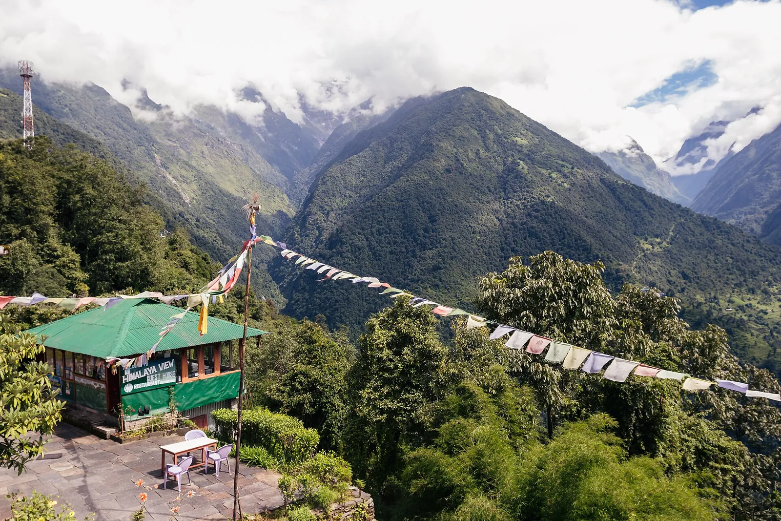
Expect lodges rather than a camp. The tourism board says that in the main trekking areas lodges have been established where trekkers find accommodation and food, that they have facilities for charging batteries, and that Annapurna is among the treks that can provide lodge accommodation.
Carry enough rupees from Pokhara for the whole walk: the UK government warns that in remote areas ATMs may not be available and credit cards are not accepted. Meals are built around dal bhat, and the tourism board says Thakalis, known for their entrepreneurship, run tea houses along the trek routes in the Annapurna region. Drink only sealed or boiled water: UK Travel Health Pro advises against untreated tap water and ice in countries with poor sanitation.
Make time for the local food
What to eat and where to look
Dal bhat
The staple meal: lentils and rice with vegetables, achar and often yoghurt, sometimes followed by chicken or mutton curry. The Nepal Tourism Board notes that the lentils change with the season, and that each part of the set is spiced to add to its taste.
- Where to look
- Every lodge dining room on the way, from Ghandruk and Chhomrong up to base camp.
- Fit it into your day
- Lunch or dinner on a trekking day.
Dhungre roti
A buckwheat pancake, more common in the Himalayan region and among the Thakali community in particular. The Nepal Tourism Board says it is traditionally served plain with a spicy dip of timmur, garlic, chilli and salt, and can be made more filling with vegetables and cheese.
- Where to look
- Lodges and tea houses run by Thakali families, who the tourism board says keep tea houses along the Annapurna trek routes.
- Fit it into your day
- Breakfast before a long climbing day.
Timmure alu
Potatoes cooked with timmur, the Nepali wild pepper. The Nepal Tourism Board says the dish comes from the higher Himalayan region, is served in most Thakali restaurants and is eaten with dal bhat or on its own as a snack.
- Where to look
- Lodge menus where Thakali dishes are cooked, as a side with the dal bhat set.
- Fit it into your day
- A side dish with dal bhat, or a snack at a tea stop.
Phulaura
Deep-fried lentil fritters, which the Nepal Tourism Board says can also be made with buckwheat flour and are more popular in the Himalayan region, usually as a snack.
- Where to look
- The tea stops between the villages, where it is sold as a snack.
- Fit it into your day
- A warm snack at a tea stop.
Momo
Dumplings of minced meat, paneer, cheese or vegetables, mostly steamed but also fried or served in a soup called jhol momo. The Nepal Tourism Board calls them probably the most popular fast food of Nepal.
- Where to look
- Lakeside restaurants in Pokhara before and after the trek, and many lodge kitchens on the trail.
- Fit it into your day
- A lunch stop or an easy evening meal.
Practical questions
How many days does the Annapurna Base Camp trek take?
Plan seven or eight days for the direct walk from Ghandruk and ten to twelve if you add Poon Hill, with a spare day for weather and a night in Pokhara before and after.
Do I need a guide for Annapurna Base Camp?
Yes. The Nepal Tourism Board lists the Poon Hill-ABC route among those that need a licensed guide and an agency-issued TIMS card at NPR 2,000, and the UK government says nobody should trek alone.
How high is Annapurna Base Camp and is altitude sickness a risk?
The Nepal Tourism Board gives the Sanctuary as 4,130 m. UK Travel Health Pro says altitude illness is a risk from 2,500 m; read the altitude section before booking.
What does the Annapurna Conservation Area permit cost?
The National Trust for Nature Conservation, checked on 17 October 2026, listed NPR 3,000 for foreigners and NPR 1,000 for SAARC nationals, for one entry. Permits issued at check-posts cost double, and children under 10 do not need one.
Is there an avalanche risk on the trek?
Yes. The UK government lists avalanches, landslides and rockfalls among the hazards above 3,000 m all year round. Keep the spare day so the plan can change with the weather.
When is the best time for the Annapurna Base Camp trek?
The Nepal Tourism Board names spring, for the rhododendron bloom, and autumn, with the clearest skies after the monsoon in October and November. Read the season section for rain and road conditions.
Sources and checks before you travel
Reference sources for the version dated 18 October 2026. Confirm opening times, access, transport and conditions for your travel dates.
- Nepal Tourism Board: top trekking destinations ↗ — opens in a new tab
- Nepal Tourism Board: Annapurna ↗ — opens in a new tab
- Nepal Tourism Board: TIMS card ↗ — opens in a new tab
- Trekking Agencies' Association of Nepal: TIMS overview ↗ — opens in a new tab
- NTNC: online permit system ↗ — opens in a new tab
- NTNC: Annapurna Conservation Area Project ↗ — opens in a new tab
- Nepal Tourism Board: trekking trail and lodges ↗ — opens in a new tab
- Nepal Tourism Board: climate ↗ — opens in a new tab
- UK Travel Health Pro: Nepal ↗ — opens in a new tab
- UK Travel Health Pro: food and water hygiene ↗ — opens in a new tab
- GOV.UK: Nepal safety and security ↗ — opens in a new tab
- GOV.UK: Nepal health ↗ — opens in a new tab
- Germany's Federal Foreign Office (Auswaertiges Amt): Nepal travel and security advice (German) ↗ — opens in a new tab
- Nepal Meteorological Department ↗ — opens in a new tab
- Yeti Airlines: Pokhara ↗ — opens in a new tab
- Nepal Tourism Board: local transportation ↗ — opens in a new tab
- Nepal Tourism Board: FAQ ↗ — opens in a new tab
- Nepal Tourism Board: food and culinary ↗ — opens in a new tab
- Nepal Tourism Board: Ghandruk ↗ — opens in a new tab
- Nepal Tourism Board: Pokhara ↗ — opens in a new tab
- Nepal Police: Tourist Police ↗ — opens in a new tab
- France Diplomatie: Nepal health advice ↗ — opens in a new tab
- France Diplomatie: Nepal security advice ↗ — opens in a new tab
Photo credits
The Annapurna massif from Annapurna Base Camp in the Sanctuary
Photograph: Bijay Chaurasia Photography, Wikimedia Commons — opens in a new tab · CC BY-SA 4.0 — opens in a new tab
Changes: Resized and converted to WebP; displayed with responsive crops. · Original photograph and licence details ↗ — opens in a new tab
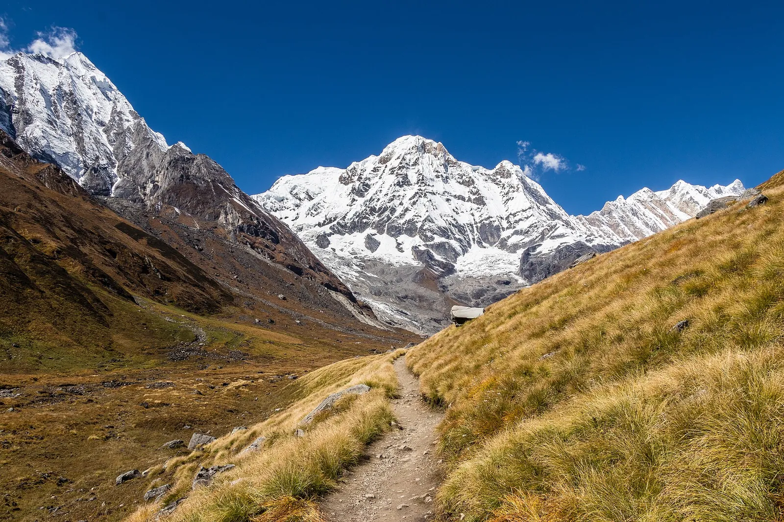
The trail in the Annapurna Sanctuary between Machhapuchhre Base Camp and Annapurna Base Camp, with Annapurna South ahead
Photograph: Bijay Chaurasia — opens in a new tab · CC BY-SA 4.0 — opens in a new tab
Changes: Resized and converted to WebP; displayed with responsive crops. · Original photograph and licence details ↗ — opens in a new tab
Chhomrong, the village on the route, seen from Lower Sinuwa
Photograph: Nirojsedhai — opens in a new tab · CC BY-SA 4.0 — opens in a new tab
Changes: Resized and converted to WebP; displayed with responsive crops. · Original photograph and licence details ↗ — opens in a new tab
The trail towards Machhapuchhre Base Camp, through a green gorge below steep rock walls
Photograph: Josep M. Gracia — opens in a new tab · CC BY-SA 4.0 — opens in a new tab
Changes: Resized and converted to WebP; displayed with responsive crops. · Original photograph and licence details ↗ — opens in a new tab
Evening at Annapurna Base Camp, with the lodges below and Machhapuchhre catching the last light
Photograph: Mithunkunwar9 — opens in a new tab · CC BY-SA 4.0 — opens in a new tab
Changes: Resized and converted to WebP; displayed with responsive crops. · Original photograph and licence details ↗ — opens in a new tab
A tea house and prayer flags on the Chhomrong hillside, on the way to Annapurna Base Camp
Photograph: Bijay Chaurasia — opens in a new tab · CC BY-SA 4.0 — opens in a new tab
Changes: Resized and converted to WebP; displayed with responsive crops. · Original photograph and licence details ↗ — opens in a new tab