Pokhara and the Annapurnas · Gandaki
Pokhara travel guide: Phewa Lake, Sarangkot and the road to the Annapurnas
Pokhara sits at about 800 m beside Phewa Lake, with the snow peaks of the Annapurna range in view within 28 km. It is easier on the body than Kathmandu, warmer, greener and slower, and it is the place where many visitors finally see the mountains they came for. It is also the start of the Poon Hill and Annapurna Base Camp treks. The decisions are how long to stay, whether to fly or take the road from Kathmandu, and what to do on the days when cloud hides the peaks.
- Suggested time
- 3 nights in Lakeside; add one night either side of a trek
- Where to stay
- Lakeside (Baidam) for the lake and the trek departure points; Sarangkot for a night at the view
- Season and timing
- The Nepal Tourism Board calls October and November the clearest months. Pokhara receives 3,345 mm of rain a year, and the UK government gives June to October as the season when floods and landslides can cut roads.
The short answer
Book three nights, based in Lakeside, with one extra night on each side of a trek if you are walking from here. Book the Kathmandu flight and, if trekking, choose a registered agency before booking the walk. Yeti Airlines gives Kathmandu to Pokhara as about 25 minutes. Buddha Air also flies the route; check the airline's booking page for the fare on your date. A marked tourist bus is the road alternative: plan a full travel day and travel by daylight. Spend one morning on Phewa Lake, visit Sarangkot by daylight, and give a day to the World Peace Pagoda, Davi's Fall and the International Mountain Museum. Checked on 18 October 2026, the museum listed NPR 750 for foreign visitors and Sunrise Paragliding's standard tandem flight cost NPR 8,500. For the Annapurna treks, arrange the permits and licensed guide described below through your agency.
Where to sleep: Lakeside, Sarangkot or a quieter lake
Pokhara is a lake town with a mountain wall behind it, and where you sleep decides whether you get the lake, the dawn view or the quiet. The Nepal Tourism Board describes the lake cluster around Pokhara as the reason the town exists, and says accommodation runs from luxury hotels and resorts to comfortable lodges with basic amenities.
Lakeside, also called Baidam, lines the eastern shore of Phewa Lake. The tourism board calls it a thriving resort town of hotels, restaurants, bars and souvenir shops, and it is where boats are hired. It is the practical base for a first visit because the lake, the cafes and the departure points for treks and paragliding are all within a short ride.
Sarangkot is the hill above the lake. The tourism board lists tourist-standard hotels, lodges, teahouses and luxury resorts there, and puts the drive from Lakeside at 11.3 km and at most 30 minutes. Sleep there if the view at first light is the point of the trip; otherwise a day visit is enough. Begnas Lake, 15 km out of town and less visited than Phewa according to the board, suits a night of quiet after a trek. For named hotels and rates, see the Nepal where-to-stay guide.
Book three nights for a first visit: an arrival afternoon on the lake, a full day for Sarangkot, the south shore and the museum, and a spare day for the weather. Add a night before and a night after a trek that leaves from here.
Phewa Lake and Lakeside: boats, the island temple and the mountain line
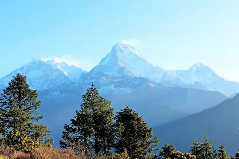
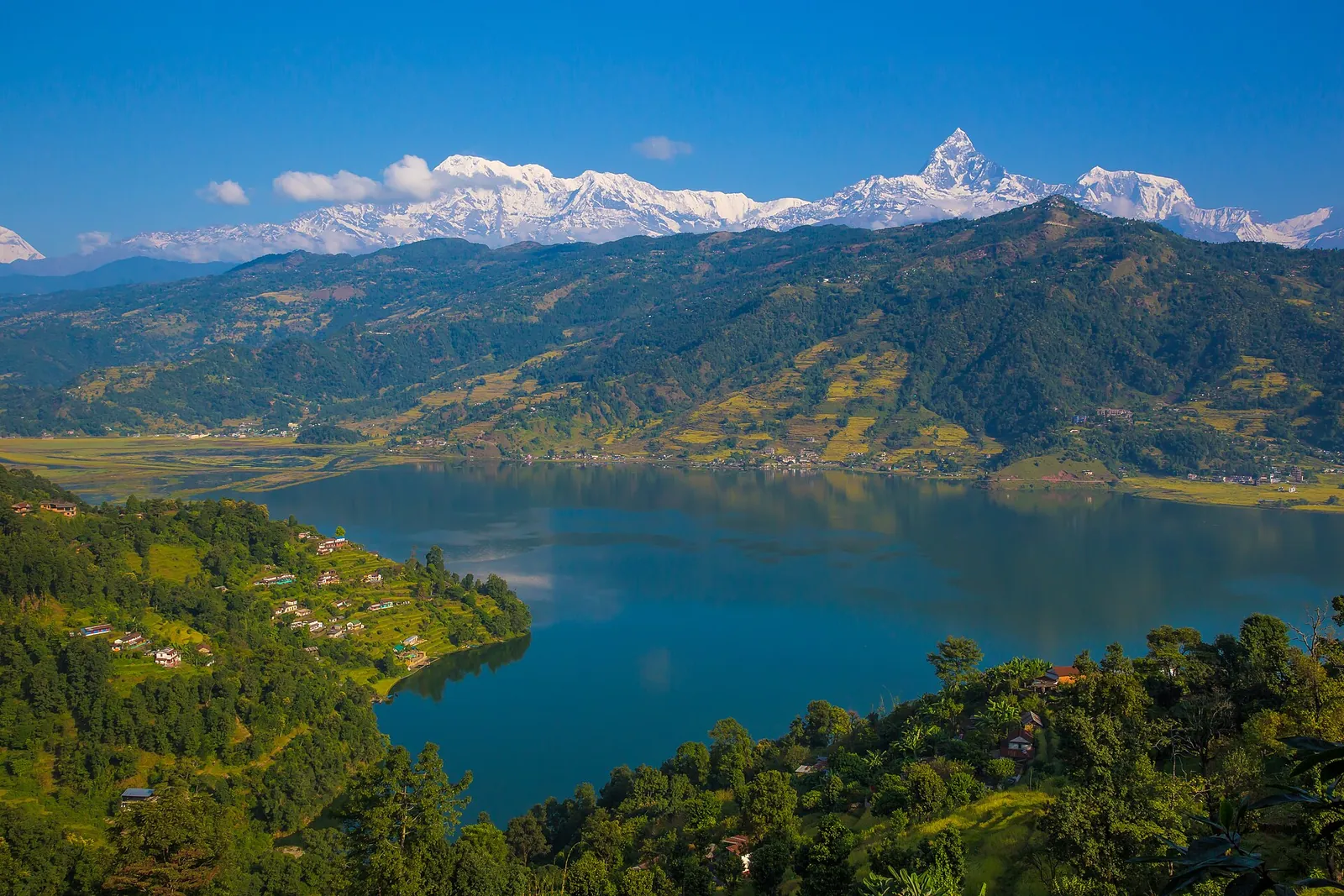
Pokhara is best known for its view of the Annapurna range. The tourism board says it is one of the few places on earth from which mountains above 6,000 m can be seen unobstructed from an altitude of 800 m, within a distance of 28 km. Many visitors, it adds, remember most the razor-edged "Fish Tail" peak of Machhapuchhre, either piercing the skyline or reflected in the still water of Phewa Lake.
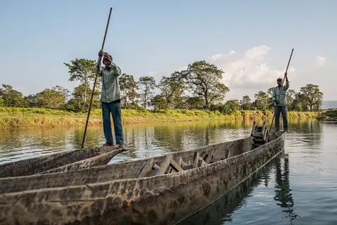
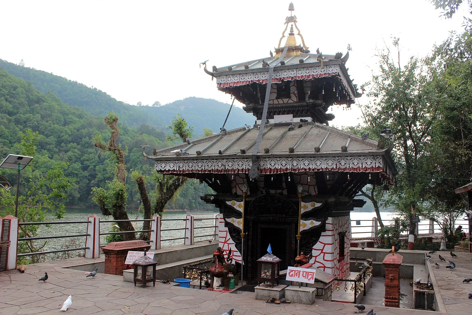
Phewa is the largest of the town's lakes and the one most people mean when they say Pokhara. Boating is described as a favourite pastime that you can enjoy at any time of day, and boats can be hired around the lake. Boaters usually visit Taal Barahi Temple, dedicated to Ajima or Shakti, on a small strip of island in the lake. The lake cluster, which also includes Begnas and Rupa, was listed as a Ramsar Site, a wetland of international importance, on 2 February 2016, the Ramsar Convention's list of sites shows.
The boats are private, so agree the price, and whether it covers the wait at Taal Barahi, on the shore before you step in. Begnas and Rupa, the other two of Pokhara's three major lakes, lie 15 km out of town. The tourism board calls them less visited but no less beautiful and excellent for boating and fishing, and boats can be hired by the lakes as on Phewa.
Sarangkot by daylight
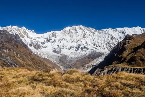
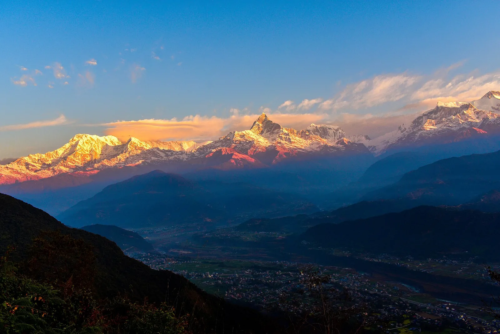
Sarangkot is the viewpoint that most visitors give a morning to. The tourism board says the peak gives a panoramic view of Pokhara from Phewa Lake in the south to the Himalaya in the north, and that tourists drive up to watch the sunrise from the view tower on the hill. The mountains it names stretch from Dhaulagiri (8,167 m) in the west to Machhapuchhre (6,997 m), the tent-like peak of Annapurna II (7,937 m) and Lamjung (6,983 m) in the east.
The drive from Lakeside is 11.3 km and takes at most 30 minutes according to the tourism board. Visit by daylight and return before dark. The board lists hiking among the activities on the hill, and Sarangkot is the first name on its list of popular short hikes around Pokhara, with Kaskikot, Naudanda and others; these are for people short of time for the longer Annapurna treks. Arrange a licensed guide for hikes, including short walks, through a registered trekking agency.
Sarangkot is also where paragliders launch and where the zip line starts. Both are covered below.
World Peace Pagoda and the south shore of Phewa
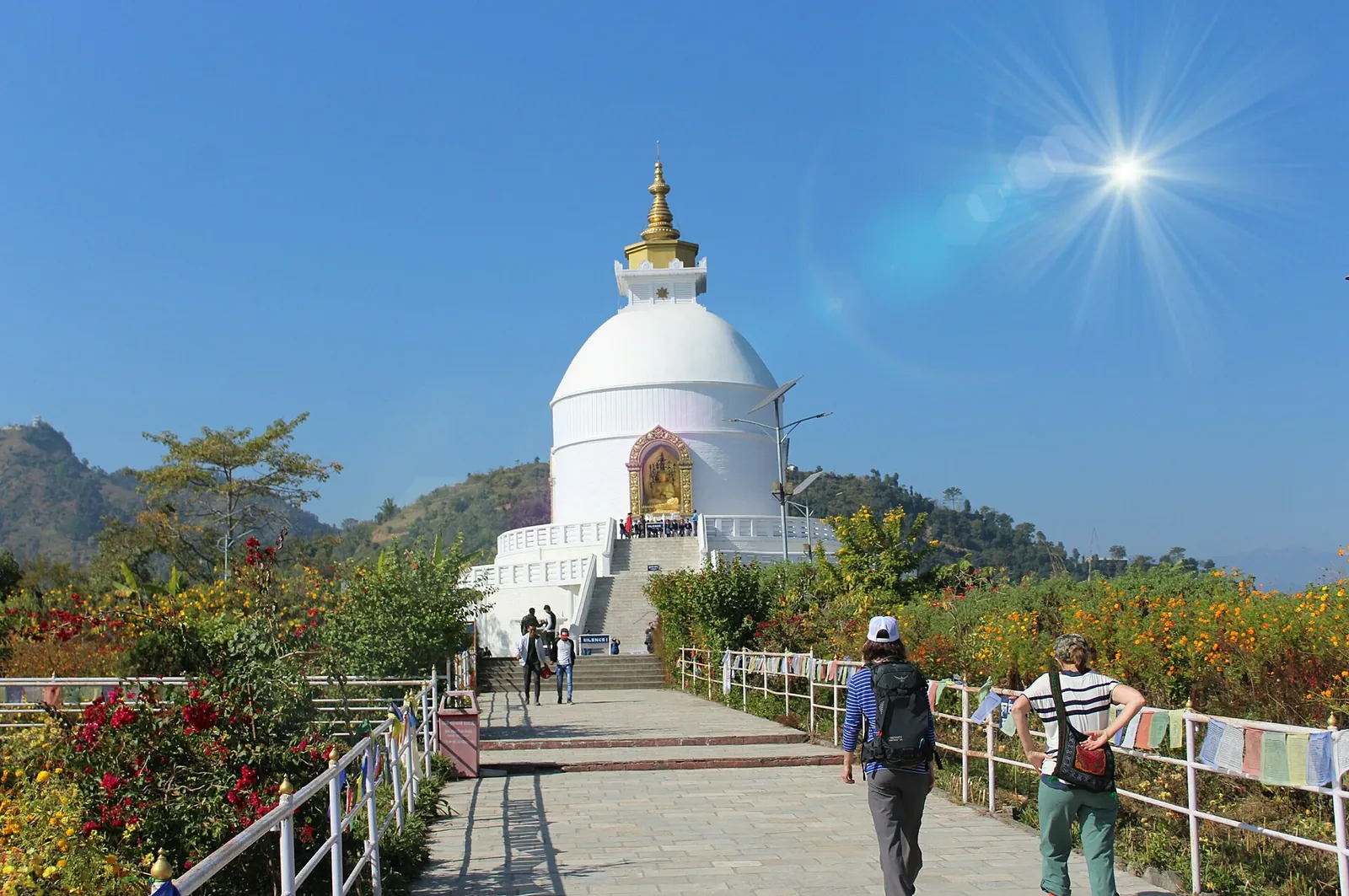
The World Peace Pagoda stands on a hill on the southern fringe of Phewa Lake. The tourism board describes a dome-shaped pagoda with four images of the Buddha facing the four directions, and says its hilltop commands a great view of the lake and of the Annapurna range.
Near it are Pumdi and Bumdi, two villages above the southern rim of the lake where the old style of oval-shaped, red clay houses survives and the mountain views are exceptional. The usual way up is to cross the lake by boat and climb: the tourism board puts the hike from the far shore at about an hour, and says the descent on the other side leads towards the caves and Davi's Fall, so the pagoda and the next section fit into one day.
Davi's Fall, the Seti gorge, Mahendra Cave and the Old Bazaar
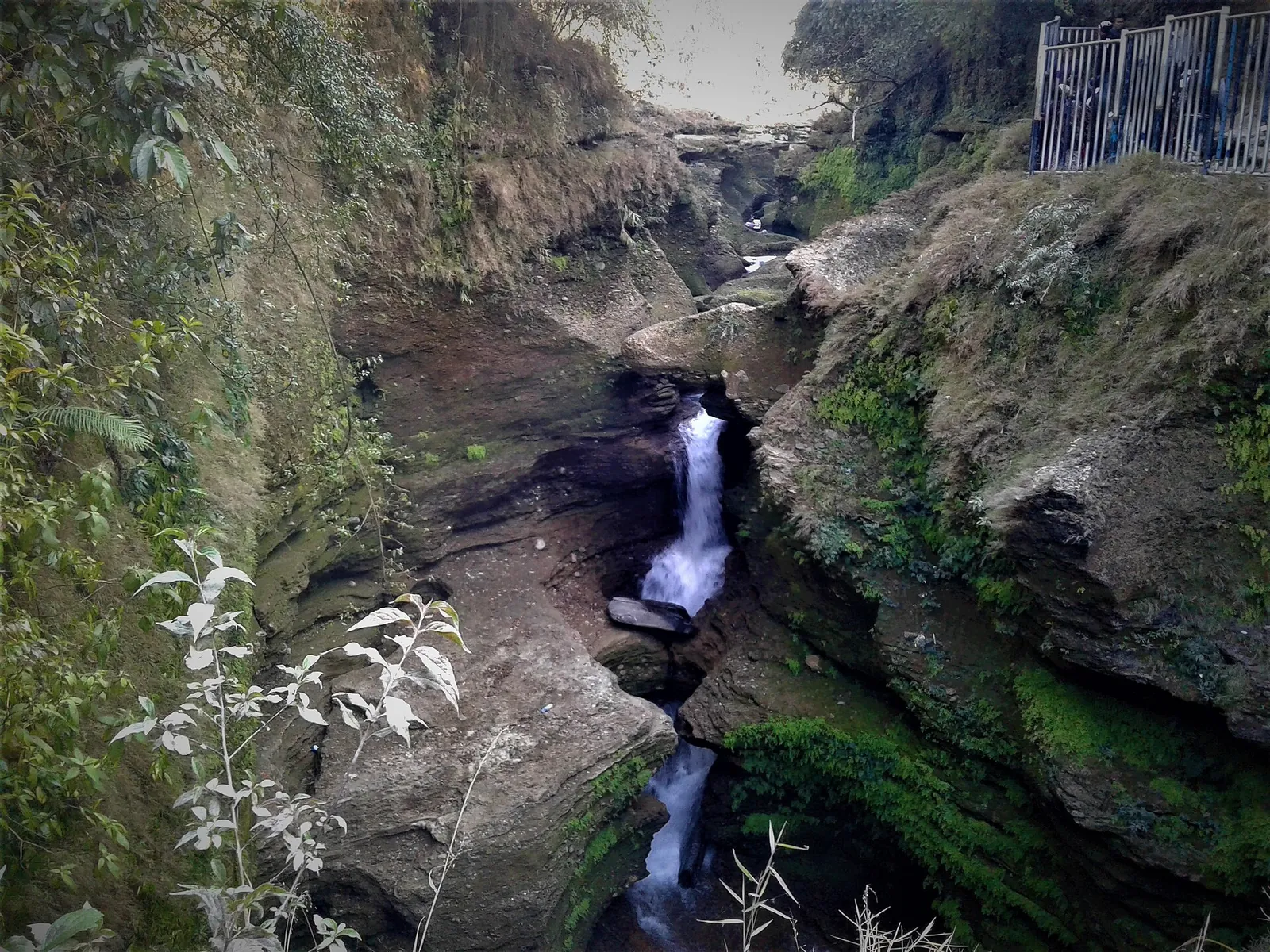
Davi's Fall, known locally as Patale Chhango, the Fall of the Netherworld, is a waterfall on the Siddhartha Highway. Its water comes from Phewa Lake, and it disappears into a complex of caves and tunnels; the Gupteshwar Mahadev cave on the other side of the fall is one of them, a Shiva shrine that the tourism board says is seldom missed. The fall is named after a Swiss woman who was swept away by it in 1961.
The Seti River, whose name means White River, cuts through the Mahabharat range and seems to vanish into caves and tunnels along its way through the city. In places it is barely 2 m wide but as much as 20 m deep. The gorge can be seen from Mahendra Pul, K.I. Singh Pul and Prithvi Chowk Pul, and from the roadside that is as much as most visitors need.
Mahendra Gupha, about 8 km north of Pokhara, is a limestone cave of stalactites and stalagmites believed to date from the Pleistocene and known locally as the House of Bats. Shepherds found it by accident in the 1950s, and a team of British speleologists studied it for the first time in 1976. The tourism board lists the Chamera or Bat Cave separately among Pokhara's caves open to visitors, next to Gupteshwor Mahadev and Mahendra Cave, and says a small sum is charged at the entrance of most of them, so carry small notes.
The Old Bazaar is 4 km from Phewa Lake and entirely different from Lakeside: a traditional market and meeting place for traders of many ethnic groups, with temples and buildings that resemble the Newar architecture of Kathmandu. Its main shrine is the Bindhyabasini temple, a white-domed building on a shaded plinth above a wide stone-paved courtyard. Pokhara once lay on the trade route between India and Tibet, and the tourism board says mule trains still set up camp on the city outskirts, bringing goods from remote Himalayan regions including Mustang.
International Mountain Museum, and two smaller museums
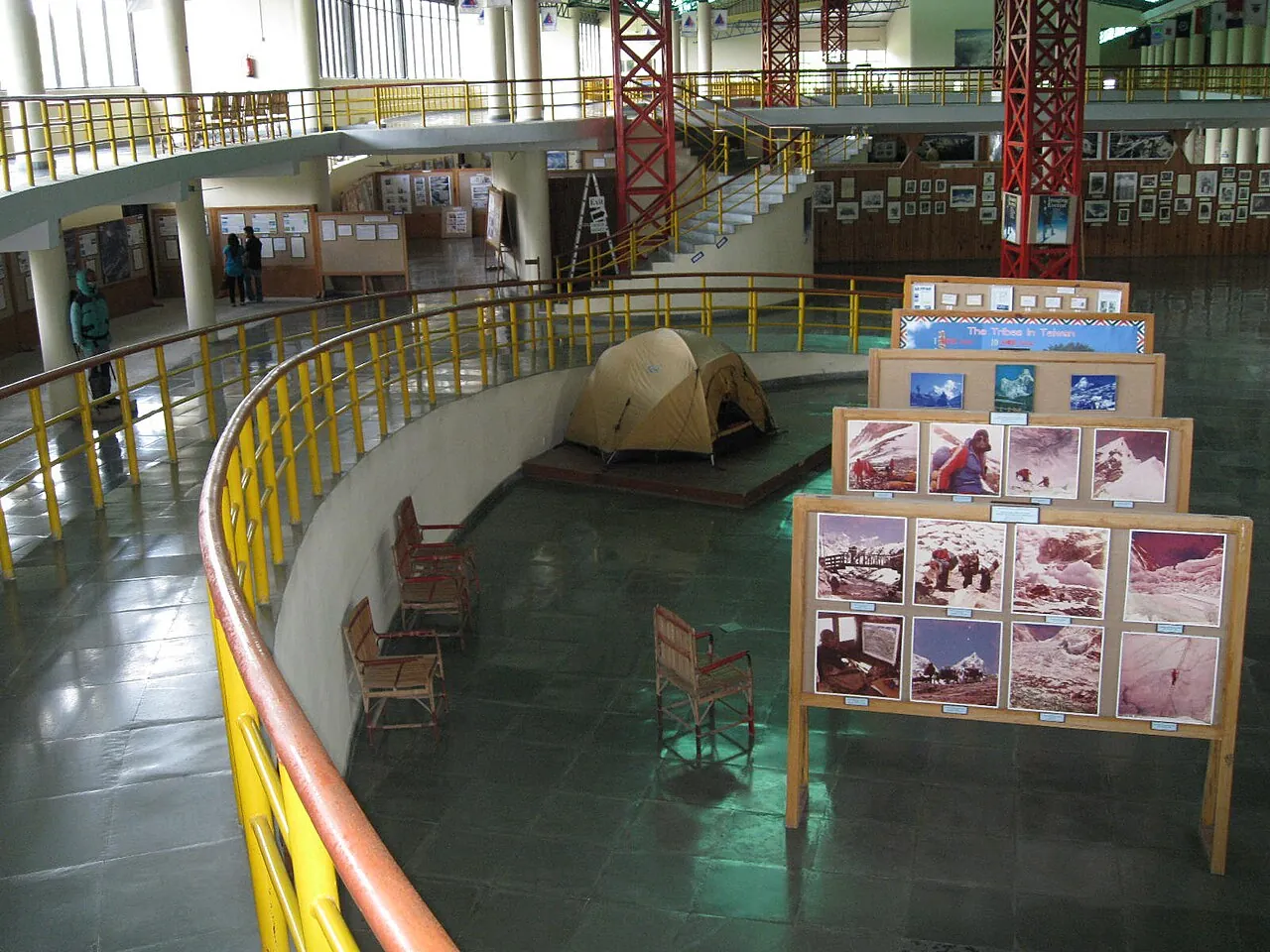
The International Mountain Museum is the one museum worth a planned hour or two. It stands at Ratopairo and was set up by the Nepal Mountaineering Association to record the history of mountaineering in the world and in the Himalaya in particular. Three halls hold the collection. The Mountain People Gallery, a basement hall, shows life-size models of mountain communities of Nepal and elsewhere after an 18-minute video introduction to the people, culture and mountains of the Khumbu region. The Mountain Gallery, the Hall of World Mountains, gives photographs and facts on all 14 peaks above 8,000 m and a geological section with rock samples. The Mountain Activities Gallery shows climbing equipment, the story of Maurice Herzog and Louis Lachenal's first ascent of Annapurna in 1950, Junko Tabei, the first woman to climb Everest, and a corner given over to the Yeti.
Outside, a living museum on 5.10 hectares reconstructs the homes and culture of Nepal's different peoples. There is also a prayer room, the Lakhang, and a library.
The museum's visitor-information page, checked on 17 October 2026, listed it as open daily from 09:30 to 17:00, 365 days a year. Entry for foreigners was NPR 750; SAARC nationals and holders of a resident visa paid NPR 350, Nepalis NPR 150 and students NPR 80. The garden was listed separately at NPR 70, and photography at NPR 1,500.
Two smaller collections suit a wet afternoon. The tourism board describes the Pokhara Museum, between the bus stop and Mahendra Pul, as a showcase of the Gurung, Thakali and Tharu peoples of western Nepal, with the remains of an 8,000-year-old settlement found in Mustang. The Annapurna Regional Museum, run by the Annapurna Conservation Area Project at Prithvi Narayan Campus east of the Old Bazaar, holds butterflies, insects, birds and wildlife models. The board also lists the Gurkha Memorial Museum at Pardi, with uniforms and medals including the Victoria Cross.
Paragliding, the zip line and the bungee tower
Pokhara is Nepal's adventure-sports town. The tourism board describes paragliding as the most rewarding short adventure sport here, with the Himalaya in the distance and villages, monasteries, temples, lakes and forest below, and says Sarangkot has been considered one of the top paragliding destinations in the world. Flights launch from Sarangkot and land by the lake.
The zip line starts on Sarangkot. Its operator, HighGround Adventures, gives the ZipFlyer a length of 1,850 m and a vertical drop of over 600 m, with speeds of well over 100 km an hour. HighGround also offers bungee jumping at Hemja.
Sunrise Paragliding's price page, checked on 18 October 2026, listed its standard flight, Cloud Buster, at NPR 8,500 for about 20 to 30 minutes in the air, with take-offs at 09:30, 11:30 and 13:30 and photos and video NPR 2,000 extra; its Cross Country flight of about 50 to 60 minutes cost NPR 11,500. HighGround Adventures listed paragliding from NPR 10,000 with photos and video. Its ZipFlyer page listed NPR 8,850 for foreign nationals, with photos and video NPR 1,500 extra; the NPR 6,850 rate is for Nepali nationals.
Make sure your travel insurance covers the activity before you pay, and keep a second morning free.
Flying or taking the bus from Kathmandu, and on to Chitwan
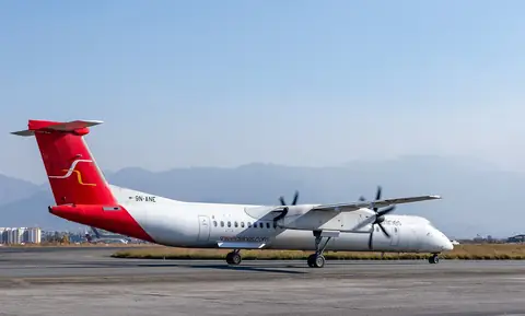
Yeti Airlines and Buddha Air serve the Kathmandu to Pokhara route. Buddha Air says it operates more than 17 daily flights from Kathmandu to Pokhara. Check the airline booking page for your travel date's fare. Yeti's fare pages, checked on 18 October 2026, showed that it charged foreign nationals other than Indian and Nepali citizens its USD fare; its free baggage allowance on those fares was 30 kg checked plus 5 kg hand carry on Super Flexi (N), 25 kg plus 5 kg on Flexi (Y) and 20 kg plus 5 kg on Flexi (G), and extra baggage on Kathmandu to Pokhara cost NPR 150 per kilo.
Weather is the risk on the way out as much as on the way in. The UK government says internal flights in high mountain areas are often delayed by poor weather and that cancellations are common, and that all Nepali airlines are on the UK Air Safety List; Germany's Federal Foreign Office says they are all on the EU list of unsafe airlines. Keep a buffer day before an international flight.
Allow a full travel day for the road journey. The Nepal Tourism Board says intercity tourist buses to Pokhara, Chitwan and Lumbini leave from Kantipath in Kathmandu. Tourist-bus operators and fares are not listed on that page; check both when booking. Buy the ticket a day ahead and have the boarding point written on it.
Take a marked tourist bus, travel only by day, and check the road is open on the morning you leave. The UK government, checked on 17 October 2026, listed areas of Gorkha, Nuwakot and Dhading among those affected by the floods of 26 August 2026 and warned that heavy rain could trigger more landslides. It also calls road conditions poor, especially in the monsoon, and advises against overloaded buses and travel at night; Germany tells travellers to use only marked tourist buses. If the road is closed, a flight is the fallback if available; the Nepal transport guide sets the two side by side. If neither flights nor daylight road travel is possible, stay put and change the plan.
For Chitwan, Buddha Air lists one daily flight from Pokhara to Bharatpur, taking 20 minutes. Keep a spare day and a road transfer as a fallback if the flight is cancelled. Travel by daylight on a marked tourist bus, after checking the road is open. The Chitwan guide names the lodge town and the park fees.
In town, the tourism board's tourist-police advice is to use an authorised tourist vehicle and note its number; the tourist police hotline is 1144.
Pokhara as the start of the Annapurna treks
The tourism board calls the Pokhara valley the gateway to the Annapurna region, where many trekkers find their Shangri-la, and two treks that start here have their own guides: Ghorepani and Poon Hill, with the sunrise viewpoint the board gives as 3,210 m, and Annapurna Base Camp in the Sanctuary, at 4,130 m.
Two permits matter, and the permits guide covers both in full. Checked on 18 October 2026, the Annapurna Conservation Area permit cost NPR 3,000 for visitors other than SAARC nationals, who paid NPR 1,000, including tax. It is valid for a single entry and can be bought on the National Trust for Nature Conservation's e-permit website or in cash at a counter; online payment adds 2.9%, while counter payment has no extra charge. A permit bought at a check-post costs double. On the tourism board's listed Poon Hill–ABC route, the TIMS card costs NPR 2,000 for trekkers other than SAARC nationals, who pay NPR 1,000, and is issued through a registered trekking agency with a licensed guide.
Get individual medical advice before planning travel above 2,300 m, as Germany's Federal Foreign Office advises. TravelHealthPro advises gaining no more than about 500 m of sleeping height a day above 3,000 m. It also advises a few days below 3,000 m before ascending and a rest day at the same altitude every three or four days. If you develop symptoms of altitude sickness, stop climbing, descend promptly with a companion to a lower altitude (below 4,000 m if you are higher) and consult a doctor. Insurance should cover your planned altitude, activity and helicopter rescue; France says mountain rescues are paid, helicopters need a payment guarantee, and flights to Kathmandu are reserved for extreme emergencies. Discuss satellite-phone provision with your guide and leave your route with someone at home. Helicopter rescue can be prevented by weather.
From Pokhara to the trailheads at Birethanti and Ghandruk
Both Annapurna treks begin with a road transfer out of Pokhara. Ask your agency to include the transfer to Birethanti when arranging the guide and TIMS card.
Ghandruk, a Gurung village where the tourism board says the Annapurna trek can also start, is reached by road as well, and the board names Kimche, Landruk and Tadapani among the trails around it. The Nepal Tourism Board puts Ghandruk 54.8 km by road from Pokhara and gives the drive as anything from about 1 hour 35 minutes to 4 to 5 hours, so keep the rest of that day free. The same rules as on the Kathmandu road apply: travel by day, by tourist bus or your agency's vehicle, once the road is open.
For a shorter walk, the board's list of popular hikes around Pokhara includes Sarangkot, Naudanda, Hemja and Australian Camp, and it suggests Dhampus, like Poon Hill, as a short trek of three to four days for families. France's government advice requires a licensed guide and an agency-issued TIMS card for hiking in Nepal; short walks are not an exemption from that advice.
When the mountains show
Pokhara is warmer than Kathmandu, with warm, humid summers and mild, pleasant winters, according to the tourism board. The monsoon runs from June to September. The board says 80 percent of Nepal's rain falls then, and gives Pokhara 3,345 mm of rain a year against 1,600 mm for the country as a whole. For May to July it lists daytime highs of 29.7 and lows of 21.3 degrees C; for December to February, 20.3 and 7.7.
The clearest skies come after the monsoon, in October and November, according to the board, which is the season for the sunrise at Sarangkot and the view from the lake.
Make time for the local food
What to eat and where to look
Dal bhat
The staple Nepali meal of dal, rice, vegetables and achar, with yogurt or buttermilk. The Nepal Tourism Board says the lentils change with the season and that a chicken or mutton curry may follow.
- Where to look
- Restaurants along Lakeside, which the board calls a resort town of hotels, restaurants and bars; on the trek, the teahouses that Thakalis run along the Annapurna routes.
- Fit it into your day
- Lunch or dinner on any day; it is the meal to eat before a trek.
Meat curries are often served alongside, so say if you eat vegetarian.
Thakali set (Thakali khana)
The Thakali version of the rice meal, from the people of the Thak Khola in Mustang. The board says dhido, a porridge of ground millet, barley, buckwheat or wheat, is sometimes served in place of rice in a Thakali set, and that timmure aloo, potatoes cooked with timmur, the Himalayan wild pepper, is served in most Thakali restaurants.
- Where to look
- Restaurants in the Old Bazaar and Lakeside that advertise a Thakali set.
- Fit it into your day
- Dinner after a day on the lake or the night before a trek.
Timmur gives a numbing, peppery heat; ask for it mild if you are unsure.
Momo
Dumplings of minced chicken, buffalo, paneer, cheese or vegetables, mainly steamed but also fried or served in soup as jhol momo. The board calls them a must-eat dish and the most popular fast food in Nepal.
- Where to look
- Small restaurants and stalls on the Lakeside strip, on the way between the lake and the museum.
- Fit it into your day
- A quick lunch between the lake and the museum.
Most fillings contain meat; ask for vegetable momo if you avoid it.
Sekuwa
Marinated chicken, mutton or buffalo meat on skewers, roasted over a wood fire. The board calls it flavourful and smoky, a snack to go with a meal or with a drink.
- Where to look
- Lakeside restaurants and bars in the evening, as a snack with a drink.
- Fit it into your day
- An evening snack after the sunset over the lake.
It is meat only; check that it is cooked through.
Dhungre roti
A buckwheat pancake common in the Himalayan region and among the Thakali community in particular, the board says, served plain with a spicy dip of timmur, garlic, chilli and salt, or made more filling with vegetables and cheese.
- Where to look
- Thakali restaurants in Lakeside and the Old Bazaar; ask whether it is on the day's menu.
- Fit it into your day
- Breakfast or a light lunch.
The timmur dip is hot; taste it before you load the pancake.
Practical questions
How many nights do I need in Pokhara?
Three nights suit a first visit: an arrival afternoon on the lake, a full day for Sarangkot, the south shore and the International Mountain Museum, and a spare day for weather. Add a night before and after a trek that starts here.
Should I fly or take the bus from Kathmandu?
Yeti Airlines and Buddha Air both serve the route; compare their live fares before choosing. The road takes a full travel day in this plan: use a marked tourist bus and travel by daylight, with the ticket bought a day ahead.
Is Sarangkot worth a visit?
Yes in the clear season, when the view runs from Dhaulagiri in the west to Lamjung in the east. Visit by daylight and return before dark.
What does the International Mountain Museum cost?
The museum's page, checked on 17 October 2026, listed NPR 750 for foreigners, NPR 350 for SAARC nationals and resident-visa holders, and NPR 70 for the garden. It is open daily from 09:30 to 17:00.
Do I need a guide and permits for a trek from Pokhara?
For Poon Hill and Annapurna Base Camp, yes. Arrange the licensed guide, TIMS card and conservation permit through a registered trekking agency, including the road transfer.
When can I see the mountains from Pokhara?
The Nepal Tourism Board calls October and November the clearest months after the rains.
How much does paragliding in Pokhara cost?
Sunrise Paragliding's page, checked on 18 October 2026, listed a standard tandem flight of about 20 to 30 minutes at NPR 8,500, with photos and video NPR 2,000 extra. HighGround Adventures listed paragliding from NPR 10,000 with photos and video.
How do I get from Pokhara to Chitwan?
Buddha Air lists one daily flight from Pokhara to Bharatpur, taking 20 minutes. A marked tourist bus by daylight is the road alternative; check the road is open before travelling.
Sources and checks before you travel
Reference sources for the version dated 18 October 2026. Confirm opening times, access, transport and conditions for your travel dates.
- Nepal Tourism Board: Pokhara ↗ — opens in a new tab
- Nepal Tourism Board: Phewa and the Cluster of 9 Lakes ↗ — opens in a new tab
- Nepal Tourism Board: Boating ↗ — opens in a new tab
- Nepal Tourism Board: Seti River ↗ — opens in a new tab
- Nepal Tourism Board: Davi's Fall and Gupteshwar ↗ — opens in a new tab
- Nepal Tourism Board: Mahendra Gupha ↗ — opens in a new tab
- Nepal Tourism Board: World Peace Pagoda ↗ — opens in a new tab
- Nepal Tourism Board: Old Bazaar and Bindhyabasini ↗ — opens in a new tab
- Nepal Tourism Board: Sarangkot ↗ — opens in a new tab
- Nepal Tourism Board: Museum tour in Pokhara ↗ — opens in a new tab
- Nepal Tourism Board: Paragliding in Pokhara ↗ — opens in a new tab
- Nepal Tourism Board: Hiking in Pokhara ↗ — opens in a new tab
- Nepal Tourism Board: Food and culinary ↗ — opens in a new tab
- International Mountain Museum: visitor information ↗ — opens in a new tab
- International Mountain Museum: home page ↗ — opens in a new tab
- International Mountain Museum: Mountain People Gallery ↗ — opens in a new tab
- International Mountain Museum: Mountain Activities Gallery ↗ — opens in a new tab
- International Mountain Museum: Living Museum ↗ — opens in a new tab
- Yeti Airlines: Pokhara ↗ — opens in a new tab
- Yeti Airlines: fare categories ↗ — opens in a new tab
- Yeti Airlines: extra baggage charges ↗ — opens in a new tab
- Buddha Air: flights from Kathmandu to Pokhara ↗ — opens in a new tab
- Buddha Air: flights from Pokhara to Bharatpur ↗ — opens in a new tab
- Nepal Tourism Board: Tourist Police ↗ — opens in a new tab
- GOV.UK: Nepal safety and security ↗ — opens in a new tab
- GOV.UK: Nepal travel advice ↗ — opens in a new tab
- Germany's Federal Foreign Office: Nepal travel and security advice (German) ↗ — opens in a new tab
- Nepal Tourism Board: TIMS card ↗ — opens in a new tab
- NTNC online permit system ↗ — opens in a new tab
- Nepal Tourism Board: Top trekking destinations ↗ — opens in a new tab
- UK Travel Health Pro: Nepal ↗ — opens in a new tab
- Nepal Tourism Board: Climate ↗ — opens in a new tab
- Sunrise Paragliding: tandem flights ↗ — opens in a new tab
- Ramsar Convention: Ramsar Sites in Nepal ↗ — opens in a new tab
- HighGround Adventures: ZipFlyer ↗ — opens in a new tab
- HighGround Adventures: home page ↗ — opens in a new tab
- Nepal Tourism Board: Cave exploration ↗ — opens in a new tab
- Nepal Tourism Board: Travel with children ↗ — opens in a new tab
- Nepal Tourism Board: Ghandruk ↗ — opens in a new tab
- Nepal Tourism Board: FAQ ↗ — opens in a new tab
- France Diplomatie: Nepal health advice ↗ — opens in a new tab
- France Diplomatie: Nepal security advice ↗ — opens in a new tab
Photo credits
Phewa Lake and the Annapurna range seen from the hills above Pokhara
Photograph: Jmhullot — opens in a new tab · CC BY 3.0 — opens in a new tab
Changes: Resized and converted to WebP; displayed with responsive crops. · Original photograph and licence details ↗ — opens in a new tab
The Annapurna range at sunrise from Sarangkot
Photograph: Paryataksarathi ( Sneha) — opens in a new tab · CC BY-SA 4.0 — opens in a new tab
Changes: Resized and converted to WebP; displayed with responsive crops. · Original photograph and licence details ↗ — opens in a new tab
The World Peace Pagoda on its hill above Phewa Lake
Photograph: Nabin845 — opens in a new tab · CC BY-SA 4.0 — opens in a new tab
Changes: Resized and converted to WebP; displayed with responsive crops. · Original photograph and licence details ↗ — opens in a new tab
Taal Barahi Temple on its island in Phewa Lake
Photograph: Maesi64 — opens in a new tab · CC0 — opens in a new tab
Changes: Resized and converted to WebP; displayed with responsive crops. · Original photograph and licence details ↗ — opens in a new tab
Inside the International Mountain Museum
Photograph: en:User:MMuzammils — opens in a new tab · CC BY-SA 3.0 — opens in a new tab
Changes: Resized and converted to WebP; displayed with responsive crops. · Original photograph and licence details ↗ — opens in a new tab
Davi's Fall in its rock gorge
Photograph: Sabina Bajracharya — opens in a new tab · CC BY-SA 4.0 — opens in a new tab
Changes: Resized and converted to WebP; displayed with responsive crops. · Original photograph and licence details ↗ — opens in a new tab