The Everest region · Koshi
Everest Base Camp trek: Lukla flight, permits, season and altitude
Everest Base Camp is the trek most people mean when they say they want to walk in the Himalaya. The Nepal Tourism Board calls it the most iconic trek in Nepal, through Sherpa villages, Namche Bazaar and old monasteries, with views of Everest, Lhotse, Nuptse and Ama Dablam. It is also the trek where the booking decisions weigh most: a flight to a mountain airstrip that is often delayed, a licensed guide and a TIMS card, the Sagarmatha National Park ticket, and a climb to about 5,300 m at base camp and 5,545 m on Kala Patthar. This guide helps you decide whether to go, how many days to hold, which permits to arrange first and when to walk.
- Suggested time
- 15 days from the flight to Lukla to the flight back (14 nights on the trail), plus two spare days and a night or two in Kathmandu either side
- Where to stay
- Kathmandu (Thamel) before and after the flights; Namche Bazaar on the trail for the rest days
- Season and timing
- The Nepal Tourism Board gives October to November and March to May as the best season in Sagarmatha National Park, with snow and a daytime temperature of 5 degrees C from December to February and rain from June to September. The UK government gives June to October as the season when floods and landslides can cut roads.
The short answer
Book 14 nights on the trail from Lukla back to Lukla, with the flight out on day 15, then keep two spare days for a late flight and a night or two in Kathmandu either side. Book a licensed trekking agency first and have it book the Lukla flight and confirm the departure airport. Foreign trekkers need a licensed guide arranged through a registered agency, a TIMS card (NPR 2,000 for non-SAARC nationals) and the Sagarmatha National Park permit (NPR 3,000 per entry for non-SAARC nationals); both fees were checked on 17 October 2026. Base camp lies at about 5,300 m, so read the altitude section before booking, and carry insurance that covers mountain rescue and helicopter costs. October and November, and March to May, are the two seasons the tourism board names for the park.
Is Everest Base Camp the right trek for you
The Nepal Tourism Board puts Everest Base Camp high on the priority list of trekkers and calls the Everest region one of the most visited in the Himalaya. The walk goes from lodge to lodge through Sagarmatha National Park, a UNESCO World Heritage Site since 1979 according to the park, and it ends beside the Khumbu glacier below a mountain the park gives as 8,848 m. The reward is the scenery along the way as much as the destination: the park's own page describes the Sherpa people, whose lives are interwoven with Buddhism, and names Tengboche, Thame, Khumjung and Pangboche among the monasteries of the region.
It is two weeks of walking, it climbs from Lukla at 2,860 m to about 5,300 m at base camp and 5,545 m on Kala Patthar, and the hardest ground comes at the end, on the glacier below base camp. Germany's Federal Foreign Office warns that the danger of altitude sickness must not be underestimated above 3,000 m and that the fitness of trekkers who are not yet acclimatised should be discussed with the guide before the walk. This is a trek for people who have walked several days in a row with a pack and can say yes to the altitude, not a first hike.
If you have a week or less, or have never slept above 2,500 m, the Poon Hill trek is the shorter choice: the tourism board describes it as one of the most popular short treks in Nepal, perfect for beginners and families, with its sunrise viewpoint at 3,210 m.
From Lukla to Namche Bazaar and on to Kala Patthar
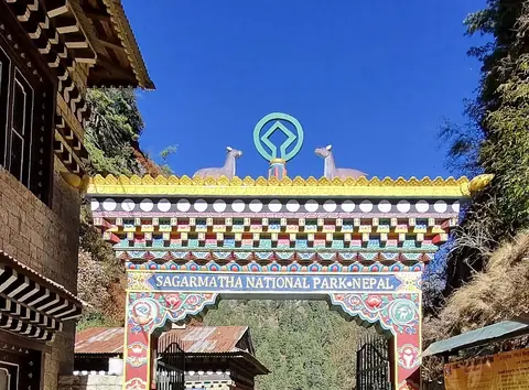
The tourism board describes the trek as starting and finishing at Lukla, an airstrip it calls the Gateway to Everest. A gentle two-day walk up the Dudh Koshi valley leads to Namche Bazaar, with tea houses all along the route. Phakding and Monjo are the popular stopovers on the first day, and just beyond Monjo the Jorsale check point is the entrance to Sagarmatha National Park, where permits are checked. The trail goes uphill from the suspension bridge a few minutes beyond Jorsale, and Namche is reached after a three-hour hike.
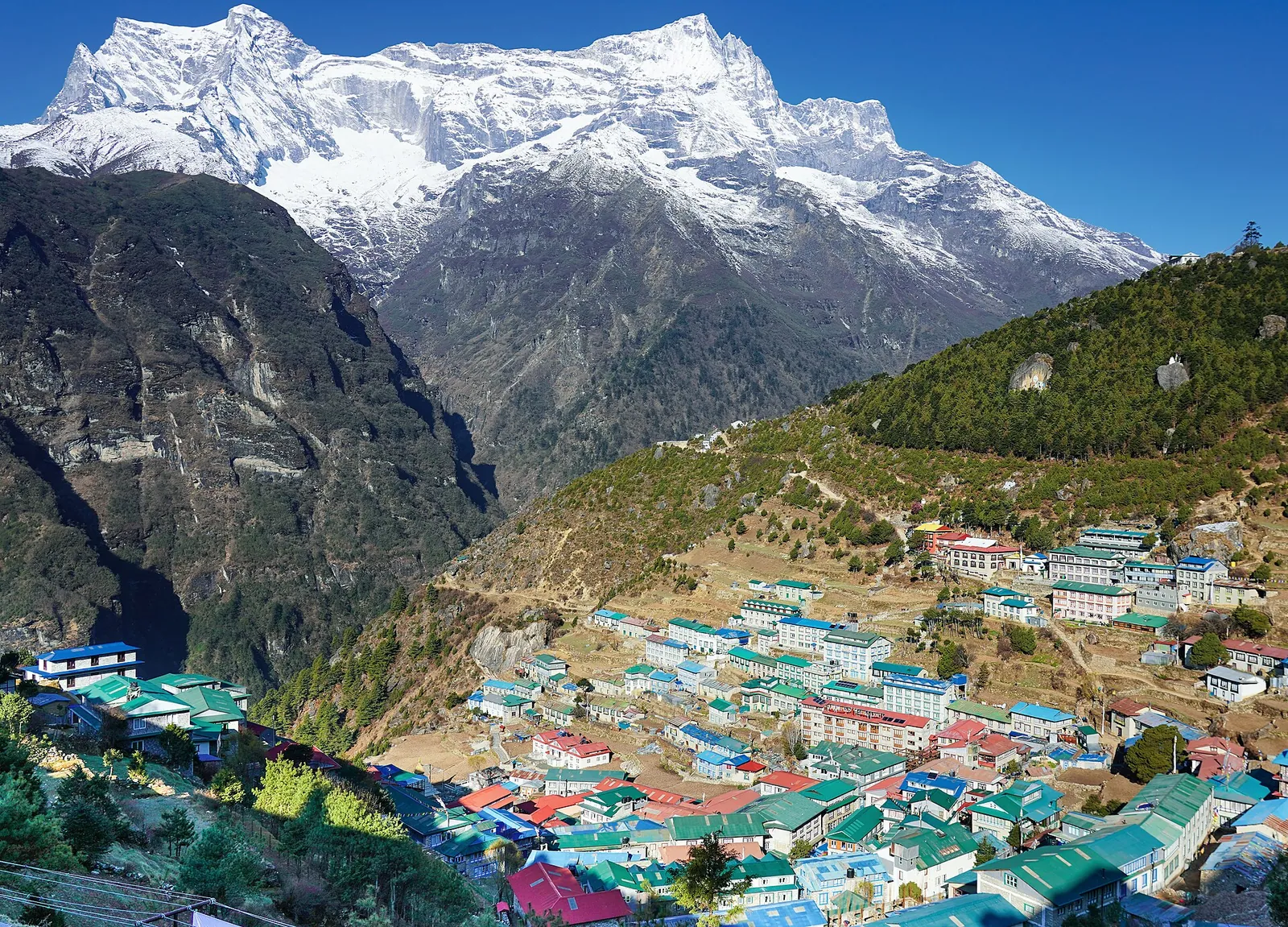
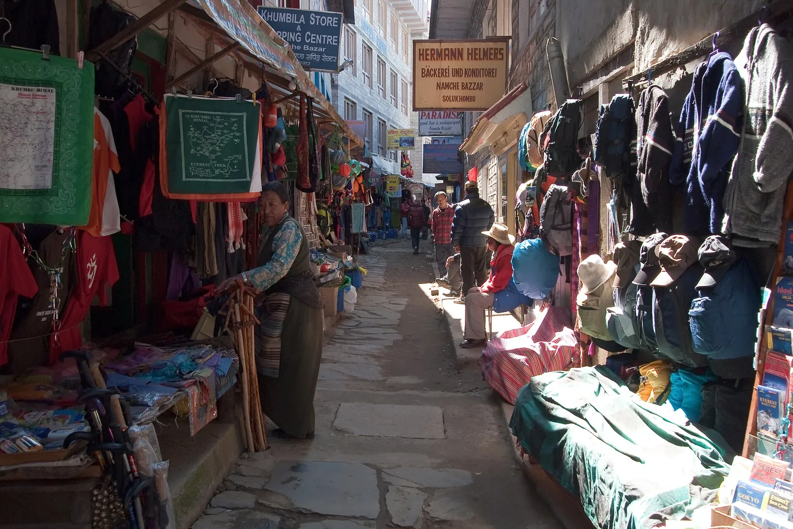
Namche Bazaar (3,500 m) is a market town built on the slope of an arch-shaped mountain, a trading hub known for homemade yak cheese and butter, with equipment shops, a pub, Wi-Fi and a place to play pool. The visitor centre at the park headquarters shows mountaineering memorabilia and explains Sherpa life, and on Saturday mornings the weekly market fills the middle of town. The board says it is good to halt here for a few days and walk in the surroundings to acclimatise, because the process cannot be hurried. Syangboche and the Sherpa villages of Thame, Khumjung and Khunde are each a few hours' walk away.
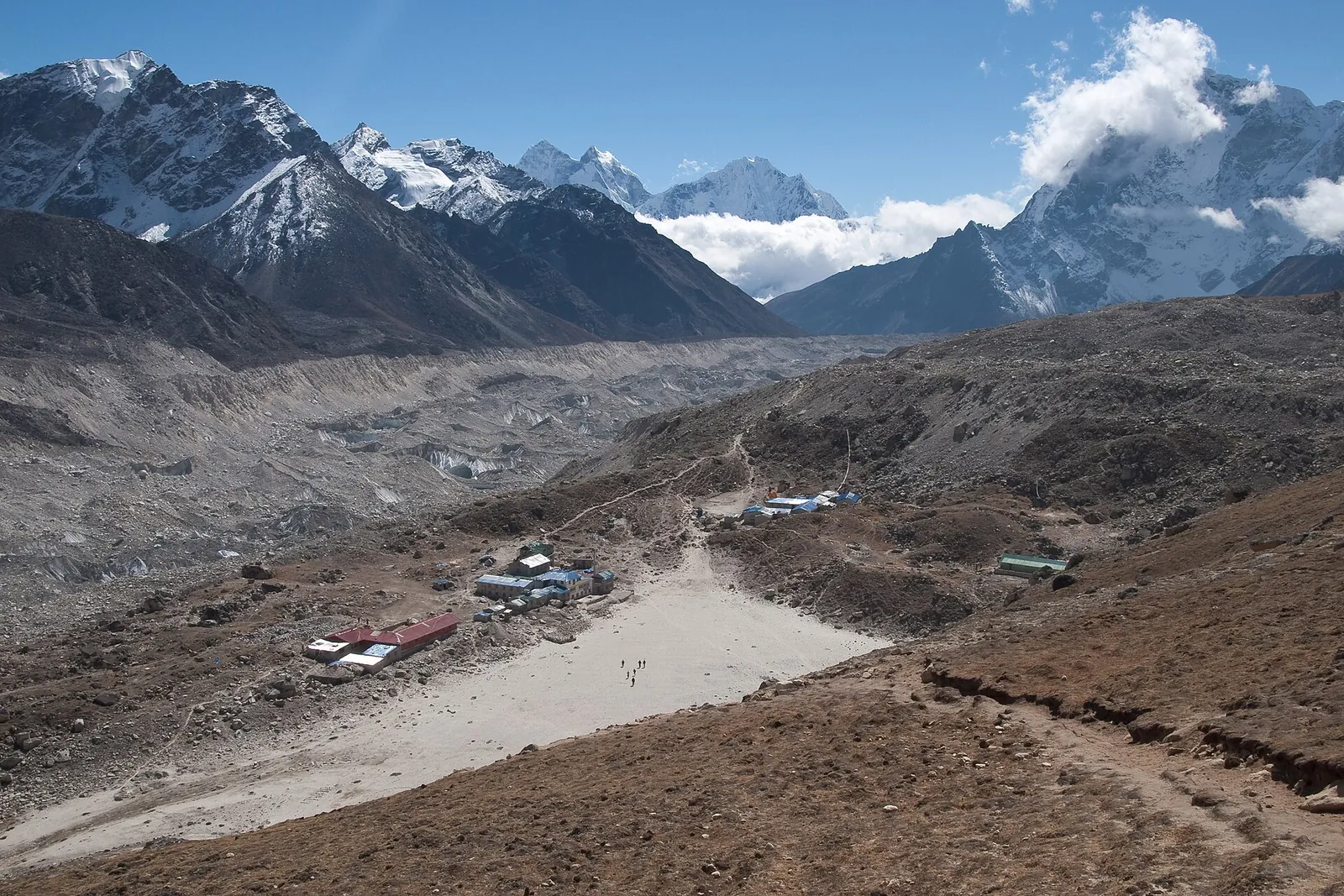
Beyond Namche the trail follows the valley of the Imja Khola with views of Thamserku, Kangtega and Ama Dablam, while Lhotse and Everest dominate the skyline ahead. The usual night halt is Tengboche, at the top of a steep climb. The trail then runs through Pangboche to Pheriche or Dingboche, where a second acclimatisation day follows; from Dingboche, a side trip to Chhukung takes about three hours. From Dingboche or Pheriche a six-hour walk leads to Lobuche, which sits on the lateral moraine of the Khumbu glacier, and a hike of roughly three hours to Gorak Shep, the last settlement, with a few tea houses.
A suggested split: 14 nights on the trail, the flight out on day 15 and two spare days after it.
- Day 1: fly to Lukla (2,860 m) from the airport on your ticket and walk up the Dudh Koshi valley through Phakding to a first night at Monjo (2,845 m).
- Day 2: through the Jorsale check point and up the climb to Namche Bazaar (3,500 m), 655 m higher than Monjo.
- Days 3 and 4: rest days in Namche, with walks up to Khunde and Khumjung or towards Thame.
- Day 5: up the Imja Khola valley to Tengboche (3,867 m) and its monastery.
- Day 6: on through Pangboche to Pheriche (4,250 m).
- Day 7: a further rest day at Pheriche, at the same height.
- Day 8: on to Lobuche, on the lateral moraine of the Khumbu glacier.
- Day 9: on to Gorak Shep, the last tea houses on the trail.
- Day 10: across the glacier to Everest Base Camp and back to Gorak Shep.
- Day 11: Kala Patthar (5,545 m) at first light, then down to Lobuche.
- Day 12: down to Pheriche.
- Day 13: back to Namche Bazaar.
- Day 14: down to Lukla for the 14th night on the trail.
- Day 15: the flight back to Kathmandu or Ramechhap.
- Days 16 and 17: spare days for a late flight, before your international departure.
Tengboche, Khumjung, Kala Patthar and base camp itself
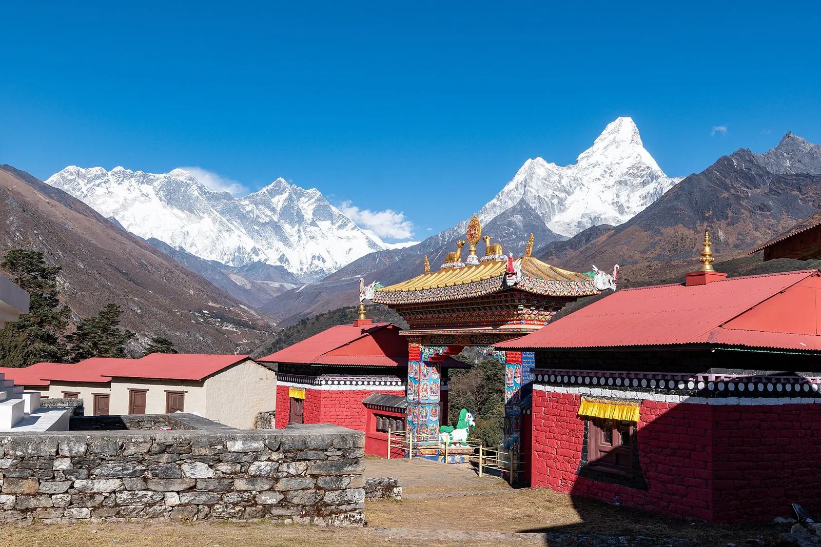
Tengboche Monastery stands at 3,867 m on a ridge across the canyon from Khunde, among pines, azaleas and rhododendrons, with Everest, Lhotse and Ama Dablam in view. The Tibetan Buddhist gompa dates from the 20th century: four wealthy men of Khumjung, Junbesi, Namche Bazaar and Gole paid for it, and Sherpa villagers gave their labour. The main temple was destroyed in the great earthquake of 1934 and rebuilt by the villagers of the Khumbu, and after a fire in 1989 it was rebuilt again. A resident Rinpoche blesses pilgrims, mountaineers and travellers, and tours of the monastery run every afternoon, so the afternoon you arrive is the time to go in. Its three-day Mani Rimdu festival, with mask dances by the monks that depict the victory of Buddhism over the Bon religion, is the reason many trekkers time their walk to coincide with it.
A rest day at Namche is the chance to walk up to Khunde and Khumjung, two Sherpa villages of stony fields divided by rock walls, with views on all sides. Kunde Hospital, at the top of Khunde, was built by Sir Edmund Hillary in 1966 and is maintained by the Himalayan Trust; it treats local people and also gives emergency care to trekkers. Khumjung, the largest village in the Khumbu, lies at the foot of the sacred peak Khumbila, and its school was built by Hillary's Himalayan Trust in 1960.
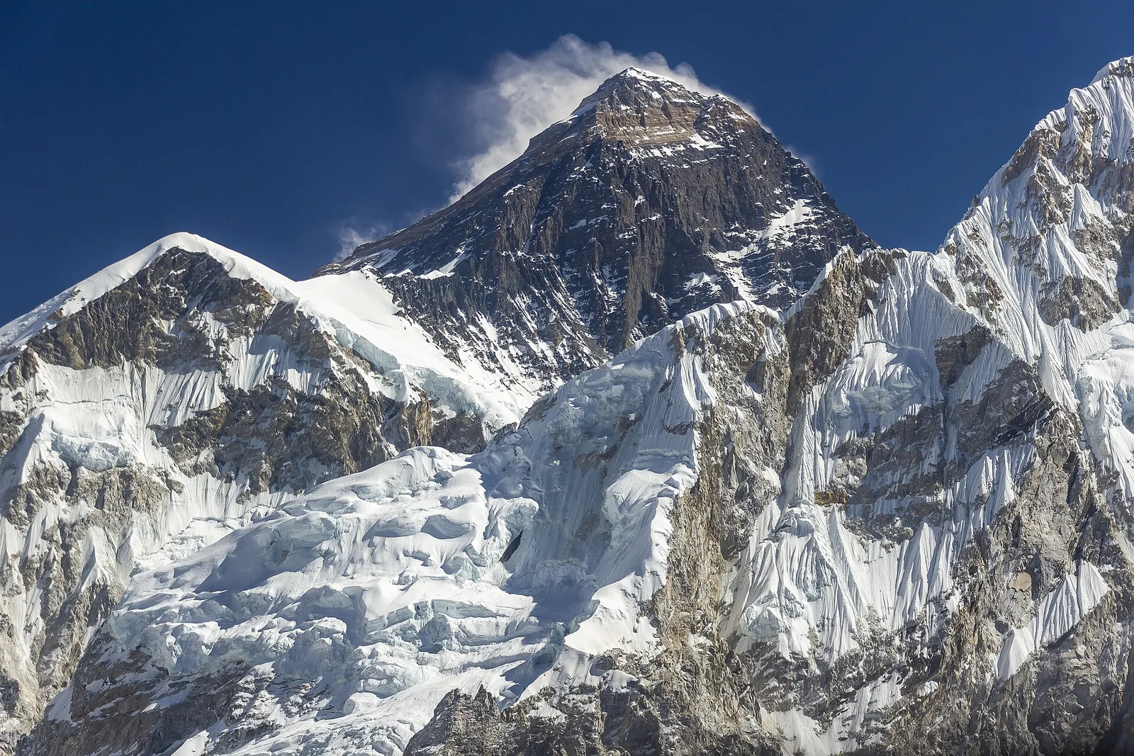
Base camp itself is the end of the walk over the glacier from Gorak Shep, which the tourism board puts at up to five hours over treacherous ground where finding a route can be tricky and slipping on the ice is a risk. It is a working camp as much as a goal: the Himalayan Rescue Association has run its Everest ER clinic there since the spring season of 2003, for climbers, their support staff and visitors. The view most trekkers come for is from Kala Patthar, the hill above Gorak Shep at 5,545 m, known for its outstanding views of Everest; it is where, the tourism board says, many a trekker has captured the image of the world's highest mountain, and the plan above climbs it on the morning after base camp.
Two other routes lie in the same national park. The Gokyo valley, west of the Khumbu and part of the same national park, has yak pastures, turquoise glacial lakes and villages where most houses are tea houses; the tourism board says Gokyo can be reached after Everest Base Camp or by trekking there directly, or by chartered helicopter, and that Gokyo Ri, at 5,357 m, gives an all-round view of the peaks and lakes, with Cho Oyu to the north and Everest, Lhotse and Makalu in the panorama. The Three Passes trek is on the board's licensed-guide and TIMS list too. No official page gives the days for either route, so book each as its own itinerary with the same two permits.
The Lukla flight and the spare days it needs
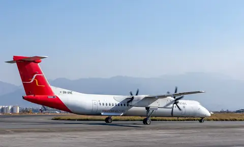
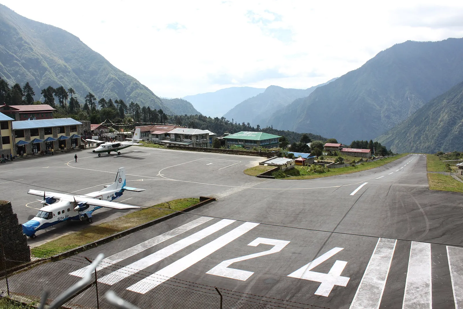
Lukla, a small town at 2,860 m served by Tenzing Hillary Airport, is reached from Kathmandu by a flight the tourism board gives as 30 minutes. Tara Air and Summit Air both fly to Lukla, and both also list Ramechhap. Summit Air says Ramechhap, served by Manthali Airport, can be reached only by road, a four hours' drive from Kathmandu, and that in its high seasons, March to April and October to December, all the flights to Lukla are rerouted there to avoid delays and backlogs. Look at the departure airport on your ticket: for Ramechhap, transfer from Kathmandu in daylight and sleep near Manthali before the flight. Have the agency check that the road is open; if it closes, delay the flight and stay in Kathmandu. For a Kathmandu departure, spend the night before in Thamel or near it; the Kathmandu guide covers the neighbourhood.
Pack to the smallest limit. Tara Air allows each passenger 10 kg of checked baggage and 5 kg of hand luggage free, 7 kg for a child under 12, and charges for excess baggage. It has no online check-in and asks passengers to check in at the airport counter at least one hour before departure. If Tara Air cancels a flight for weather or technical reasons, its terms give a full refund, or you can rebook on the next available flight. If you cancel a Tara Air USD ticket yourself, it costs 10% of the base fare up to 12 hours before departure and 33.33% up to 1 hour before; a request inside check-in time is a no-show with no refund, so allow for the drive when your flight leaves from Ramechhap. The transport guide compares the other domestic airlines.
The flight is still the weakest link in the schedule. The UK government says internal flights in high mountain areas can be delayed by poor weather and that cancellations are common. Keep at least two spare days between the planned return flight and your international departure, and do not book a tight onward connection. Every Nepali airline is on the EU and UK air-safety lists: Germany's Federal Foreign Office says all Nepali airlines are on the EU list of unsafe airlines, and the UK government points to the UK Air Safety List and says there have been fatal accidents in commercial aviation in Nepal.
The tourism board also describes a way in without the Lukla flight: a bus to Jiri and a walk through the mid-hills of Solu, which adds roughly 10 days to reach Namche Bazaar and suits trekkers with weeks to spare. Tara Air and Summit Air also fly to Phaplu, a trekking town in Solukhumbu district whose airport Summit Air puts at 8,035 ft. Plan either way in as a separate trek with its own days, not as a fallback on the day a flight is cancelled.
Guide, TIMS card, park ticket and what the permits cost
Foreign trekkers may not walk to Everest Base Camp alone. The Nepal Tourism Board says that since the revised rule took effect on 31 March 2023, foreign trekkers on a listed set of routes in protected areas must be accompanied by a licensed trekking guide and carry a TIMS card issued through a trekking agency, and its list names the Everest Basecamp Trek. The UK government adds that people who ignore the requirements may be fined or removed from protected areas. Only agencies buy the TIMS card: the agency registers the trekkers, guides and route on the board's system, pays online, and each trekker receives an e-card with a QR code. Choose a government-registered agency, and be wary, as the UK government is, of trekking deals that look very cheap; the permits guide covers every route.
Fees. On the official pages checked on 17 October 2026, the TIMS card cost NPR 2,000 for foreign trekkers other than South Asian (SAARC) nationals, who pay NPR 1,000. The Sagarmatha National Park entry fee was NPR 3,000 per person per entry for foreigners and NPR 1,500 for SAARC nationals, and the tourism board's fee table lists children under 10 as free. The park fee can be paid at the Tourist Service Center in Bhrikutimandap, Kathmandu, or at the park entry points; on this trail the park's check is at Jorsale, just beyond Monjo. TAAN gives the TIMS check post for this route at Monjo, for entry and exit, and Nepal Police lists a tourist-police post at Lukla. No official page lists the Khumbu Pasang Lhamu rural municipality's own entry fee or where it is paid; ask your agency whether it applies. Give your agency the full dates, spare days included: Germany's Federal Foreign Office says permits must always cover the whole period of the planned trek.
What the fixed costs come to for two. For two foreign adults other than SAARC nationals, the two TIMS cards (NPR 4,000) and the two park permits (NPR 6,000) come to NPR 10,000 at the fees above. Budget separately for two return Lukla flights from the airport on your ticket; Tara Air charges foreign nationals other than Indian and Nepali nationals its USD fare, which the booking page shows for your date. Add the daylight transfer and night near Manthali if the ticket departs there. Lodge and meal rates are not listed here; have the agency quote those nights, spare days included, alongside the guide and any porter. The Kathmandu nights before and after are priced in the where-to-stay guide.
Altitude from Lukla at 2,860 m to base camp at about 5,300 m
The heights the tourism board, the park and Summit Air give for the trail are Lukla 2,860 m, Monjo 2,845 m, the lowest point of the park, Namche Bazaar 3,500 m, Tengboche 3,867 m, the Himalayan Rescue Association's aid post at Pheriche 4,250 m and Kala Patthar 5,545 m, the highest point of the plan. UK Travel Health Pro gives Everest south base camp as about 5,300 m and Kathmandu as 1,220 m, far below the 2,500 m at which it says altitude illness becomes a risk.
Spend a few days below 3,000 m and, where possible, avoid going from under 1,200 m to over 3,500 m in one day, UK Travel Health Pro advises. TravelHealthPro advises gaining no more than about 500 m of sleeping height a day above 3,000 m. Take a rest day at the same altitude every three or four days. Day 2 gains 655 m from Monjo to Namche; rest days do not remove the risk from that ascent. Namche to Tengboche then gains 367 m and Tengboche to Pheriche 383 m, with a further rest day at Pheriche. Above Pheriche, the sleeping heights of Lobuche and Gorak Shep are a gap in the official pages used here; have your agency explain its acclimatisation plan for days 8 and 9 before you book and tell your guide at once if you feel unwell. Germany's Federal Foreign Office advises seeing a doctor experienced in altitude medicine before any journey above 2,300 m.
Headache, tiredness, loss of appetite, nausea and poor sleep are the early signs of altitude sickness. If you develop symptoms of altitude sickness, stop climbing, descend promptly with a companion to a lower altitude (below 4,000 m if you are higher) and consult a doctor. The tourism board lists severe headache, vomiting, walking as if drunk, confusion, severe fatigue and breathlessness at rest as worsening symptoms; UK Travel Health Pro says cerebral and pulmonary oedema need immediate descent and emergency medical treatment. Acetazolamide can assist acclimatisation, the same source says, but does not replace a gradual ascent. The Himalayan Rescue Association gives a talk on altitude sickness each day at 3 pm at its Pheriche aid post in the spring and autumn seasons.
Cold is part of the altitude. The tourism board says average temperatures in Nepal drop 6 degrees C for every 1,000 m of height, so the nights at Lobuche and Gorak Shep are far colder than the days at Lukla.
Helicopter rescue and the insurance that pays for it
The UK government advises trekkers to make sure their insurance includes cover for mountain rescue services and helicopter costs, and says it may be difficult to get a rapid helicopter evacuation from a remote area; read the policy for the maximum altitude it covers and for whether it pays the helicopter directly. France's foreign ministry says mountain rescue is paid for and helicopters fly only when payment is guaranteed; give your insurance details to the agency before the trek. It reserves helicopter transport from an accident site to Kathmandu for extreme emergencies. France's foreign ministry recommends that trekkers or their guides carry satellite phones. The UK government also reports isolated cases of guides taking inexperienced trekkers too high too quickly and then calling an expensive helicopter evacuation.
On the trail, the Himalayan Rescue Association runs the aid post at Pheriche, staffed by volunteer doctors in spring and autumn, and the Everest ER clinic at base camp, and Kunde Hospital above Namche gives emergency care to trekkers. The tourist police can be reached on 1144, and the Nepal Meteorological Department's toll-free line, 1155, gives weather and flood information.
When to walk: October and November, or March to May
The Nepal Tourism Board's page for Sagarmatha National Park names October to November and March to May as the best season. The tourism board's climate page explains the autumn side: the clearest skies come after the monsoon, in October and November, while spring is the time for rhododendrons to bloom.
From December to February the park page gives snow and a daytime temperature of 5 degrees C, and from June to September it gives rain. The monsoon runs from June to September. The UK government gives June to October as the season when floods and landslides can cut roads. Germany's Federal Foreign Office adds that heavy rain, floods and snowfall are a growing risk for high-mountain treks, above all in the changes between dry and rainy periods, which it gives as September to October, February to March and May to June. Even in the best weeks, look at the forecast each day with your guide; the best-time guide compares the seasons across the country.
Lodges, meals and cash on the trail
The Nepal Tourism Board says that in the main trekking areas lodges have been established where trekkers find accommodation and food and meet other trekkers, that most trails are well maintained and in many cases sign-posted, and that the popular Everest treks can provide lodge accommodation. Its lodges have facilities for charging batteries. The park's page lists lodges and tea houses among the places to sleep, and Summit Air says Lukla is dotted with shops and lodges serving trekkers with western-style meals and trail supplies. Namche has a pub, equipment shops and Wi-Fi.
Carry enough cash for the days above Namche, since the UK government warns that cash machines may not be available in remote areas and cards may not be accepted. Drink only treated or boiled water: UK Travel Health Pro advises against drinking untreated tap water in countries with poor sanitation, and against ice.
Food on the trail is simple and filling, built around dal bhat, the staple Nepali meal, with momo and dhido on lodge menus; Namche, the tourism board says, is known for its homemade yak cheese and butter.
Make time for the local food
What to eat and where to look
Dal bhat
The staple Nepali meal of dal, rice, vegetables and achar, with yogurt or buttermilk. The Nepal Tourism Board says the lentils change with the season and that a chicken or mutton curry may follow.
- Where to look
- The tea houses at each night's stop, up to the few at Gorak Shep.
- Fit it into your day
- The evening meal after a long walking day, such as the one into Lobuche.
Meat curries are often served alongside, so say if you eat vegetarian.
Momo
Dumplings that the Nepal Tourism Board says came from Tibet with Newari traders, filled with minced chicken, mutton, buff, paneer, cheese or vegetables, and steamed, fried or served in soup as jhol momo.
- Where to look
- The restaurants of Namche Bazaar on the rest days.
- Fit it into your day
- Lunch on a rest day in Namche.
Ask for a vegetable or cheese filling if you avoid meat.
Dhido
A porridge of hot water and ground grain such as millet, barley, buckwheat or wheat flour, eaten with curry, achar or soup. The Nepal Tourism Board calls it one of the most popular indigenous meals in the Himalayan community.
- Where to look
- Tea houses in Namche Bazaar and at Pheriche.
- Fit it into your day
- A filling dinner in Namche or Pheriche.
Dhido is made from ground grain; ask which grain if you avoid gluten.
Yak cheese
The Nepal Tourism Board describes Namche Bazaar as a historic trading hub famous for its homemade yak cheese and butter.
- Where to look
- Namche Bazaar, on the rest days, and its Saturday-morning market.
- Fit it into your day
- A picnic for the walk up to Khunde and Khumjung.
Carry it sealed in your daypack for the walk.
Practical questions
How many days does the Everest Base Camp trek take?
The Nepal Tourism Board describes it as a two-week trek that starts and finishes at Lukla; the plan in this guide is 14 nights on the trail with the flight out on day 15. Add a night in Kathmandu either side and at least two spare days for the flights, which are often delayed.
Do I need a guide and a TIMS card for Everest Base Camp?
Yes. The Nepal Tourism Board lists the Everest Basecamp Trek among the routes that need a licensed guide and an agency-issued TIMS card (NPR 2,000, checked on 17 October 2026).
How high is Everest Base Camp, and is altitude sickness a risk?
UK Travel Health Pro gives Everest south base camp as about 5,300 m, and says altitude illness is a risk from 2,500 m. Read the altitude section before booking.
What permits and fees does the trek need?
On the official pages checked on 17 October 2026, the TIMS card cost NPR 2,000 and the Sagarmatha National Park permit NPR 3,000 per entry for foreigners other than SAARC nationals, NPR 10,000 for two.
What happens if my Lukla flight is cancelled?
The UK government says cancellations of mountain flights are common, so keep spare days. If Tara Air cancels for weather or technical reasons, its terms give a full refund, and you can ask to be rebooked instead; the walk-in from Jiri adds roughly 10 days to reach Namche Bazaar.
When is the best time to trek to Everest Base Camp?
The Nepal Tourism Board names October to November and March to May as the best season in Sagarmatha National Park. Snow and cold set in from December to February, and the monsoon brings rain from June to September.
Sources and checks before you travel
Reference sources for the version dated 18 October 2026. Confirm opening times, access, transport and conditions for your travel dates.
- Nepal Tourism Board: Everest Base Camp ↗ — opens in a new tab
- Nepal Tourism Board: Sagarmatha National Park ↗ — opens in a new tab
- Nepal Tourism Board: Everest ↗ — opens in a new tab
- Nepal Tourism Board: Namche Bazaar ↗ — opens in a new tab
- Nepal Tourism Board: top trekking destinations ↗ — opens in a new tab
- Sagarmatha National Park (DNPWC) ↗ — opens in a new tab
- Nepal Tourism Board: TIMS card ↗ — opens in a new tab
- Nepal Tourism Board: park entry fees ↗ — opens in a new tab
- Nepal Tourism Board: safety in the mountains ↗ — opens in a new tab
- Nepal Tourism Board: climate ↗ — opens in a new tab
- Nepal Tourism Board: trekking in Nepal ↗ — opens in a new tab
- Nepal Tourism Board: food and culinary ↗ — opens in a new tab
- UK Travel Health Pro: Nepal ↗ — opens in a new tab
- UK Travel Health Pro: food and water hygiene ↗ — opens in a new tab
- GOV.UK: Nepal safety and security ↗ — opens in a new tab
- GOV.UK: Nepal health ↗ — opens in a new tab
- Germany's Federal Foreign Office (Auswaertiges Amt): Nepal travel and security advice (German) ↗ — opens in a new tab
- Summit Air: Lukla ↗ — opens in a new tab
- Nepal Police: Tourist Police ↗ — opens in a new tab
- Nepal Meteorological Department ↗ — opens in a new tab
- Nepal Tourism Board: Tengboche ↗ — opens in a new tab
- Nepal Tourism Board: Tengboche Monastery ↗ — opens in a new tab
- Nepal Tourism Board: Khunde and Khumjung ↗ — opens in a new tab
- Summit Air: Ramechhap ↗ — opens in a new tab
- Summit Air: Phaplu ↗ — opens in a new tab
- Tara Air: FAQ ↗ — opens in a new tab
- Tara Air: fare and cancellation policy ↗ — opens in a new tab
- Tara Air: terms and conditions ↗ — opens in a new tab
- Nepal Tourism Board: Gokyo ↗ — opens in a new tab
- Trekking Agencies' Association of Nepal: TIMS overview ↗ — opens in a new tab
- France Diplomatie: Nepal health advice ↗ — opens in a new tab
- France Diplomatie: Nepal security advice ↗ — opens in a new tab
Photo credits
Tengboche Monastery, with Everest, Lhotse and Ama Dablam behind it, on the trail above Namche Bazaar.
Photograph: Rohit Sharma — opens in a new tab · CC BY-SA 4.0 — opens in a new tab
Changes: Resized and converted to WebP; displayed with responsive crops. · Original photograph and licence details ↗ — opens in a new tab
Namche Bazaar from above, with Kongde Ri to the west.
Photograph: Nirojsedhai — opens in a new tab · CC BY-SA 4.0 — opens in a new tab
Changes: Resized and converted to WebP; displayed with responsive crops. · Original photograph and licence details ↗ — opens in a new tab
Mount Everest from Kala Patthar, the viewpoint above Gorak Shep.
Photograph: Bijay Chaurasia — opens in a new tab · CC BY-SA 4.0 — opens in a new tab
Changes: Resized and converted to WebP; displayed with responsive crops. · Original photograph and licence details ↗ — opens in a new tab
Gorak Shep and the Khumbu glacier, the last settlement before base camp.
Photograph: Vyacheslav Argenberg — opens in a new tab · CC BY 4.0 — opens in a new tab
Changes: Resized and converted to WebP; displayed with responsive crops. · Original photograph and licence details ↗ — opens in a new tab
The runway at Lukla's Tenzing Hillary Airport, the start and end of the trek.
Photograph: Superikonoskop — opens in a new tab · CC BY-SA 3.0 — opens in a new tab
Changes: Resized and converted to WebP; displayed with responsive crops. · Original photograph and licence details ↗ — opens in a new tab
A shopping street in Namche Bazaar.
Photograph: Vyacheslav Argenberg — opens in a new tab · CC BY 4.0 — opens in a new tab
Changes: Resized and converted to WebP; displayed with responsive crops. · Original photograph and licence details ↗ — opens in a new tab