Kathmandu Valley · Bagmati
Nagarkot travel guide: sunrise, one night or a day trip
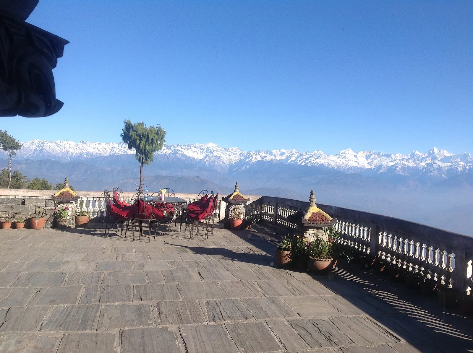
Nagarkot is not a town to tour but a ridge on the eastern rim of the Kathmandu Valley, 32 km from the capital, chosen for one thing: the light on the Himalayas at the start and end of the day. It is a small hill settlement of hotels and a popular view tower, where you watch the sun come up and go down over the snow peaks and the valley below. The real decision is whether to sleep there: a night on the ridge gives you sunset and sunrise, while a day trip in daylight gives you the midday view and a choice between Changu Narayan and Bhaktapur.
- Suggested time
- 1 night on the ridge, or a day trip in daylight
- Where to stay
- Nagarkot ridge for the sunrise and sunset views; Bhaktapur old town as the cultural stop before or after
- Season and timing
- The clearest skies come after the monsoon, in October and November, according to the Nepal Tourism Board; spring brings the rhododendrons but often haze. Winter mornings on the ridge are cold and often hazy.
The short answer
Book one night on the ridge, arriving in the afternoon so you see the sunset and wake in position for sunrise, and go back to Kathmandu or on to Bhaktapur the next morning. A day trip from Kathmandu cannot reach the ridge for sunrise without driving in the dark. Book the room first and ask the hotel to quote a car with a driver for both legs. Changu Narayan costs NPR 300 for foreign visitors other than SAARC nationals, who pay NPR 100. Bhaktapur Durbar Square costs USD 18 or NPR 1,800 for foreign visitors other than SAARC and Chinese nationals, who pay NPR 500. These fees were checked on 18 October 2026. Children under 10 enter Bhaktapur Durbar Square free, and in a group of 11 to 20 one tour leader enters free.
What Nagarkot gives you: sunrise, sunset and a long line of snow peaks
Nagarkot sits on the rim of the Kathmandu Valley, and the Nepal Tourism Board recommends it, together with Dhulikhel, for panoramic views of the Himalayas within a short drive of the capital. It is a laid-back hill settlement with a mix of high-end hotels and camping, where you can watch the sun come up and go down from your room or from the popular view tower. The ridge belongs to Changunarayan Municipality, which took in the former Nagarkot Municipality, lies between 1,372 m and 2,191 m above sea level and names Nagarkot and the Changu Narayan temple as its main attractions.
In clear weather the morning brings a panorama of snow peaks along the northern horizon, rising above green hills, with the valley below still in shadow; the evening brings the same view in warmer light. Between the two, walk the nearby hills for a different angle. Watch first light from your hotel, with a warm layer for the wait, and visit the tower in daylight; its entry fee needs checking locally.
Dhulikhel is the board's other ridge for the same plan: about an hour's drive east of Kathmandu, with a night there for the sunrise and sunset. It is the alternative if the Nagarkot hotels are full.
One night on the hill or a day trip from Kathmandu
Sleep one night if the mountains are the point. Sunrise is the reason most people come, and the tourism board itself suggests staying overnight to watch the sunrise and sunset. Arrive in the afternoon, walk the ridge while the light is good, and keep the evening free for the sunset.
A day trip in daylight suits a traveller with a single free day. Leave Kathmandu after sunrise, take in the ridge view and choose between Bhaktapur and a guided walk to Changu Narayan for the rest of the day. Leave time for the road journey back before dusk.
Stay two nights only if you plan to walk the hills, because a second night adds a second chance at the view rather than a second thing to do. The board also lists Nagarkot among Nepal's popular camping places; this guide plans a hotel night.
Getting to Nagarkot and back
Nagarkot is 32 km from Kathmandu on a hill road; allow the afternoon for the journey and settling in, especially if you stop in Bhaktapur, 12 km east of Kathmandu. A car fare, driving time, Bhaktapur–ridge distance and any marked tourist-bus option need checking when you arrange the transfer through your hotel. Book a car with a driver for both legs.
Drive up and down in daylight: the UK government advises against travelling at night, and Germany's Federal Foreign Office warns of short-notice road closures and local night-driving bans, especially on the larger roads around the Kathmandu Valley. In the monsoon, flooding and landslides can make roads impassable; check the road is open before setting off. If it is closed, stay in Kathmandu or Bhaktapur and postpone the ridge. Other governments may draw a wider line, so check your own government's advice before travelling.
Taxis, ride-hailing and the valley's other road facts are covered in the transport guide.
Walking to Changu Narayan and the hill paths
The tourism board names the hike down from Nagarkot to Changu Narayan, a Vishnu temple and World Heritage monument on a ridge overlooking Bhaktapur. It is one of the oldest specimens of pagoda architecture in the valley, dating from the Licchavi period and embellished with exquisite wood and stone carvings. The route is surrounded by greenery and is also used by mountain bikers; the temple fee is given above.
The trail's length and walking time need checking with your guide; start in the morning, carry water and have the car meet you at the temple. Follow France's advice for hiking in Nepal: use a licensed guide and obtain a TIMS card through a government-registered trekking agency. Our trekking-permits guide explains the agency booking process.
The tourism board lists over 50 hiking trails around the Kathmandu Valley, ranging from easy to difficult, and names Nagarkot among the hiking areas. Plan any longer hill walk with your guide and choose a route you can finish in daylight.
Make time for the local food
What to eat and where to look
Dal bhat
Rice with lentils, vegetables and achar, a sauce or dip, served with yogurt or buttermilk and often a chicken or mutton curry; the Nepal Tourism Board says Nepalis eat rice twice a day, at lunch and dinner.
- Where to look
- Thakali and Newari eateries, which the board says are spread all over the valley: in Bhaktapur old town at lunch, or your hotel's dining room for dinner on the ridge.
- Fit it into your day
- Lunch in Bhaktapur, or dinner after the sunset.
Ask what a dish contains if you have an allergy.
Momo
Dumplings filled with minced chicken, mutton, buffalo, paneer, cheese or vegetables, usually steamed but also fried; the board says Newari traders brought them to Nepal from Tibet and calls momo probably the most popular fast food in Nepal.
- Where to look
- Newari eateries in Bhaktapur old town, the first town on the way down.
- Fit it into your day
- A quick lunch in Bhaktapur, or a snack before the drive back.
Chatamari
A rice-flour crepe topped with marinated minced meat, eggs, onions and spices, a Newari street snack nicknamed Newari pizza for its look.
- Where to look
- Newari eateries in Bhaktapur old town; the board says Newari eateries are spread all over the valley.
- Fit it into your day
- Lunch in Bhaktapur after the walk to Changu Narayan.
Wo or bara
A Newari patty of spiced lentils, called wo in Newari and bara in the hills, made for festivals and rituals and sold as a snack.
- Where to look
- Newari eateries in Bhaktapur old town.
- Fit it into your day
- Alongside chatamari for a snack lunch.
Juju dhau
Sweet buffalo-milk yoghurt set in a clay pot, which the board calls the King of Yoghurt and says originates from Bhaktapur.
- Where to look
- Curd shops in Bhaktapur old town, where it is still sold in small clay pots.
- Fit it into your day
- After the Durbar Square, before the drive back.
Which season gives the clearest view
The Nepal Tourism Board names spring and autumn as the best times to visit, with rhododendrons in spring and the clearest skies after the monsoon in October and November. The monsoon runs from June to September. Spring shares the dry-season haze: Germany's Federal Foreign Office says forest fires cause air pollution and fine dust from November to May, and Nepal's Department of Environment finds pollution generally highest in winter and before the monsoon. Winter brings bright sun, but haze can hide the peaks, so for the mountains autumn is the better bet.
Expect cold mornings. The board puts Kathmandu Valley winter temperatures at 2 to 12 degrees C and says temperatures fall about 6 degrees C for every 1,000 m of altitude, so the ridge is colder than the city. The best-time guide compares the seasons across the country.
For extreme-weather and flood information, the Department of Hydrology and Meteorology's toll-free line is 1155. The Ministry of Home Affairs publishes the public-holiday list for each Nepali year; book early if your hotel dates fall on a holiday.
Rooms and areas on the ridge
Two areas matter, and they answer different questions. Stay on the ridge itself if the view is the reason for coming, since you can watch the sunrise and sunset from your hotel. Stay in Bhaktapur instead if you would rather walk the old city early and late and visit Nagarkot by day, giving up the sunrise.
Our where-to-stay guide compares the ridge's rooms. The 10-day itinerary budgets a whole trip with a night on the ridge.
Practical questions
Is one night enough in Nagarkot?
Yes, for most travellers. One night puts you on the ridge for sunset and the next sunrise, which is what the hill is known for. Add a second night only if you want to walk the hill paths.
Can I see the sunrise on a day trip from Kathmandu?
No, not without driving up in the dark, so plan a night on the ridge for sunrise. For a day trip, leave Kathmandu after sunrise, see the ridge and choose between Bhaktapur and a guided walk to Changu Narayan, allowing time to return before dusk.
When is the best time to see the Himalayas from Nagarkot?
Choose autumn for the mountain view; the season section above compares it with spring, winter haze and the monsoon.
How far is the walk to Changu Narayan?
Ask your licensed guide about the trail length and walking time, and arrange a car to meet you at the temple. Its entry fee is given in the answer above.
Is Dhulikhel an alternative to Nagarkot?
Yes. The tourism board recommends both ridges for panoramic Himalayan views and puts Dhulikhel about an hour's drive east of Kathmandu, with a night there for the sunrise and sunset.
Sources and checks before you travel
Reference sources for the version dated 18 October 2026. Confirm opening times, access, transport and conditions for your travel dates.
- Nepal Tourism Board: Nagarkot sunrise and sunset ↗ — opens in a new tab
- Nepal Tourism Board: mountain viewing ↗ — opens in a new tab
- Nepal Tourism Board: hiking ↗ — opens in a new tab
- Nepal Tourism Board: camping ↗ — opens in a new tab
- Nepal Tourism Board: heritage site entry fees ↗ — opens in a new tab
- Changunarayan Municipality: introduction (Nepali) ↗ — opens in a new tab
- Nepal Tourism Board: Bhaktapur ↗ — opens in a new tab
- Nepal Tourism Board: food and culinary ↗ — opens in a new tab
- Nepal Tourism Board: climate ↗ — opens in a new tab
- GOV.UK: Nepal travel advice, safety and security ↗ — opens in a new tab
- Germany's Federal Foreign Office: Nepal, travel and safety advice (German) ↗ — opens in a new tab
- Department of Environment: Status of air quality in Nepal, annual report 2025 (Nepali) ↗ — opens in a new tab
- Department of Hydrology and Meteorology ↗ — opens in a new tab
- Ministry of Home Affairs: holidays ↗ — opens in a new tab
- France Diplomatie: Nepal security advice ↗ — opens in a new tab
- Department of Environment: air-quality annual report, 2025 (PDF) ↗ — opens in a new tab
Photo credits
A stone viewing terrace at Nagarkot with the snow-capped Himalayan range along the horizon.
Photograph: Carlosdfox — opens in a new tab · CC BY-SA 4.0 — opens in a new tab
Changes: Resized and converted to WebP; displayed with responsive crops. · Original photograph and licence details ↗ — opens in a new tab
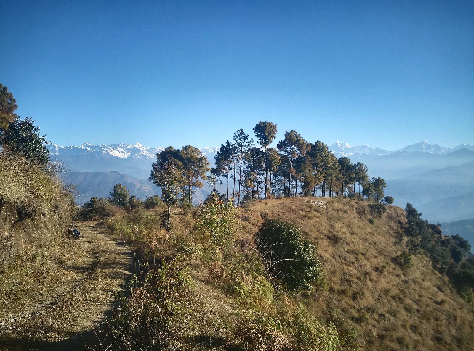
A grassy hill path with pines and a long line of snow peaks in the distance, on the Nagarkot panoramic hiking trail.
Photograph: Carlosdfox — opens in a new tab · CC BY-SA 4.0 — opens in a new tab
Changes: Resized and converted to WebP; displayed with responsive crops. · Original photograph and licence details ↗ — opens in a new tab
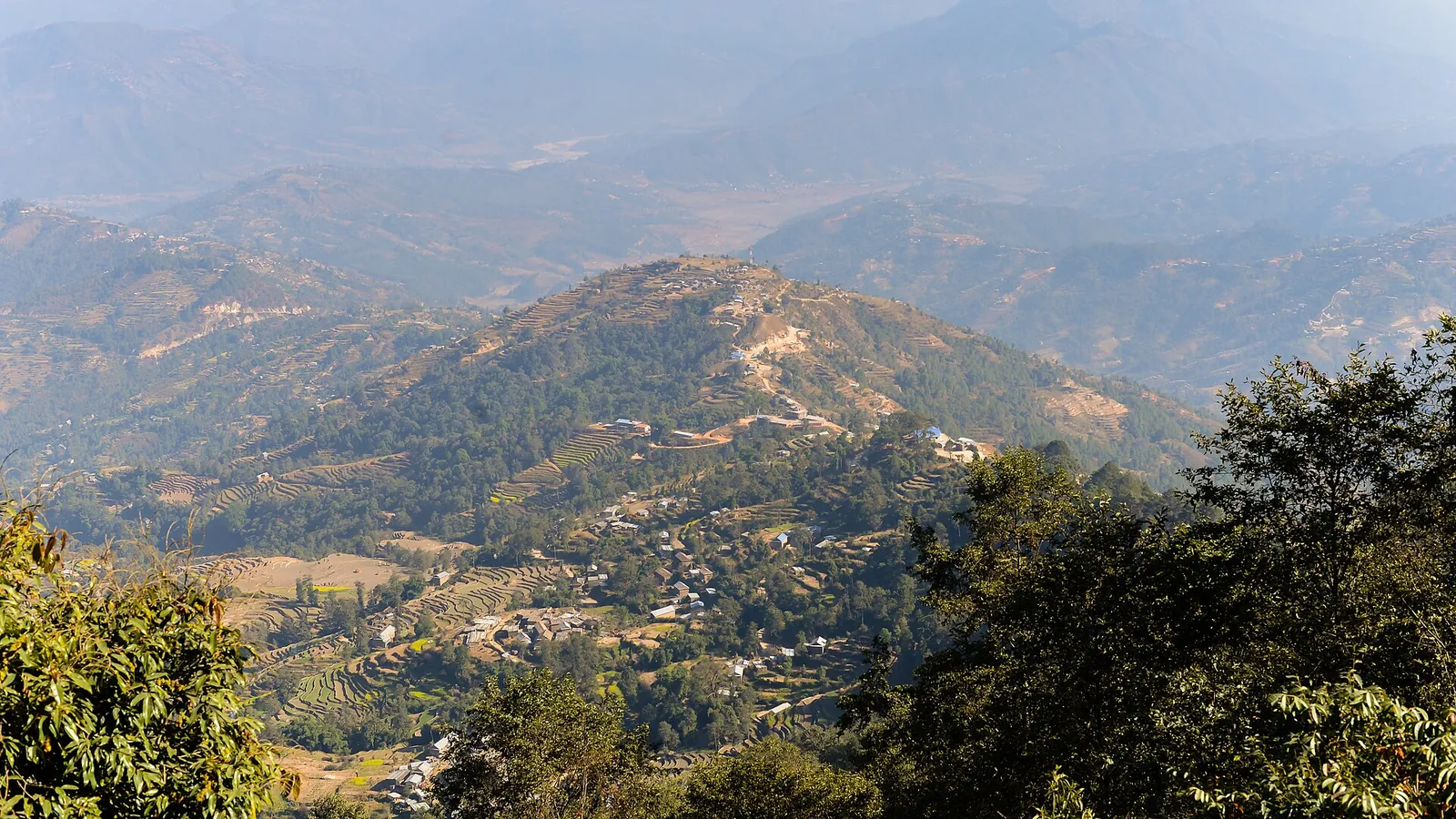
Ridges, terraces and scattered houses in the hills below Nagarkot.
Photograph: Bijay Chaurasia Photography, Wikimedia Commons — opens in a new tab · CC BY-SA 4.0 — opens in a new tab
Changes: Resized and converted to WebP; displayed with responsive crops. · Original photograph and licence details ↗ — opens in a new tab
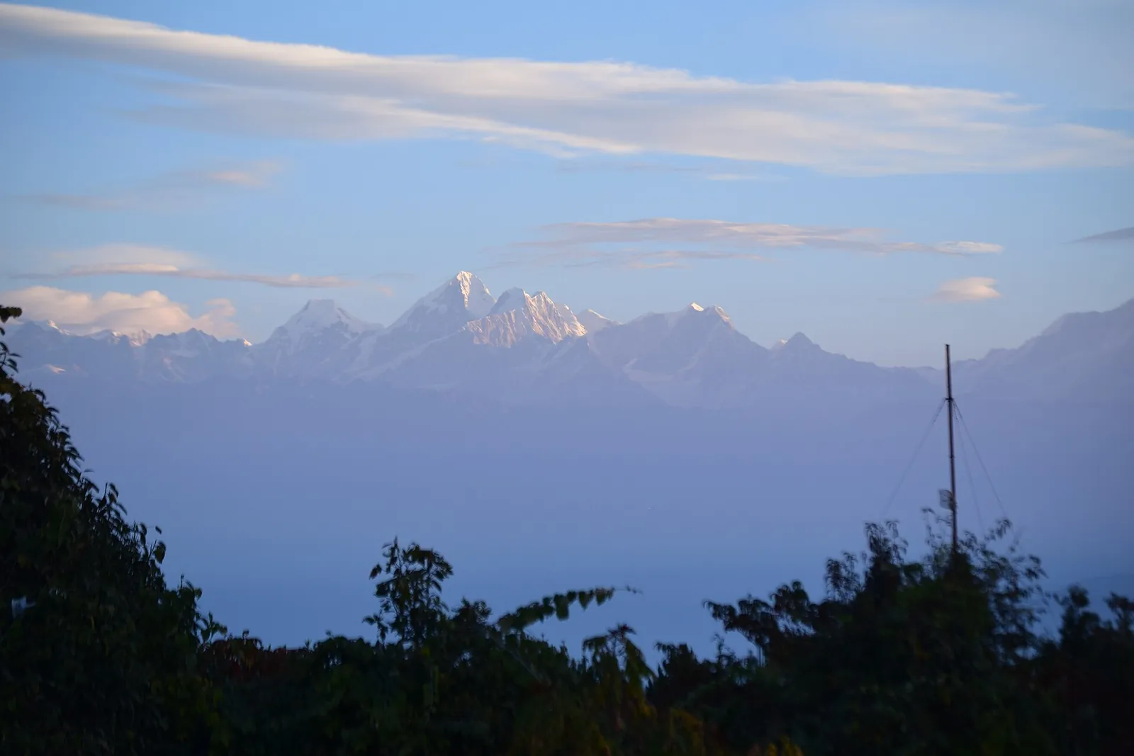
Snow peaks catching the first light above dark hills at Nagarkot sunrise.
Photograph: NSaad (WMF) — opens in a new tab · CC BY-SA 4.0 — opens in a new tab
Changes: Resized and converted to WebP; displayed with responsive crops. · Original photograph and licence details ↗ — opens in a new tab
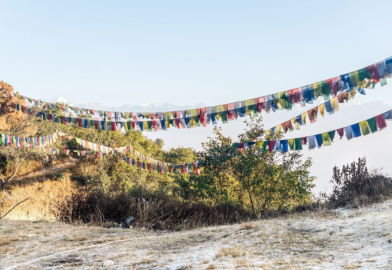
Prayer flags over a dry hilltop at Nagarkot, with pale peaks on the horizon.
Photograph: Bijay Chaurasia Photography, Wikimedia Commons — opens in a new tab · CC BY-SA 4.0 — opens in a new tab
Changes: Resized and converted to WebP; displayed with responsive crops. · Original photograph and licence details ↗ — opens in a new tab