Central Vietnam · Gia Lai
Quy Nhon travel guide: Ky Co, Eo Gio, Cham towers and where to stay
Quy Nhon is a working port city on the south-central coast with a long town beach, a ring of rocky headlands and a peninsula of fishing villages across the lagoon. It has what a beach holiday needs — clear coves, seafood, sunshine — but moves at a slower pace than Vietnam's busier beach towns, and its sights are spread out: Cham towers in the city and on the plain, Ky Co and Eo Gio on the Phuong Mai Peninsula, and quiet bays to the south. Since the 2025 provincial merger, Binh Dinh has become part of Gia Lai Province, so you will now see Quy Nhon described as being in Gia Lai.
- Suggested time
- 3–4 nights
- Where to stay
- The city beach for convenience; Bai Xep or Nhon Ly for a village bay
- Season and timing
- Vietnam's national tourism agency gives April to September as the best time for Ky Co. The UK government's travel advice puts the tropical-cyclone season at May to November, with seasonal flooding in central Vietnam in October and November, so keep boat and beach days flexible late in the year.
The short answer
Give Quy Nhon three nights: one day on the Phuong Mai Peninsula for Eo Gio, Ky Co and the Nhon Ly fishing village, one day for the Twin Towers, Ghenh Rang and Quy Hoa in and south of the city, and a third for Banh It tower and the Thi Nai lagoon, Hon Kho, or simply the beach. Sleep on the city beach if you want restaurants and taxis on the doorstep; choose Bai Xep for a small fishing-village bay south of town, or Nhon Ly if you want to be on the peninsula early. You will need a car, a taxi or a motorbike for almost every sight. Fly into Phu Cat, about 30 km from the city.
City beach, Bai Xep or Nhon Ly: choose your base first
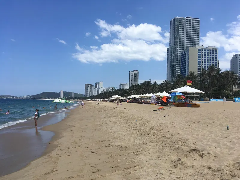
Most first-time visitors sleep along the city beach, a crescent of golden sand that the national tourism agency describes as stretching about 5 km from Tan Cape to Ghenh Rang, with mountains behind the town. This is where the restaurants, cafés, shops and taxis are, and it puts you within a short ride of the Twin Towers and Ghenh Rang. The trade-off is that the beaches you came for — Ky Co, Eo Gio, Hon Kho — are across the lagoon on the Phuong Mai Peninsula; the national tourism agency puts Eo Gio about 25 km from the city centre by road.
Bai Xep is the alternative to the south: a fishing village by Quy Hoa beach, about 13 km from the city centre according to the national tourism agency, which describes its rise as a homestay destination and quotes Business Insider calling it a car-free village with a relaxing beach and fresh seafood. Mornings there are about boats and village lanes rather than traffic. Nhon Ly, on the peninsula itself, puts you closest to Eo Gio and Ky Co for an early start; expect a fishing village rather than a resort strip, with fewer choices in the evening. Whichever you choose, check how the property handles transport: a hotel that can arrange a car or rent a motorbike saves a lot of waiting.
Eo Gio, Ky Co and Nhon Ly on the Phuong Mai Peninsula
The peninsula is reached from the city over the Thi Nai Bridge, which the national tourism agency describes as 2,477.7 metres long across the Thi Nai Lagoon. Its rocky hills, sand dunes, coral reefs and fishing villages hold most of Quy Nhon's coastal scenery, so plan a full day here.
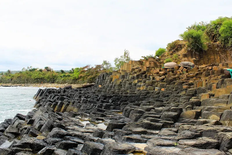
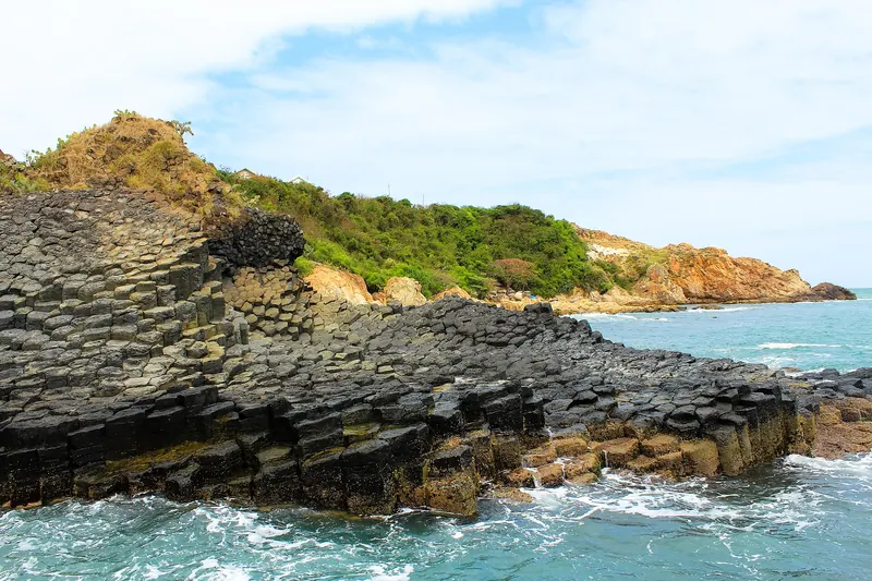
Eo Gio ("wind strait") is a curved strait embraced by rocky mountains, with a boulder beach and uneven paths at the foot of the slope and rocks shaped by wind and sea. From the top, the agency notes, you look over the Nhon Ly fishing village and its boats. Near the mountainside is Ngoc Hoa Pagoda, whose 18-metre double statue of Avalokitesvara the agency calls the tallest in Vietnam.
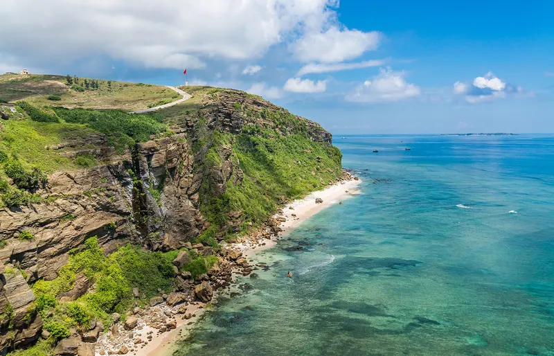
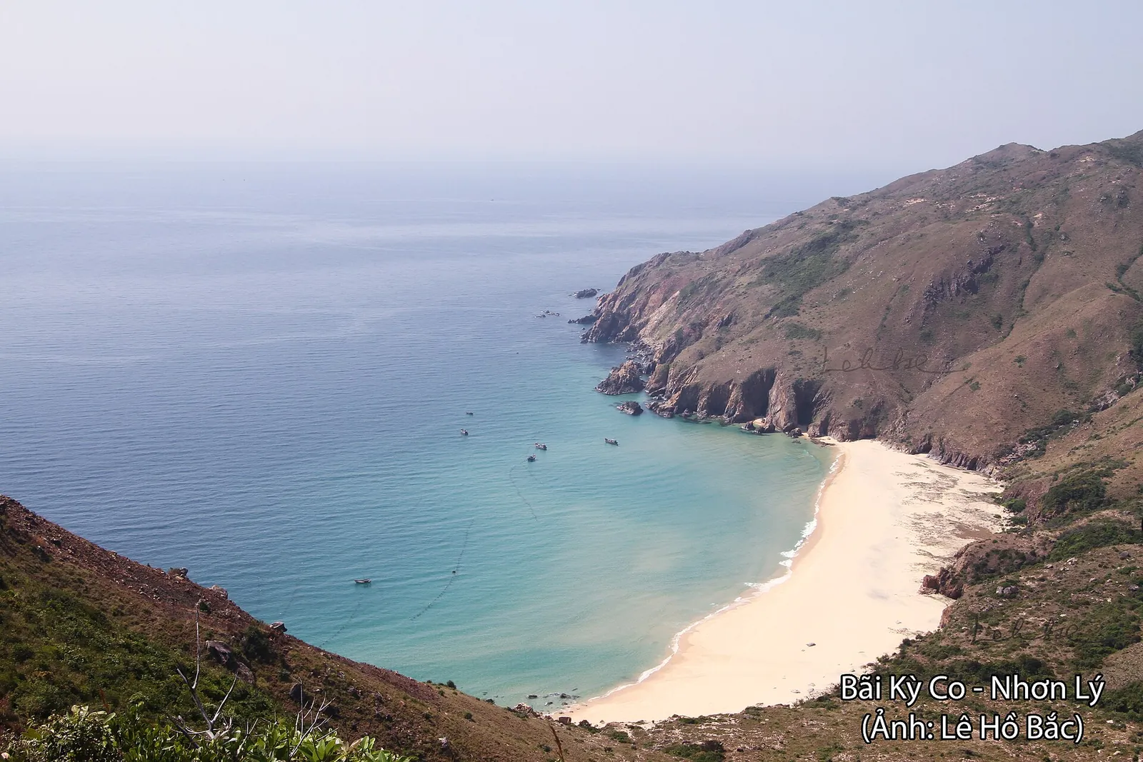
Ky Co is a small, white-sand crescent with three sides facing the mountains and rock formations at both ends, and water that shades from dark blue to jade. The national tourism agency describes reaching it by canoe or boat from Eo Gio, about 25 km north-east of the city centre, and later reported that a road now runs along the cliffs south of Eo Gio, so you can also arrive by car or on foot. It suggests basket-boat rides, snorkelling and fishing trips with local boatmen, and seafood such as grilled abalone and steamed crab. Agree what is included, the price and the return time before you board any boat, and wear the life jacket.
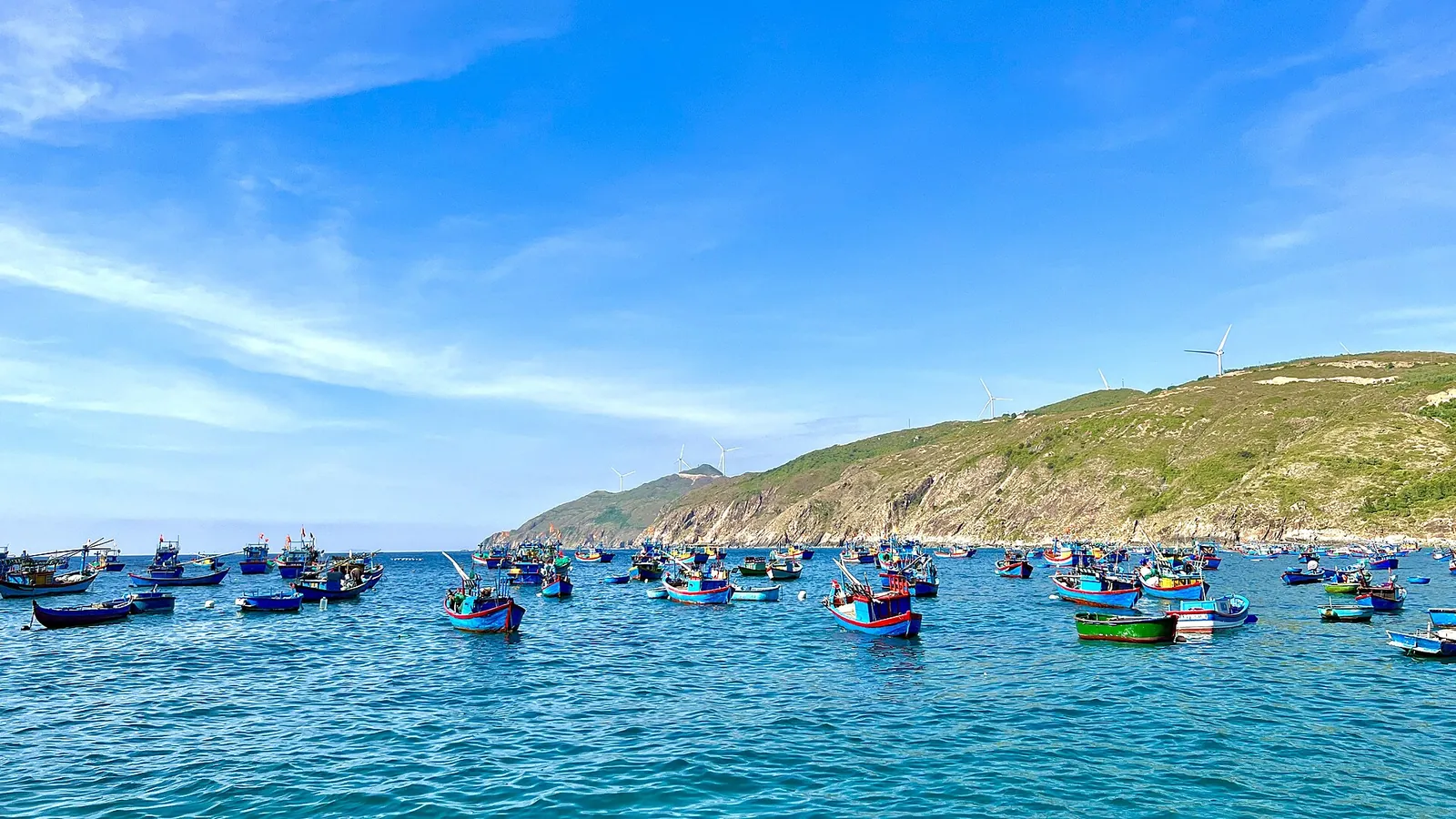
Leave time for the village itself. The agency describes Nhon Ly and Nhon Hai as peaceful fishing communities under the mountains, with crab cages and moored boats; at Nhon Hai a section of an old Champa wall about 200 metres offshore shows above the water only at low tide.
Make time for the local food
What to eat and where to look
Jumping-shrimp pancake (banh xeo tom nhay)
Small, crisp pancakes filled with tiny fresh shrimp, eaten with herbs and a dipping sauce. The national tourism agency calls it a speciality of Quy Nhon, and the Australian magazine Traveller, quoted by the agency, sent readers to Xuan Dieu street for it.
- Where to look
- Family-run eateries on and around Xuan Dieu, the seafront street often called seafood street.
- Fit it into your day
- An early dinner after a day on the peninsula; order a few rounds and share.
Contains shellfish, and the dipping sauce usually contains fish sauce.
Squid pancake (banh xeo muc) in the fishing villages
The same crisp pancake made with fresh squid, which Lonely Planet, as reported by the national tourism agency, recommends tasting in the coastal villages around Quy Nhon in the early morning.
- Where to look
- Breakfast stalls in fishing villages such as Nhon Ly and Bai Xep.
- Fit it into your day
- Breakfast before an Eo Gio or Ky Co morning.
Contains seafood; stalls may sell out by mid-morning.
Seafood at Ky Co and Hon Kho
Grilled abalone, steamed crab and squid served by local boat and restaurant operators at Ky Co, according to the national tourism agency, and floating seafood restaurants at Hon Kho.
- Where to look
- Beach and floating restaurants at Ky Co and off Nhon Hai; ask at your hotel which are open that day.
- Fit it into your day
- Lunch on the peninsula day.
Agree the price by weight before the seafood is cooked, and choose places that are busy and keep their seafood alive.
Fish-cake noodles and banh beo
Bun cha ca, rice noodles in broth with fish cake, and banh beo, small steamed rice cakes topped with dried shrimp, are among the inexpensive local dishes the national tourism agency recommends in the city.
- Where to look
- Noodle shops in the city centre; the agency points to Nguyen Hue Street for bun cha ca.
- Fit it into your day
- A quick breakfast or lunch on the city day.
Both usually contain fish or shrimp; ask for fish sauce on the side if you need to.
Nem chua and Bau Da rice wine
Binh Dinh's sour, fermented pork roll (nem tre from Huyen market is the best known) and Bau Da, a fiery local rice wine, are the two regional specialities the tourism agency names first.
- Where to look
- Markets and specialty shops in the city; restaurants serving local dishes often list both.
- Fit it into your day
- A snack with drinks in the evening, or a food gift to take home.
Nem chua is cured, not cooked; skip it if you are pregnant or avoid raw pork. Bau Da is very strong.
The Cham towers: Thap Doi in town, Banh It on the plain
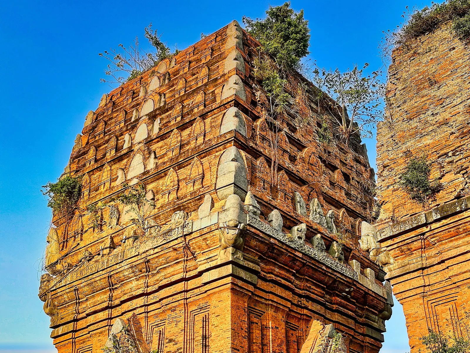
For about five centuries the Champa kingdom had its capital in Binh Dinh, and the former province still has eight clusters with 14 Cham towers, managed by the provincial museum. Two are easy from the city. The Twin Towers (Thap Doi, also called Hung Thanh) stand in the middle of town and date from the end of the 12th or beginning of the 13th century, according to the national tourism agency. They are a short taxi ride from the beach and work well late in the afternoon. The provincial museum, which manages the site, staged Binh Dinh martial-arts and Cham dance performances there over the 2026 Tet holiday and planned weekly Friday-evening programmes from April to September 2026; ask locally whether these are still running.
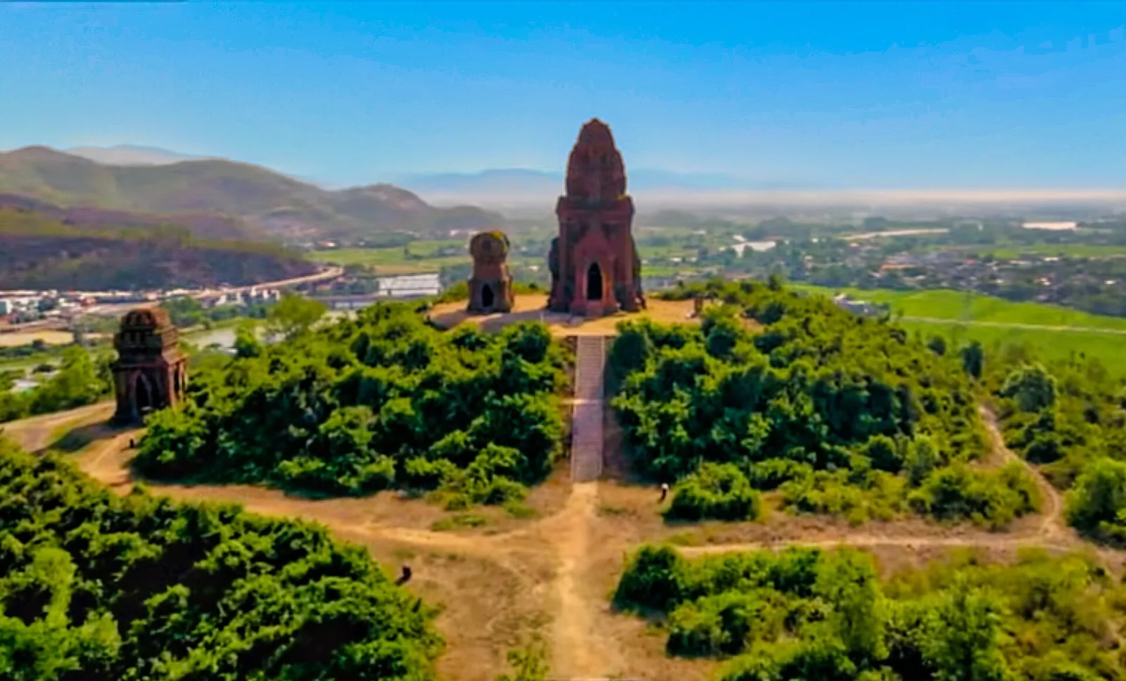
Banh It (Silver Towers), about 19 km north of the city, is the Cham cluster with the most towers left in Gia Lai: a gate tower, a stele tower, a fire tower and the main tower on a hilltop above rice fields, dating from the late 11th to early 12th century, according to the national tourism agency. A winding path leads up the gentle hill, and the view over the fields and town below is part of the visit. The province completed an additional exhibition building there in 2024, showing a map of Champa sites, reliefs, Cham ceramics, costume and instruments.
Dress modestly at both sites, do not climb on the brickwork, and bring water: there is little shade on the hilltop at Banh It.
Ghenh Rang, Queen's Beach and the Quy Hoa valley
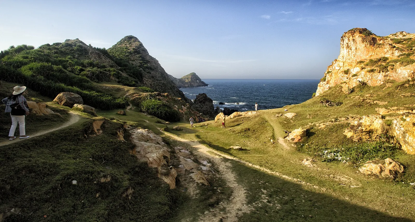
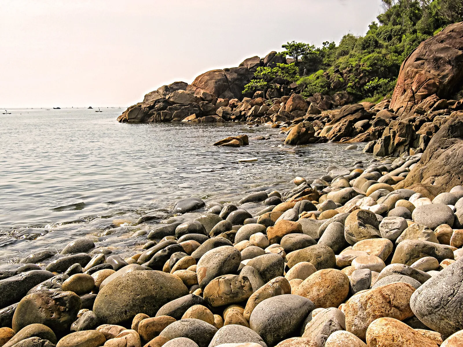
Just south-east of the city, Ghenh Rang is a stretch of winding rocky shore and caves by Xuan Van Mountain, with a panoramic view back over Quy Nhon. Its best-known cove is Hoang Hau, or Queen's Beach, named, the national tourism agency explains, because the last emperor, Bao Dai, and Queen Nam Phuong chose it as a private retreat during a visit in 1927. Its stone beach, Bai Trung ("egg beach"), is covered with smooth, egg-shaped stones; come for the view and the stones rather than a long swim.
On the same headland is the tomb of the poet Han Mac Tu. A little further south, the Quy Hoa valley holds the leprosy hospital and village founded around 1929 by the French priest Paul André Maheu, whose French-era houses still stand among coconut and casuarina trees; it is where Han Mac Tu spent his last years and where a memorial house to him stands. Treat it as a living community rather than a museum.
About 7 km south of the centre on Highway 1D, the road to Quy Nhon's science valley leads to the International Centre for Interdisciplinary Science and Education, with a cosmos model house, a science museum and a public planetarium; the province promotes the area for what it calls science tourism. Bai Xep's fishing village is beyond, and the agency notes that Lonely Planet singles it out for the open-air dining that fills the bay after dark.
Hon Kho, the Thi Nai lagoon and other day trips
Hon Kho, an islet off Nhon Hai, has clear water, coral and floating seafood restaurants, according to reports carried by the national tourism agency, which put it 15 to 20 km from the city centre. From about March to September a sandbar more than 500 metres long can appear at low tide, letting visitors wade across; it depends on the tide, so ask boatmen in Nhon Hai before you set out.
The Thi Nai Lagoon, more than 5,000 hectares of water between the city and the peninsula, is a quieter half day. In 2025 a report on the national tourism portal described boat trips from Quy Nhon to the Hai Minh fishing village, the Thay Boi shrine on a rock in the lagoon and the mangroves of Con Chim, which the agency calls the lagoon's green lung, with hundreds of bird species recorded.
Further afield, Vi Rong Cape, about 20 km north of the city, is a rocky promontory with a natural sea pool; the tourism agency gives April to late August as the calm season and warns that the rocks are slippery. Ong Nui Pagoda, about 30 km away, rewards more than 600 steps with a giant seated Buddha facing the sea.
A workable three-night plan
This is an editorial suggestion, not a timetable. Check the weather and sea state each morning, and swap days if the boats are not running.
- Day 1 — The peninsula: an early start across the Thi Nai Bridge to Eo Gio, then Ky Co for the morning by road or boat, a seafood lunch, and the Nhon Ly fishing village before driving back for dinner on the city beach.
- Day 2 — South of the city: Ghenh Rang and Queen's Beach in the morning, the Quy Hoa valley and the science centre, an afternoon at Bai Xep, and the Twin Towers in the late afternoon light.
- Day 3 — Your choice: Banh It tower and the Thi Nai Lagoon by boat, or Hon Kho and Nhon Hai at low tide if the sea is calm.
- Day 4 (optional): Vi Rong Cape or Ong Nui Pagoda, or a slow beach day before your flight.
Practical questions
How many days do I need in Quy Nhon?
Three nights give you a full day on the Phuong Mai Peninsula for Eo Gio and Ky Co, a day for the Twin Towers, Ghenh Rang and Quy Hoa, and a third for Banh It, the Thi Nai Lagoon or Hon Kho. Add a night if you want a beach day.
Is Quy Nhon a good alternative to Nha Trang?
If you want a quieter beach city with fishing villages, Cham towers and rocky coves, yes. Lonely Planet, as reported by the national tourism agency, highlights its slow pace while many beach destinations grow crowded. Expect fewer organised tours and more need for your own transport.
How do I get to Ky Co beach?
Ky Co is on the Phuong Mai Peninsula, beyond Eo Gio, which the national tourism agency puts about 25 km north-east of the city centre. You can take a boat from Eo Gio or the nearby fishing villages, or go by road along the cliffs south of Eo Gio. Most visitors combine it with Eo Gio and Nhon Ly in one day.
When is the best time to visit Quy Nhon?
The national tourism agency recommends April to September for Ky Co. The tropical-cyclone season normally runs from May to November, and central Vietnam sees seasonal flooding in October and November, so allow spare days for boat trips late in the year.
Which province is Quy Nhon in?
Quy Nhon was the capital of Binh Dinh Province. Since Binh Dinh and Gia Lai merged in 2025, it has been part of Gia Lai Province, and many official sources now write "Quy Nhon, Gia Lai".
What is the nearest airport to Quy Nhon?
Phu Cat Airport (UIH), about 30 km from the city. Allow time for the road transfer, and if you are coming by train, check whether your service runs to Quy Nhon station or only to Dieu Tri on the main line.
Sources and checks before you travel
Reference sources for the version dated 3 October 2026. Confirm opening times, access, transport and conditions for your travel dates.
- Vietnam National Authority of Tourism: Come to explore Quy Nhon City ↗ — opens in a new tab
- Vietnam National Authority of Tourism: Phuong Mai Peninsula ↗ — opens in a new tab
- Vietnam National Authority of Tourism: Ky Co beach's pristine beauty ↗ — opens in a new tab
- Vietnam National Authority of Tourism: Quy Nhon among Lonely Planet's best destinations for 2026 ↗ — opens in a new tab
- Vietnam National Authority of Tourism: Binh Dinh kicks off 2025 Summer Tourism Festival ↗ — opens in a new tab
- Vietnam National Authority of Tourism: Gia Lai, where the forest meets the sea ↗ — opens in a new tab
- Vietnam National Authority of Tourism: Banh It tower and Gia Lai's tourism image ↗ — opens in a new tab
- Vietnam National Authority of Tourism: restoring Binh Dinh's Cham towers ↗ — opens in a new tab
- Vietnam National Authority of Tourism: Quy Nhon worth a visit ↗ — opens in a new tab
- Vietnam National Authority of Tourism: Finding peacefulness in Quy Nhon ↗ — opens in a new tab
- Vietnam National Authority of Tourism: spring in the Quy Hoa valley ↗ — opens in a new tab
- Vietnam National Authority of Tourism: survey of tourist sites in Quy Nhon Nam ward ↗ — opens in a new tab
- Vietnam National Authority of Tourism: homestays at Bai Xep fishing village ↗ — opens in a new tab
- Vietnam National Authority of Tourism: exploring the pristine islet in Quy Nhon ↗ — opens in a new tab
- Vietnam National Authority of Tourism: Thi Nai Lagoon tours ↗ — opens in a new tab
- Vietnam National Authority of Tourism: 5 beautiful beaches in Binh Dinh ↗ — opens in a new tab
- Vietnam National Authority of Tourism: Vi Rong Cape ↗ — opens in a new tab
- Vietnam National Authority of Tourism: Australian magazine dubs Quy Nhon a hidden gem ↗ — opens in a new tab
- Vietnam National Authority of Tourism: Gia Lai targets tourism boom ↗ — opens in a new tab
- Vietnam National Authority of Tourism: first train of 2025 to Quy Nhon station ↗ — opens in a new tab
- UK FCDO travel advice: Vietnam safety and security ↗ — opens in a new tab
Photo credits
Ky Co on the Phuong Mai Peninsula, reached by boat from Eo Gio or by the cliff road
Photograph: Lê Hồ Bắc — opens in a new tab · CC BY-SA 4.0 — opens in a new tab
Changes: Resized and converted to WebP; displayed with responsive crops. · Original photograph and licence details ↗ — opens in a new tab
Fishing boats in the bay at Nhon Ly, the village beside Eo Gio
Photograph: Pulencio from Tarlac, Philippines — opens in a new tab · CC BY 2.0 — opens in a new tab
Changes: Resized and converted to WebP; displayed with responsive crops. · Original photograph and licence details ↗ — opens in a new tab
The eroded headland at Eo Gio, Nhon Ly
Photograph: Hưng Hồ Bá — opens in a new tab · CC BY 2.0 — opens in a new tab
Changes: Resized and converted to WebP; displayed with responsive crops. · Original photograph and licence details ↗ — opens in a new tab
One of the Twin Towers (Thap Doi) in central Quy Nhon
Photograph: Ms Sarah Welch — opens in a new tab · CC0 — opens in a new tab
Changes: Resized and converted to WebP; displayed with responsive crops. · Original photograph and licence details ↗ — opens in a new tab
The Banh It towers on their hill north of Quy Nhon
Photograph: Ms Sarah Welch — opens in a new tab · CC0 — opens in a new tab
Changes: Resized and converted to WebP; displayed with responsive crops. · Original photograph and licence details ↗ — opens in a new tab
The egg-stone shore at Ghenh Rang, south-east of the city
Photograph: Thuydaonguyen — opens in a new tab · CC BY-SA 3.0 — opens in a new tab
Changes: Resized and converted to WebP; displayed with responsive crops. · Original photograph and licence details ↗ — opens in a new tab