South Central Coast and Highlands · Dak Lak
Tuy Hoa and the Phu Yen coast: Ganh Da Dia, Mui Dien and where to stay
Tuy Hoa is the town on the coast road that most travellers drive straight through. Vietnam's national tourism site describes it as roughly halfway between Nha Trang and Quy Nhon, well connected but quiet enough to be passed over by the crowds and tour buses. That is the reason to stop. North of town, lava that cooled where it met the sea has left Ganh Da Dia, a shoreline of stacked basalt columns and the province's best-known landmark. South of town, Mui Dien is one of the first places in Vietnam to see the sun rise. In between are a grid-planned town on the Da Rang River, a Cham tower on a hill, lagoons, coves and a seafood kitchen built on ocean tuna. Since 2025 this coast, the former Phu Yen province, has been part of an enlarged Dak Lak province, so you will see both names.
- Suggested time
- 2–3 nights
- Where to stay
- Tuy Hoa beachfront or town centre
- Season and timing
- The national tourism site says the coast can be visited all year but advises avoiding the storm season from September to December. For the capes, coves and coast road, plan your visit for January to August.
The short answer
Give Tuy Hoa two nights, three if you want an unhurried beach day. Sleep in Tuy Hoa itself, either on the beachfront promenade or near the centre, and treat it as a base for two half-day trips: north to Ganh Da Dia (with O Loan lagoon on the way) and south to Mui Dien for sunrise, with Bai Mon and Bai Xep nearby. Spend the late afternoon at Nhan Tower above the river. We could not verify any public transport to the capes, so hire a car with a driver, use a taxi or ride-hailing car for the whole trip, or rent a motorbike only if you are licensed and confident. Arrive by plane at Tuy Hoa Airport (TBB), about 10 km from the centre according to the national tourism site, or by train or road on the coast between Quy Nhon and Nha Trang. Avoid September to December, which the national tourism site gives as the storm season.
Why stop in Tuy Hoa, and where to sleep
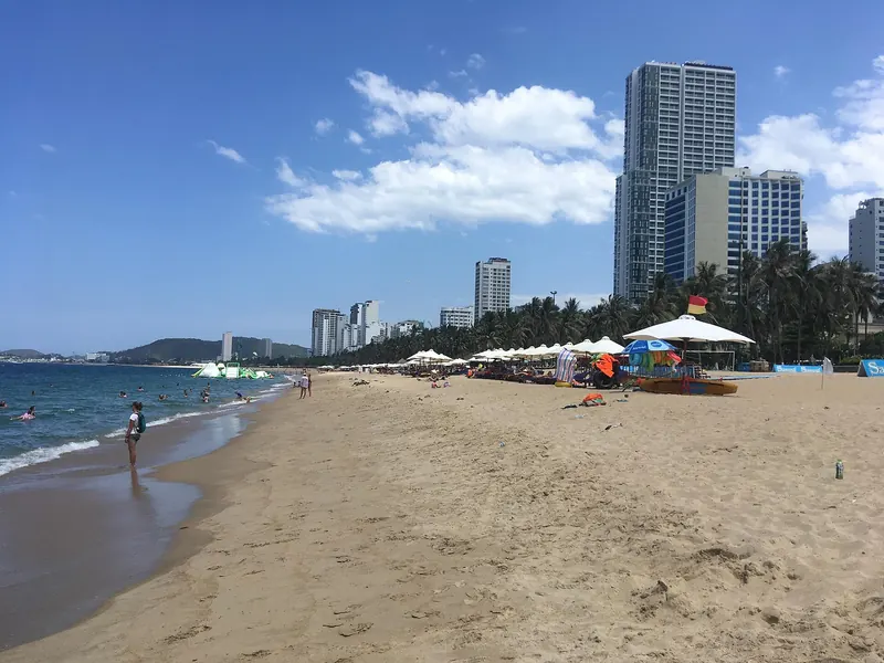
Tuy Hoa works as a stop rather than a resort. The national tourism site describes a well-planned town with a grid of wide streets along the river and Tuy Hoa Beach running up the eastern edge behind a promenade. What it lacks is a single headline sight in town; the reasons to come are spread along the coast to the north and south, so the town is a base and your days are built around two short drives.
Sleep on or near the beachfront, where you can walk the promenade at dawn and dusk and be on the coast road early, or in the town centre near the river if you prefer street food and local cafés over a sea view. The Dak Lak provincial government held its 2026 tourism conference at a resort in Tuy Hoa, and the province lists Ganh Da Dia, Xuan Dai Bay, O Loan Lagoon, Mui Dien, Vung Ro and Nghinh Phong Tower among its key coastal destinations, but the national tourism site still calls the province relatively off the beaten path. Do not expect the range of English menus and tour desks you find in Nha Trang.
Two nights is enough for both day trips. Add a third if you want a full beach day, or if a cloudy sunrise at Mui Dien means you want a second try.
Ganh Da Dia: the basalt columns
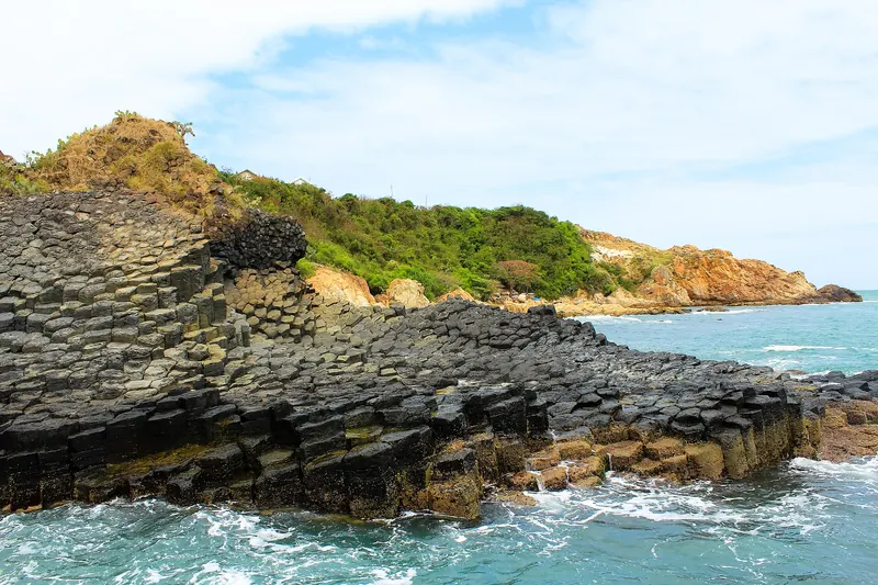
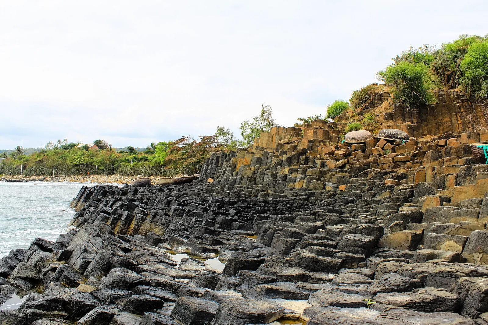
Ganh Da Dia is the reason this coast is on the map for geology lovers. According to the Department of Cultural Heritage, the columns formed when basalt from volcanic activity on the Van Hoa plateau inland cooled and cracked into regular five- and six-sided columns, later lifted and exposed by the sea. Its record describes about 11,500 exposed columns with an average diameter of 43 cm, stacked so that from the side they look like piles of plates, which is where the name, 'reef of stone plates', comes from. The Prime Minister ranked it a special national monument in December 2020.
The site sits in Phu Hanh village in the former An Ninh Dong commune of Tuy An, north of Tuy Hoa. The main area is two small promontories: on one the columns stand upright and step down into the water; on the other they bend and lie almost flat, like a bundle of giant chopsticks seen end-on. On the south-west edge is a small shrine to the whale god of the fishing community, built in the mid-19th century. South of the columns, the arc of Bai Bang beach runs towards the cliff of Mui Mom.
Practical points: the rocks are uneven, often wet and can be slippery near the waterline, so wear shoes with grip and keep well back when the swell is up. The national tourism site notes that a beach next to the columns offers food and drinks, and that a path leads north up the cliffs to a lighthouse looking back over the rocks. Morning light is gentler for photographs and the heat builds fast. When we checked on 2026-10-03, we could not find an official page listing current opening hours or an entrance fee, so check on arrival.
Make time for the local food
What to eat and where to look
Ocean tuna dishes
Phu Yen fishermen began fishing for ocean tuna in the early 1990s, and the town has built a small cuisine on it: chilled raw slices eaten with herbs and a soy, wasabi and chilli dip, and steamed tuna eye cooked in a clay pot with spices.
- Where to look
- Seafood restaurants in Tuy Hoa; ask for cá ngừ đại dương (ocean tuna).
- Fit it into your day
- Dinner on your first or last night in town.
Raw fish depends on careful freezing and handling; choose a busy place and skip it if you are pregnant or have a weak stomach.
Blood cockles from O Loan Lagoon
Sò huyết, the lagoon's best-known catch, are prized locally for their thick, sweet and fragrant flesh.
- Where to look
- Simple seafood places around O Loan Lagoon on the road north to Ganh Da Dia.
- Fit it into your day
- Lunch or a late snack on the northern day trip.
Shellfish is a common cause of upset stomachs; make sure they are cooked through.
Bánh canh with fish cake and chives
Thick rice or tapioca noodles in broth, often with fish cake or flaked fish and a handful of garlic chives, are a cheap everyday dish in Tuy Hoa, and every stall makes them slightly differently.
- Where to look
- Pavement stalls in central Tuy Hoa, especially around the post office area.
- Fit it into your day
- Breakfast before or after the sunrise trip.
Broths often contain fish sauce and shellfish.
Bánh xèo and chả dông
Crisp rice-flour pancakes with shrimp or squid and bean sprouts, and spring rolls made with minced sand lizard, are local favourites, eaten with herbs, rice paper and garlic-chilli fish sauce.
- Where to look
- Long-running shops on Nguyen Cong Tru Street in Tuy Hoa.
- Fit it into your day
- An easy dinner to share.
Chả dông is made from lizard meat; ask if you prefer to avoid it.
Mui Dien and Bai Mon at sunrise
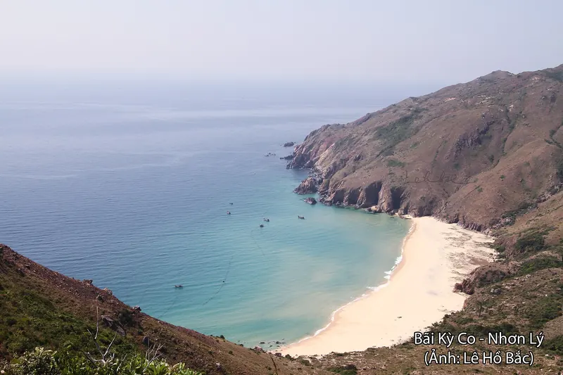
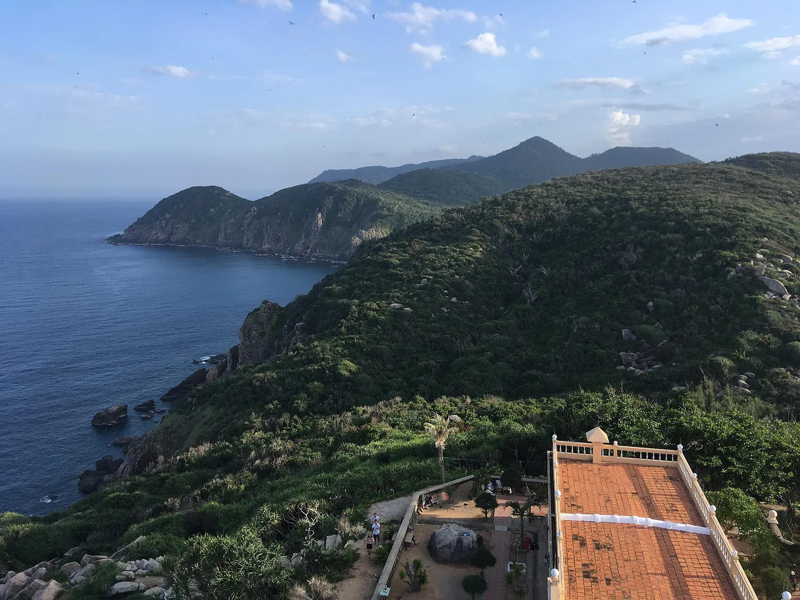
South of Tuy Hoa, Mui Dien (Dien Cape, also called Dai Lanh Cape) is the place for an early start. The national tourism site suggests coming at dawn and walking up a winding staircase to the lighthouse to watch the sun rise over the sea at what it calls Vietnam's second-to-easternmost point; the honour of the easternmost goes to Mui Doi, about 50 km further south.
A second staircase leads down to Bai Mon, a small beach between green and grey cliffs that the national tourism site describes as feeling like a secret. Its Phu Yen page names Bai Mon and Long Thuy as beaches for swimming and for a sunrise swim. Pack water and a torch for the walk up in the dark, and plan to be back in town for a late breakfast.
On the same southern side of the province, the Dak Lak provincial portal lists Vung Ro bay among the coast's main destinations. If you have a car for the morning, it is easy to combine with the cape.
Bai Xep, O Loan Lagoon and the coves north of town
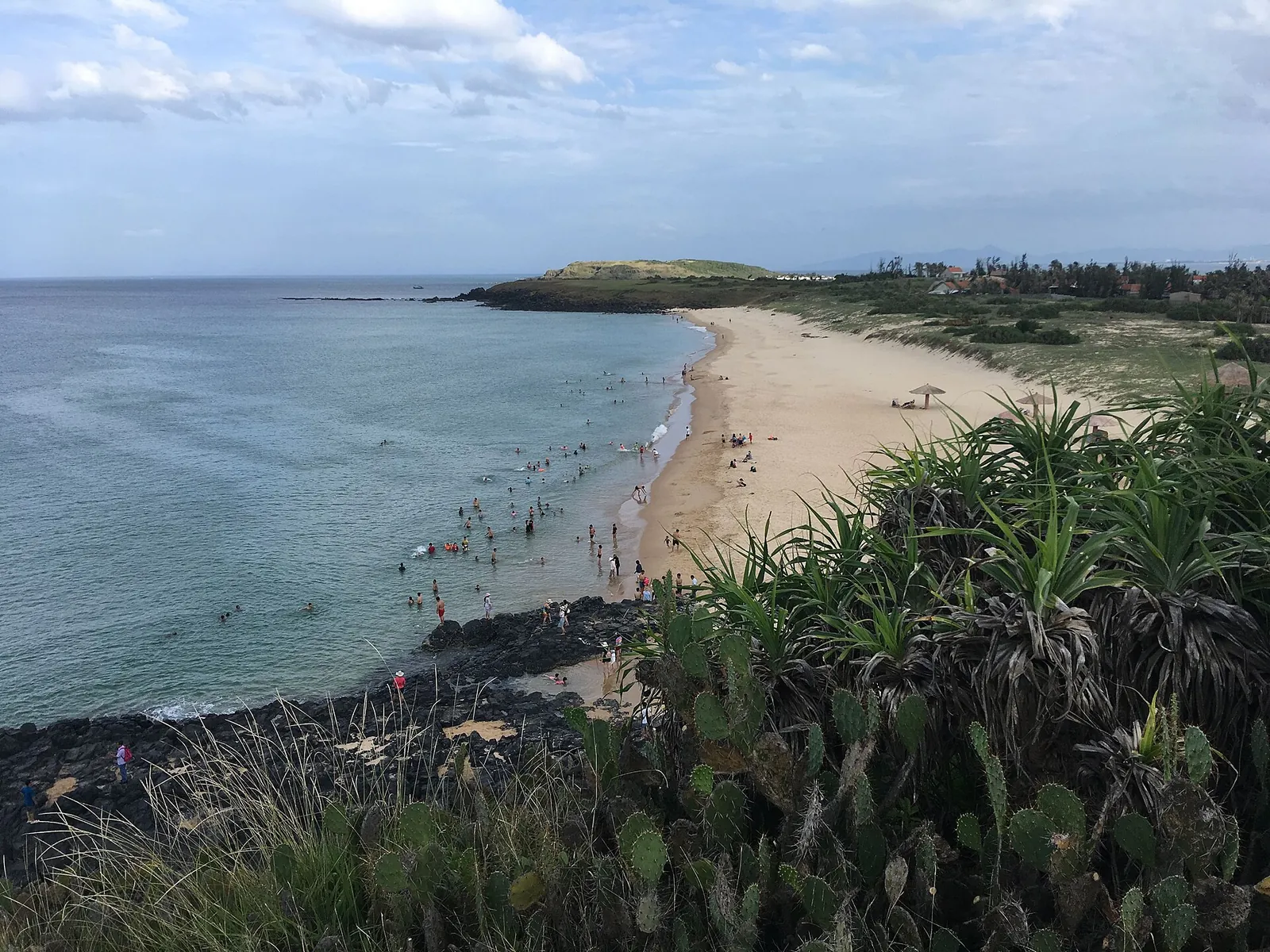
Bai Xep is the beach that made the province famous. The national tourism site explains that the 2015 film *Toi Thay Hoa Vang Tren Co Xanh* (known in English as *Dear Brother*) shot a scene here, and the grassy bluff above the sea, lined with yellow-flowering cactus, has been a photo stop ever since. A path leads down to the beach, where shacks rent loungers and sell drinks.
On the way to or from Ganh Da Dia, the road passes O Loan Lagoon, a brackish lagoon by National Road 1 known for its blood cockles. The national tourism site suggests kayaking on the lagoon and in Xuan Dai Bay further north, and mentions camping on Lao Mai Nha, a small, undeveloped islet about 4 km from the lagoon. Be aware that the provincial government broke ground on a large resort on Cu Lao Mai Nha in December 2025, with a first phase due by early 2028 and a cable car to the mainland in the plans, so expect construction and check what the islet is like before planning a night there.
If you want one long day instead of two short ones, a car can take you north to O Loan and Ganh Da Dia in the morning and back down to Bai Xep in the afternoon, but the coast is more enjoyable at an easy pace.
Nhan Tower and the town by the river
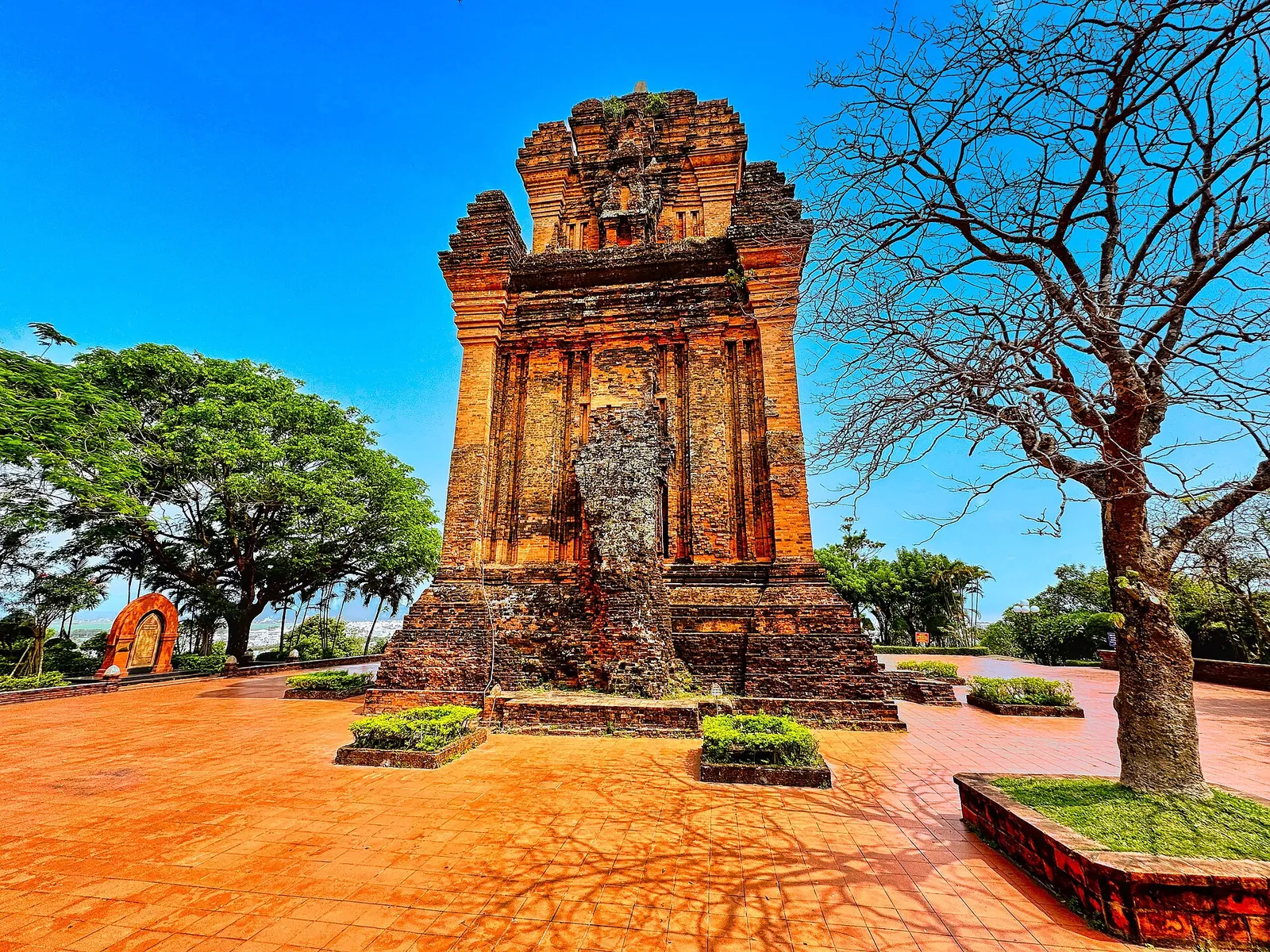
Nhan Tower (Thap Nhan) stands on Nhan Mountain, a hill above the Da Rang River in the middle of Tuy Hoa. The national tourism site dates it to the late 11th century and calls the tower, the hill and the river together the symbol of the province; from the top you look over the town, the river and its bridges to the sea. Come in the late afternoon, when the heat has eased and the light falls across the river.
Nghinh Phong Tower in Tuy Hoa ward is the other landmark. The provincial portal describes the area as a popular gathering place, and over the 30 April–1 May holidays it hosted a hot-air balloon show, with tethered rides giving a view of the town and its coastline.
If you have time, the national tourism site also recommends Mang Lang Church, near the Ky Lo River, a Gothic-style church with two steeples, coloured windows and a wooden ceiling, which keeps sculptures telling the story of St Andrew Phu Yen in its basement. Dress modestly and keep quiet during services.
Getting there and getting around
By air: Tuy Hoa Airport (TBB) is about 10 km from the city centre, according to the national tourism site, which says there are daily flights from major cities such as Hanoi and Ho Chi Minh City. Vietnam Airlines lists Tuy Hoa as a destination on its route pages.
By train or road: the North–South railway and National Road 1 both run along this coast, and the national tourism site recommends the train for the scenery. Tuy Hoa is the obvious overnight stop if you are going slowly between Quy Nhon and Nha Trang. When we checked on 2026-10-03, we did not verify a timetable, so check journey times on the operator's site before you book.
Around the coast: the sights are spread over a long stretch north and south of town with no tourist shuttle we could verify. A car with a driver or a taxi kept for the half day is the simplest option; a rented motorbike gives freedom on the coastal roads but only makes sense if you are licensed, insured and confident on hills and in wind.
A two- or three-night plan
This is an editorial suggestion, not a timetable. Check sunrise times, the sea and the weather for your dates.
- Day 1 — Arrival: check in, walk the beachfront promenade, then Nhan Tower for sunset and a tuna dinner in town.
- Day 2 — North: early drive to Ganh Da Dia before the heat, lunch near the beach next to the columns, O Loan Lagoon on the way back and Bai Xep in the late afternoon.
- Day 3 — South: sunrise at Mui Dien, down the steps to Bai Mon for a swim, back for breakfast, then onward to Nha Trang or Quy Nhon, or a lazy day on Tuy Hoa Beach if you are staying a third night.
Practical questions
Is Tuy Hoa worth a stop between Quy Nhon and Nha Trang?
Yes, if you like empty capes and geology more than nightlife. Two nights is enough to see Ganh Da Dia, Mui Dien, Bai Xep and Nhan Tower without rushing.
What is Ganh Da Dia?
A stretch of shore north of Tuy Hoa made of stacked five- and six-sided basalt columns formed by cooling lava. The Department of Cultural Heritage records about 11,500 exposed columns, and the site has been a special national monument since 2020.
When should I avoid the Phu Yen coast?
The national tourism site advises avoiding the storm season from September to December. Check forecasts before driving the coast road or visiting the capes.
How do I get to Tuy Hoa?
Fly to Tuy Hoa Airport (TBB), about 10 km from the centre, from Hanoi or Ho Chi Minh City, or come by train or road along the coast from Quy Nhon or Nha Trang.
Is Tuy Hoa in Phu Yen or Dak Lak?
Both names are in use. Phu Yen province was merged into Dak Lak province in 2025, and Tuy Hoa is now a ward of Dak Lak; travel material often still says Phu Yen.
Where should I stay?
In Tuy Hoa itself, on the beachfront or near the centre. The capes and coves are short drives away, so there is little reason to sleep elsewhere.
Sources and checks before you travel
Reference sources for the version dated 3 October 2026. Confirm opening times, access, transport and conditions for your travel dates.
- Vietnam Tourism: Phu Yen ↗ — opens in a new tab
- Vietnam Tourism: Phu Yen, undiscovered nature and remote culture ↗ — opens in a new tab
- Department of Cultural Heritage: Ganh Da Dia, Phu Yen ↗ — opens in a new tab
- Dak Lak provincial portal: connecting tours and developing tourist destinations ↗ — opens in a new tab
- Dak Lak provincial portal: hot-air balloons by Nghinh Phong Tower ↗ — opens in a new tab
- Dak Lak provincial portal: resort project on Cu Lao Mai Nha ↗ — opens in a new tab
- Vietnam Airlines: flights to Tuy Hoa ↗ — opens in a new tab
- Wikipedia (Vietnamese): Phu Yen province ↗ — opens in a new tab
- Wikipedia (Vietnamese): O Loan Lagoon ↗ — opens in a new tab
- Wikipedia: Tuy Hoa ↗ — opens in a new tab
Photo credits
The basalt columns of Ganh Da Dia on the Phu Yen coast north of Tuy Hoa
Photograph: Đông Hồ — opens in a new tab · CC BY-SA 2.0 — opens in a new tab
Changes: Resized and converted to WebP; displayed with responsive crops. · Original photograph and licence details ↗ — opens in a new tab
Nhan Tower (Thap Nhan), the Cham tower on Nhan Mountain in Tuy Hoa
Photograph: Ms Sarah Welch — opens in a new tab · CC0 — opens in a new tab
Changes: Resized and converted to WebP; displayed with responsive crops. · Original photograph and licence details ↗ — opens in a new tab
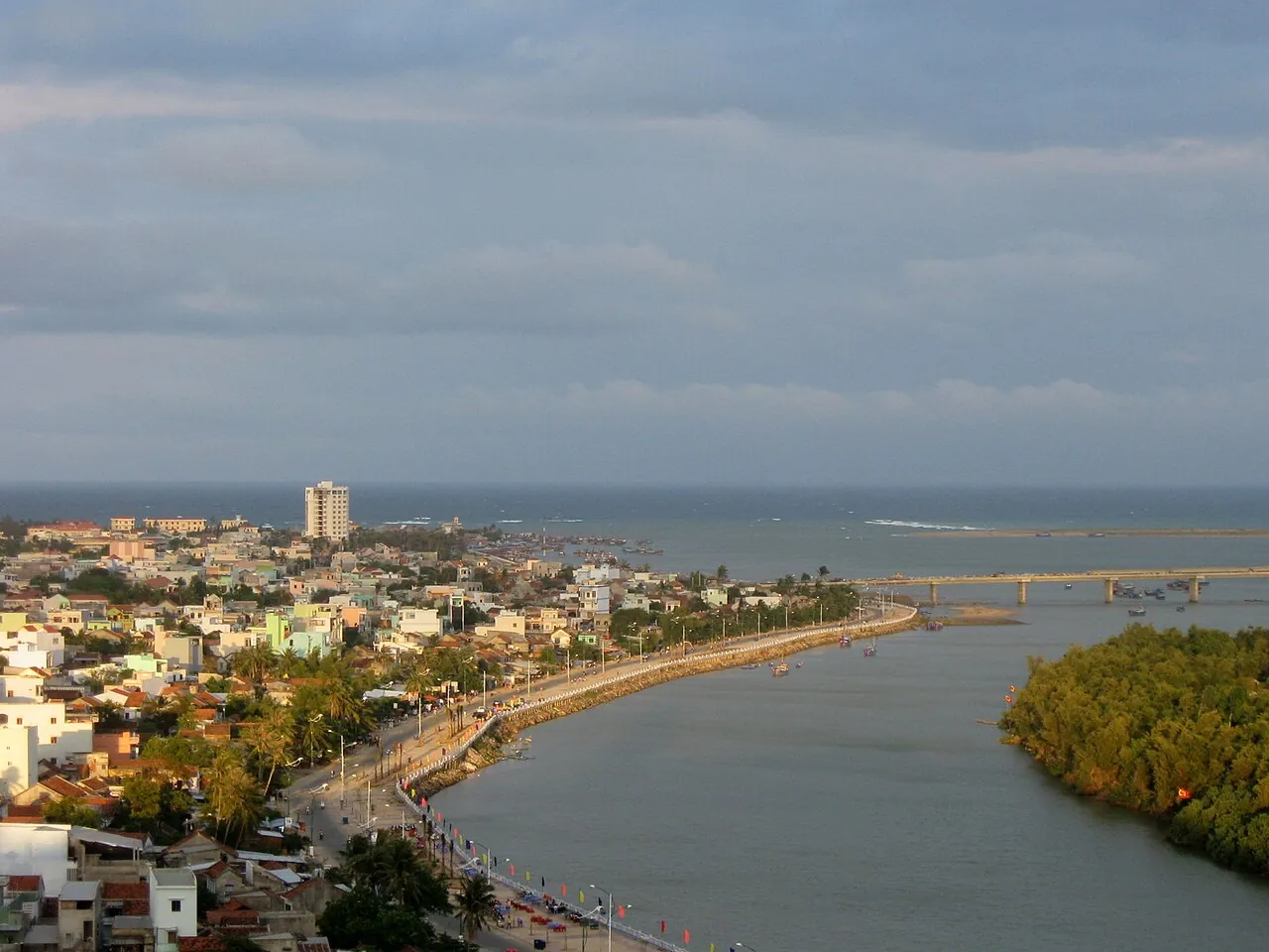
Tuy Hoa and the mouth of the Da Rang River seen from Nhan Mountain
Photograph: Huynh Phuc Hung — opens in a new tab · CC BY-SA 3.0 — opens in a new tab
Changes: Resized and converted to WebP; displayed with responsive crops. · Original photograph and licence details ↗ — opens in a new tab
Bai Xep, the cove north of Tuy Hoa made famous by the film Dear Brother
Photograph: Christophe95 — opens in a new tab · CC BY-SA 4.0 — opens in a new tab
Changes: Resized and converted to WebP; displayed with responsive crops. · Original photograph and licence details ↗ — opens in a new tab
The coast south of Mui Dien, seen from the lighthouse
Photograph: Christophe95 — opens in a new tab · CC BY-SA 4.0 — opens in a new tab
Changes: Resized and converted to WebP; displayed with responsive crops. · Original photograph and licence details ↗ — opens in a new tab
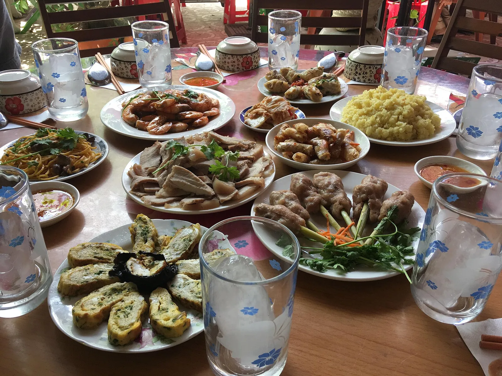
A shared Vietnamese meal in Tuy Hoa
Photograph: Christophe95 — opens in a new tab · CC BY-SA 4.0 — opens in a new tab
Changes: Resized and converted to WebP; displayed with responsive crops. · Original photograph and licence details ↗ — opens in a new tab