Plan your trip · Indonesia
Volcano hikes in Indonesia: Batur, Bromo, Ijen, Rinjani and Kelimutu
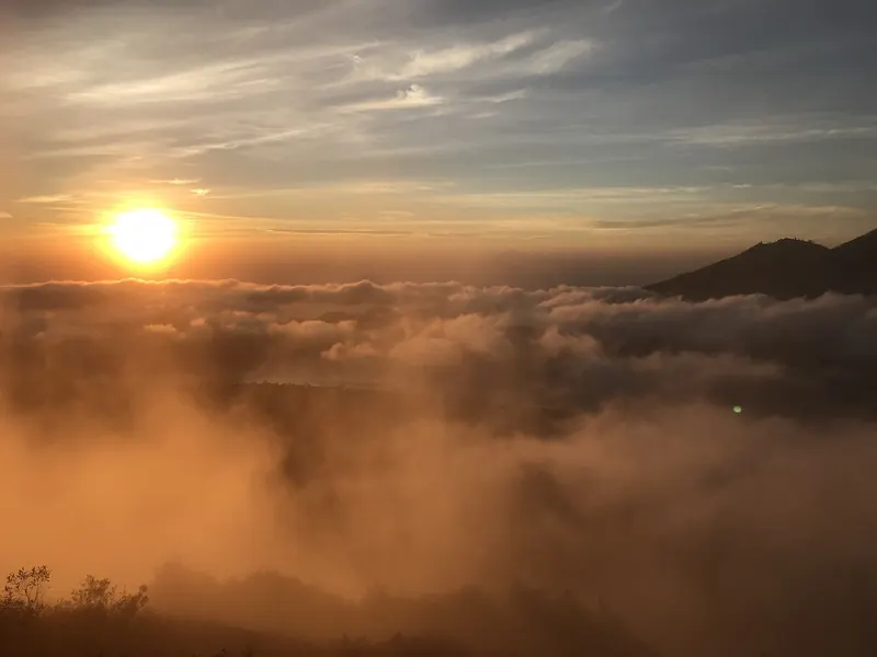
Indonesia's best-known volcano walks are very different trips that happen to share a pre-dawn alarm. Kelimutu on Flores is a 30-minute walk from a car park. Bromo is mostly a jeep ride and a staircase, Batur a steady two-hour climb on volcanic sand and Ijen a night walk into toxic gas. Rinjani on Lombok is a multi-day expedition with permits, porters and camping at altitude. All five are active volcanoes watched by the national volcanology agency, and parks can close them at short notice for eruptions, fires, earthquakes or the wet season, as several did in 2026. This guide compares them by effort, timing and rules, and shows you how to check the official alert level the day before you set off.
- Suggested time
- One night per volcano for Kelimutu, Bromo, Batur and Ijen; three to four days for a Rinjani trek
- Where to stay
- Toya Bungkah or Kedisan (Batur), Cemoro Lawang (Bromo), Banyuwangi (Ijen), Sembalun or Senaru (Rinjani), Moni (Kelimutu)
- Season and timing
- The dry months, roughly May to October. Official sources give May to October for Batur, July to October for Bromo and April to October for Ijen. Rinjani's trails close every year from 1 January to 31 March.
The short answer
Choose by effort first. If you have never hiked a mountain, go to Kelimutu, where a car park sits below the viewpoint, or to Bromo, where you can sleep on the caldera rim at Cemoro Lawang and reach the sunrise hills by jeep. For a real but short climb, do Batur from a night by Lake Batur, about one and a half to two hours up with a local guide. Do Ijen from Banyuwangi with a guide and a proper gas mask, starting in the middle of the night. Keep Rinjani for experienced hikers with three or four days: the park requires proof of previous hiking and a guide or experienced hiker in every group, and in October 2026 it had suspended new online bookings. Each of these needs one night at the trailhead, or three to four for Rinjani. The evening before any of them, check the volcano's level and the official advice on MAGMA Indonesia, and the park's own closure notices.
Five volcanoes, five very different days
The names often appear in one list, but the walking is not comparable. Here they are from easiest to hardest, with what the official sources say about each.
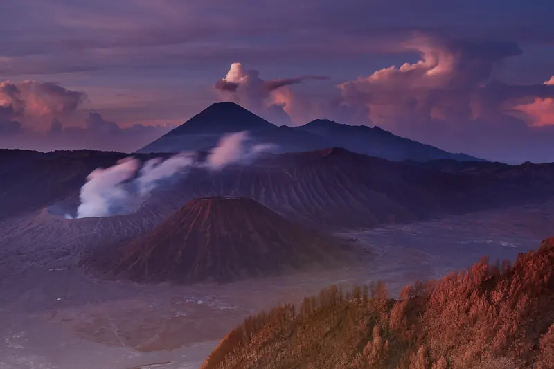
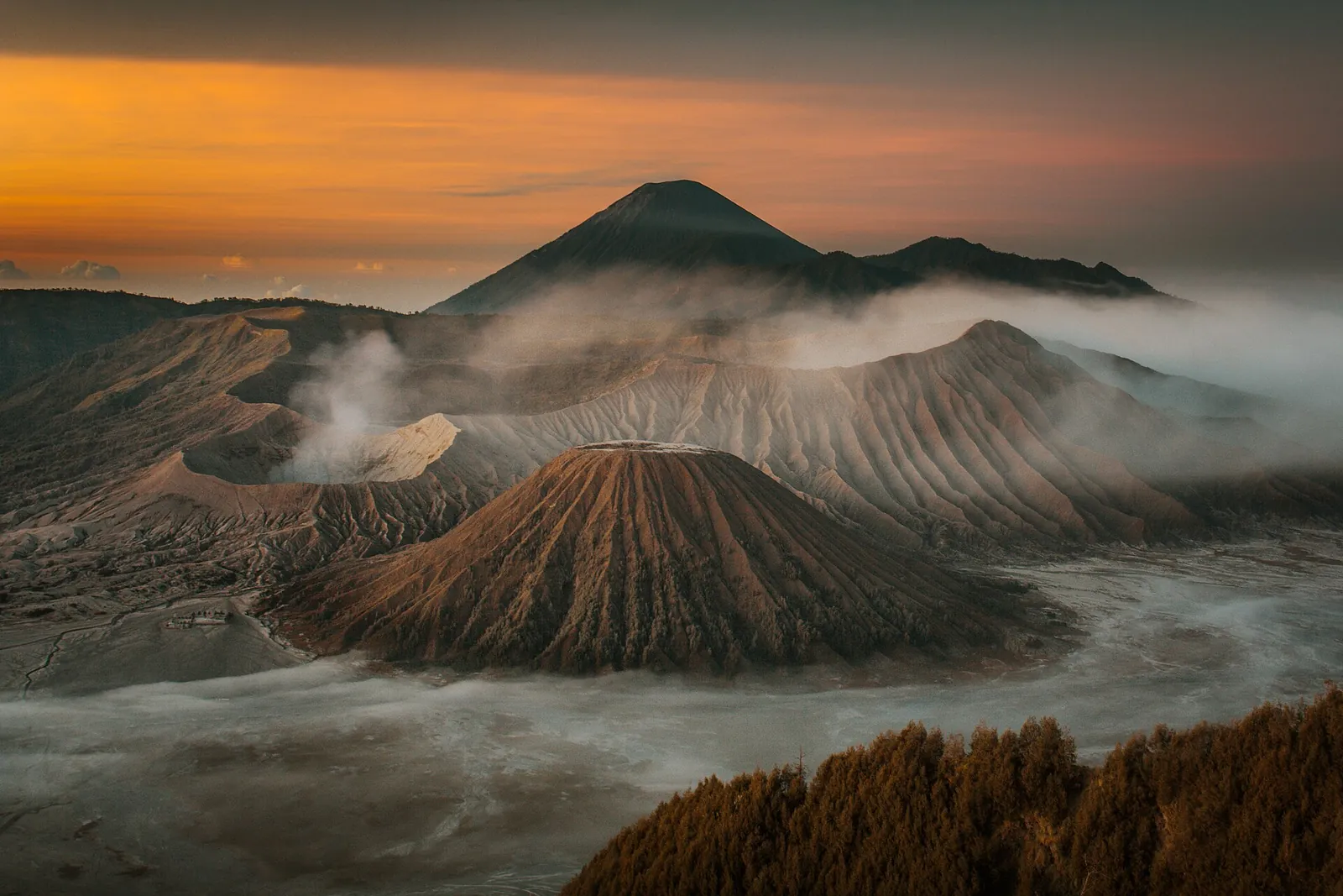
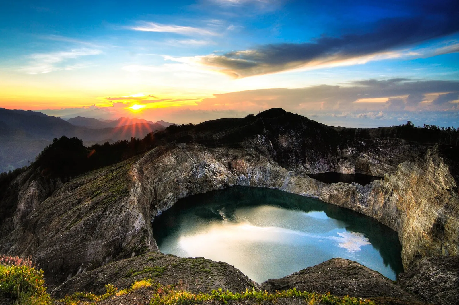
Kelimutu (Flores) is the gentlest. The Ministry of Tourism describes an 11 km drive from Moni to a car park, then a 30-minute walk to the viewpoints above the three crater lakes, whose colours change unpredictably. Bromo (East Java) is mainly a vehicle trip: you drive or take a jeep to a sunrise viewpoint such as Penanjakan, then cross the sea of sand, on foot or by pony, to the steps up to the crater rim. The effort is short, but the night is cold. At Bromo's Level II status in October 2026, the rim lay inside the 1 km zone around the active crater that the agency asked visitors to avoid, so check before you plan to climb the steps.
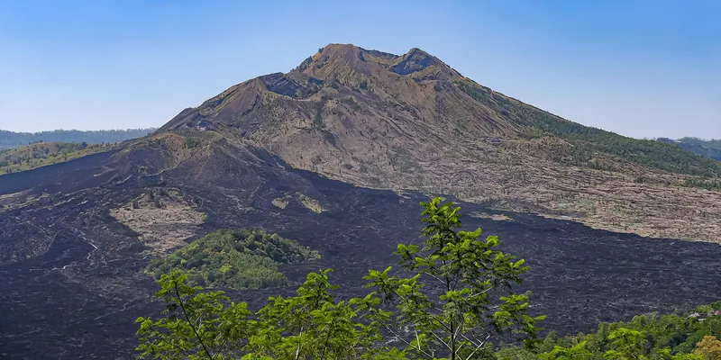
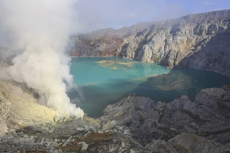
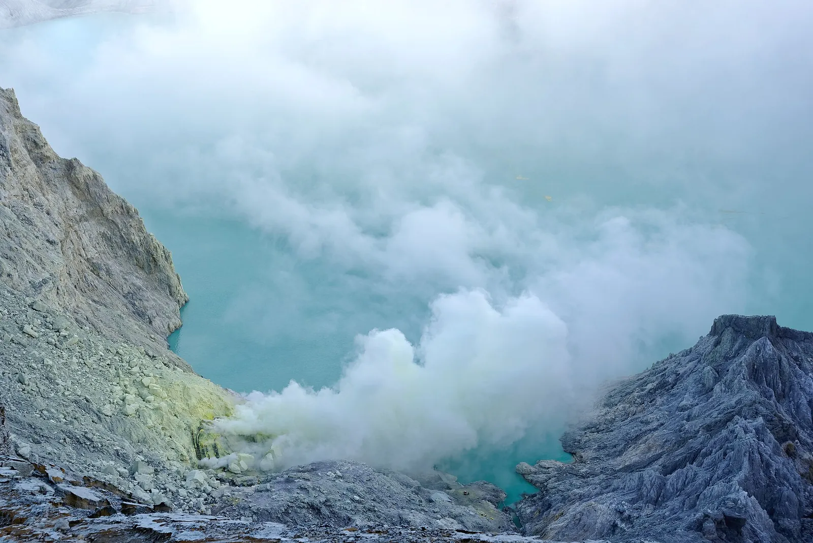
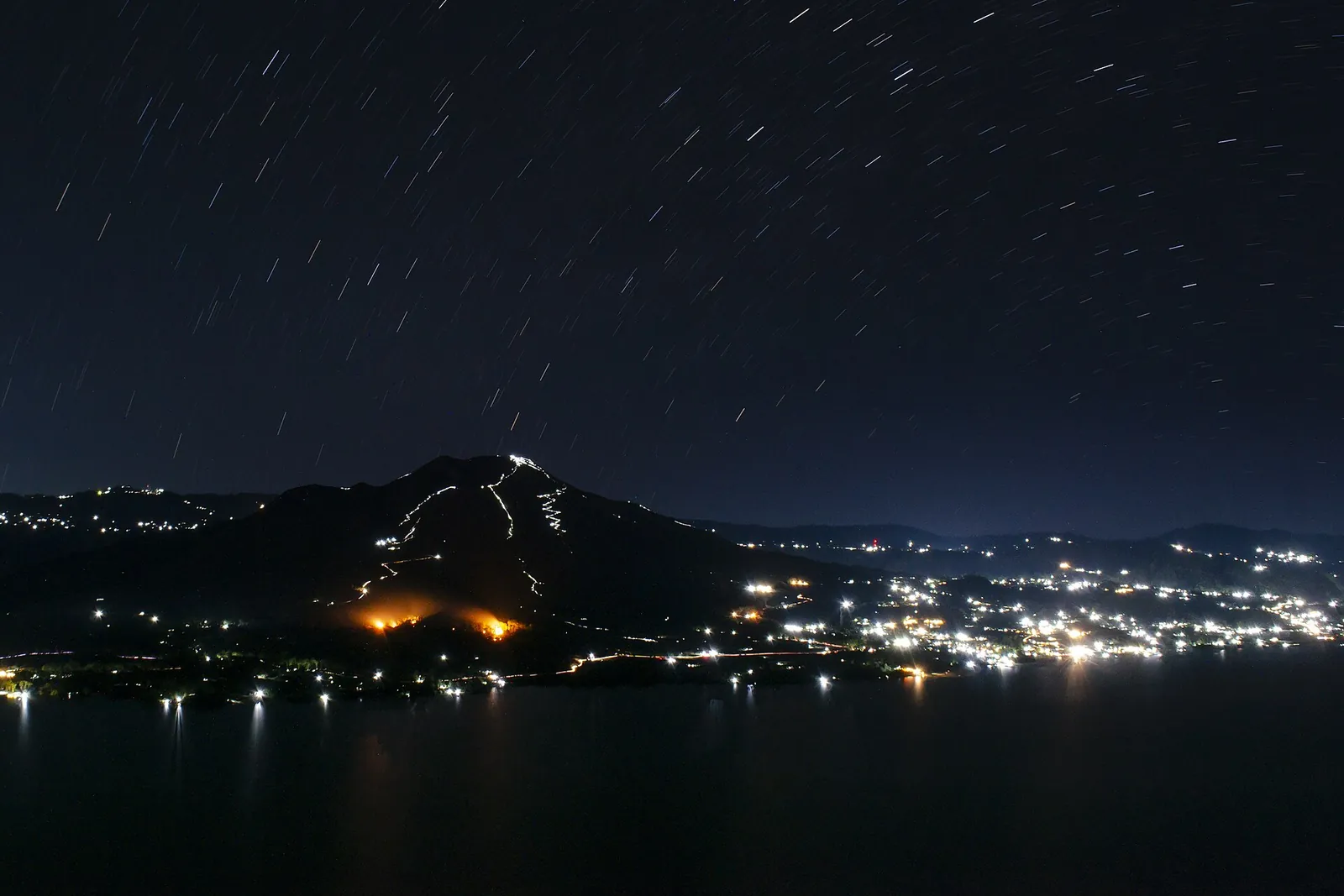
Batur (Bali) is the most popular real climb. The Batur UNESCO Global Geopark guide published by Bangli Regency describes a guided ascent from Toya Bungkah or Songan of about one and a half to two hours on loose volcanic sand, starting around 03:30 to reach the 1,717 m summit for sunrise. Ijen (East Java) is a night hike: the ministry describes a 3 to 4 km trek of two to three hours from the Paltuding post to the crater rim, timed for the blue fire between about 02:00 and 04:00. The challenge here is gas more than gradient.
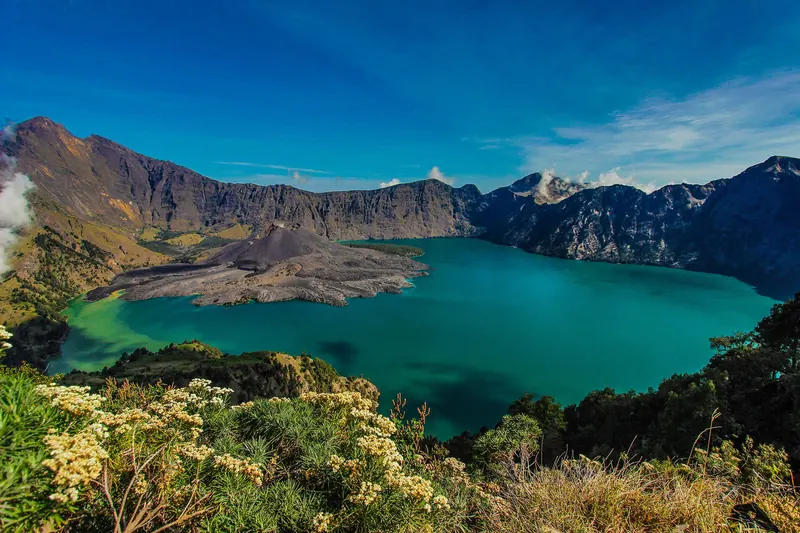
Rinjani (Lombok) is a different category. At 3,726 m it is the country's second-highest volcano, according to the ministry. The summit takes two days and one night from Sembalun, and three to four days if you continue down to the crater lake, Segara Anak, and out through Senaru. Do not treat it as an add-on to a beach week.
- Kelimutu: about 30 minutes' walk from the car park. Suits almost anyone who can manage a short uphill walk.
- Bromo: a jeep or a drive to the viewpoint, then a walk across the sand and a staircase. Suits most travellers.
- Batur: about 1.5 to 2 hours up on loose sand in the dark. Suits reasonably fit walkers, with a local guide.
- Ijen: a trek of 2 to 3 hours, about 4 km, at night, in sulphur gas. Suits fit walkers with a guide and a gas mask.
- Rinjani: 2 to 4 days with camping. Only for experienced hikers, under the park's rules.
How to read Indonesia's volcano alert levels
The Centre for Volcanology and Geological Hazard Mitigation (PVMBG) publishes the status of every monitored volcano on MAGMA Indonesia (magma.esdm.go.id), in Indonesian. Under a 2011 energy ministry regulation there are four levels: Level I (Normal), Level II (Waspada), Level III (Siaga) and Level IV (Awas). Its explanatory page says that even at Level I there can be toxic gas around the craters of some volcanoes. At Level II, the danger is around the crater and people are advised not to be active near it. At Level III and IV, the hazard can spread and communities prepare to evacuate or are evacuated.
The level alone is not enough. Each volcano has a daily report with a Rekomendasi (recommendation) section, which states the exact distance or area to avoid. When we checked on 2026-10-03, Batur, Ijen and Kelimutu were at Level I, and Bromo and Rinjani were at Level II. Even so, the daily reports told visitors not to linger or camp in Batur's active crater and to keep away from its gas vents. At Ijen, they said not to go down to or approach the crater floor and not to camp within 500 m of the crater. At Kelimutu, they said to stay behind the barriers and keep away from the lake shores. At Bromo, they said to stay out of a 1 km radius of the active crater and to be aware that sudden phreatic eruptions can happen without clear warning. At Rinjani, hiking was allowed except on the Barujari cone, the young cone inside the caldera, and within 1.5 km of its crater. Hikers were also told to carry masks and eye protection in case of ash.
To check, open the activity-level page, find your volcano under its level, and open "Lihat laporan" (see report). A translation app is enough to read the recommendation. Then check the park or reserve's own channels, because closures for fire, weather or repairs come from the park, not from the volcano status. The UK government's travel advice makes the same point: exclusion zones can change at short notice, valleys beyond them can be hit by mud and debris flows, and ash clouds can disrupt flights.
Make time for the local food
What to eat and where to look
Rawon
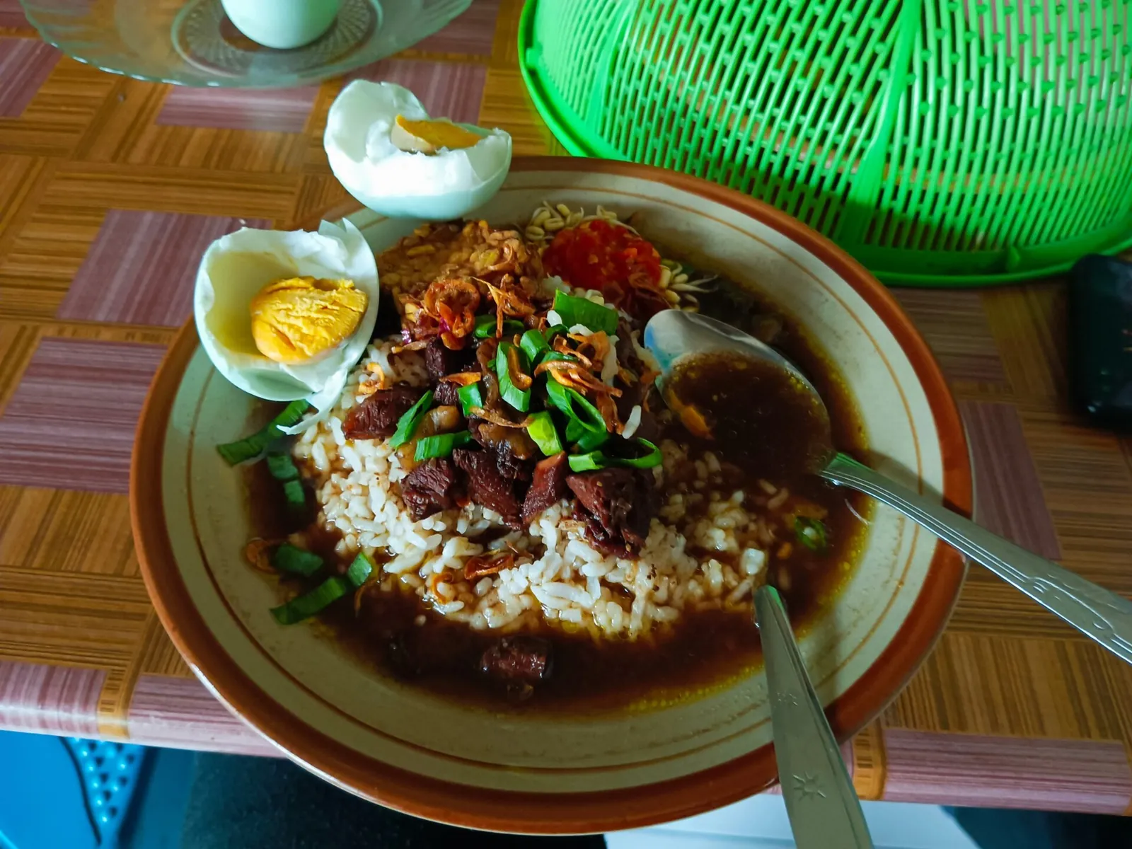
East Java's black beef soup, coloured and flavoured with kluwek (keluak) nuts. The Ministry of Tourism lists it as one of the province's most iconic dishes, popular in Surabaya, Malang and Pasuruan, all on the way to Bromo.
- Where to look
- Warungs and rawon specialists in Surabaya, Malang and Probolinggo, before or after the Bromo night.
- Fit it into your day
- A hot lunch on the drive back from Bromo, or the day before, when you arrive in Malang or Probolinggo.
Contains beef. It is usually served with rice, salted egg and sambal; ask for the chilli on the side.
Nasi tempong
A Banyuwangi plate of steamed rice with boiled vegetables and a raw, very hot sambal. The ministry names it among the town's own dishes.
- Where to look
- Local warungs in Banyuwangi town, the usual base for Ijen.
- Fit it into your day
- Dinner the evening before the Ijen night, early enough to sleep for a few hours before the pick-up.
Very spicy by design. Go easy on it before a night hike, and check what fried sides come with it.
Mujair nyat-nyat
Tilapia from Lake Batur cooked in Balinese basa gede spice paste, which the ministry recommends in the Kintamani area.
- Where to look
- Lakeside restaurants around Lake Batur and Kintamani, near the trailheads.
- Fit it into your day
- Lunch after the sunrise climb and a soak in the hot springs, before the drive back to Ubud or the south.
Fish with bones, and the spice paste is hot. Ask whether chilli can be reduced.
Plecing kangkung
Lombok's water-spinach salad with a sharp tomato and chilli sambal. The ministry describes it as a fresh side for grilled fish, chicken or satay.
- Where to look
- Warungs in Mataram, Senaru and Sembalun, and at most Sasak eateries on Lombok.
- Fit it into your day
- A light dinner the night before a Rinjani trek, or a welcome fresh plate when you come down.
The sambal often contains shrimp paste (terasi). Ask if you avoid shellfish.
Season, closures and what changed in 2026
All five are best in the dry season, but the official windows differ slightly. The Batur geopark guide recommends May to October, and the Ministry of Tourism singles out July and August for stable sunrise-hiking weather. The ministry gives July to October for clear, fog-free skies at Bromo and April to October for Ijen. Rinjani's trails are closed every year at the start of the wet season. For 2026, the national park listed a closure from 1 January to 31 March, with the last eRinjani bookings on 28 December 2025.
The dry season has its own risk, which is fire. In September 2026, the Bromo Tengger Semeru National Park closed the Bromo area because of wildfires and reopened it on 19 September, according to ANTARA; visitors with tickets for 12 to 18 September had to reschedule or claim refunds. Ijen Crater Nature Park was closed from 4 September for firefighting and reopened on 28 September, ANTARA reported. On Rinjani, the park opened on a limited basis from 1 September for fire prevention, suspended new eRinjani bookings, and searched bags for anything that could start a fire. After a fire at Bukit Setampol, its 29 September update said that the Torean and Senaru trails were still temporarily closed.
Earthquakes can close sites too. After the Flores earthquake in August 2026, the Geological Agency found a crack about 100 m long near the rim of one Kelimutu crater and asked visitors to keep 6 to 10 m back from the edge in that area. ANTARA reported that the lakes reopened on 25 August. In practice, keep one spare day in any plan that hangs on a single sunrise, and do not book a non-refundable trek for dates that fall at the edge of a closure.
Tickets, guides and the rules each park sets
Bromo: the national park has required online tickets since 1 December 2019, with a daily quota of 2,752 visitors and no tickets sold at the gate. When we checked on 2026-10-03, the park's booking guide sent visitors to bookingbromo.bromotenggersemeru.org and gave two hours to pay the virtual-account invoice. You then show the barcode at the entrance. Its fee notice says visitors without a ticket are fined five times the normal fare.
Ijen: ANTARA reported that, for the September 2026 reopening, tickets were sold online through the Forestry Ministry's ayoketamannasional.kehutanan.go.id site. Hikers must bring a torch, warm clothing and masks. The ministry's destination page puts the daily climbing start at 01:00, or 03:00 during restriction periods, and its blue-fire guide strongly recommends a guide because of toxic gas.
Rinjani: the park's mandatory rules require at least two people per group, a guide or an experienced hiker, proof of previous mountain hiking (photos, certificates or an interview), a parent's letter for under-17s and reusable food and drink containers. Bookings go through the eRinjani app, either directly or through a trekking organiser. Batur: the geopark guide tells visitors to use local guides, for safety and to support the community. Kelimutu: you walk only on the paths and to the viewpoints. Parts of the crater are dangerous and restricted, as the ministry and the daily volcano report both note.
Combining volcanoes on one trip
Bromo and Ijen are both in East Java, so they pair naturally. One way to do it is a night at Cemoro Lawang for Bromo, then a long road day east to Banyuwangi, which the ministry describes as the base for Ijen's blue fire. Banyuwangi also links to Bali: there are daily flights, and a ferry runs from Gilimanuk in west Bali to Ketapang. That makes an overland Bali–Ijen–Bromo–Surabaya route possible. Do not plan Ijen the night after Bromo. Two pre-dawn starts in a row, with a full driving day between them, is how people end up too tired for the gas and the rocks.
Batur fits into any Bali stay. Rinjani needs its own block of days on Lombok, plus a buffer day on each side for transfers from the airport or harbour. Kelimutu belongs on an overland Flores trip between Ende and Maumere. The ministry notes daily flights from Denpasar and Kupang to Maumere. If you only have a week, choose one volcano from Java or Bali and do it well, rather than three sunrises in five days.
What to bring and how to stay safe on the night
Every one of these walks starts in the dark and in the cold. The ministry warns that Ijen's crater can drop to about 2 degrees and is usually around 10. The Batur geopark guide lists anti-slip trekking shoes, a windproof jacket, a head torch and a refillable water bottle as essential. At Bromo, plan for the cold while you wait at the viewpoint before dawn.
For gas, a cloth mask is not enough at Ijen. Bring a proper gas mask or confirm that your guide supplies one, follow your guide, and turn back if the wind pushes the plume onto the path. Respect the barriers at Kelimutu and Bromo's rim, and the crater-floor ban at Ijen. Volcanic sand is loose on the way down at Batur and Rinjani, so poles help. The Ministry of Tourism also advises leaving silver jewellery behind at Ijen, because the sulphur tarnishes it.
Finally, check your insurance. The UK government's advice is that insurance should cover your itinerary, planned activities and emergency expenses. A multi-day trek at altitude, or a crater hike, may not be covered by a basic policy. Our safety guide covers emergency numbers and evacuation cover in more detail.
Practical questions
Which Indonesian volcano hike is easiest?
Kelimutu on Flores. The Ministry of Tourism describes a car park about 11 km from Moni and a 30-minute walk to the viewpoints. Bromo is also manageable for most people, because a jeep or car takes you to the sunrise viewpoints. Batur and Ijen are real night climbs, and Rinjani is a multi-day trek for experienced hikers.
How do I check if a volcano in Indonesia is safe to visit?
Open the activity-level page on MAGMA Indonesia (magma.esdm.go.id), which the volcanology agency PVMBG runs, and find your volcano. Open its daily report and read the Rekomendasi section, which gives the area or radius to avoid. Then check the national park or reserve's notices, because closures for fire or weather are announced there.
Is it safe to hike a volcano at Level II (Waspada)?
It can be, if the hike stays outside the area the agency names. When we checked on 2026-10-03, Bromo and Rinjani were both at Level II. Visitors were told to stay out of 1 km around Bromo's active crater, and hiking on Rinjani was allowed except on the Barujari cone and within 1.5 km of its crater. Follow the current recommendation, not an old blog post.
Do I need a guide for these hikes?
On Rinjani, the park requires a guide or an experienced hiker in every group of at least two, plus proof of hiking experience. The Batur geopark guide tells visitors to use local guides, and the Ministry of Tourism strongly recommends a guide at Ijen because of toxic gas. Kelimutu and Bromo's viewpoints can be visited without one.
Can I buy a Bromo ticket at the gate?
No. The national park has required online booking since December 2019, with a daily quota of 2,752 visitors. Book in advance through the park's official booking site and bring the barcode. Entering without a ticket is fined at five times the normal fare.
When is Mount Rinjani closed?
Every year during the wet season. For 2026, the park listed a closure from 1 January to 31 March. In September 2026 it also limited access for fire prevention, suspended new eRinjani bookings and closed the Torean and Senaru trails after a forest fire. Check the park's website before you book.
Sources and checks before you travel
Reference sources for the version dated 3 October 2026. Confirm opening times, access, transport and conditions for your travel dates.
- MAGMA Indonesia (PVMBG): volcano activity levels ↗ — opens in a new tab
- MAGMA Indonesia (PVMBG): what the volcano activity levels mean ↗ — opens in a new tab
- MAGMA Indonesia: Bromo activity report, 3 October 2026 ↗ — opens in a new tab
- MAGMA Indonesia: Rinjani activity report, 2 October 2026 ↗ — opens in a new tab
- MAGMA Indonesia: Ijen activity report, 2 October 2026 ↗ — opens in a new tab
- MAGMA Indonesia: Batur activity report, 2 October 2026 ↗ — opens in a new tab
- MAGMA Indonesia: Kelimutu activity report, 2 October 2026 ↗ — opens in a new tab
- Bangli Regency (JDIH): Batur UNESCO Global Geopark comprehensive guide ↗ — opens in a new tab
- Indonesia Travel (Ministry of Tourism): one day in Kintamani ↗ — opens in a new tab
- Bromo Tengger Semeru National Park: online booking required to enter the Bromo area ↗ — opens in a new tab
- Bromo Tengger Semeru National Park: fee notice under PP 36/2024 ↗ — opens in a new tab
- Indonesia Travel: Mount Bromo (Gunung Bromo) ↗ — opens in a new tab
- Indonesia Travel: Bromo Tengger Semeru National Park – Mount Bromo ↗ — opens in a new tab
- ANTARA: TNBTS reopens Bromo after the fires (18 September 2026) ↗ — opens in a new tab
- Indonesia Travel: Ijen Crater ↗ — opens in a new tab
- Indonesia Travel: The Magic of Kawah Ijen ↗ — opens in a new tab
- ANTARA: East Java's Ijen Crater to reopen to tourists following wildfires (26 September 2026) ↗ — opens in a new tab
- Indonesia Travel: Banyuwangi ↗ — opens in a new tab
- Gunung Rinjani National Park: mandatory rules for hikers ↗ — opens in a new tab
- Gunung Rinjani National Park: Rinjani opened on a limited basis ↗ — opens in a new tab
- Gunung Rinjani National Park: handling the forest fire at Bukit Setampol (update to 29 September 2026) ↗ — opens in a new tab
- Gunung Rinjani National Park: closure of hiking destinations, 1 January – 31 March 2026 ↗ — opens in a new tab
- Indonesia Travel: Gunung Rinjani ↗ — opens in a new tab
- Indonesia Travel: Lake Kelimutu ↗ — opens in a new tab
- ANTARA: Geological Agency finds a crack at Kelimutu crater after the earthquake ↗ — opens in a new tab
- ANTARA Kupang: ASITA NTT on Flores tourism after the earthquake (31 August 2026) ↗ — opens in a new tab
- UK FCDO travel advice: Indonesia safety and security ↗ — opens in a new tab
- Indonesia Travel: Rawon ↗ — opens in a new tab
- Indonesia Travel: Plecing kangkung ↗ — opens in a new tab
- Indonesia Travel: Ngurah Rai Airport ↗ — opens in a new tab
- UK FCDO travel advice: Indonesia warnings and insurance ↗ — opens in a new tab
Does this experience fit your route?
Planning a volcano sunrise? Compare guided Batur, Bromo and Ijen trips, and check each operator's closure and refund policy against the park notices before you book.
Check dates and details on Viator ↗ — opens in a new tabAffiliate link · Book with ViatorPhoto credits
Bromo at sunrise: the sea of sand under mist, with Semeru on the horizon
Photograph: Andhika bayu nugraha — opens in a new tab · CC BY-SA 4.0 — opens in a new tab
Changes: Resized and converted to WebP; displayed with responsive crops. · Original photograph and licence details ↗ — opens in a new tab
The acid crater lake at Ijen, seen from the rim
Photograph: Jakub Hałun — opens in a new tab · CC BY-SA 4.0 — opens in a new tab
Changes: Resized and converted to WebP; displayed with responsive crops. · Original photograph and licence details ↗ — opens in a new tab
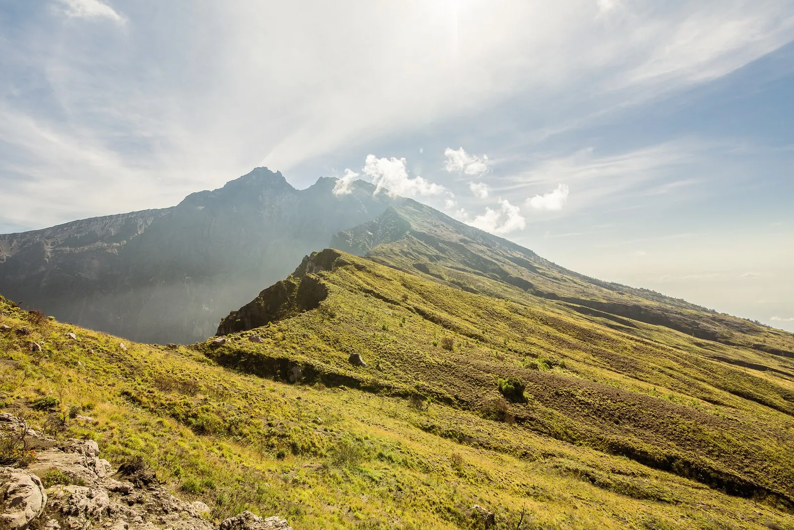
On the crater rim of Mount Rinjani, Lombok
Photograph: Alex Ausweiler — opens in a new tab · CC BY 3.0 — opens in a new tab
Changes: Resized and converted to WebP; displayed with responsive crops. · Original photograph and licence details ↗ — opens in a new tab
Kelimutu at sunrise, seen from the viewpoint above the lakes
Photograph: Bagus Pinandoyo Basuki — opens in a new tab · CC BY-SA 4.0 — opens in a new tab
Changes: Resized and converted to WebP; displayed with responsive crops. · Original photograph and licence details ↗ — opens in a new tab
Night on Mount Batur: hikers' torches on the way up for sunrise
Photograph: Imadedana — opens in a new tab · CC BY-SA 4.0 — opens in a new tab
Changes: Resized and converted to WebP; displayed with responsive crops. · Original photograph and licence details ↗ — opens in a new tab
Nasi rawon, East Java's black beef soup served over rice
Photograph: Fiskal Purbawan — opens in a new tab · CC BY-SA 4.0 — opens in a new tab
Changes: Resized and converted to WebP; displayed with responsive crops. · Original photograph and licence details ↗ — opens in a new tab