Bali · Bali
Mount Batur sunrise hike and Kintamani: how to plan it from Ubud
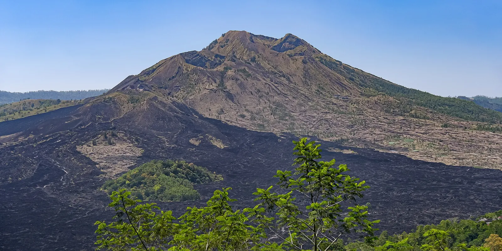
Mount Batur is the active volcano in the middle of a double caldera in Bali's Kintamani highlands, with crescent-shaped Lake Batur at its foot. Most visitors come for one thing: a hike in the dark to watch the sun rise over the lake, with Mount Agung on the horizon. The caldera around it — lava fields, lakeside hot springs, the Bali Aga village of Trunyan, the great temples of Ulun Danu Batur and coffee grown on the rim — is reason enough to slow down and stay, rather than rushing back to the coast by mid-morning.
- Suggested time
- 1 night by the lake (or a long pre-dawn day trip from Ubud)
- Where to stay
- Toya Bungkah or Kedisan on Lake Batur for the hike; Ubud if you only come for the day
- Season and timing
- The dry season, roughly May to September or October, gives the clearest sunrises; the Ministry of Tourism singles out July and August as the most stable months for hiking. It is cold before dawn all year, and mist is common in the wet season.
The short answer
If you are reasonably fit, do the sunrise hike with a local guide: it starts in the dark, takes roughly one and a half to two hours up on loose volcanic sand, and is back down by mid-morning. The easiest way is a guided tour with pick-up from Ubud, which means leaving in the middle of the night; the better way is to sleep one night by the lake at Toya Bungkah or Kedisan, near the trailheads, and give the rest of the day to the hot springs, Lake Batur and Kintamani's viewpoints. If you would rather not hike, watch sunrise from Pinggan or by jeep, and see the caldera from Penelokan instead.
Should you do the sunrise hike?
Mount Batur rises to 1,717 metres from the floor of the caldera, and the standard sunrise trek is short by volcano standards. The Bangli regency's official guide to the Batur UNESCO Global Geopark sets out a typical morning: pick-up and the drive to the trailhead at Toya Bungkah or Songan between about 2:30 and 3:30, a climb of roughly one and a half to two hours on volcanic sand with an official local guide, sunrise over Lake Batur and Mount Agung at the top, and a descent past old lava flows by about 9:00.
It is a real climb, not a walk: the trail is steep, dark and loose underfoot, and the summit is cold before the sun comes up. The regency asks visitors to wear trekking shoes with non-slip soles and to bring a windproof jacket, a head torch and a refillable water bottle; the Ministry of Tourism adds a thick jacket for the wait at the top. If you have knee problems, little hiking experience or young children, the viewpoints described below give you the same caldera without the climb.
Batur is an active volcano. When we checked on 3 October 2026, Indonesia's volcanology agency (PVMBG, on its MAGMA Indonesia site) listed Batur at Level I (Normal). Levels can change at short notice, so check that page again the day before your hike.
How to arrange it: guides, tours and timing
Go with a local guide. The Bangli regency's geopark guide tells visitors to use local guide services for safety and to support the villages, and to follow the guide's instructions at every site. The mountain lies in a nature recreation park (Taman Wisata Alam) managed by Bali's conservation agency, BKSDA, and in November 2024 the regency met with the caldera villages, local agencies and the Batur development forum (FP2GB) to tighten the rules for hiking on Batur after three recent accidents, and asked BKSDA to clarify permits and safe routes. Arrangements can change, so ask your guide or tour which permits and fees are included.
From Ubud, the simplest option is a guided trek with hotel pick-up. That means a very early start, a long, winding drive up and back, and an afternoon spent tired. Sleeping by the lake at Toya Bungkah or Kedisan removes most of the night drive. It also lets you finish at the hot springs and spend the rest of the day in the caldera instead of in a car. The Ministry of Tourism notes that the road up to Kintamani is steep with sharp bends: if you ride a scooter, check the brakes first.
Weekends are crowded throughout Kintamani, according to the Ministry of Tourism, so hike on a weekday if you can. Carry cash: the ministry notes that many local stalls and fee posts accept only cash, even though the large cafés take digital payments.
Make time for the local food
What to eat and where to look
Mujair nyat-nyat
Tilapia raised in Lake Batur, cooked with the Balinese spice paste basa gede for a savoury, spicy dish. The regency and the Ministry of Tourism both name it as the meal to eat here.
- Where to look
- Restaurants and warungs at Penelokan and around the lake shore.
- Fit it into your day
- Lunch after the hike and the hot springs.
Usually spicy; it is a whole fish with bones.
Kintamani arabica coffee
Arabica grown above 1,000 metres on the caldera slopes, often under shade trees and among citrus. It has a citrus-like acidity, and it was the first coffee in Indonesia to receive a geographical indication.
- Where to look
- Cafés on the caldera rim and the coffee farms along the road up to Kintamani.
- Fit it into your day
- A cup with the view in the afternoon, once you are back from the summit.
Some farms offer kopi luwak; ask how the civets are kept before buying.
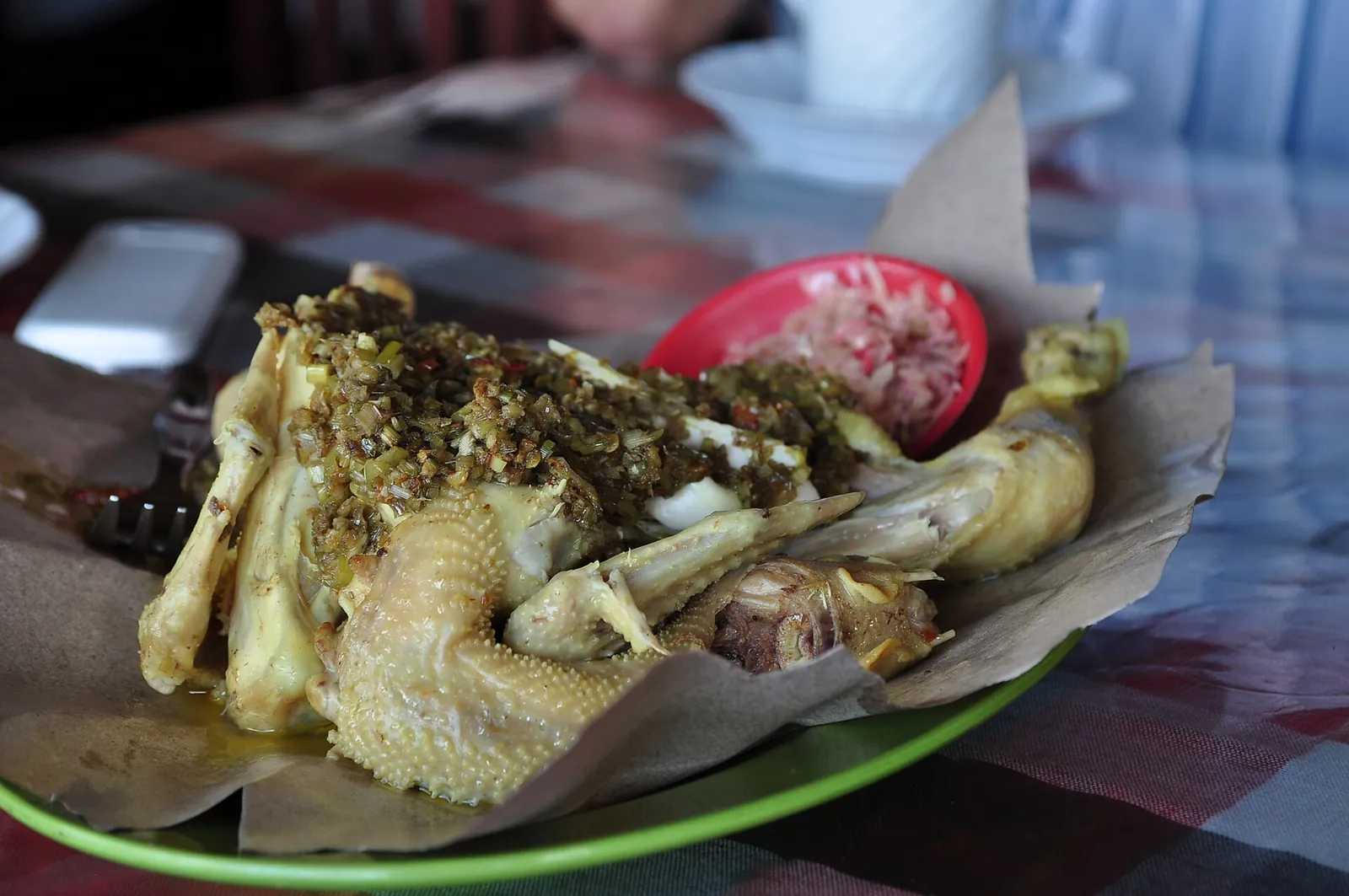
Ayam betutu
Chicken stuffed and coated with a betutu spice paste of shallots, garlic, turmeric, galangal, kencur and chilli, wrapped in banana leaves and slow-cooked until very tender. The Ministry of Tourism recommends it for warming up in Kintamani's cool weather.
- Where to look
- Warungs serving Balinese food in Kintamani and on the way back to Ubud.
- Fit it into your day
- A substantial lunch or an early dinner after the long day.
The spice paste contains shrimp paste (terasi) and can be very hot.
Kintamani oranges
Thin-skinned, juicy citrus grown in the volcanic soil of the caldera, sweet with a fresh sharpness, according to the regency's guide.
- Where to look
- Roadside stalls and markets around Kintamani.
- Fit it into your day
- A snack for the drive down.
Wash or peel fruit bought at the roadside.
Lake Batur, the hot springs and Trunyan
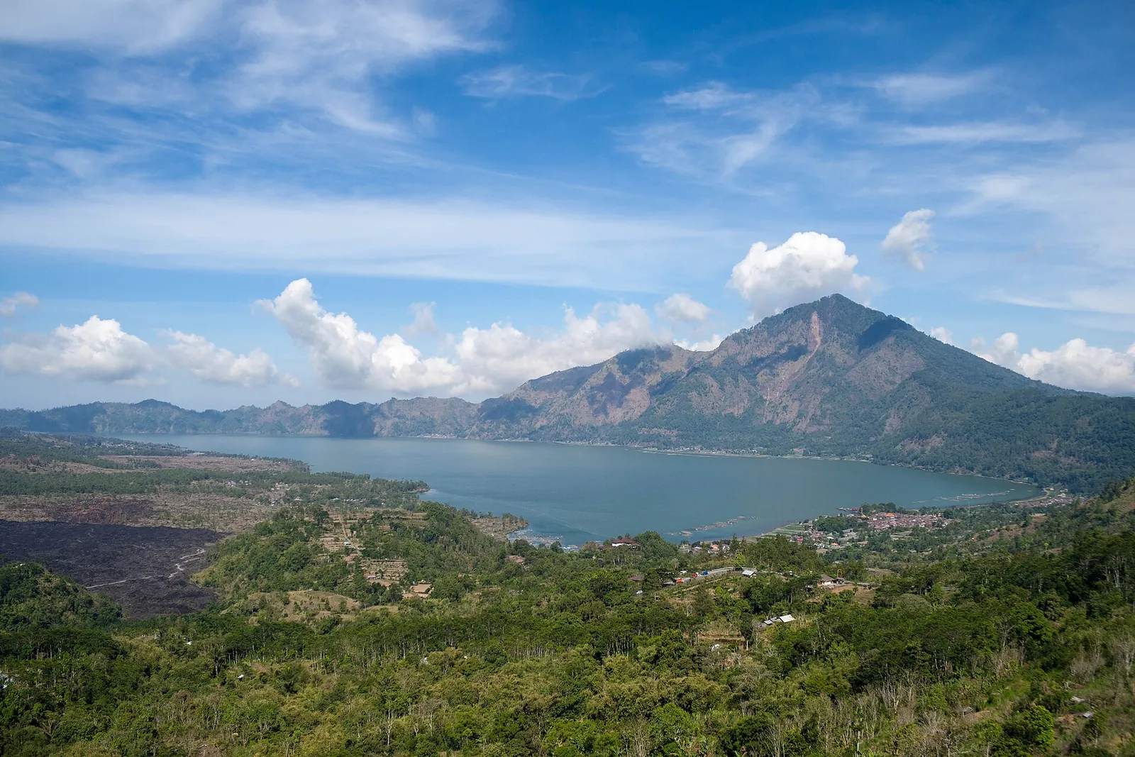
Lake Batur fills the south-east of the caldera at about 1,050 metres above sea level. The geopark's official site gives its surface area as 16.05 square kilometres and its shoreline as about 21.4 kilometres, with Mount Abang (2,172 metres) rising steeply on the far side. The Ministry of Tourism describes it as Bali's largest lake; small boats can be hired to go out on the water.
After the hike, the lakeside hot springs are the obvious next stop: the Ministry of Tourism lists Toya Devasya on the shore of Lake Batur, and the regency's sample itinerary puts a soak in natural hot water right after the descent.
Trunyan, on the eastern shore, is a Bali Aga village, home to the original Balinese community that predates Majapahit influence. Instead of cremating their dead, villagers lay them on the ground under a bamboo frame near a fragrant tree, the taru menyan — a rite called mepasah. The village is reached by motorboat from Kedisan harbour, a crossing of about 15 to 30 minutes depending on the weather, and the Ministry of Tourism recommends going in the morning or early afternoon when the lake is calmer. The cemetery is sacred: dress modestly, keep your voice down, ask before taking photos and touch nothing.
Kintamani above the caldera: viewpoints, temples and the museum
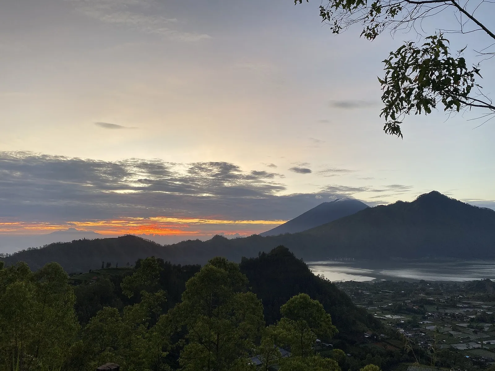
Penelokan — literally 'place to look' — is the roadside viewpoint on the caldera rim where Mount Batur, Lake Batur and the black lava fields fit into one frame; the Ministry of Tourism recommends it at sunset. For a sunrise without the climb, it suggests Pinggan, where mist often fills the valley below the village. The Black Lava fields of old flows below the volcano are popular for jeep and dirt-bike trips.
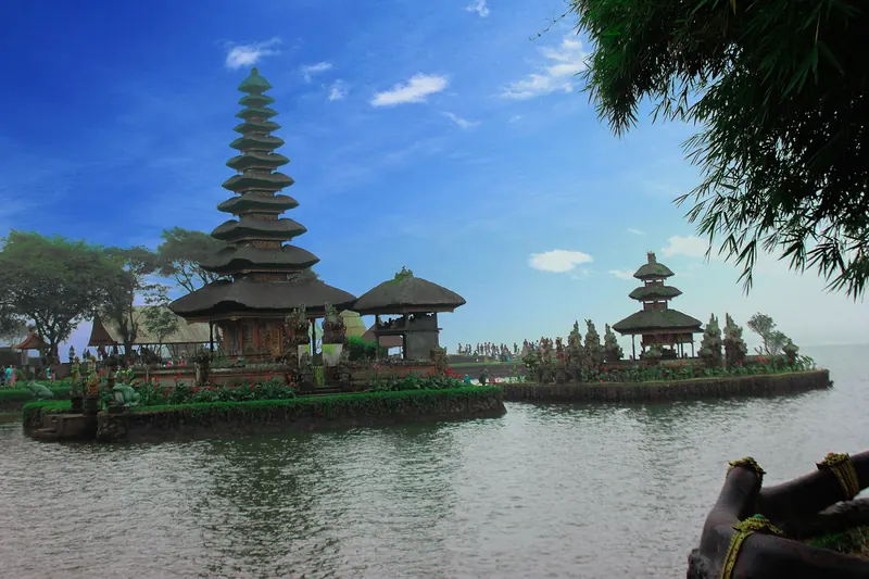
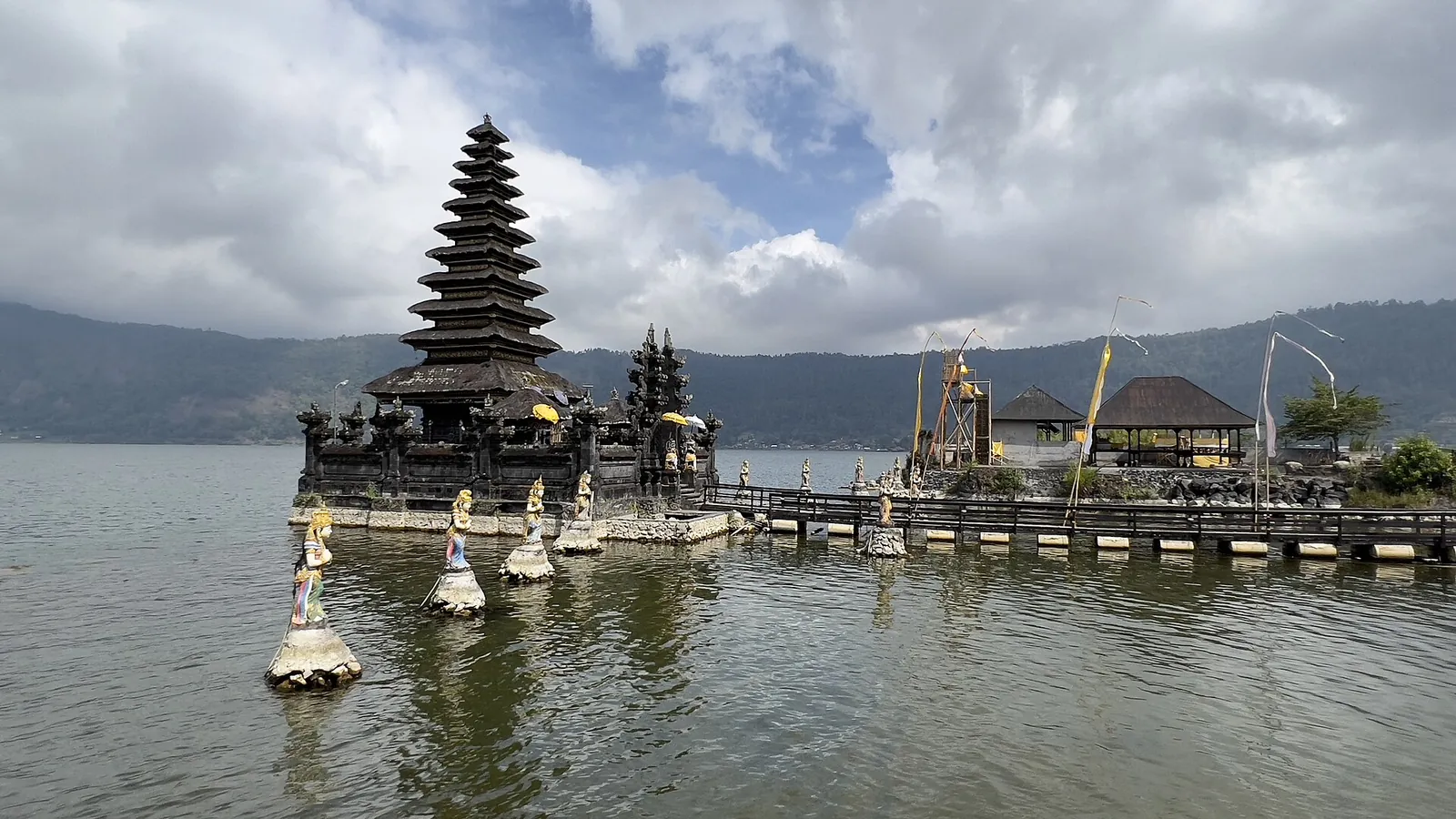
Pura Ulun Danu Batur, on the caldera rim, is described by the Ministry of Tourism as Bali's second most important temple complex after Besakih, dedicated to Vishnu and to Dewi Danu, the goddess of the lake. Its lakeside counterpart, Pura Segara Ulun Danu Batur, stands at the water's edge. The Batur Geopark Museum, in Kintamani, explains the volcano's history with rock collections and displays on how the caldera formed, a useful hour if the summit was clouded in.
Further north on the rim, the regency's guide lists Pura Puncak Penulisan at 1,745 metres, one of Bali's oldest temples, and Pura Balingkang, linked to the legend of King Jaya Pangus and his Chinese queen Kang Ching Wie. Wear a sarong (kamen) at both, as the regency asks.
A volcano inside a volcano
Batur became Indonesia's first UNESCO Global Geopark in 2012. According to the Bangli regency's guide, the landscape is a double caldera: an outer caldera of about 13.8 by 10 kilometres left by a huge eruption around 29,300 years ago, and an inner one formed by a second large eruption around 20,150 years ago. Today's Mount Batur cone grew inside the inner caldera.
That is why the hike feels the way it does: you start on the caldera floor among old lava flows, climb a young cone of loose ash and cinders, and at the top look across the lake to the old caldera wall. The regency's guide asks visitors not to leave litter or damage the protected black lava formations.
A workable 24 hours
An editorial suggestion based on the Bangli regency's sample itinerary, not a timetable. Confirm pick-up and finish times with your guide.
- Afternoon before: arrive at Toya Bungkah or Kedisan, stop at Penelokan on the way down, and go to bed early.
- Before dawn: meet your guide and climb Mount Batur by head torch for sunrise at the summit.
- Morning: descend past the lava fields, then soak in a lakeside hot spring.
- Late morning: the Batur Geopark Museum, or a boat to Trunyan from Kedisan while the lake is calm.
- Lunch and afternoon: lake fish and Kintamani coffee at Penelokan, then Pura Ulun Danu Batur before driving on to Ubud, Sidemen or Munduk.
Practical questions
How long does the Mount Batur sunrise hike take?
The Bangli regency's sample itinerary allows about one and a half to two hours for the climb, starting around 3:30, with sunrise at the summit and the descent finished by about 9:00. Allow extra time for the drive to the trailhead.
Do I need a guide to climb Mount Batur?
Go with a local guide. The regency's official geopark guide tells visitors to use local guides for safety, and the mountain is a protected nature park where the regency has been tightening the rules after accidents. Ask what permits and fees your guide or tour includes.
Can I do the Mount Batur hike as a day trip from Ubud?
Yes, most tours collect you from your hotel in the middle of the night. Sleeping at Toya Bungkah or Kedisan by Lake Batur makes the start much shorter and leaves time for the hot springs and the caldera afterwards.
When is the best time to hike Mount Batur?
The dry season, roughly May to September or October. The Ministry of Tourism names July and August as the most stable months; go on a weekday to avoid the crowds.
Is Mount Batur safe to climb right now?
When we checked on 3 October 2026, Indonesia's volcanology agency listed Batur at Level I (Normal) on MAGMA Indonesia. Check again shortly before your hike, and follow your guide's instructions on the summit.
Is there a way to see sunrise at Batur without hiking?
Yes. The Ministry of Tourism suggests Pinggan village for sunrise over the misty valley, and many jeep tours drive to the black lava fields. Penelokan, on the caldera rim, is the classic viewpoint for the whole caldera.
Sources and checks before you travel
Reference sources for the version dated 3 October 2026. Confirm opening times, access, transport and conditions for your travel dates.
- Bangli Regency (JDIH): Batur UNESCO Global Geopark comprehensive guide ↗ — opens in a new tab
- Batur Global Geopark official website ↗ — opens in a new tab
- Indonesia Travel (Ministry of Tourism): 7 Kintamani tourist attractions and a one-day itinerary ↗ — opens in a new tab
- Indonesia Travel: Geopark Batur ↗ — opens in a new tab
- Indonesia Travel: Trunyan Village ↗ — opens in a new tab
- Indonesia Travel: Pura Segara Ulun Danu Batur ↗ — opens in a new tab
- Indonesia Travel: Museum Geopark Batur ↗ — opens in a new tab
- Indonesia Travel: Kintamani ↗ — opens in a new tab
- MAGMA Indonesia (PVMBG): volcano activity levels ↗ — opens in a new tab
- ANTARA: Bangli regency moves to regulate mountain hiking (3 November 2024) ↗ — opens in a new tab
- ANTARA: BKSDA and Bangli to build a hiking centre at Mount Batur (12 April 2023) ↗ — opens in a new tab
- Indonesia Travel: Ayam Betutu ↗ — opens in a new tab
- Indonesia Travel: Ngurah Rai Airport ↗ — opens in a new tab
- Indonesia Travel: Bali ↗ — opens in a new tab
Does this experience fit your route?
A guided sunrise trek with pick-up is the simplest way to climb Batur from Ubud. Check the pick-up time, what the price includes and whether the hot springs are part of the day before you book.
Check dates and details on Viator ↗ — opens in a new tabAffiliate link · Book with ViatorPhoto credits
Mount Batur and the black lava flows on the caldera floor, Kintamani
Photograph: Jorge Franganillo — opens in a new tab · CC BY 2.0 — opens in a new tab
Changes: Resized and converted to WebP; displayed with responsive crops. · Original photograph and licence details ↗ — opens in a new tab
Lake Batur and Mount Abang from the rim of the Batur caldera
Photograph: Dmitry Baranovskiy from Sydney, Australia — opens in a new tab · CC BY 2.0 — opens in a new tab
Changes: Resized and converted to WebP; displayed with responsive crops. · Original photograph and licence details ↗ — opens in a new tab
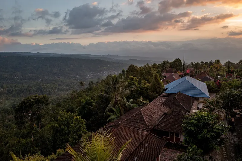
Daybreak over the Batur caldera from the Kintamani rim
Photograph: Eka343 — opens in a new tab · CC BY-SA 4.0 — opens in a new tab
Changes: Resized and converted to WebP; displayed with responsive crops. · Original photograph and licence details ↗ — opens in a new tab
Pura Segara Ulun Danu Batur on the shore of Lake Batur
Photograph: Stefan Fussan — opens in a new tab · CC BY-SA 4.0 — opens in a new tab
Changes: Resized and converted to WebP; displayed with responsive crops. · Original photograph and licence details ↗ — opens in a new tab
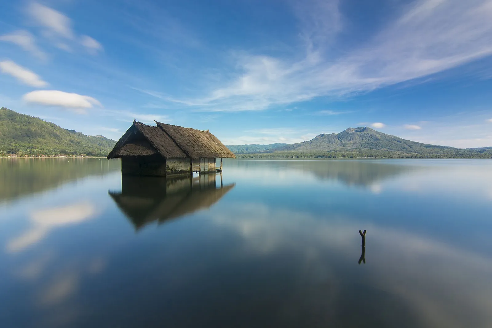
A fishing hut on Lake Batur in the early morning
Photograph: Made agus devayana — opens in a new tab · CC BY-SA 4.0 — opens in a new tab
Changes: Resized and converted to WebP; displayed with responsive crops. · Original photograph and licence details ↗ — opens in a new tab
Ayam betutu, Balinese chicken slow-cooked in betutu spice paste
Photograph: m4sh.3d — opens in a new tab · CC BY-SA 2.0 — opens in a new tab
Changes: Resized and converted to WebP; displayed with responsive crops. · Original photograph and licence details ↗ — opens in a new tab