Bali · Bali
Nusa Penida guide: stay overnight, cliff viewpoints and manta snorkelling
Nusa Penida sits across the Badung Strait from south-east Bali, close enough for a day trip and big enough to ruin one. Its interior is hilly limestone rising to 524 metres, the roads to the famous viewpoints are steep and in places still rough, and the best-known sights sit on opposite coasts. The island rewards travellers who stay at least a night, split the west and east coasts over separate days and keep a calm morning for the sea, where reef manta rays live year-round.
- Suggested time
- 1–3 nights
- Where to stay
- North coast around Ped and Toyapakeh; Sampalan for the island's main town
- Season and timing
- The Ministry of Tourism recommends the dry season, roughly April to October, for more favourable weather. Reef manta rays are present all year; mola-mola are mostly seen from July to October. Sea crossings take longer or are cancelled in rough weather.
The short answer
Give Nusa Penida two nights, or at least one. Cross by fast boat from Sanur (or from Padang Bai or Kusamba further east), sleep on the north coast around Ped and Toyapakeh, and split the island into a west-coast day (Kelingking, Broken Beach, Angel's Billabong, Crystal Bay) and an east-coast day (Diamond and Atuh beaches, Goa Giri Putri). Book the manta snorkelling or diving trip for a morning with a licensed operator, and hire a car with a driver unless you are an experienced scooter rider. A day trip from Bali is possible but covers only one coast, with most of the day spent on the boat and the road.
Stay overnight rather than day-trip
The crossing itself is short. Indonesia's Ministry of Tourism describes the fast-boat journey from Bali to the harbours at Toyapakeh or Sampalan as usually 30 to 45 minutes, depending on the weather; a Bali provincial tourism article gives about an hour from Sanur to Banjar Nyuh. The time goes on land: the ministry warns that the island's terrain is hilly and some roads are still rocky, and Kelingking on the south-west coast and Diamond Beach on the east coast are far apart by road.
A day trip therefore usually means a single coast, an early boat, a crowded viewpoint at midday and a return crossing in the afternoon. Staying one or two nights lets you see the cliffs in the softer early and late light, put the manta trip on a morning when the sea is calm and leave room for a cancelled boat. The Ministry of Tourism also advises booking fast-boat tickets well in advance in holiday periods, when they can sell out.
Take the crossing seriously. Wikivoyage warns that the strait is open water with strong currents, that boarding often means wading and getting wet, and that tourist fast boats have capsized; wear the life jacket in rough seas, keep valuables in a dry bag and do not board an overloaded boat.
The west coast: Kelingking, Broken Beach and Crystal Bay
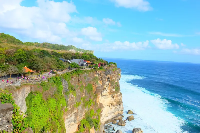
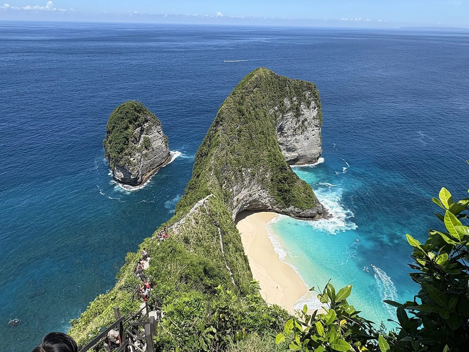
Kelingking Beach in Bunga Mekar, on the south-west coast, is the image most people come for: a headland that the Ministry of Tourism compares to a T-Rex, above a strip of white sand. The viewpoint at the top is reachable by car. Going down to the beach is a different matter: the ministry calls the descent steep and dangerous, so treat it as a serious scramble, not a stroll, and skip it in the heat of the day, in wet weather or in unsuitable shoes.
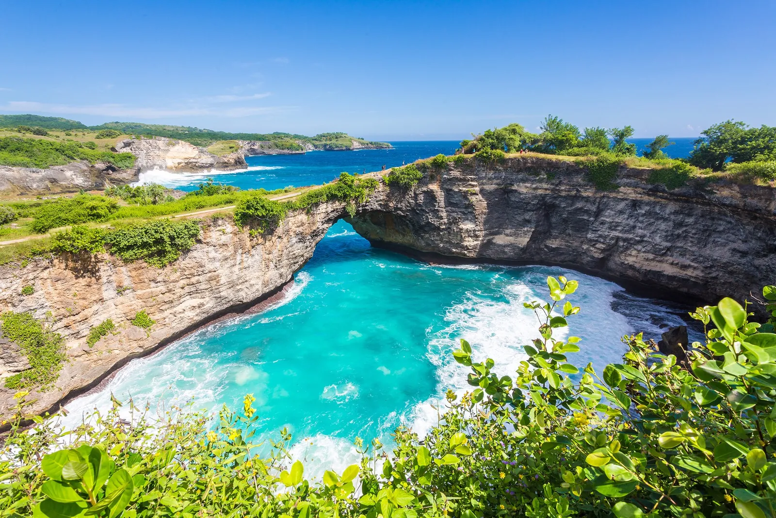
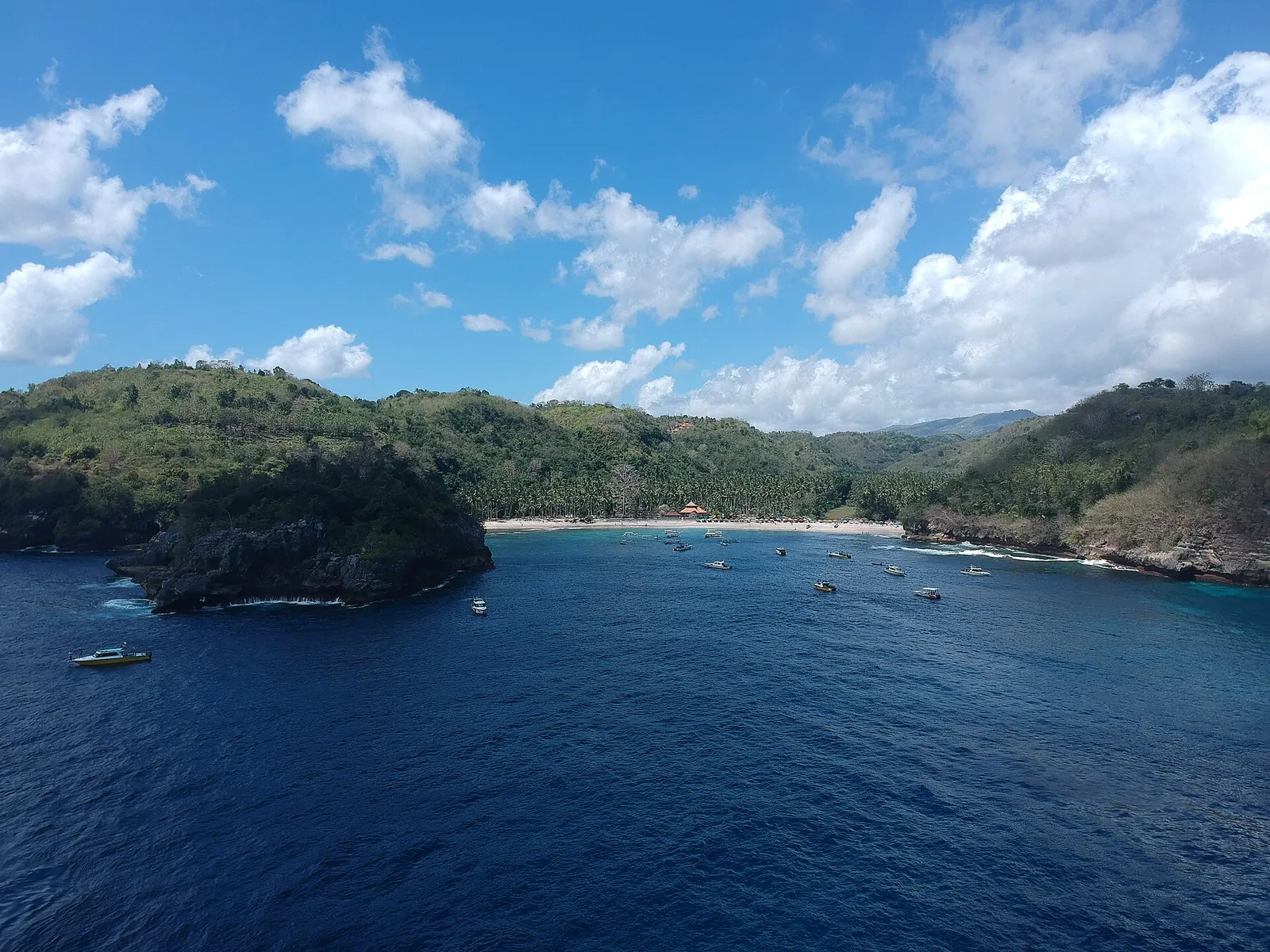
Broken Beach (Pasih Uug), about 3 kilometres north-west of Kelingking according to the ministry, is a cove where the sea enters through a natural arch into an enclosed pool; Angel's Billabong is in the same area. Crystal Bay, in Sakti village, is the west coast's swimming and snorkelling beach, with the small islet of Batu Mejinong offshore and a sunset view, as the Bali provincial tourism site describes.
Further south-east along the cliffs, the ministry lists the Tembeling spring, about 30 minutes' walk down through the forest, and Guyangan waterfall, reached by a long blue staircase down the cliff to a small temple and a pool. Both involve steep steps. A realistic west-coast day takes in three or four of these places, not all of them.
Make time for the local food
What to eat and where to look
Ikan bakar (grilled fish)
Fish grilled and served with rice and sambal, an everyday meal on an island whose waters are zoned for fishing and seaweed farming as well as tourism.
- Where to look
- Simple warungs and beach restaurants along the north coast around Ped and Toyapakeh.
- Fit it into your day
- Dinner on the north coast after a day on the road, when you are back near your guesthouse.
Ask about the price of fish sold by weight before it goes on the grill.
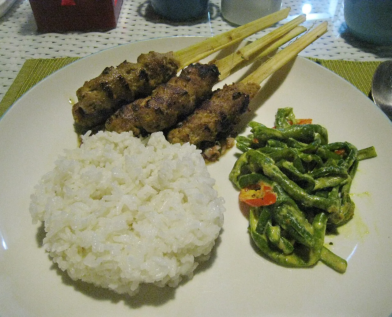
Sate lilit
Balinese satay of minced, spiced fish, pork or chicken wrapped around a lemongrass stalk or bamboo stick and grilled.
- Where to look
- Warungs serving Balinese food and roadside grills in the villages.
- Fit it into your day
- A snack or part of a mixed plate at lunch between viewpoints.
Often made with pork; ask which meat is used.
Nasi campur
Rice with small portions of several dishes — vegetables, meat or fish, egg, peanuts and sambal — chosen from what the kitchen has cooked that day.
- Where to look
- Local warungs in Sampalan, Ped and Toyapakeh; it is the easiest everyday lunch on the island.
- Fit it into your day
- A quick lunch on a touring day, since restaurants near the clifftop viewpoints are limited.
The sambal can be very hot; ask for it on the side.
Manta Point, Crystal Bay and the marine park
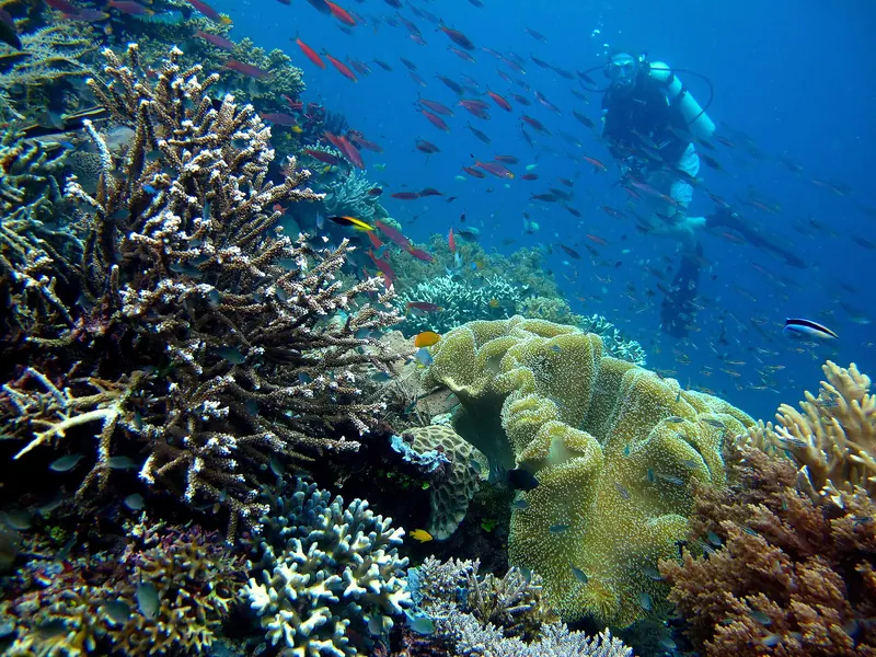
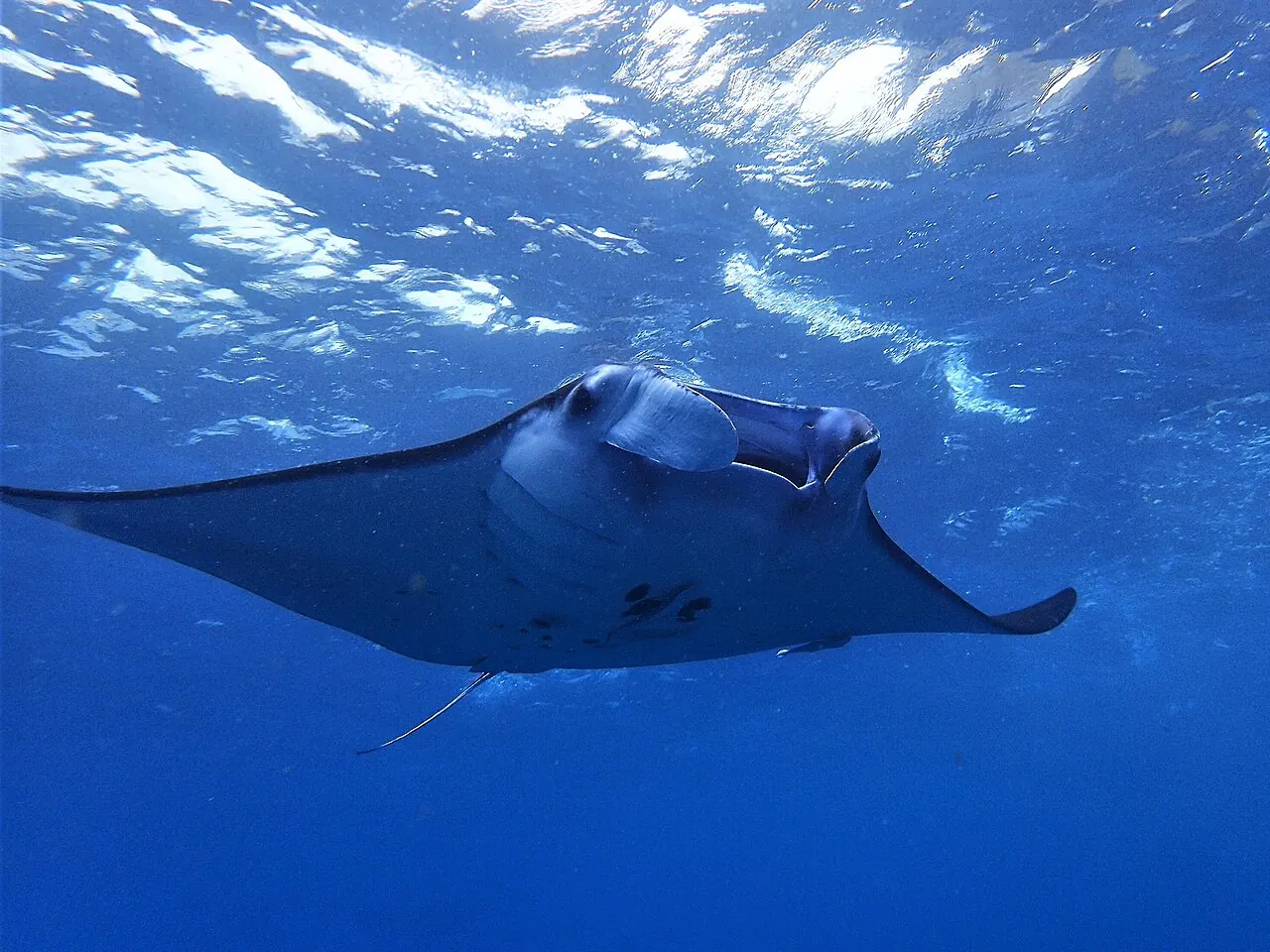
The waters around Nusa Penida, Lembongan and Ceningan form the Nusa Penida Marine Protected Area. According to the Coral Triangle Center, which helped develop the park's zoning, more than 600 individual reef manta rays have been identified there since 2004 and they are present year-round, while mola-mola (ocean sunfish) gather at cleaning stations mainly between July and October.
The Ministry of Tourism lists three main snorkelling and diving spots: Manta Point on the southern side of the island, Malibu Point on the east and Crystal Bay in the west. Currents here are strong and change with the tide, so this is a trip to do with an operator, not on your own. Ask whether the operator follows the manta and mola-mola codes of conduct developed with local dive operators, or holds Green Fins certification; both are promoted in the marine park. Do not touch or chase the animals, and keep fins off the coral.
Boats can be turned back by sea conditions, which is another reason to stay longer than one day.
The east coast: Diamond Beach, Atuh and Goa Giri Putri
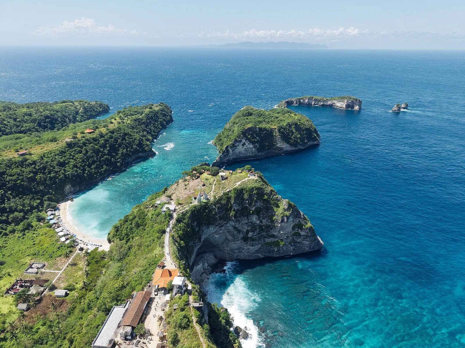
The east coast is the second full day. Diamond Beach and Atuh Beach, which the Ministry of Tourism recommends for their ocean views, both lie at Pejukutan on the east coast below limestone cliffs, with steps down to the sand; Wikivoyage notes that Atuh catches the sunrise. The climb back up is the hard part, so go down early, before the heat. The ministry also suggests trekking on Teletubbies Hill, a landscape of rounded green hills, if you want a walk away from the sea.
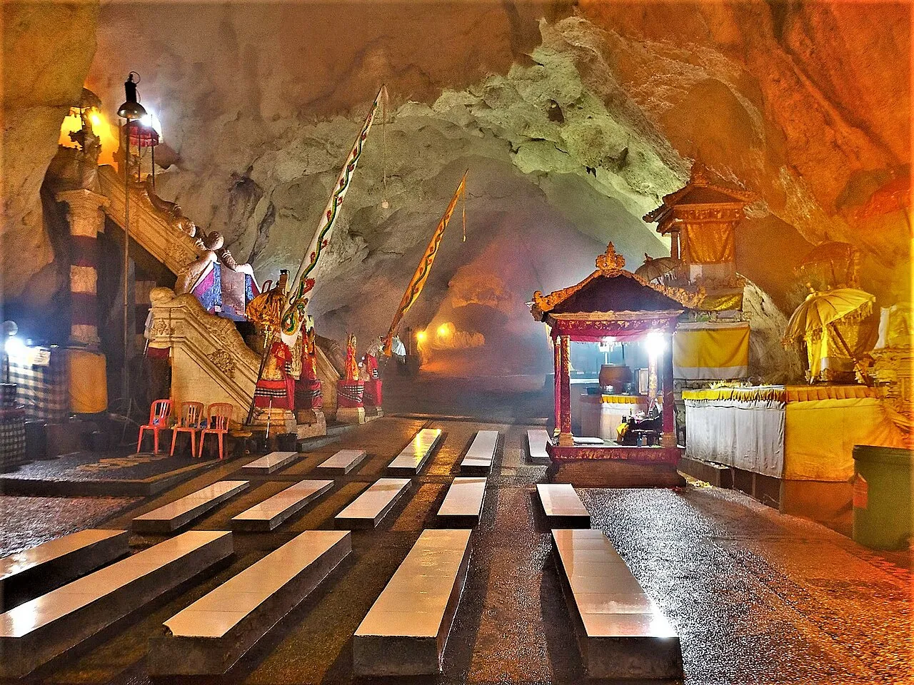
Goa Giri Putri, north of Suana on the east coast, is a Hindu temple inside a limestone cave, which the ministry presents as a spiritual experience for visitors interested in culture. It is an active place of worship, entered by a short climb from the road: you will need a sarong (Wikivoyage reports they can be rented at the roadside), worshippers may be present, and you should follow the instructions of the temple attendants.
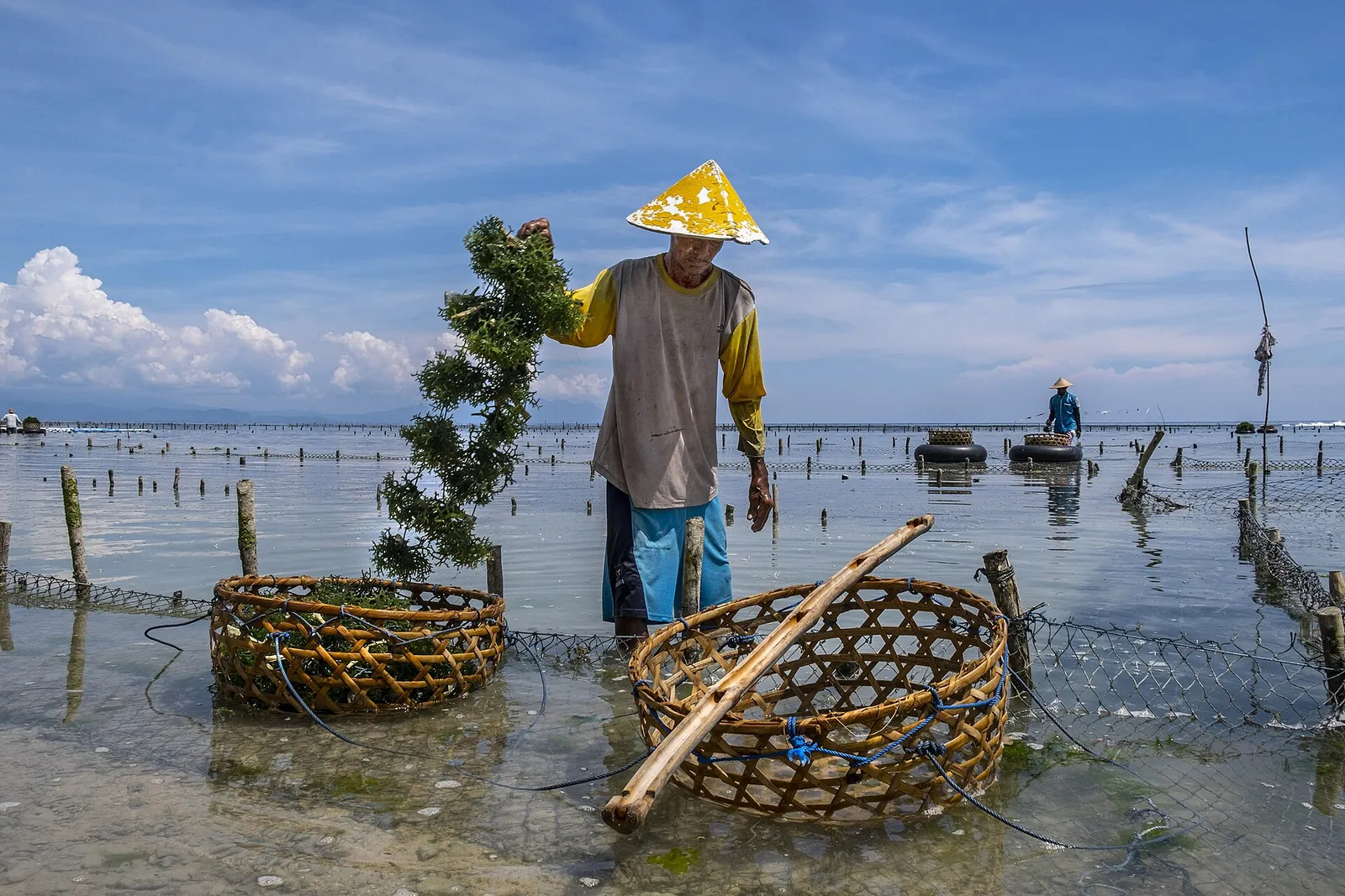
On the way you will see the seaweed farms that line parts of the shore; seaweed farming is one of the activities the marine park's zoning provides for, alongside fishing, tourism and protected sacred zones next to coastal temples.
Getting around: drivers, scooters and road time
The ministry's advice is to rent a car or motorbike, with or without a driver, and to choose a vehicle in good condition because of the hilly, partly rocky roads. For most visitors a car with a local driver is the safer choice: the drivers know which roads are passable and where to park, and you avoid riding steep, gravelly descents on an unfamiliar scooter.
Plan one coast per day and keep the afternoon of your departure day free, since boats run to fixed departure times and the drive back to the harbour can take longer than the map suggests.
- Day 1: morning boat from Sanur, check in on the north coast, Crystal Bay for a late-afternoon swim and sunset.
- Day 2: manta snorkelling or diving in the morning, then Kelingking and Broken Beach once the boat is back.
- Day 3: Diamond and Atuh beaches and Goa Giri Putri on the east coast, then the afternoon boat back to Bali — or a third night.
Before you go: Bali levy and a quieter island
Nusa Penida is part of Klungkung Regency in Bali province, so the Bali tourist levy applies. When we checked on 2026-10-03, the official Love Bali site listed the levy for international tourists at IDR 150,000; the Ministry of Tourism describes it as a one-time payment during your stay, paid cashless through Love Bali or at counters at Ngurah Rai airport and Benoa port.
The island is also more rural and less developed than southern Bali. Together with Lembongan and Ceningan it forms a community-run bird sanctuary that has released the critically endangered Bali starling, and islanders speak their own Balinese dialect. Expect a slower, simpler island than the resort coast across the strait.
Practical questions
Is Nusa Penida worth a day trip from Bali?
Only if you have no other option. A day trip usually covers one coast, with much of the day on the boat and the road. One or two nights let you see both coasts, put the manta trip on a calm morning and keep a buffer for cancelled boats.
How do I get to Nusa Penida?
By fast boat from Sanur, Padang Bai or Kusamba on Bali to harbours such as Toyapakeh, Sampalan or Banjar Nyuh. The Ministry of Tourism gives 30 to 45 minutes for the crossing, depending on the weather. Book ahead in holiday periods.
Can I walk down to Kelingking Beach?
There is a path, but the Ministry of Tourism calls the descent steep and dangerous. Go only if you are fit and sure-footed, in good shoes and dry weather, and avoid the midday heat. The view from the top is the main attraction.
When can I see manta rays at Nusa Penida?
Reef manta rays are present all year, according to the Coral Triangle Center. Mola-mola are mainly seen from July to October. Sightings depend on conditions and are never guaranteed.
Should I rent a scooter on Nusa Penida?
Only if you are an experienced rider. The ministry warns that the roads are hilly and partly rocky. A car with a local driver is safer and easier for most visitors.
Do I need to pay the Bali tourist levy for Nusa Penida?
Nusa Penida is part of Bali province, and the Bali levy for international tourists is a one-time payment per stay. When we checked on 2026-10-03, the Love Bali site listed it at IDR 150,000.
Sources and checks before you travel
Reference sources for the version dated 3 October 2026. Confirm opening times, access, transport and conditions for your travel dates.
- Indonesia Travel (Ministry of Tourism): Nusa Penida beaches, harbour access and tips ↗ — opens in a new tab
- Indonesia Travel (Ministry of Tourism): Kelingking Beach ↗ — opens in a new tab
- Indonesia Travel (Ministry of Tourism): snorkelling at Nusa Penida ↗ — opens in a new tab
- Love Bali (Bali Provincial Government): Nusa Penida, Bali's golden egg ↗ — opens in a new tab
- Love Bali: tourist levy ↗ — opens in a new tab
- Indonesia Travel (Ministry of Tourism): Bali regulations ↗ — opens in a new tab
- Coral Triangle Center: Nusa Penida MPA ↗ — opens in a new tab
- Wikivoyage: Nusa Penida ↗ — opens in a new tab
- Wikipedia: Nusa Penida ↗ — opens in a new tab
Photo credits
Kelingking Beach on Nusa Penida's south-west coast, seen from the viewpoint at the top of the cliff.
Photograph: Chainwit. — opens in a new tab · CC BY 4.0 — opens in a new tab
Changes: Resized and converted to WebP; displayed with responsive crops. · Original photograph and licence details ↗ — opens in a new tab
Broken Beach (Pasih Uug), where the sea flows through a natural arch into an enclosed pool.
Photograph: I Ketut Arnaya — opens in a new tab · CC BY-SA 4.0 — opens in a new tab
Changes: Resized and converted to WebP; displayed with responsive crops. · Original photograph and licence details ↗ — opens in a new tab
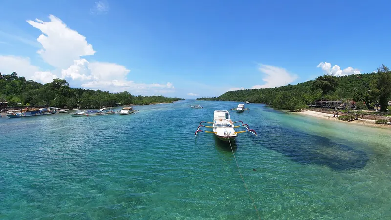
Crystal Bay, the west coast's snorkelling and swimming bay, with boats moored off the beach.
Photograph: Magul — opens in a new tab · CC BY-SA 4.0 — opens in a new tab
Changes: Resized and converted to WebP; displayed with responsive crops. · Original photograph and licence details ↗ — opens in a new tab
A manta ray seen while snorkelling off Nusa Penida.
Photograph: Sasuke shinozawa — opens in a new tab · CC BY-SA 4.0 — opens in a new tab
Changes: Resized and converted to WebP; displayed with responsive crops. · Original photograph and licence details ↗ — opens in a new tab
The Diamond Beach coastline on Nusa Penida's east coast from the air.
Photograph: FBilula — opens in a new tab · CC BY 4.0 — opens in a new tab
Changes: Resized and converted to WebP; displayed with responsive crops. · Original photograph and licence details ↗ — opens in a new tab
A seaweed farmer at work in the shallows of Nusa Penida.
Photograph: RaiyaniM — opens in a new tab · CC BY-SA 4.0 — opens in a new tab
Changes: Resized and converted to WebP; displayed with responsive crops. · Original photograph and licence details ↗ — opens in a new tab
Inside Goa Giri Putri, a Hindu temple set in a cave on Nusa Penida.
Photograph: Sasuke shinozawa — opens in a new tab · CC BY-SA 4.0 — opens in a new tab
Changes: Resized and converted to WebP; displayed with responsive crops. · Original photograph and licence details ↗ — opens in a new tab
Sate lilit, Balinese minced satay, here a pork version with rice and spiced long beans.
Photograph: Gunawan Kartapranata — opens in a new tab · CC BY-SA 4.0 — opens in a new tab
Changes: Resized and converted to WebP; displayed with responsive crops. · Original photograph and licence details ↗ — opens in a new tab