Java · Special Region of Yogyakarta
Mount Merapi from Kaliurang: lava jeep tours, museums and alert levels
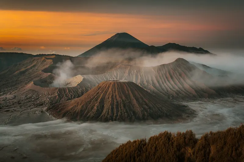
Mount Merapi rises north of Yogyakarta and is one of the most active volcanoes in the world. You don't come here to stand on the crater. You come to see what the volcano has done to the land: river valleys scoured by the 2010 eruption, villages left as memorials, and the cool hill resort of Kaliurang on its southern slope, where Dutch planters once escaped the heat and Javanese royalty still have a resthouse. How close you can get depends on one thing that changes without notice: the alert level set by Indonesia's volcanology agency.
- Suggested time
- 1 day from Yogyakarta, or 1 night in Kaliurang
- Where to stay
- Yogyakarta city for a day trip; Kaliurang or the Pentingsari homestay village for a night on the slopes
- Season and timing
- Merapi can be visited all year, but its summit is often hidden in cloud and rain changes the risk: Indonesia's volcanology agency warns people near Merapi to watch for lahars (volcanic mudflows) and pyroclastic flows, especially when it rains. Plan the jeep tour for the morning and stay flexible on wet days.
The short answer
Give Merapi one full day from Yogyakarta, or one night in Kaliurang if you want a cool, quiet evening and an early start. Check the alert level and the latest hazard zones on MAGMA Indonesia the evening before. Then do it in two halves: a morning lava jeep tour from the Kaliadem and Kepuharjo area in Cangkringan (the Sisa Hartaku house museum, the bunker and the lahar-scoured valleys), and an afternoon in Kaliurang at the Merapi Volcano Museum and Ullen Sentalu, with jadah tempe for a snack. Climbing to the summit is out while Merapi is at Level III, because the summit lies inside the danger zone.
Read the alert level before you plan anything
Indonesia's volcanology agency (PVMBG) publishes the status of every volcano on its MAGMA Indonesia site. There are four levels, set under a 2011 energy ministry regulation: Level I (Normal), Level II (Waspada), Level III (Siaga) and Level IV (Awas). MAGMA's guidance explains what each means on the ground. At Level II, people are advised to stay away from the crater. At Level III, the danger can spread further but does not yet threaten settlements, and people should avoid river valleys that start at the summit. At Level IV, people in threatened areas must evacuate when the local government orders it.
When we checked on 2026-10-03, MAGMA listed Merapi at Level III (Siaga). That day's report placed the danger area for lava avalanches and pyroclastic flows on the south-south-west side up to 5 km along the Boyong river and up to 7 km along the Bedog, Krasak and Bebeng rivers, and on the south-east side up to 3 km along the Woro and 5 km along the Gendol. Ejected material from an explosive eruption could reach 3 km from the summit in any direction. MAGMA asked people to do no activity at all inside these areas.
In practice: read the latest Merapi report on MAGMA the evening before you go, note which rivers and distances it names, and ask your jeep operator or guide how the day's route stays outside them. If the level goes up, plans change, and a good operator will tell you so.
The lava jeep tour on the south-east slopes
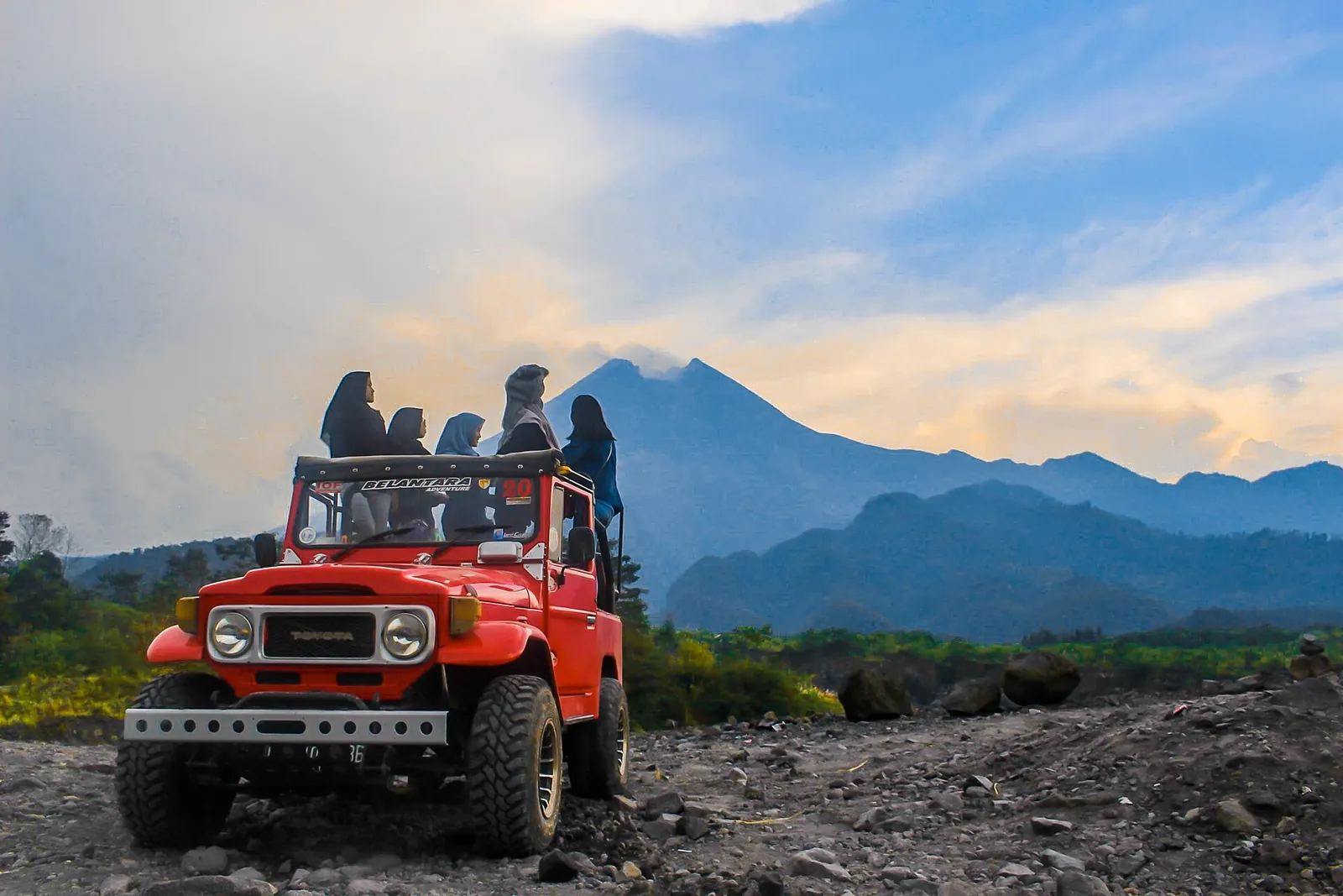
Most visitors meet Merapi on a lava tour: a ride in an open off-road jeep through the area of Kepuharjo, Cangkringan, that the 2010 eruption devastated. The Ministry of Tourism says many jeep communities at Kaliadem offer these trips, always led by a professional driver who also acts as your guide; some riders go by off-road motorbike instead. The provincial tourism office describes routes through Kali Kuning, Kali Gendol, Petung village, Kaliadem and Jambu, past houses ruined by the pyroclastic clouds that locals call *wedhus gembel*, a broken check dam, and sand miners working the upper Gendol and Opak rivers.
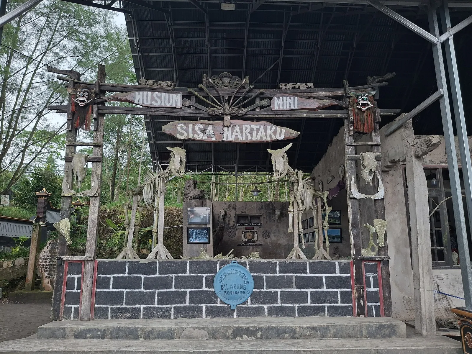
Typical stops, according to the ministry and the provincial office, are Museum Sisa Hartaku, a family house kept as it was after the 2010 eruption, with melted motorbikes, televisions and a clock stopped at the moment the hot ash cloud arrived; the Kaliadem bunker, an underground shelter where two volunteers died in the heat; and Batu Alien, a boulder in the Gendol riverbed that looks like a human face.
The ministry advises bringing a sweater for the cool air on the slopes; expect dust in the dry months and mud after rain. Wikivoyage warns that many of the jeeps are old and of uneven reliability, and reports a fatal accident in June 2018 involving an open jeep with a faulty steering wheel. Look at the vehicle before you get in, and choose an operator that briefs you on the route and the current hazard zones.
Make time for the local food
What to eat and where to look
Jadah tempe
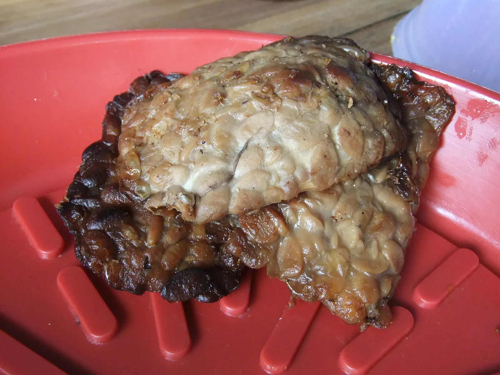
Kaliurang's signature snack pairs *jadah*, sticky rice steamed with grated coconut and pounded smooth, with *tempe bacem*, tempeh braised slowly in a sweet spiced broth and then fried. The provincial tourism office tells how Sultan Hamengku Buwono IX tasted it at a stall near Tlogo Putri and gave the snack its name; when the office wrote about it in 2017, the Mbah Carik stall was run by the founder's granddaughter.
- Where to look
- Stalls around Tlogo Putri and the market in front of the Kaliurang parking area.
- Fit it into your day
- An afternoon snack in Kaliurang with a hot drink, or a packet for the ride back to Yogyakarta.
Tempe bacem is sweet and the sticky rice is dense; the soybean tempeh is unsuitable for soy allergies.
Kopi Merapi
Robusta and arabica grown in Merapi's volcanic soil and roasted the traditional way in a clay pan over a wood fire. The provincial tourism office describes Warung Kopi Merapi in Petung, Kepuharjo, which was built from eruption debris after the 2010 eruption destroyed its owner's coffee farm.
- Where to look
- Warung Kopi Merapi in Dusun Petung, Kepuharjo, Cangkringan, on the road to the lava tour.
- Fit it into your day
- A break during or after the jeep tour; on a clear day the warung looks straight at the volcano.
Food there is limited to fried snacks and instant noodles, and the road is dusty when jeeps and sand trucks pass.
Sayur lodeh at a kopi klothok warung
Vegetables in coconut milk, eaten with rolled omelette, fried tempeh and sambal, alongside *kopi klothok*, coffee boiled together with the grounds. The provincial tourism office recommends Warung Kopi Klothok in the rice fields of Pakem.
- Where to look
- Warung Kopi Klothok on Jalan Kaliurang KM 16, Pakem, on the way up from the city.
- Fit it into your day
- A home-style breakfast or lunch on the drive between Yogyakarta and Kaliurang.
Very busy at weekends, according to the tourism office; go early or on a weekday.
Rabbit satay and wedang gedang
The Ministry of Tourism names rabbit satay, duck satay and *wedang gedang*, a traditional warm drink, among Kaliurang's best-known foods, alongside jadah tempe.
- Where to look
- Satay stalls and warungs along the roads around Kaliurang.
- Fit it into your day
- Dinner if you stay the night on the slopes.
Satay is usually served with sweet soy or peanut sauce; ask if you need to avoid peanuts.
Kaliurang: museums and forest on the southern slope
Kaliurang is a hill resort about 25 km north of central Yogyakarta, built as a retreat for Dutch planters in the colonial era, as the Ministry of Tourism explains. It was hit hard by the last major eruption but has recovered. Today it is a weekend escape for Yogyakarta families, with villas, forest walks and a cooler climate.
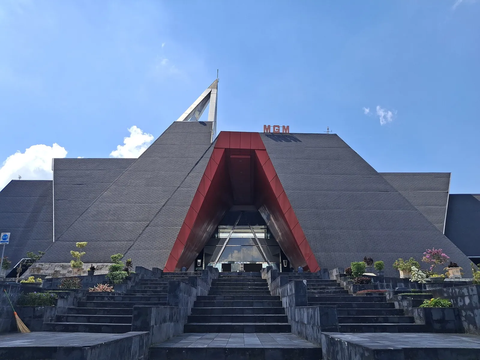
The Merapi Volcano Museum (Museum Gunungapi Merapi), on Jalan Kaliurang KM 22, is the place to understand what you see on the jeep tour. It opened to the public on 1 January 2010 and is run by Sleman Regency's culture department. According to the Ministry of Tourism, it has volcanic rocks and pyroclastic material, household objects damaged by eruptions, an earthquake simulator and a film theatre showing Merapi's eruptions. The ministry's Indonesian-language guide adds rooms on Merapi's history and on volcanoes, earthquakes and tsunamis worldwide.
Ullen Sentalu, on Jalan Boyong, is a private museum of the royal houses of Yogyakarta, Pakualaman, Surakarta and Mangkunegaran, opened in 1997 next to a palace resthouse because Javanese belief holds Merapi sacred. Visits are by guided tour only, and photography is allowed only in certain areas. When we checked on 2026-10-03, the museum's official site listed opening hours of Tuesday to Sunday, 08:30–16:30 (last tour 15:15, closed Monday), and tours from Rp 50,000 (Adiluhung Mataram) to Rp 100,000 (Vorstenlanden or the English-guided tour).
For walking, the national park's forest areas above town have trails, the Tlogo Muncar waterfall (which can dry up in the dry season) and Japanese-era caves (Goa Jepang). The ministry warns that some uphill paths are steep and slippery and that macaques snatch belongings. A May 2024 notice from the provincial tourism office listed four national park nature sites open daily from 09:00 to 15:00, including Muncar in Kaliurang and Kalikuning–Plunyon in Cangkringan. Check that they are open on the day, because closures follow the volcano's status.
Viewpoints and slow time on the slopes
If the cloud lifts, you want a clear line to the cone. The Ministry of Tourism suggests Bukit Klangon in Glagaharjo, Cangkringan, for one of the best views of Merapi, with a camping area. Its Indonesian guide also points to the observation tower in Kaliurang, about 7 km from the crater, where you can wait for the view with a cup of *wedang ronde*, a warm ginger drink. Bukit Kalikuning, opened by the national park in 2017 on a hill formed after the eruption, has spring-fed streams and a campsite.
To see how people live with the volcano, the ministry recommends Pentingsari (Dewi Peri), a tourism village in Umbulharjo, Cangkringan, where you can stay with a local family and try batik, coffee processing and herbal gardens. The ministry's own lava tour writer stopped there on the way up to try planting rice.
The volcano also matters in Javanese court belief. The Yogyakarta palace is aligned with Merapi, and each year, on the anniversary of the Sultan's coronation, the palace carries offerings (*labuhan*) to the mountain, and to the Indian Ocean on the same day, according to the Ministry of Tourism.
Why the landscape looks the way it does
MAGMA gives Merapi's height as 2,968 metres and places it across the regencies of Sleman, Magelang, Boyolali and Klaten, on the border of Yogyakarta and Central Java. The Ministry of Tourism's Indonesian guide links a great eruption around 1006 CE to the ancient Mataram kingdom's move to East Java and to ash burying the area around Borobudur. It calls the late-October 2010 eruption the worst since 1870, with 353 people killed.
That eruption is what the jeep tours show you. The Ministry of Tourism's writer describes the path the lava dug down the mountain and across the valley, now a canyon with a rushing river; the provincial tourism office describes houses burnt by the hot clouds and a check dam the eruption broke. Rain still carries volcanic material down these valleys as lahars, which is why MAGMA's warnings name rivers rather than just distances, and why the safe area can differ from one valley to the next.
A workable Merapi day
An editorial suggestion, not a timetable. Confirm pick-up times with your operator and check MAGMA the evening before.
- Morning: leave Yogyakarta early (or walk out of your Kaliurang homestay) for a lava jeep tour from Kaliadem or Kepuharjo.
- Midday: coffee from the slopes at Warung Kopi Merapi in Petung, on the lava tour route.
- Early afternoon: the Merapi Volcano Museum on Jalan Kaliurang KM 22.
- Late afternoon: a guided tour at Ullen Sentalu (last tour 15:15 when we checked), then jadah tempe in Kaliurang before the drive back down.
Practical questions
Is it safe to visit Mount Merapi right now?
It depends on the current alert level and hazard zones. When we checked on 2026-10-03, MAGMA Indonesia listed Merapi at Level III (Siaga), with danger areas of 3 to 7 km along specific river valleys and 3 km around the summit, and asked people to do no activity inside them. Read the latest Merapi report on MAGMA before you go, and use an operator whose route stays outside the zones.
What does Level III (Siaga) mean for visitors?
MAGMA describes Level III as clearly increasing activity or an eruption, with danger that can spread but does not yet threaten settlements. People are advised to avoid river valleys that start at the summit. It does not close the whole mountain, but the summit and the named valleys are off-limits.
Can I climb to the summit of Merapi?
Not while Merapi is at Level III: MAGMA's danger area includes everything within 3 km of the summit. When the status allows climbing, the usual route has been from Selo on the north side, between Merapi and Merbabu, rather than from Kaliurang, according to Wikivoyage.
What is the Merapi lava tour?
An open-jeep ride, led by a local driver-guide, through the Kepuharjo and Kaliadem area that the 2010 eruption devastated. Stops usually include the Sisa Hartaku house museum, the Kaliadem bunker and the Batu Alien boulder, according to the Ministry of Tourism. Check the jeep's condition and the route before you set off.
How far is Kaliurang from Yogyakarta?
About 25 km north of the city centre, according to the Ministry of Tourism. It works as a day trip from Yogyakarta, but a night there gives you an early start and cooler air.
What are Ullen Sentalu's opening hours?
When we checked on 2026-10-03, the museum's official site listed Tuesday to Sunday, 08:30–16:30, with the last tour at 15:15 and Monday closed. Visits are by guided tour only.
Sources and checks before you travel
Reference sources for the version dated 3 October 2026. Confirm opening times, access, transport and conditions for your travel dates.
- MAGMA Indonesia (PVMBG): volcano activity levels ↗ — opens in a new tab
- MAGMA Indonesia: Merapi activity report, 3 October 2026 (12:00–18:00 WIB) ↗ — opens in a new tab
- MAGMA Indonesia: Tingkat Aktivitas Gunung Api (alert level guidance) ↗ — opens in a new tab
- Indonesia Travel (Ministry of Tourism): Kaliurang ↗ — opens in a new tab
- Indonesia Travel: Museum Gunungapi Merapi ↗ — opens in a new tab
- Indonesia Travel: Mendaki Merapi, Si Gunung Berapi yang Megah di Jawa Tengah ↗ — opens in a new tab
- Indonesia Travel: Mount Merapi Adventures ↗ — opens in a new tab
- Indonesia Travel: 5 Awesome Places for Family Recreation in Kaliurang, Mount Merapi ↗ — opens in a new tab
- Visiting Jogja (Yogyakarta tourism office): Lava Tour Merapi ↗ — opens in a new tab
- Visiting Jogja: Serunya Wisata Lava Tour Merapi ↗ — opens in a new tab
- Visiting Jogja: Jam Operasional Objek Wisata Alam Kawasan Merapi (30 May 2024) ↗ — opens in a new tab
- Visiting Jogja: Bukit Kalikuning ↗ — opens in a new tab
- Visiting Jogja: Jadah Tempe Mbah Carik ↗ — opens in a new tab
- Visiting Jogja: Warung Kopi Merapi ↗ — opens in a new tab
- Visiting Jogja: Warung Kopi Klothok Kaliurang ↗ — opens in a new tab
- Museum Ullen Sentalu (official site) ↗ — opens in a new tab
- Wikivoyage: Mount Merapi ↗ — opens in a new tab
- Indonesia Travel: Karaton Ngayogyakarta ↗ — opens in a new tab
- Wikivoyage: Yogyakarta ↗ — opens in a new tab
Does this experience fit your route?
A lava jeep tour with pick-up from Yogyakarta is the easiest way to see Merapi. Check the alert level the night before, and ask the operator which route they will take.
Check dates and details on Viator ↗ — opens in a new tabAffiliate link · Book with ViatorPhoto credits
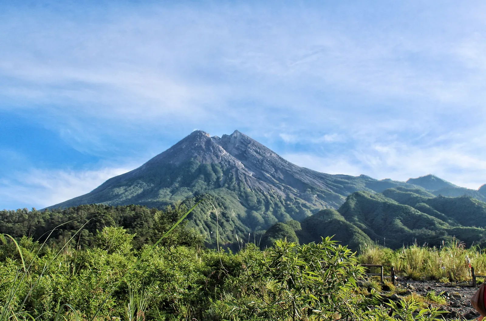
Mount Merapi from its southern slope in Sleman, the side facing Kaliurang and Yogyakarta
Photograph: Rosalia.silaban — opens in a new tab · CC BY-SA 4.0 — opens in a new tab
Changes: Resized and converted to WebP; displayed with responsive crops. · Original photograph and licence details ↗ — opens in a new tab
A lava tour jeep on the slopes of Merapi
Photograph: Wrsrachma — opens in a new tab · CC BY-SA 4.0 — opens in a new tab
Changes: Resized and converted to WebP; displayed with responsive crops. · Original photograph and licence details ↗ — opens in a new tab
The entrance to Museum Sisa Hartaku in Cangkringan, a house museum of objects left by the 2010 eruption
Photograph: Fandy Aprianto Rohman dan Erlyndita Setyawardani — opens in a new tab · CC BY-SA 4.0 — opens in a new tab
Changes: Resized and converted to WebP; displayed with responsive crops. · Original photograph and licence details ↗ — opens in a new tab
Museum Gunungapi Merapi, the volcano museum on Jalan Kaliurang
Photograph: Erlyndita Setyawardani dan Fandy Aprianto Rohman — opens in a new tab · CC BY-SA 4.0 — opens in a new tab
Changes: Resized and converted to WebP; displayed with responsive crops. · Original photograph and licence details ↗ — opens in a new tab
Tempe bacem, the sweet braised tempeh that is paired with sticky rice in jadah tempe
Photograph: Midori — opens in a new tab · CC BY 3.0 — opens in a new tab
Changes: Resized and converted to WebP; displayed with responsive crops. · Original photograph and licence details ↗ — opens in a new tab