Java · Central Java
Dieng Plateau guide: temples, craters, Sikunir sunrise and where to stay
The Dieng Plateau is a high volcanic basin in Central Java, about 2,000 metres above sea level on the border of Wonosobo and Banjarnegara regencies. It holds some of the oldest Hindu temples in Java, steaming fumaroles a short walk from potato fields, sulphur-tinted lakes and two of the island's best-known sunrise climbs. It is cold, often misty, and a long drive from anywhere — which is the main thing to plan around.
- Suggested time
- 1–2 nights
- Where to stay
- Dieng Kulon or Dieng Wetan villages on the plateau; Wonosobo town if you want more choice
- Season and timing
- The ministry recommends May or June to August for clearer weather and the chance of frost on cold mornings; Java's dry season runs roughly April to October and the wet season November to March. It is cold all year, especially before dawn and at night.
The short answer
Stay one or two nights on the plateau rather than doing a day trip. From Yogyakarta the drive via Magelang and Wonosobo takes three to five hours each way, the Ministry of Tourism warns that mist often covers the plateau by early afternoon, and the Sikunir sunrise climb starts at 03:00 or 04:00. Sleep in Dieng Kulon or Dieng Wetan, both within walking distance of the Arjuna temples; climb Sikunir at dawn, see the temples, Sikidang crater and Telaga Warna by late morning, and keep the afternoon for the museum and a warm bowl of mie ongklok. Fly into Yogyakarta (YIA) or Semarang and arrange a car.
Day trip or overnight: the real decision
Dieng looks close to Yogyakarta on a map, but it is not. The Ministry of Tourism's English guide gives a 3–4 hour drive from Yogyakarta via Magelang and Wonosobo, and the same from Semarang via Temanggung; its newer Indonesian-language page puts the Yogyakarta route at about 4–5 hours. The plateau itself is about 27 km above Wonosobo town on a road of steep climbs and bends — the ministry advises checking a vehicle's brakes, tyres and engine before you go.
A day trip therefore means six to ten hours in a car for a few hours on the plateau, and those hours fall at the worst time: the ministry advises arriving before noon because the plateau is often covered in mist by early afternoon. The sunrise viewpoints, which are the reason many people come, need a start at 03:00 or 04:00 — impossible from Yogyakarta without leaving in the middle of the night.
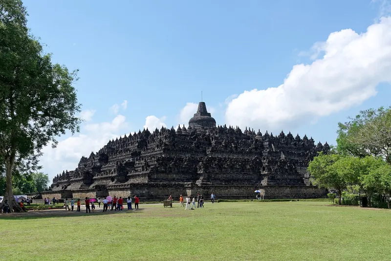
One night on the plateau lets you do the sunrise, the temples, the crater and the lakes in one unhurried morning. Two nights give you a spare dawn if the first one is clouded out, or time for Mount Prau. If you only have a single day from Yogyakarta, Borobudur is the better use of it; save Dieng for when you can sleep there.
Dieng Kulon, the village beside the Arjuna temples on the Banjarnegara side, is where the ministry's village page notes many homestays, from simple rooms to more comfortable ones; it is also the centre of the Dieng Culture Festival. Dieng Wetan, on the Wonosobo side, lies a short way east. The ministry advises booking ahead for holiday seasons and festivals, and the plateau is busiest at weekends.
The temples: Arjuna, Gatotkaca, Bima and the Kailasa Museum
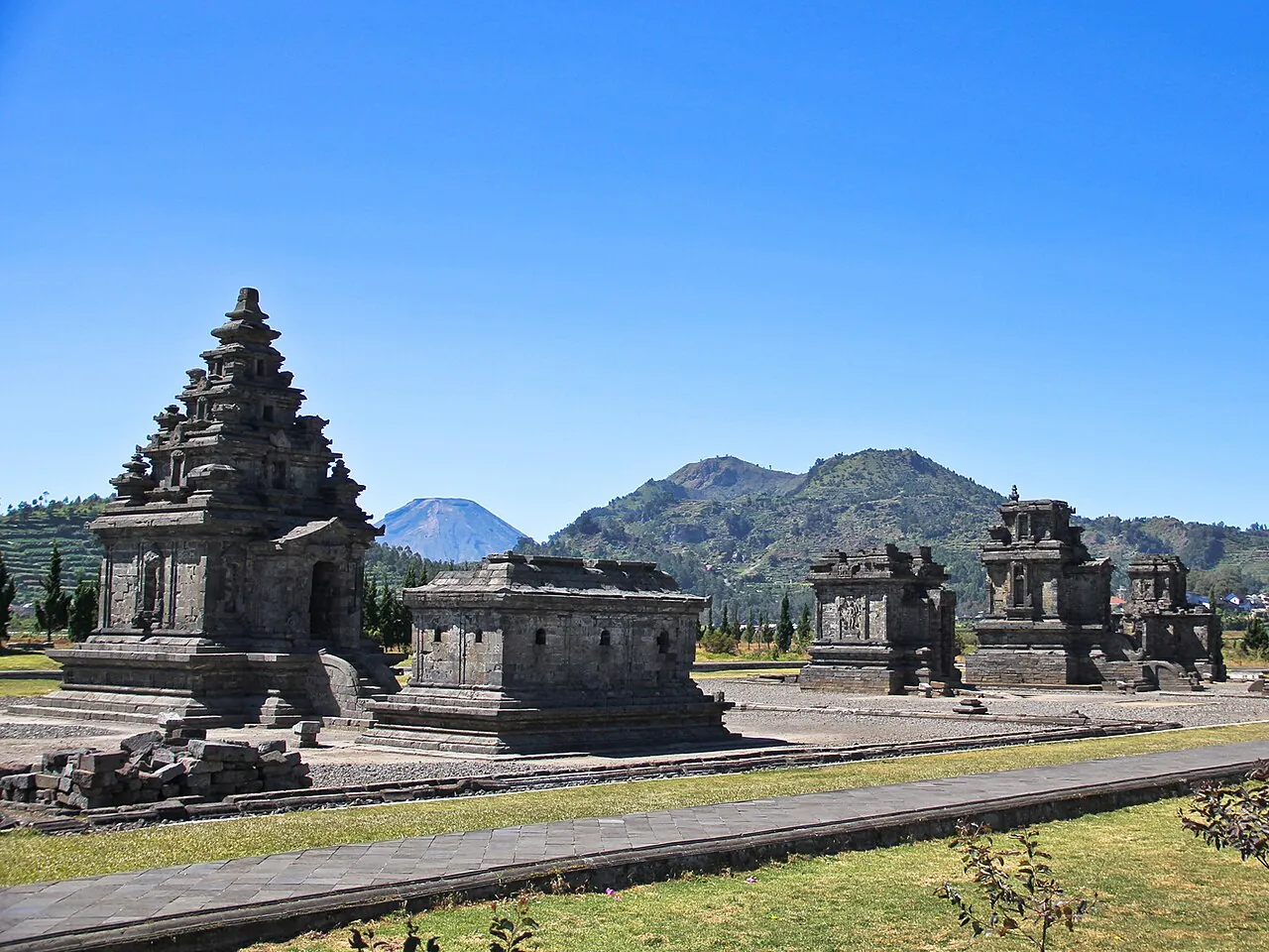
The Ministry of Tourism dates Dieng's Hindu temples to around the 7th and 8th centuries, which makes them some of the oldest temple sites in Java. Eight still stand: Arjuna, Semar, Srikandi, Puntadewa, Sembadra, Dwarawati, Bima and Gatotkaca. Their names come from heroes of the Mahabharata as told in Javanese wayang and were given by local people; the temples' original names and their builders are not known for certain.
The Arjuna group is the main site, a row of small stone shrines on a level lawn in the middle of the plateau. Banjarnegara's tourism office describes Arjuna as the northernmost of the row, a 6 by 6 metre Shiva temple facing west, with the smaller Semar temple facing it as a companion shrine. An inscription found nearby is dated to 731 Saka, about 808 CE, and is cited as the oldest known text in Old Javanese script. The office also notes that the temples were found standing in water in 1814 and that the lake around them was drained from 1856. The ministry says visitor numbers at the temple area are sometimes limited to protect the structures and the ground.
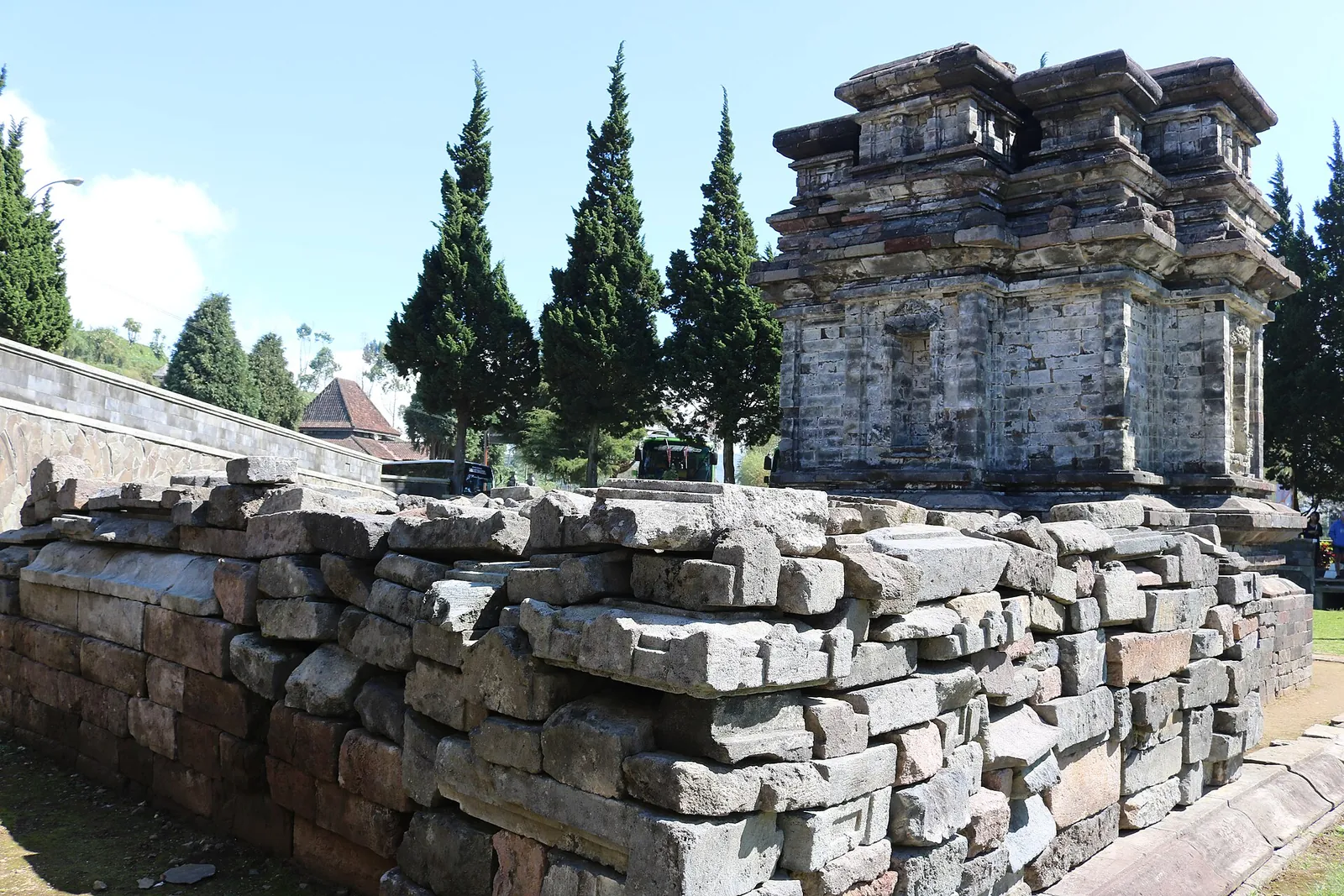
Candi Gatotkaca, a square shrine, stands near the Arjuna group, while Candi Bima stands apart on a rise to the south — the largest of the Dieng temples, with a tower that recalls temples in India more than those elsewhere in Java. The Kailasa Museum nearby, on a 560-square-metre site, keeps statues, makara, lingga and yoni and other carvings removed from the temples, and explains how the plateau formed — worth an hour when the afternoon mist comes in.
These are archaeological and religious sites: stay off the temple walls and roofs, and keep clear of any ritual or offering in progress.
Make time for the local food
What to eat and where to look
Mie ongklok
Wonosobo's signature dish: boiled yellow noodles with cabbage and chives under a thick broth of chicken or beef stock cooked with shallots, garlic, dried shrimp, sweet soy sauce and a little palm sugar, as the Ministry of Tourism describes it.
- Where to look
- Noodle shops in Wonosobo town, the dish's home, which you pass on the way up to the plateau.
- Fit it into your day
- A warming lunch on the drive up, or dinner after a cold day; the ministry notes it is almost always served with beef satay and tempe kemul.
Contains dried shrimp and is sweet and thick rather than clear; ask about the stock if you avoid beef.
Sate sapi and tempe kemul
The usual partners for mie ongklok: grilled beef satay with peanut or soy sauce, and tempe kemul, tempeh fried in a seasoned batter with chives, crisp outside and soft inside.
- Where to look
- The same mie ongklok shops; tempe kemul is also sold as a snack at warung.
- Fit it into your day
- Order the noodles, satay and tempe together as one meal.
Fried snacks are best eaten hot; check what oil and batter are used if you have allergies.
Carica
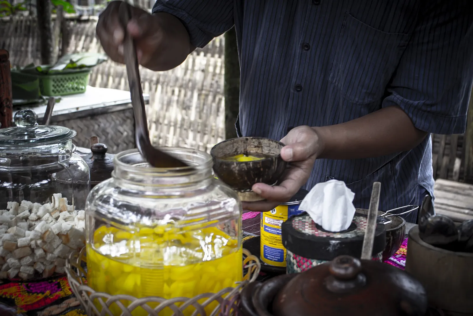
A small mountain papaya that the ministry says grows best in the Dieng highlands. It is rarely eaten raw; instead it is preserved in syrup and sold in cups and jars, sweet with a slight sourness.
- Where to look
- Souvenir (oleh-oleh) shops in Wonosobo.
- Fit it into your day
- A dessert or a souvenir to take home; the cups travel well.
Very sweet; jars of syrup count as liquids in hand luggage on flights.
Purwaceng
A highland herb of the Dieng plateau made into herbal drinks and coffee with a distinctive, warming taste, according to the ministry.
- Where to look
- Souvenir shops in Wonosobo and on the plateau, sold as powder, tea or coffee.
- Fit it into your day
- A hot drink after the Sikunir sunrise or in the cold evening.
It is sold as a herbal tonic rather than ordinary coffee; read the label to see what is in the blend.
Sikidang crater, Telaga Warna and the volcanic ground
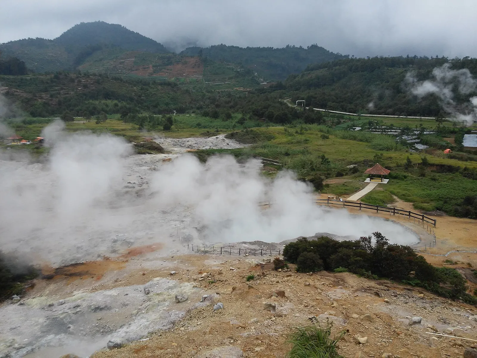
Dieng is an active volcanic complex, not an extinct one. The Geological Agency describes it as having several volcanic cones and fumarole fields across Banjarnegara, Wonosobo and Batang, and the ministry counts about 22 craters. Kawah Sikidang is the one most visitors see: Banjarnegara's tourism office describes a crater whose boiling grey mud and steam vents shift about and 'jump like a deer' (kidang), which gives it its name. Walk only on the marked paths and boardwalks, and bring a mask if sulphur fumes bother you.
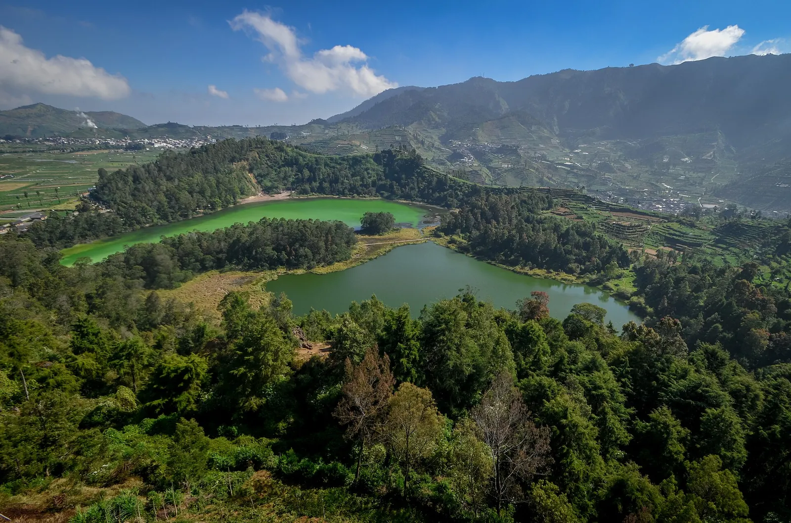
Telaga Warna, the 'Coloured Lake' in Kejajar district on the Wonosobo side, changes between green, yellow and blue; the ministry attributes this to its high sulphur content reflecting sunlight. Its neighbour Telaga Pengilon, the 'mirror lake', is clear and does not change colour; a path and a wooden bridge link the two. For the classic view of both lakes from above, climb to the Batu Pandang Ratapan Angin viewpoint, named for the wailing sound of the wind through the rocks.
Two craters are a real hazard rather than a sight. When the Geological Agency lowered Dieng's alert to Level I (Normal) in March 2023, it still recommended that visitors stay at least 500 metres from the rim of Kawah Sileri, where phreatic eruptions can happen without warning, and that nobody carry out activities at Kawah Timbang, which in 2013 released carbon dioxide at dangerous concentrations up to 2 km away. When we checked on 2026-10-03, MAGMA Indonesia listed Dieng at Level I (Normal). Check it again before you go, and obey closures and signs.
Sunrise: Sikunir Hill or Mount Prau
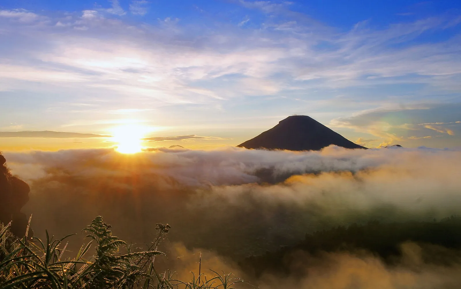
Sikunir Hill, above Sembungan village and Telaga Cebong, is the easier sunrise. The ministry describes a climb of 30 minutes to an hour on a stepped path, suitable for families, with a start at 03:00 or 04:00, and recommends warm clothes and sturdy shoes because the trail is cold and can be challenging. On a clear morning you look across a sea of cloud to Mount Sindoro and Mount Sumbing. Parking is near Telaga Cebong. Expect company: it is the plateau's most popular dawn.
Mount Prau, about 2,590 metres high and rising above the plateau, is a real hike rather than a walk. The ministry gives about 2–4 hours to the top, describes Patak Banteng in Kejajar as the most popular trail and the Dwarawati trail from Dieng Kulon as one of the quickest at 2.5–3 hours, and says every hiker must register at an official basecamp. Many hikers camp near the top to be there for sunrise. Avoid it in bad weather and carry a head torch and warm layers.
Tickets, opening hours, cold and the festival
Each site charges its own small entrance fee, and the official figures do not agree with each other. When we checked on 2026-10-03, the Ministry of Tourism's English Dieng page listed the tourist areas as generally open from 07:00 to 17:00 and gave approximate fees of IDR 10,000 for the Dieng area, IDR 20,000 for Sikidang Crater, IDR 22,500 for Telaga Warna and IDR 15,000 for the Arjuna temples, adding that prices may differ for international visitors. A separate ministry article on Wonosobo listed Telaga Warna at IDR 100,000–150,000 for international tourists, open 08:00–16:00, and Sikunir at IDR 15,000. Carry cash in small notes and expect the price at the gate to be the one that counts.
The ministry describes Dieng as cold all day and very cold before dawn and at night; bring a jacket, layers, a hat and gloves even if the rest of your trip is in beachwear. In the cold, clear mornings of the dry season the plateau can see frost, which locals call bun upas. The ministry also advises keeping an eye on your health at this altitude.
The Dieng Culture Festival, run by the community in Dieng Kulon, is held every August; its centrepiece is the ruwatan ritual cutting the naturally matted hair of the plateau's 'dreadlocked children', alongside parades, a lantern release and music. The 2026 edition ran from 28 to 30 August, according to the festival's official site. Rooms on the plateau sell out for it, so book early if you plan to go, or avoid those dates if you want quiet.
A workable one- or two-night plan
This is an editorial suggestion, not a timetable. Driving times depend on traffic and weather.
- Day 1: leave Yogyakarta or Semarang early, have mie ongklok in Wonosobo on the way up, and reach the plateau by midday. Visit the Kailasa Museum and the Arjuna temples if the mist holds off; otherwise rest and sleep early in Dieng Kulon or Dieng Wetan.
- Day 2: Sikunir Hill for sunrise (leave around 03:00–04:00), back for breakfast, then Telaga Warna and Pengilon with the Ratapan Angin viewpoint, Sikidang crater, Candi Bima and Candi Gatotkaca before the afternoon cloud. Drive down after lunch, or stay a second night.
- Day 3 (optional): a second chance at sunrise, or a hike up Mount Prau from a registered basecamp, then the return drive.
Practical questions
Can I visit the Dieng Plateau as a day trip from Yogyakarta?
You can, but it is a poor trade. The Ministry of Tourism gives a 3–5 hour drive each way, mist often covers the plateau by early afternoon, and a day trip cannot include the sunrise. One night on the plateau is far better.
Where should I stay on the Dieng Plateau?
In Dieng Kulon or Dieng Wetan, the two villages on the plateau, which are within walking distance of the Arjuna temples and closest to Sikunir. Wonosobo town, about 27 km below, has more choice but adds a drive before every sunrise.
How cold is Dieng?
Cold enough for a proper jacket, hat and gloves, especially before dawn and at night. In the dry season the plateau can see frost on clear mornings.
What is the best time to visit the Dieng Plateau?
The ministry recommends May or June to August for clearer weather and a chance of frost. Arrive before noon on any day, because mist often rolls in by early afternoon.
Is it safe to visit the craters?
Sikidang is a normal visitor site if you stay on the paths. When we checked on 2026-10-03, MAGMA Indonesia listed Dieng at Level I (Normal), but the Geological Agency still advises staying 500 m from the rim of Kawah Sileri and avoiding activity at Kawah Timbang because of carbon dioxide. Check the current level before you go.
How long is the Sikunir sunrise walk?
The ministry gives 30 minutes to an hour on a stepped path, starting at 03:00 or 04:00 to be at the top for sunrise.
Sources and checks before you travel
Reference sources for the version dated 3 October 2026. Confirm opening times, access, transport and conditions for your travel dates.
- Indonesia Travel (Ministry of Tourism): Dieng Plateau ↗ — opens in a new tab
- Indonesia Travel (Ministry of Tourism): Dataran Tinggi Dieng (Indonesian) ↗ — opens in a new tab
- Indonesia Travel: Dieng's Telaga Warna ↗ — opens in a new tab
- Indonesia Travel: Pieces of heaven in Wonosobo ↗ — opens in a new tab
- Indonesia Travel: Dieng Kulon tourism village ↗ — opens in a new tab
- Indonesia Travel: Dieng Plateau Temple Compound ↗ — opens in a new tab
- Indonesia Travel: Gunung Prau (Indonesian) ↗ — opens in a new tab
- Indonesia Travel: 7 must-try foods from Wonosobo (Indonesian) ↗ — opens in a new tab
- Banjarnegara Regency tourism office: Candi Arjuna ↗ — opens in a new tab
- Banjarnegara Regency tourism office: Kawah Sikidang ↗ — opens in a new tab
- Geological Agency (ESDM): Dieng lowered to Level I, 6 March 2023 ↗ — opens in a new tab
- MAGMA Indonesia (PVMBG): volcano activity levels ↗ — opens in a new tab
- Dieng Culture Festival (official site) ↗ — opens in a new tab
- Indonesia Travel: Dieng Culture Festival 2026 ↗ — opens in a new tab
- Indonesia Travel: Weather, climate and seasons ↗ — opens in a new tab
- Indonesia Travel: Karaton Ngayogyakarta ↗ — opens in a new tab
- Wikipedia: Dieng temples ↗ — opens in a new tab
- Wikivoyage: Dieng Plateau ↗ — opens in a new tab
- Wikipedia: Dieng Plateau ↗ — opens in a new tab
Does this experience fit your route?
If you cannot spend a night on the plateau, a guided tour with an early start is the simplest way to see Dieng before the mist. Check the pick-up time, the entrance fees included and the time you get back.
Check dates and details on Viator ↗ — opens in a new tabAffiliate link · Book with ViatorPhoto credits
The Arjuna temple group, the main temple site on the Dieng Plateau
Photograph: Uncredited — opens in a new tab · Public domain — opens in a new tab
Changes: Resized and converted to WebP; displayed with responsive crops. · Original photograph and licence details ↗ — opens in a new tab
Telaga Warna and Telaga Pengilon from the Batu Pandang Ratapan Angin viewpoint
Photograph: Haridi123 — opens in a new tab · CC BY-SA 4.0 — opens in a new tab
Changes: Resized and converted to WebP; displayed with responsive crops. · Original photograph and licence details ↗ — opens in a new tab
Steam vents at Kawah Sikidang, the most visited crater on the plateau
Photograph: AdeRiska — opens in a new tab · CC BY-SA 4.0 — opens in a new tab
Changes: Resized and converted to WebP; displayed with responsive crops. · Original photograph and licence details ↗ — opens in a new tab
Sunrise above the clouds from Sikunir Hill
Photograph: Hadiwibowo — opens in a new tab · CC BY-SA 4.0 — opens in a new tab
Changes: Resized and converted to WebP; displayed with responsive crops. · Original photograph and licence details ↗ — opens in a new tab
Candi Gatotkaca, near the Arjuna group
Photograph: M Yusril Mirza — opens in a new tab · CC BY-SA 4.0 — opens in a new tab
Changes: Resized and converted to WebP; displayed with responsive crops. · Original photograph and licence details ↗ — opens in a new tab
Es carica: Dieng's mountain papaya preserved in syrup
Photograph: Malikpb — opens in a new tab · CC BY-SA 4.0 — opens in a new tab
Changes: Resized and converted to WebP; displayed with responsive crops. · Original photograph and licence details ↗ — opens in a new tab