Sumatra · West Sumatra
Bukittinggi travel guide: Sianok Canyon, Harau, Maninjau and nasi kapau
Bukittinggi is a cool market town at about 930 metres in the Minangkabau highlands, on the rim of the forested Sianok Canyon. It is small enough to walk: the clock tower, the markets, the canyon rim and the Second World War tunnels are all close together. The reason to stay several nights is what lies around it — the cliffs of the Harau Valley, the caldera of Lake Maninjau and the horned roofs of the Minangkabau palace at Pagaruyung — and the food, because nasi kapau comes from a village just outside town.

- Suggested time
- 3–4 days
- Where to stay
- Bukittinggi town centre near Jam Gadang; a Harau Valley homestay or Lake Maninjau for a slower extra night
- Season and timing
- Cool all year at about 930 m, with temperatures of roughly 16–25 °C. Rain can fall in any month, so plan walks and viewpoints for the morning. Avoid driving up from Padang at weekends if you can, when traffic on the climb is heavy.
The short answer
Give Bukittinggi three nights. Spend the first day on foot in town: Jam Gadang and the markets, the Panorama park and Lobang Jepang on the canyon rim, then the walk down into Sianok Canyon and up to Koto Gadang. Use the next two days for full-day trips by hired car with a driver — west to Lake Maninjau, and east to the Harau Valley or south-east to Pagaruyung Palace. Sleep in the town centre near Jam Gadang; add a night in a Harau homestay or by the lake if you want the landscapes without the drive back. Arrive through Minangkabau International Airport (PDG) near Padang, about two hours away by road.
Sleep in the centre and walk the town first
Bukittinggi's centre is compact. Indonesia's Ministry of Tourism describes almost everywhere in town as within walking distance, and Wikivoyage puts the main sights 15 to 30 minutes' walk from each other. The obvious base is the area around Jam Gadang, the clock tower that the ministry describes as 26 metres tall and built under Dutch rule, with four large clock faces. Its plaza is the town's meeting point, and after dark hawkers set up nearby. Pasar Atas, the main market for clothes and souvenirs, and Pasar Bawah, for fruit and vegetables, are next to it.
From the clock tower, walk north to the old Dutch hill of Fort de Kock, the outpost founded in 1825 that gave the town its colonial name. Little more than a hilltop is left; the Limpapeh footbridge links it with Taman Bundo Kanduang, a park with a replica rumah gadang used as a museum of Minangkabau culture. The house where Mohammad Hatta, Indonesia's first vice-president, was born is also in town and is now a museum.
Bukittinggi is also a bus and minibus hub. Wikivoyage places the main terminal, Aur Kuning, about 2 km south-east of the centre; ride-hailing apps work in town. Most budget guesthouses and small hotels are within a few minutes of Jam Gadang, on and around Jalan Ahmad Yani and Jalan Teuku Umar; rooms near the mosques can be loud at prayer times.
Sianok Canyon, Lobang Jepang and the walk to Koto Gadang
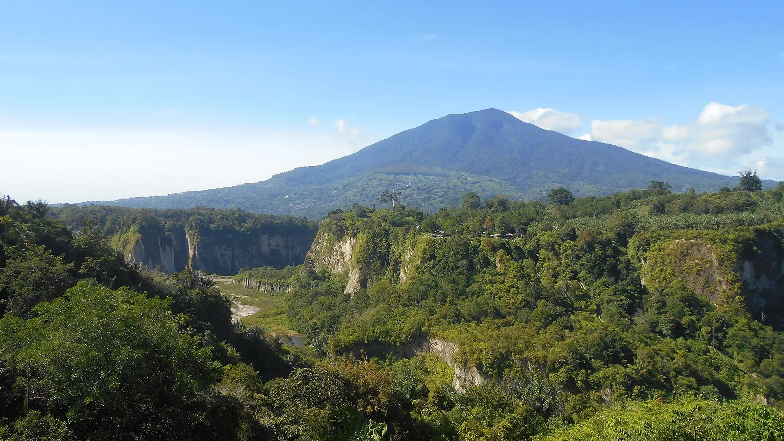
Ngarai Sianok, the Sianok Canyon, runs along the south-western edge of town, about 1 km from the centre. The ministry recommends it in early morning light, when the sun breaks through the mist in the valley with Mount Singgalang behind. Panorama Park, on Jalan Panorama, has gazebos, monkeys and a lookout tower of about 20 metres near the souvenir stalls.
Next to the park is Lobang Jepang, a network of tunnels dug during the Japanese occupation in the Second World War, when Bukittinggi was the headquarters of the Japanese 25th Army in Sumatra. The ministry gives it a length of about 1,470 metres and a depth of up to 40 metres, with rooms it describes as meeting rooms, ammunition stores and cells. Local guides offer to lead you through; Wikivoyage notes that the tunnels are not large enough to get lost in, so a guide is mainly for the history.
Then walk the canyon rather than just looking at it. The ministry describes a path down to the settlement and paddy fields on the canyon floor, across a bridge over the river and up the other side to Koto Gadang, a village known for its silver filigree. The stepped wall-like path between Panorama Park and Koto Gadang, Janjang Koto Gadang, is often compared to a miniature Great Wall. Wear shoes with grip, carry water, and allow half a day if you want to browse the silversmiths.
Make time for the local food
What to eat and where to look
Nasi kapau
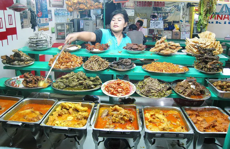
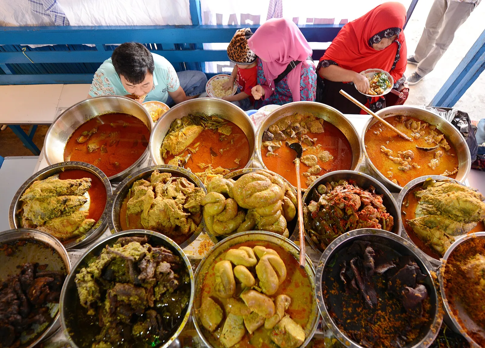
Rice with a choice of curries and side dishes from Nagari Kapau, a village just outside Bukittinggi. The ministry singles out its tangy flavour, from asam kandis and tamarind, and the way the cook scoops each dish from the pots with a long-handled ladle as you point.
- Where to look
- Lapau nasi kapau, the traditional stalls, especially at Pasar Ateh (Pasar Atas) in the centre, which the ministry recommends.
- Fit it into your day
- A long lunch on your town day; choose two or three dishes rather than a full spread.
Many of the side dishes contain offal or are very spicy; point to what you want.
Gulai kapau and gulai tambusu
The two signature curries of a nasi kapau counter: gulai kapau, young jackfruit in a yellow coconut-milk curry with turmeric, galangal and chilli, and gulai tambusu, beef intestine stuffed with a spiced mix of egg and tofu.
- Where to look
- Any nasi kapau stall; the jackfruit curry is usually ladled onto the rice by default.
- Fit it into your day
- Order them with your nasi kapau, plus sambal on the side.
Tambusu is offal; ask for it to be left off if you prefer.
Rendang and dendeng batokok
Rendang is meat cooked slowly for a long time in coconut milk and spices, the best-known Minangkabau dish. Dendeng batokok is thin beef pounded flat, grilled and topped with chilli sambal; balado versions are fried crisp in a chilli and shallot paste.
- Where to look
- Minangkabau rice restaurants throughout town, most of which serve the Padang style of cooking with many dishes set out at once.
- Fit it into your day
- A dinner with rice and two or three other dishes to share.
Spicy and rich; ask for sambal separately if you are unsure.
Dadiah
A traditional fermented milk, like yoghurt, made from buffalo milk and usually eaten for breakfast with emping (crisp rice flakes) and palm sugar, or alongside rice.
- Where to look
- The Pasar Atas area of Bukittinggi, where the ministry names a long-standing dadiah stall.
- Fit it into your day
- Breakfast or a mid-morning snack before the canyon walk.
A dairy product with a sour edge; try a small portion first if you are not used to it.
Keripik balado and kue bika
The snacks people take home from Bukittinggi: keripik balado, spicy cassava chips in a chilli coating, and kue bika, a sweet made from coconut, rice flour and palm sugar.
- Where to look
- Pasar Atas and the snack shops on the Padang road; bika is associated with Koto Baru, between Padang Panjang and Bukittinggi.
- Fit it into your day
- Buy fresh bika to eat warm on the road, and chips for later.
Check the packing date on market snacks; fresh batches taste better.
Day trips: Maninjau to the west, Harau and Pagaruyung to the east
The two classic day trips from Bukittinggi go in opposite directions, and Wikivoyage notes that each takes most of a day. A rented car with a driver, which the ministry names as the most private way to get around, is the simplest way to do either; check that the price covers fuel, parking and entry tickets.
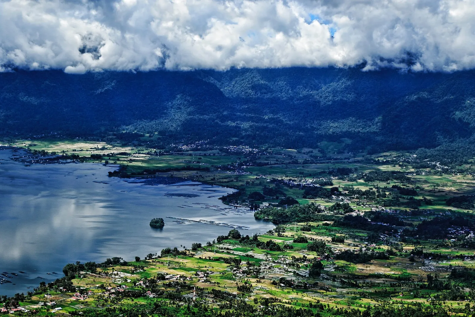
Lake Maninjau lies about 36 km west of Bukittinggi. It fills a volcanic caldera roughly 16 km long and 7 km wide, with its surface at about 461 metres according to the ministry. The road down to the shore drops through the Kelok 44, a series of numbered hairpin bends with views over the water; Puncak Lawang, high above the lake, is a viewpoint and a paragliding take-off. On the lake you can take a boat, fish or cycle the shore road.
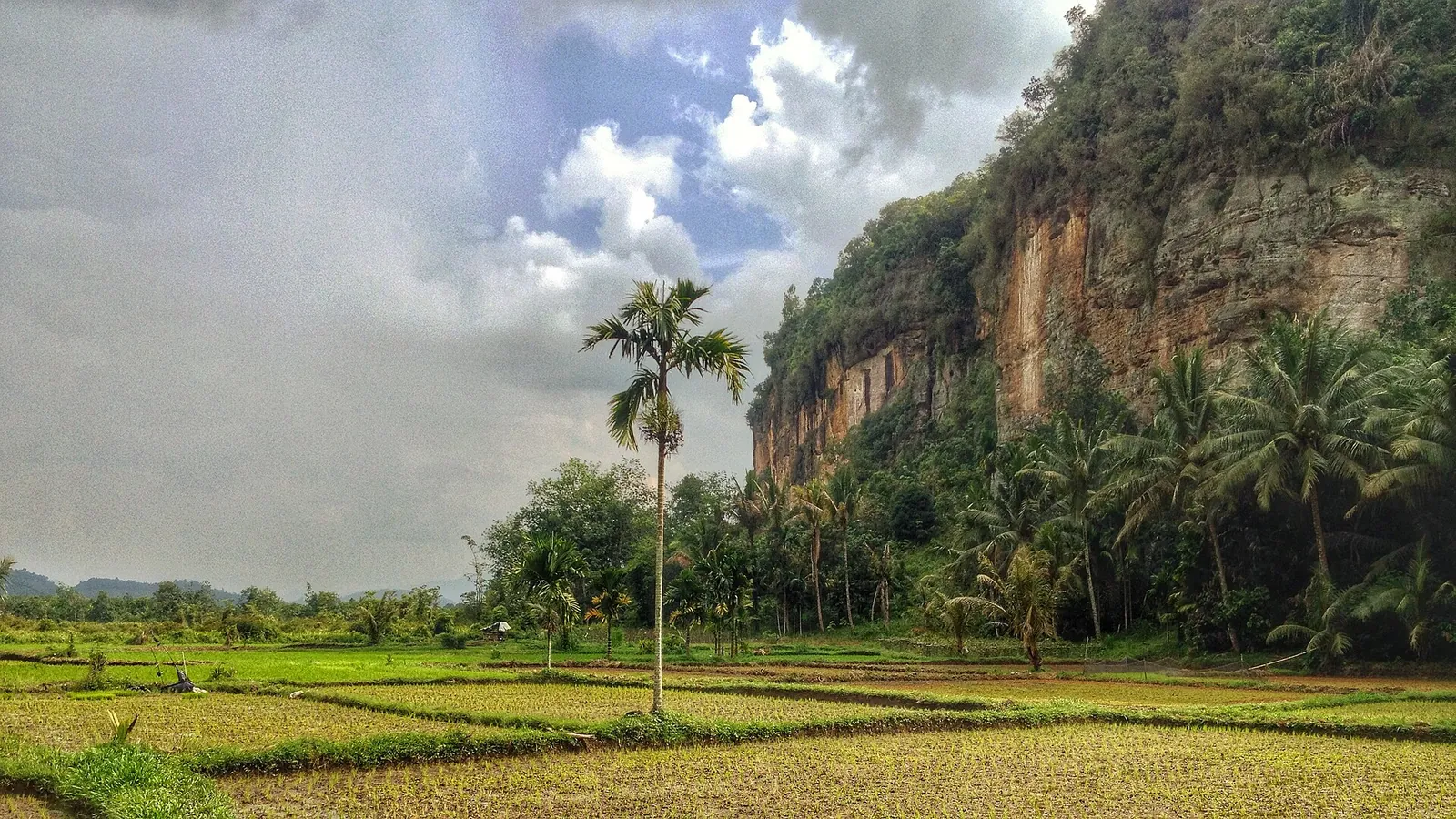
To the east, the Harau Valley near Payakumbuh is a flat-bottomed valley of rice fields enclosed by sheer cliffs that the ministry says reach 100 to 300 metres, with waterfalls, caves and hiking paths. Wikivoyage puts it about an hour's drive from Bukittinggi. It is worth a night in one of the valley's homestays for the morning light on the cliffs.
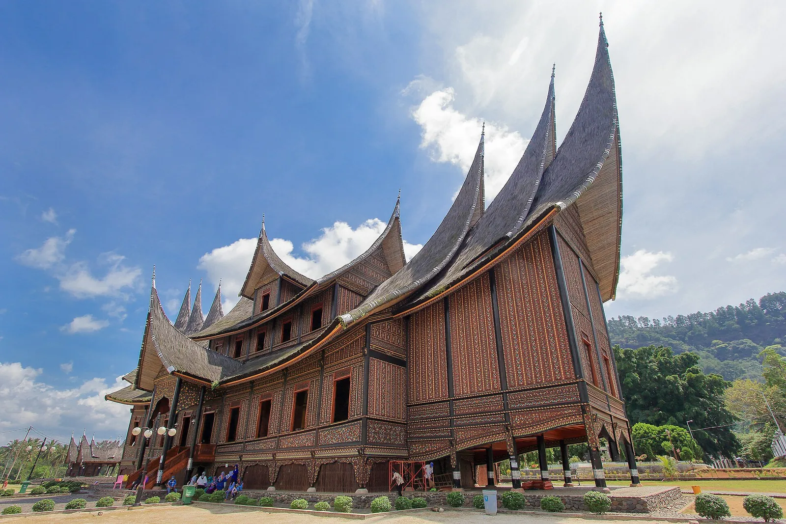
South-east, near Batusangkar in Tanah Datar, Istano Basa Pagaruyung is a rebuilt royal palace of the Minangkabau in the rumah gadang style, with tiers of horn-shaped gonjong roofs. The palace burned in 1804, 1966 and 2007, after lightning struck the roof; the current building was completed in 2013 and works as a museum. The ministry mentions heirlooms, traditional dress and weapons inside, and costume hire for photographs. Tours on this side often add the weaving and carving village of Pandai Sikek.
Mount Marapi: look, but check before going higher
Mount Marapi, the active volcano east of town, dominates the view from Bukittinggi. When we checked on 2026-10-03, MAGMA Indonesia, the government's volcano monitoring service, listed Marapi at Level II (Waspada) in its report for 2 October 2026 and asked visitors and climbers not to enter or carry out any activity within 3 km of the Verbeek crater. Residents of the river valleys that start at the summit were warned to watch for lahars, especially in the rainy season.
None of the sights in this guide lies within that radius, but treat any offer of a Marapi climb with caution and read MAGMA's current report first. If ash falls, the agency advises wearing a mask and protecting your eyes.
A workable three-day plan
This is an editorial suggestion, not a timetable. Ask your driver about road conditions the evening before each day trip.
- Day 1 — Town and canyon: Panorama Park at the start of the day, Lobang Jepang, then the walk through Sianok Canyon to Koto Gadang; Jam Gadang, the markets and nasi kapau in the evening.
- Day 2 — Lake Maninjau: down the Kelok 44 to the lake, lunch by the water, and back via Puncak Lawang for the view from above.
- Day 3 — Harau or Pagaruyung: the Harau Valley cliffs and waterfalls, or the palace at Pagaruyung with Pandai Sikek on the way; staying overnight in Harau makes either easier.
- Day 4 (optional): Fort de Kock, the Bung Hatta birthplace museum and the markets before the drive to Padang.
Getting to Bukittinggi and moving on
The gateway is Minangkabau International Airport (PDG) at Ketaping in Padang Pariaman, which has domestic flights from Jakarta, Medan and other cities and international flights from Malaysia and Singapore. The ministry gives about two hours for the flight from Jakarta. From the airport, the ministry suggests a taxi or bus to Bukittinggi; the road climbs about 90 km from the Padang area through the Anai Valley to the Agam plateau, which the ministry describes as a two-hour drive.
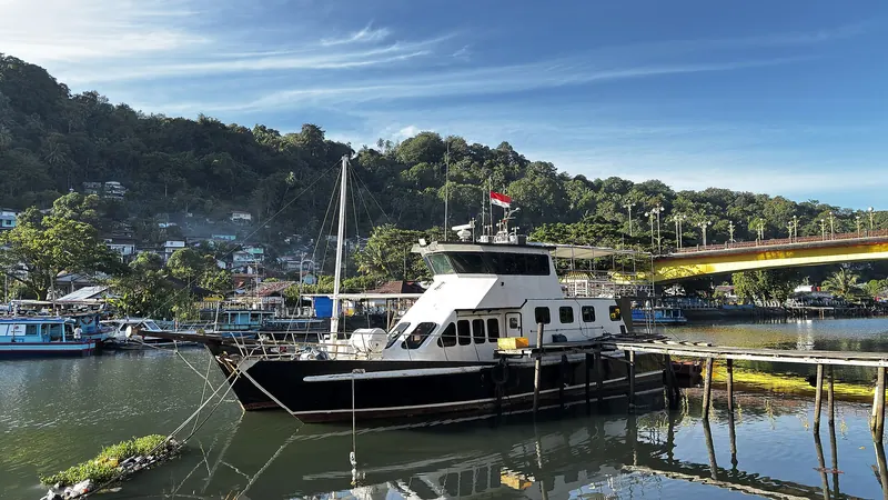
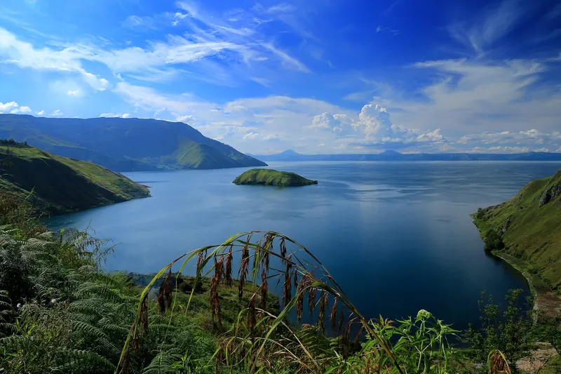
From Padang itself, the ministry mentions frequent local buses and cheaper shared minivans to Bukittinggi. The highlands combine well with a night or two in Padang for its old waterfront, beaches and food, and Padang is also the starting point for the Mentawai Islands. Long-distance buses link Bukittinggi with Lake Toba and Medan to the north, but the road is winding and the journey takes most of a day and night; flying from Padang to Medan is the faster alternative.
Practical questions
How many days do I need in Bukittinggi?
Three nights cover a day in town and Sianok Canyon plus two full-day trips — Lake Maninjau to the west, and the Harau Valley or Pagaruyung Palace to the east. Add a fourth night, in Harau or by the lake, if you want a slower pace.
How do I get from Padang airport to Bukittinggi?
Minangkabau International Airport (PDG) is near Padang. The Ministry of Tourism suggests a taxi or bus for the onward journey, a drive of about two hours to Bukittinggi. Shared minivans and buses also run from Padang.
Can I walk from Bukittinggi into Sianok Canyon?
Yes. A path leads down from the edge of town to the paddy fields and settlement on the canyon floor, across the river and up to the silver-working village of Koto Gadang. Panorama Park and Lobang Jepang are on the rim, about 1 km from the centre.
Is it worth staying in the Harau Valley?
If you have the time, yes. It is about an hour's drive from Bukittinggi, and a night in one of the valley's homestays lets you see the cliffs in the morning without driving back and forth.
Is Mount Marapi safe to climb?
Check MAGMA Indonesia first. On 2026-10-03 its latest report listed Marapi at Level II (Waspada) and asked visitors and climbers to stay out of a 3 km radius around the Verbeek crater.
What is the difference between nasi kapau and nasi padang?
Both come from West Sumatra, but at a nasi kapau stall the cook ladles the dishes you point at onto your rice from behind a counter, while nasi padang restaurants traditionally bring many dishes to the table. Nasi kapau is known for a tangier flavour and for gulai tambusu.
Sources and checks before you travel
Reference sources for the version dated 3 October 2026. Confirm opening times, access, transport and conditions for your travel dates.
- Indonesia Travel (Ministry of Tourism): Bukittinggi ↗ — opens in a new tab
- Indonesia Travel: Ngarai Sianok ↗ — opens in a new tab
- Indonesia Travel: Lobang Jepang ↗ — opens in a new tab
- Indonesia Travel: Jam Gadang ↗ — opens in a new tab
- Indonesia Travel: Lembah Harau ↗ — opens in a new tab
- Indonesia Travel: Danau Maninjau ↗ — opens in a new tab
- Indonesia Travel: Istano Basa Pagaruyung ↗ — opens in a new tab
- Indonesia Travel: Nasi Kapau, a culinary treasure from Bukittinggi ↗ — opens in a new tab
- Indonesia Travel: Makanan khas suku Minangkabau ↗ — opens in a new tab
- Indonesia Travel: West Sumatra ↗ — opens in a new tab
- Indonesia Travel: Padang ↗ — opens in a new tab
- MAGMA Indonesia: Marapi activity report, 2 October 2026 ↗ — opens in a new tab
- MAGMA Indonesia: volcano activity levels ↗ — opens in a new tab
- Wikipedia: Bukittinggi ↗ — opens in a new tab
- Wikipedia: Pagaruyung Palace ↗ — opens in a new tab
- Wikipedia: Lake Maninjau ↗ — opens in a new tab
- Wikipedia: Minangkabau International Airport ↗ — opens in a new tab
- Wikivoyage: Bukittinggi ↗ — opens in a new tab
- Wikivoyage: Harau Valley ↗ — opens in a new tab
Photo credits
Jam Gadang and its plaza on a busy weekend, the centre of Bukittinggi
Photograph: Adhmi — opens in a new tab · CC BY-SA 4.0 — opens in a new tab
Changes: Resized and converted to WebP; displayed with responsive crops. · Original photograph and licence details ↗ — opens in a new tab
Sianok Canyon and Mount Singgalang, seen from above Lobang Jepang on the edge of town
Photograph: Firzafp — opens in a new tab · CC BY-SA 4.0 — opens in a new tab
Changes: Resized and converted to WebP; displayed with responsive crops. · Original photograph and licence details ↗ — opens in a new tab
Istano Basa Pagaruyung near Batusangkar, the rebuilt royal palace of the Minangkabau
Photograph: Herusutimbul — opens in a new tab · CC BY-SA 4.0 — opens in a new tab
Changes: Resized and converted to WebP; displayed with responsive crops. · Original photograph and licence details ↗ — opens in a new tab
Lake Maninjau from Lawang on the caldera rim west of Bukittinggi
Photograph: seven red — opens in a new tab · CC0 — opens in a new tab
Changes: Resized and converted to WebP; displayed with responsive crops. · Original photograph and licence details ↗ — opens in a new tab
Rice fields under the cliffs of the Harau Valley near Payakumbuh
Photograph: https://www.flickr.com/people/fitri-agung — opens in a new tab · CC BY 2.0 — opens in a new tab
Changes: Resized and converted to WebP; displayed with responsive crops. · Original photograph and licence details ↗ — opens in a new tab
Nasi kapau dishes laid out for diners to choose from
Photograph: Erisonjkambari — opens in a new tab · CC BY-SA 4.0 — opens in a new tab
Changes: Resized and converted to WebP; displayed with responsive crops. · Original photograph and licence details ↗ — opens in a new tab