Itineraries · Vietnam
Ha Giang Loop in 4 days: day-by-day route, overnight stops and Cao Bang
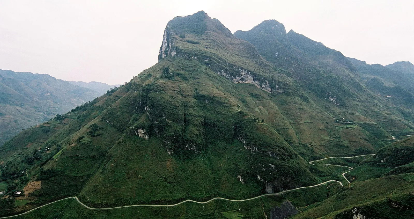
The Ha Giang Loop is not a loop you can rush. The road climbs from Ha Giang city onto the Dong Van Karst Plateau, a UNESCO Global Geopark, crosses the Ma Pi Leng Pass above the Nho Que River and comes back down the Gam River valley, and every stage is short on the map and long in the saddle. This plan follows the four-day route published by the Vietnam National Authority of Tourism, night by night, and adds what the official outline leaves open: where a slower traveller should sleep instead, how the days change with a local driver or a car, and how to keep going east into Cao Bang instead of turning back.
- Suggested time
- 4 days on the road plus a travel day each way from Hanoi; 2–3 more days with the Cao Bang extension
- Where to stay
- Ha Giang city, Yen Minh, Dong Van, Meo Vac or Bao Lam, then Ha Giang city again (or Cao Bang city for the extension)
- Season and timing
- The national tourism site calls September to November a good time for cooler weather, April to June pleasant and warm, and July and August very hot with regular monsoon rain. Buckwheat flowers bloom from October to December, and the 2026 Buckwheat Flower Festival opens in Dong Van on 6 November.
The short answer
Give it six days from Hanoi: a travel day up to Ha Giang city (about six hours by bus from My Dinh), four days on the road and a travel day back. Sleep in Ha Giang city, then Yen Minh, then Dong Van, then either Meo Vac (a shorter third day, with the afternoon free around Ma Pi Leng) or Bao Lam (the official route, which leaves day four with less ground to cover), and Ha Giang city again on the last night. Unless you are an experienced rider with a licence that is valid in Vietnam, do it on the back of a local driver's motorbike (an easy rider) or in a car with a driver. To see Cao Bang too, turn east at Bao Lam instead of west and add two or three days via Ban Gioc before taking the bus back to Hanoi from Cao Bang city.
How the four days fit together
The national tourism site's route runs northeast on National Road 4C from Ha Giang city across the plateau to Bao Lam, then southwest on National Road 34 back to Ha Giang. The two roads meet at both ends: the northern end of 4C now joins 34 in Ly Bon commune in Cao Bang province, which is why Bao Lam, the official third night, is already in Cao Bang. That geometry is what makes the Cao Bang extension possible later in this guide.
The stops along the way are small mountain towns, each a natural end to a day: Yen Minh after the first passes, Dong Van, the largest town on the loop, after the high karst, and Meo Vac or Bao Lam on the far side of Ma Pi Leng. Book these nights ahead. The official route's own advice is to contact a local travel company for homestays and itineraries, because the best-known places sell out quickly in the busy season, especially around the buckwheat-flower weeks in November.
Treat the times as loose. Mèo Vạc is only 24 kilometres from Dong Van, and the tourism site still says the ride takes most of a morning if you stop for the views. Roadworks and obstacles appear without warning, and its safety advice is to take curves carefully, travel in daylight and stop once it gets dark. A day that starts at breakfast and ends before sunset is the right size, so the plan below never puts two big sights in the same afternoon.
Day 0 and Day 1: Hanoi to Ha Giang, then over Heaven's Gate to Yen Minh
Day 0 — Hanoi to Ha Giang city. Ha Giang city is about 300 kilometres from Hanoi. According to the national tourism site, buses leave My Dinh bus station day and night, from sleeper coaches to smaller minivans, and take around six hours; private transfers and packaged tours from Hanoi are the alternative. Take a day bus and sleep in Ha Giang city, or stay in Thon Tha, a village of stilt-house homestays a few minutes outside the city. If you ride yourself, this is the evening to collect the bike: rental shops are in Ha Giang city, and so are Honda and Kawasaki service centres. An overnight bus that drops you at dawn and a first day straight into the passes is the combination to avoid.
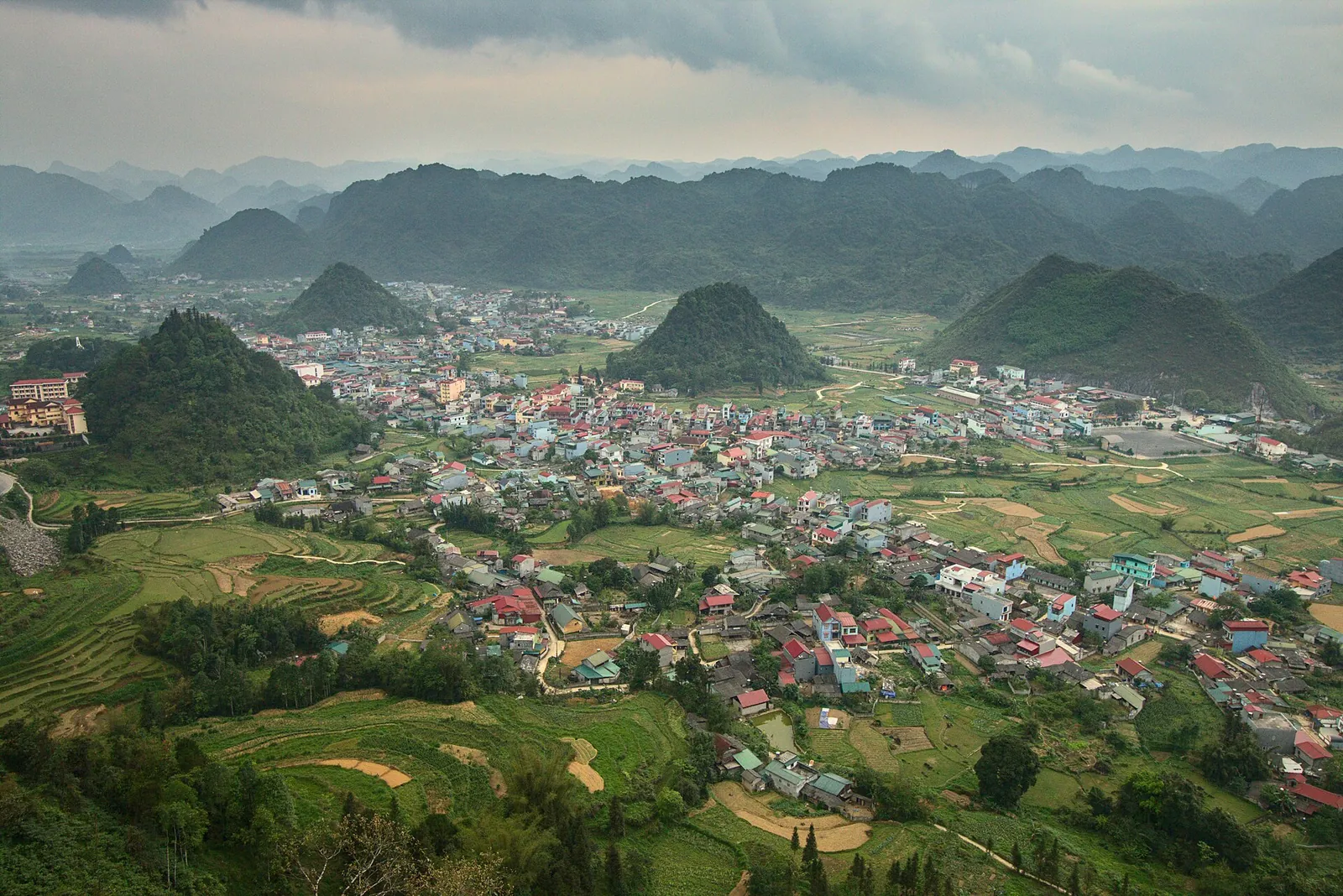
Day 1 — Ha Giang city to Yen Minh. Heading north on 4C, the road climbs into forested limestone and onto the Dong Van Karst Plateau. The first big view is the Quan Ba Pass, called Heaven's Gate, the entrance to the geopark; the tourism site recommends a coffee on the veranda of Cafe Cong Troi above the hairpins. Below the pass, lunch in Tam Son, the Quan Ba town, where roadside restaurants serve northern Vietnamese food.
If you have time before lunch, the Lung Tam linen co-operative in the foothills of Quan Ba is a social enterprise run by Flower Hmong women, where you can watch hemp being spun, dyed with plants and woven. In the afternoon the road follows the Mien River and climbs through a canyon to Yen Minh for the night.
Make time for the local food
What to eat and where to look
Banh cuon in Dong Van
Steamed rice rolls filled with pork, wood-ear mushrooms and egg, served with a bowl of hot broth with chives and pork sausage (cha). The national tourism site picks it out as the traditional Dong Van breakfast.
- Where to look
- Breakfast shops in Dong Van's old quarter; the tourism site names Banh Cuon Gia Truyen on Pho Co Street.
- Fit it into your day
- Breakfast on day three, before Ma Pi Leng.
Contains pork and egg; ask for it without the sausage if you prefer.
Thang co (Hmong meat stew)
A traditional Mong dish whose name means meat soup. It was originally made with horse meat; the tourism site says many restaurants now use buffalo, beef or pork for visitors. The broth, simmered from bones and offal with about a dozen spices such as star anise and cardamom, is the point.
- Where to look
- Market stalls and local restaurants in the plateau towns, especially on market mornings in Dong Van or Meo Vac.
- Fit it into your day
- A warming lunch on day two or three, eaten with men men (steamed ground maize) as locals do.
Usually contains offal and may be horse; ask what is in the pot. It is traditionally served with corn wine, which you should skip if you are riding.
Bac Me bamboo-tube rice
Rice cooked inside a section of bamboo, one of the dishes of the Ha Giang plateau listed by the national tourism site alongside Dong Van's rice rolls.
- Where to look
- Ask at the food stalls in Bac Me, the official lunch stop on day four.
- Fit it into your day
- Lunch, or food for the road, on the ride back along the Gam River.
Filling but plain; eat it with whatever meat or vegetable dishes the stall has.
Au tau porridge (chao au tau)
A rich sticky-rice porridge made with au tau, a local tuber that the Mong soak and simmer for hours before cooking it with bone broth; it is eaten with minced pork, pepper and spring onions and has a faint bitterness.
- Where to look
- Ask your hosts in Dong Van or Meo Vac where it is made.
- Fit it into your day
- A warming supper on a cold evening after a day on the passes, especially in winter.
Contains pork and bone broth, and it is very rich.
Buckwheat cakes
Simple cakes of ground buckwheat seed, the crop whose flowers cover the plateau in autumn. The tourism site also lists buckwheat noodles, pho, beer and wine.
- Where to look
- Roadside sellers and markets on the plateau, especially in the flowering season.
- Fit it into your day
- A snack at a viewpoint stop on day one or two.
Plain and lightly sweet; ask what is in the dough if you have allergies.
Day 2: Yen Minh to Dong Van via the Hmong King's Palace and Lung Cu
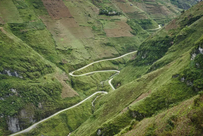
This is the longest day if you take every detour, so start early. Above Yen Minh the road rises above the tree line onto bare, eroded karst. Stop at Doc Chin Khoanh, the Nine Turn Pass, to look down on the bends you are about to ride, then take a fuel and food stop in the Sa Phin valley. Sa Phin is also where the Hmong King's Palace stands among pines: a wood-framed residence in Chinese style, built in 1902 for the Hmong leader Vuong Chinh Duc, entered through carved wooden doors into three connected courtyards.
The official route then adds a detour of about three hours to the Lung Cu Flag Tower on the northern border, with 360-degree views into China. The national tourism site suggests arriving in the late afternoon when the heat has eased, since there are about 200 steps to climb. That timing only works if you are in Dong Van before dark, so if the morning ran long, save Lung Cu for an early start on day three and accept a later arrival at Ma Pi Leng.
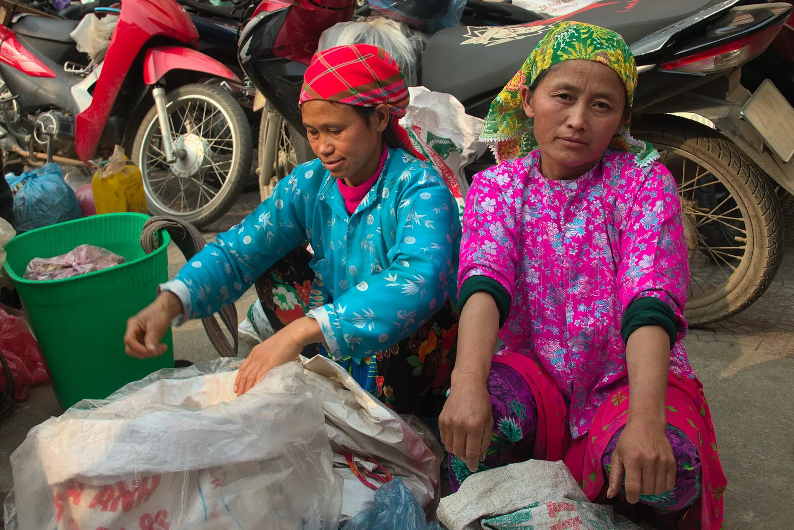
Sleep in Dong Van. It is the largest town on the loop and has an old quarter, and a 20-minute walk takes you up to the Don Cao fortress above the town for the view. Markets are a big part of the plateau's life, but their days change, so the official advice is to ask your host in Dong Van for the dates and times. If one falls on your morning, go early, ask before photographing anyone, and remember that it is a working market, not a performance.
Day 3: Ma Pi Leng to Meo Vac, then a choice of night
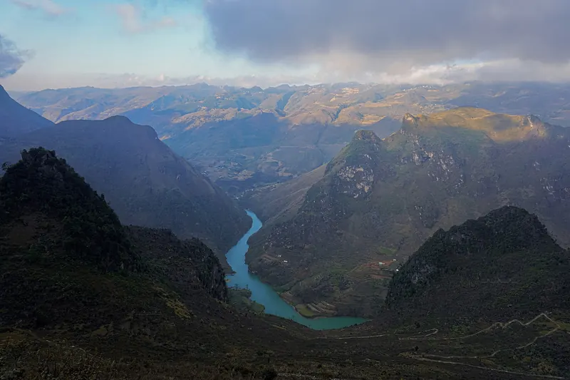
Have breakfast in Dong Van: the tourism site's pick is banh cuon, steamed rice rolls with a bowl of hot broth, at Banh Cuon Gia Truyen on Pho Co Street. Then ride the stretch it calls arguably the most spectacular road in Vietnam, from Dong Van over the Ma Pi Leng Pass, with the Nho Que River far below. It is 24 kilometres to Meo Vac, and with stops it takes most of the morning.
Two ways to see the river more closely. For a ride, the official route suggests turning left off 4C at the bottom of the pass onto side road 193A, a short road with views down to the Nho Que. On foot, the sky path is a steep small road and path that climbs through Flower Hmong villages to a neighbouring peak, about 500 metres in total and a two-hour walk according to the tourism site, with views over the river and the Happiness Road, which it says took 1,300 volunteers seven years to build. Wear proper shoes.
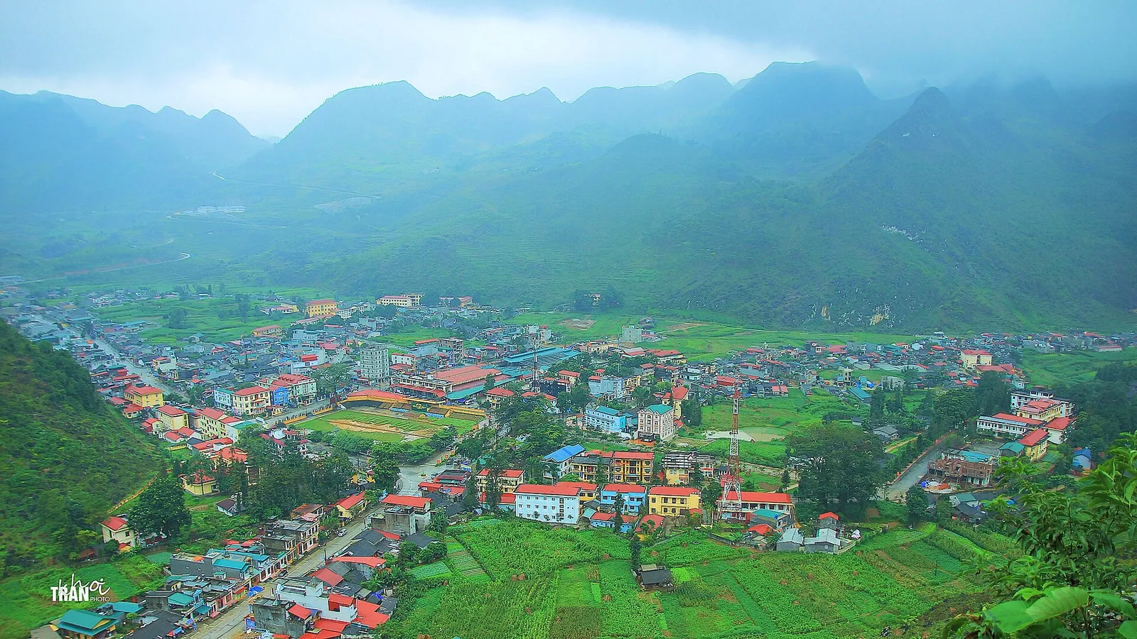
Then decide where to sleep. Meo Vac, which the tourism site calls a quaint town with more than a few options for lunch, is the choice if you want the afternoon for the sky path or the river road. Bao Lam, a small, remote place further east where the official route stops, makes the last day back to Ha Giang shorter, and it is where the Cao Bang extension begins. Organised trips do not all stop in the same place, so ask your easy rider or tour company which town they use If you sleep in Meo Vac and still return along the Gam River, day four also has to cover the road from Meo Vac to Bao Lam.
Day 4: back to Ha Giang along the Gam River
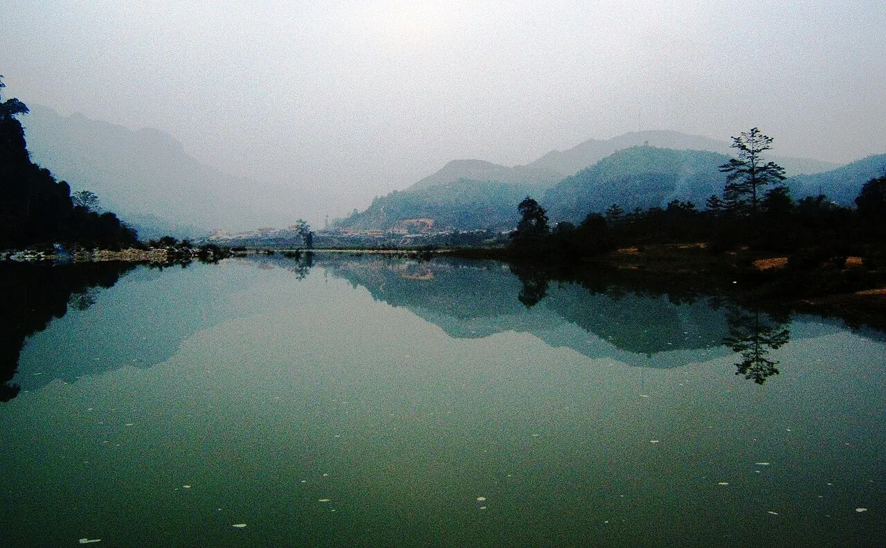
From Bao Lam, National Road 34 runs southwest towards Ha Giang, following the Gam River for most of the way. There are still bends and a few passes, but the tourism site describes nothing as hard as the previous days. Stock up on food before you leave, because there are fewer towns on the last stretch into the city.
Stop in Bac Me for lunch at one of the food stalls. Bac Me bamboo-tube rice is one of the plateau's dishes listed by the national tourism site, so look out for it there. Arrive in Ha Giang city in the afternoon, hand the bike back in daylight and sleep there. Do not book an international flight from Hanoi for the day after the loop. Take the bus back on day five and fly the day after if you can.
Riding yourself, an easy rider or a car: what changes
The national tourism site lists three ways to do the loop: rent a motorbike in Ha Giang city if you are an experienced rider, book a tour on the back of a motorbike, or go by private car. The route and the overnight stops are the same for all three. What changes is who does the concentrating and how tired you are at the end of each day.
- Riding yourself: only if you already ride confidently at home and hold a licence that is valid in Vietnam. The UK government tells British travellers they need the 1968 international driving permit with their UK licence, that riding without third-party insurance is illegal and that helmets are compulsory for rider and passenger. In April 2026, after a young British traveller died following a motorbike accident on the loop, Viet Nam News reported stepped-up police patrols from Ha Giang to the plateau, focused on tour drivers and foreigners renting vehicles, and checking licences, speed, lane discipline, alcohol and helmets.
- An easy rider: a local driver with you on the back, the usual choice for non-riders. Your days are less tiring and you can look at the view on the passes. Ask who the driver is, what helmet you will get, which town the third night is in and what happens on a day of heavy rain. Viet Nam News reported one large Ha Giang operator sending nearly 100 of its pillion drivers to a traffic-police safety training in April 2026; ask any company whether its drivers have had similar training.
- A car with a driver: loses the open-air feel but makes long detours such as Lung Cu and wet days much easier, and it is the sensible choice with children. With a car, the Meo Vac night and a longer final day are less of a strain than on a pillion seat.
- Whichever you choose: check that your travel insurance covers the way you are travelling, carry your passport, and confirm in writing whether a border-area permit is needed and included (see the FAQ).
The Cao Bang extension: turn east at Bao Lam
Because National Road 34 links Ha Giang with Cao Bang, you do not have to ride back the way you came. Instead of turning southwest at Bao Lam on day four, follow 34 east through Bao Lac and Nguyen Binh to Cao Bang city. Around Bao Lac, Cao Bang's tourism portal points to one more famous bend: the Khau Coc Cha pass on National Road 4A, about 2.5 kilometres with 14 hairpins, between Xuan Truong and Bao Lac communes. Treat it as a detour for an experienced rider or a hired driver. We could not find an official driving time for Bao Lam to Cao Bang city, so plan it as a full day and ask your driver.
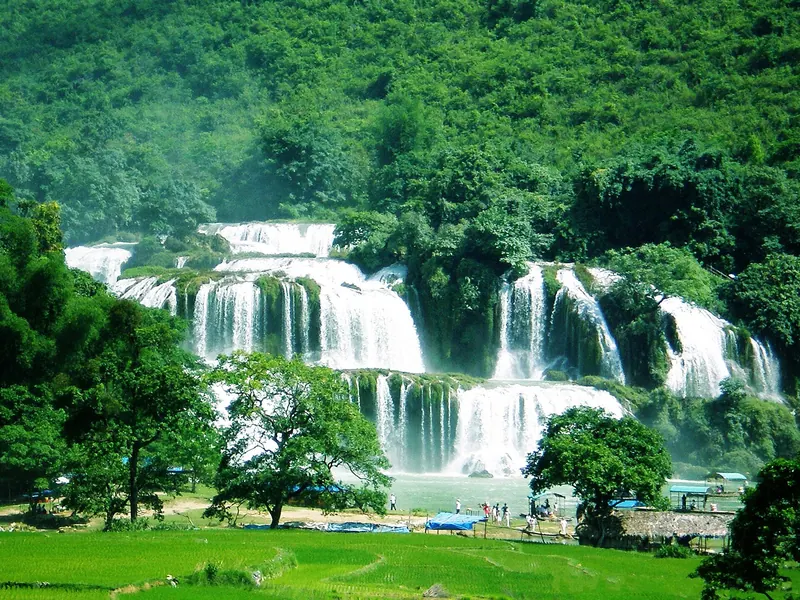
In Cao Bang city, which the national tourism site describes as a base with a small but contemporary choice of hotels, shops and restaurants, spend the next day at Ban Gioc Waterfall, about 92 kilometres from the city according to the provincial portal. Sleep near the falls or back in the city, then take the bus to Hanoi: day and overnight buses run between Cao Bang and My Dinh bus station, about 280 kilometres and around eight hours according to the tourism site. Our Cao Bang guide has the details for the falls, the cave and the stone villages.
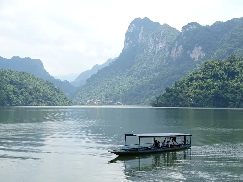
This works best with a car and driver or an easy-rider company that runs one-way trips, because a rental bike from Ha Giang has to go back to Ha Giang. Ask the rental shop before you set off; do not assume it can be dropped in Cao Bang. If you want a gentler end, Ba Be Lake, about 50 kilometres from Bac Kan, can be a two-night stop between Cao Bang and Hanoi; see our Ba Be guide.
The plan at a glance
This is an editorial outline, not a timetable. Stage lengths depend on the weather, roadworks and how often you stop; ride only in daylight.
- Day 0 — Hanoi to Ha Giang city: a day bus from My Dinh (around six hours). Night: Ha Giang city or Thon Tha.
- Day 1 — Quan Ba and Yen Minh: Heaven's Gate and coffee at the top, lunch in Tam Son, the Lung Tam linen co-operative, the Mien River. Night: Yen Minh.
- Day 2 — the high karst: the Nine Turn Pass, the Hmong King's Palace in Sa Phin, Lung Cu Flag Tower in the late afternoon if time allows. Night: Dong Van.
- Day 3 — Ma Pi Leng: banh cuon for breakfast, the pass to Meo Vac (24 km, most of a morning), road 193A or the sky path towards the Nho Que River. Night: Meo Vac, or Bao Lam on the official route.
- Day 4 — the Gam River: National Road 34 via Bac Me back to Ha Giang city. Night: Ha Giang city.
- Day 5 — back to Hanoi: bus from Ha Giang to My Dinh.
- Cao Bang instead of days 4–5: east on National Road 34 to Cao Bang city, a day at Ban Gioc, then the bus from Cao Bang to Hanoi (around eight hours).
Practical questions
Is four days enough for the Ha Giang Loop?
Yes. Four days on the road is the length of the Vietnam National Authority of Tourism's own route, with nights in Yen Minh, Dong Van and Bao Lam (or Meo Vac). Add a travel day each way from Hanoi, about six hours by bus, so plan six days in total.
Should I sleep in Meo Vac or Bao Lam on the third night?
Meo Vac if you want the afternoon around Ma Pi Leng, the sky path or the Nho Que River road; Bao Lam, the official route's stop, if you want less ground to cover on the last day or plan to continue to Cao Bang. Ask your tour company which town it uses before you book.
Can I do the loop with an easy rider or by car instead of riding?
Yes. The national tourism site lists riding yourself, riding on the back of a driver's motorbike and going by private car as the three options. The route and overnight stops are the same. Without a licence that is valid in Vietnam, choose an easy rider or a car.
Do I need a permit for the Ha Giang Loop?
Parts of the loop are border areas, and the UK government advises checking with local authorities whether you need a permit. In 2026, Time Out reported operators saying permits for Quan Ba, Yen Minh, Dong Van and Meo Vac would be checked, but found no official notice. When we checked on 2026-10-03, we found no official page on the current procedure either, so ask your tour company in writing whether a permit is needed and included, and carry your passport.
Can I continue from Ha Giang to Cao Bang?
Yes. National Road 34 links the two provinces: from Bao Lam, follow it east via Bao Lac to Cao Bang city instead of riding back to Ha Giang. Allow two or three extra days for Ban Gioc and the bus to Hanoi (around eight hours from Cao Bang). A rental bike from Ha Giang usually has to go back to Ha Giang, so this suits a car or a one-way tour.
When is the best time to do the loop?
September to November for cooler weather, with buckwheat flowers from October to December; the 2026 Buckwheat Flower Festival opens in Dong Van on 6 November, when beds fill up. July and August are hot with regular monsoon rain.
Sources and checks before you travel
Reference sources for the version dated 3 October 2026. Confirm opening times, access, transport and conditions for your travel dates.
- Vietnam National Authority of Tourism: the Ha Giang loop, a four-day road trip ↗ — opens in a new tab
- Vietnam National Authority of Tourism: Ha Giang ↗ — opens in a new tab
- Vietnam National Authority of Tourism: roadside adventures in Ha Giang ↗ — opens in a new tab
- Vietnam National Authority of Tourism: the cuisine of the Ha Giang karst plateau ↗ — opens in a new tab
- Vietnam National Authority of Tourism: discovering Cao Bang, 7 must-do experiences ↗ — opens in a new tab
- Cao Bang tourism portal: Khau Coc Cha pass ↗ — opens in a new tab
- Cao Bang tourism portal: Ban Gioc Waterfall ↗ — opens in a new tab
- Wikipedia (Vietnamese): National Road 34 ↗ — opens in a new tab
- Wikipedia (Vietnamese): National Road 4 system (4C) ↗ — opens in a new tab
- Wikipedia: Bao Lam district, Cao Bang ↗ — opens in a new tab
- Viet Nam News: Ha Giang Loop to see stricter measures rolled out to ensure safety (April 2026) ↗ — opens in a new tab
- UK Foreign, Commonwealth and Development Office: Vietnam safety and security ↗ — opens in a new tab
- Time Out: Ha Giang Loop permits, what travellers need to know ↗ — opens in a new tab
- Viet Nam News: Buckwheat flower festival to showcase Tuyen Quang's heritage ↗ — opens in a new tab
- Ba Be commune (Thai Nguyen): Ba Be Lake ↗ — opens in a new tab
Does this experience fit your route?
Without a licence that is valid in Vietnam, an organised loop with an easy rider or a car is the way to do it. Before you book, check which town the third night is in, what is included and whether a permit is covered.
Browse relevant experiences on Viator ↗ — opens in a new tabAffiliate link · Book with ViatorPhoto credits
The road over the Ma Pi Leng Pass between Dong Van and Meo Vac, the highlight of day three
Photograph: Khánh Hmoong — opens in a new tab · CC BY 2.0 — opens in a new tab
Changes: Resized and converted to WebP; displayed with responsive crops. · Original photograph and licence details ↗ — opens in a new tab
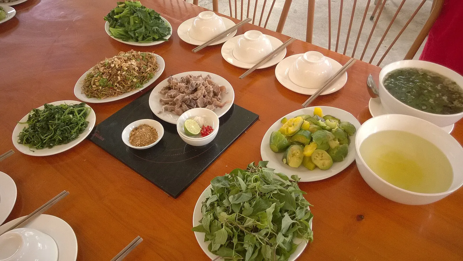
A spread of local dishes at a meal in Ha Giang city, where the loop starts and ends
Photograph: Vuong Tri Binh — opens in a new tab · CC BY-SA 4.0 — opens in a new tab
Changes: Resized and converted to WebP; displayed with responsive crops. · Original photograph and licence details ↗ — opens in a new tab
The Quan Ba valley, below the Heaven's Gate pass on day one
Photograph: Benjamin Smith — opens in a new tab · CC BY-SA 4.0 — opens in a new tab
Changes: Resized and converted to WebP; displayed with responsive crops. · Original photograph and licence details ↗ — opens in a new tab
Meo Vac seen from a viewpoint, one of the two choices for the third night
Photograph: Khoitran1957 — opens in a new tab · CC BY-SA 4.0 — opens in a new tab
Changes: Resized and converted to WebP; displayed with responsive crops. · Original photograph and licence details ↗ — opens in a new tab
Traders at Meo Vac market; ask before you photograph anyone
Photograph: Benjamin Smith — opens in a new tab · CC BY-SA 4.0 — opens in a new tab
Changes: Resized and converted to WebP; displayed with responsive crops. · Original photograph and licence details ↗ — opens in a new tab
The Gam River near Bac Me, followed by National Road 34 on day four
Photograph: BacLuong — opens in a new tab · CC BY-SA 4.0 — opens in a new tab
Changes: Resized and converted to WebP; displayed with responsive crops. · Original photograph and licence details ↗ — opens in a new tab