Northern Mountains · Cao Bang
Cao Bang and Ban Gioc Waterfall: caves, Tay villages and where to stay
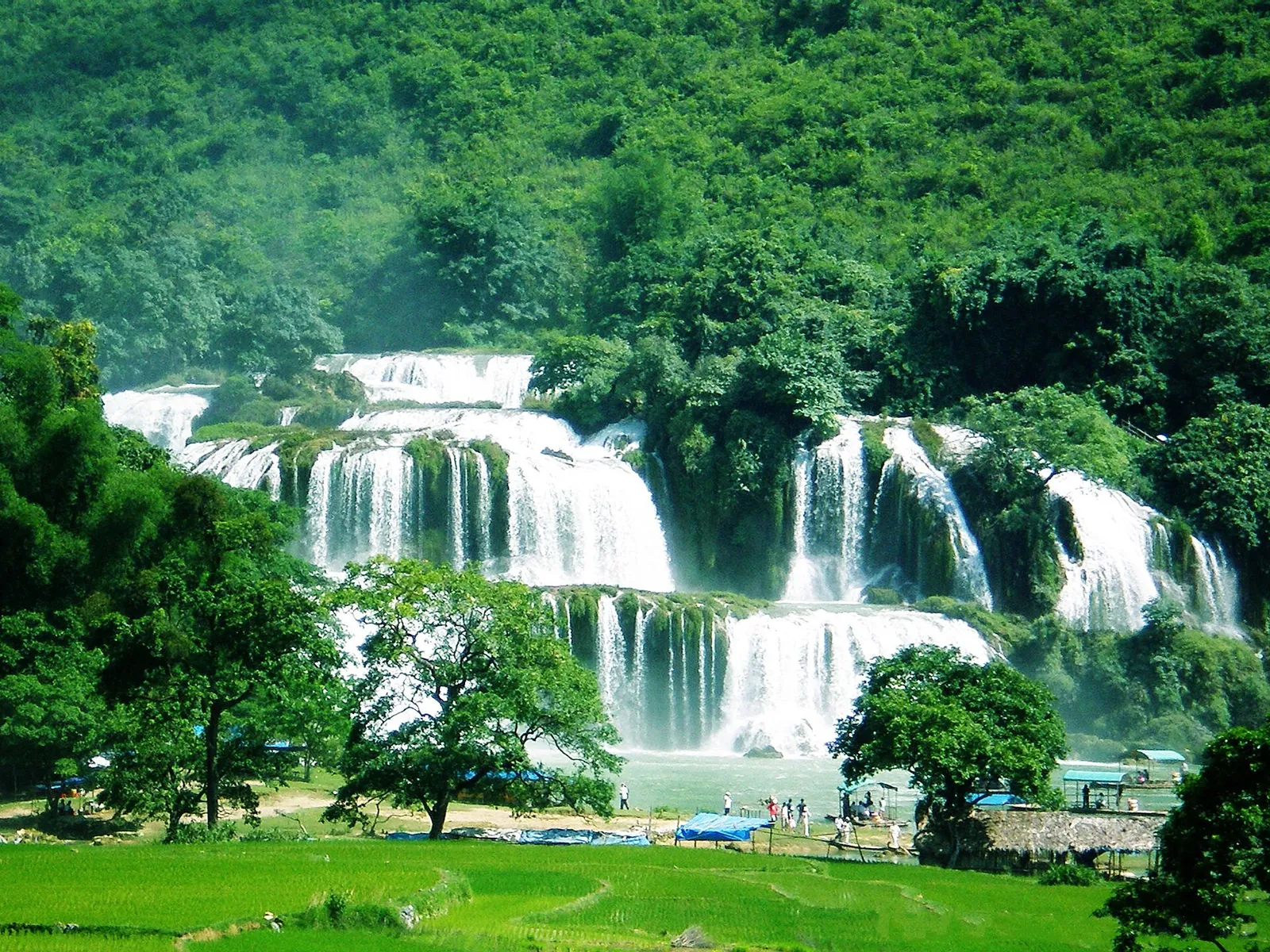
Ban Gioc Waterfall sits on the Vietnam–China border in the far north-east, around 340 kilometres from Hanoi, and most people who come this far see the falls, take a raft photo and turn round. That is a lot of road for one view. The waterfall is the best-known site in the Non Nuoc Cao Bang UNESCO Global Geopark, a limestone country of caves, linked lakes and valleys farmed by Tay and Nung communities. Give it the nights it needs and Cao Bang becomes a trip in its own right rather than a long detour.
- Suggested time
- 2–3 nights (3 recommended)
- Where to stay
- Cao Bang city for arrival and onward buses; a Dam Thuy homestay near Ban Gioc for an early start at the falls
- Season and timing
- The falls are fullest in the rainy season (about June to September). From October the water runs clearer and the autumn harvest colours the fields. November to February can be cold.
The short answer
Plan on three nights from Hanoi, or at the very least two. Take the bus from Hanoi's My Dinh station to Cao Bang city (Vietnam Tourism gives about 280 kilometres and around eight hours) and sleep in the city. The next day, go out to Ban Gioc, which the provincial tourism portal puts about 92 kilometres from the city, and add Nguom Ngao Cave and the Truc Lam pagoda viewpoint nearby. Sleep in a homestay in Dam Thuy commune, for example in the Khuoi Ky stone village, so you can be at the falls before the day-trippers. On the way back, stop at Thang Hen lakes and the Eye of the Mountain God, or spend a day at Pac Bo in the north. Without your own transport, hire a driver or join a tour from Cao Bang city.
Work out the distances before you book a bed
Cao Bang is a province, and the waterfall is not in the provincial capital. Vietnam Tourism puts Cao Bang city about 280 kilometres from Hanoi, with day and overnight buses from My Dinh bus station taking around eight hours. Ban Gioc is a further 92 kilometres or so from the city, in Dam Thuy commune, according to the province's tourism portal. Pac Bo is 52 kilometres north of the city, and the Thang Hen lakes and the Eye of the Mountain God are further stops again. Seen on a map, this is a circuit, not a single stop.
That is why the right base changes during the trip. Cao Bang city, on the Bang River, has what Vietnam Tourism calls a small but contemporary choice of hotels, shops and restaurants, and it is where buses arrive and leave. In Dam Thuy, near the falls and the cave, you sleep in a village homestay instead. Khuoi Ky, a Tay village of 14 stone stilt houses about 2 kilometres from Ban Gioc on the road to Nguom Ngao, runs community homestays. One night in each is the simplest pattern: the city first, then the village, then back through the lakes.
Ban Gioc Waterfall: rafts, a viewpoint and the water level
Ban Gioc is fed by the Quay Son River and is nearly 300 metres wide. The provincial portal describes a main waterfall of three tiers running along the Vietnam–China border and a secondary waterfall that lies wholly in Vietnam. Vietnam Tourism says the water drops more than 30 metres over limestone cliffs. It was designated a national scenic site in 1998.
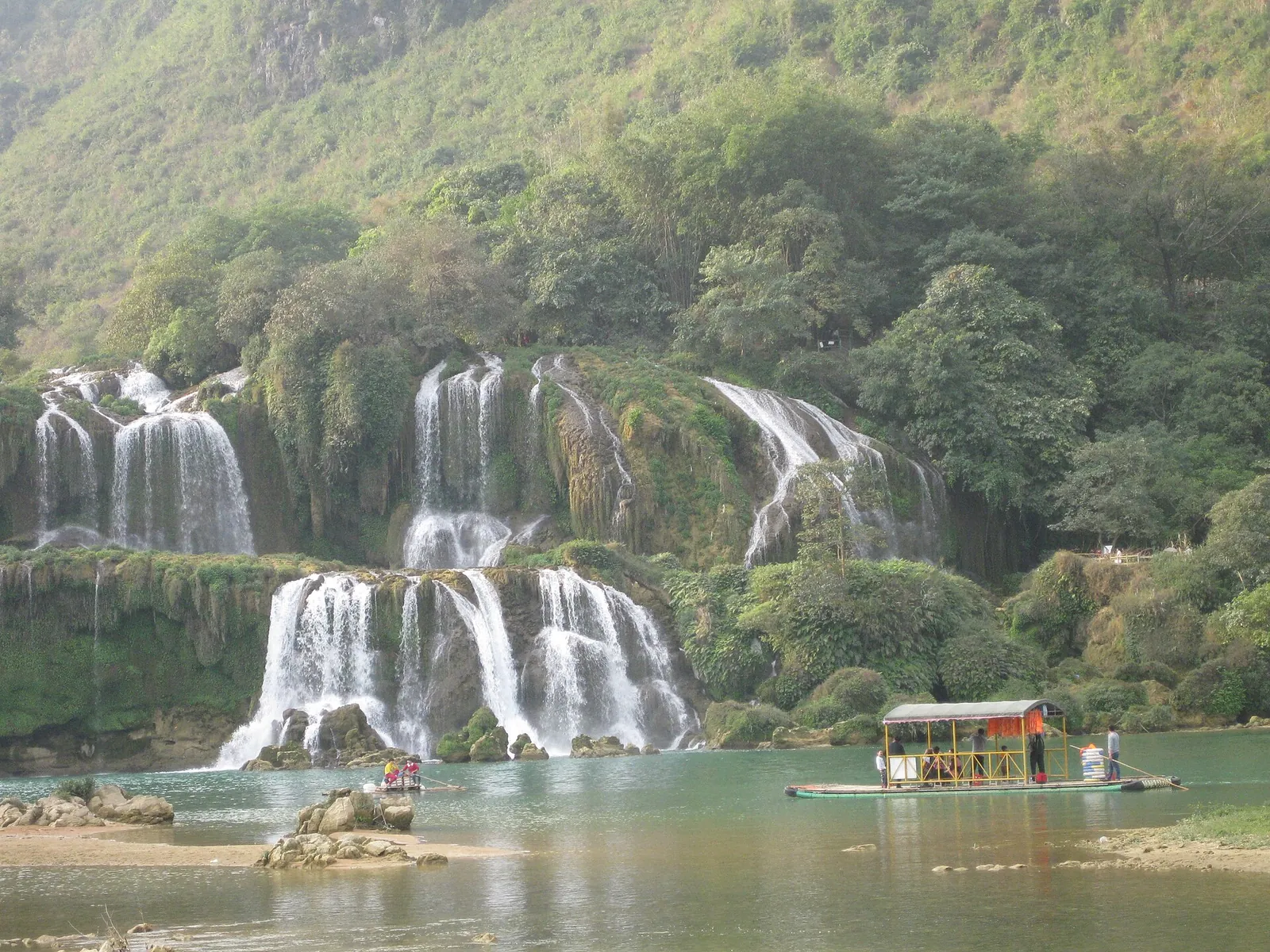
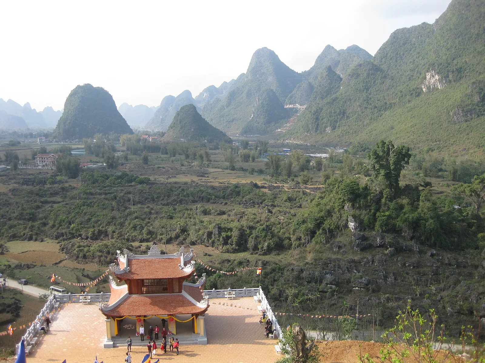
The usual way to get close is a bamboo raft on the Quay Son River. Vietnam Tourism describes locally run rafts that take visitors to the base of the main cascade. Around midday, when the sun catches the mist, you can often see rainbows. For the overall view, walk up the short, steep path to the Phat Tich Truc Lam Ban Gioc pagoda on the hillside above the valley. Vietnam Tourism suggests early morning or the end of the day for photography there, and that is a good argument for sleeping nearby.
The flow changes a great deal through the year. In the rainy season, roughly June to September, the falls become one wall of white water. From October to May they are quieter and the river turns turquoise. The river is dam-controlled: when we checked on 2026-10-03, Vietnam Tourism's Cao Bang guide said that at the end of the dry season water is released every day between 10:30 and 13:00, bringing the falls up to full flow. If you come late in the dry season, time your visit for that window. Check locally before you go, because a release schedule can change.
Make time for the local food
What to eat and where to look
Phở chua (sour pho)
A dry, mixed bowl rather than a soup. Rice noodles are topped with roast duck, crisp-fried pork belly and Chinese-style sausage, then dressed with the duck's juices and a sweet-sour sauce of vinegar thickened with arrowroot starch. Fried shredded sweet potato, ground roast peanuts, cucumber and herbs finish it, as Bao Cao Bang describes.
- Where to look
- Noodle shops in Cao Bang city. The provincial paper says only some eateries in the province serve it, so ask your hotel which one locals use.
- Fit it into your day
- A filling lunch or dinner on your arrival day in the city.
Contains pork, duck and peanuts; the tart sauce is seasoned with garlic and chilli.
Bánh cuốn Cao Bang (rice rolls in bone broth)
Thin steamed rice sheets rolled around stir-fried minced pork and wood-ear mushroom and served with a hot, clear pork-bone broth instead of the dipping fish sauce used elsewhere. If you order it with egg, the cook cracks one onto the sheet as it steams and rolls it up with the egg inside.
- Where to look
- Small breakfast shops in Cao Bang city, which are busy from early morning, according to Bao Cao Bang.
- Fit it into your day
- Breakfast before the drive to Ban Gioc; it is especially good on cool mornings.
The broth is made from pork bones. Pepper and chilli bamboo shoots are on the table for you to add yourself.
Roast duck with mac mat leaves
Cao Bang's roast duck is stuffed with a cooked mixture of mac mat leaves (a fragrant wild leaf of the northern mountains) and seasonings, sewn shut and roasted until the skin crisps. The juices from inside are then poured off as a dipping sauce. Bao Cao Bang describes the leaf's aroma as the point of the dish.
- Where to look
- Roast-duck stalls and restaurants in Cao Bang city; the same duck also goes into phở chua.
- Fit it into your day
- Order it to share at a sit-down dinner, with rice and a vegetable dish.
It is served chopped into pieces; ask whether it is sold by the whole, half or quarter bird before ordering.
Trung Khanh chestnuts
The province's best-known local product: large, thin-shelled chestnuts grown on the limestone soil around Trung Khanh, roasted or boiled. The provincial portal describes a nutty, naturally sweet flavour.
- Where to look
- Specialty-product stalls in Cao Bang city (the provincial portal lists one in Thuc Phan ward) and markets around Trung Khanh in season.
- Fit it into your day
- A snack on the road between the falls and the city, or something to take home.
They are harvested in autumn and winter, so outside that season what you find may not be local or fresh.
Nguom Ngao Cave and the Khuoi Ky stone village
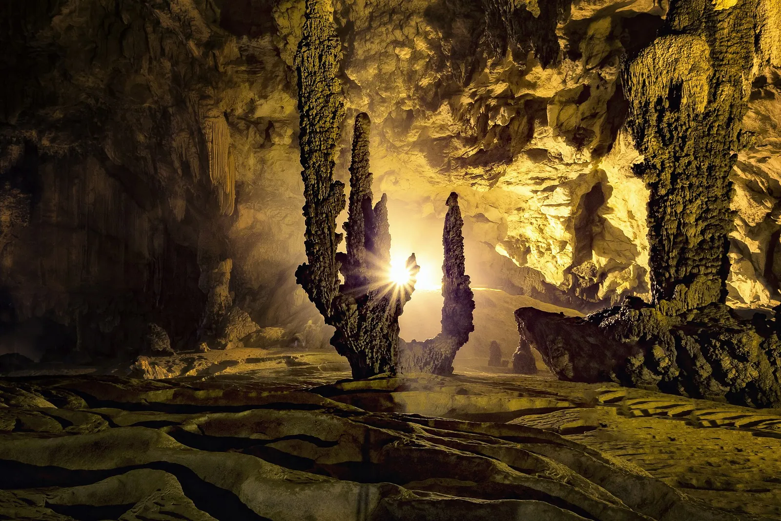
Nguom Ngao Cave is just over 3 kilometres from the waterfall. The provincial portal describes a cave more than 2,000 metres long in limestone that contains coral and sea-anemone fossils, which it dates to about 400 million years ago, and a second branch, Ban Thuon, of about 2 kilometres that opened to visitors in April 2021. The lit walkway passes stalactites and stalagmites in many shapes. Vietnam Tourism's tip is to bring drinking water, because the walk of around one kilometre on the main route can easily take an hour.
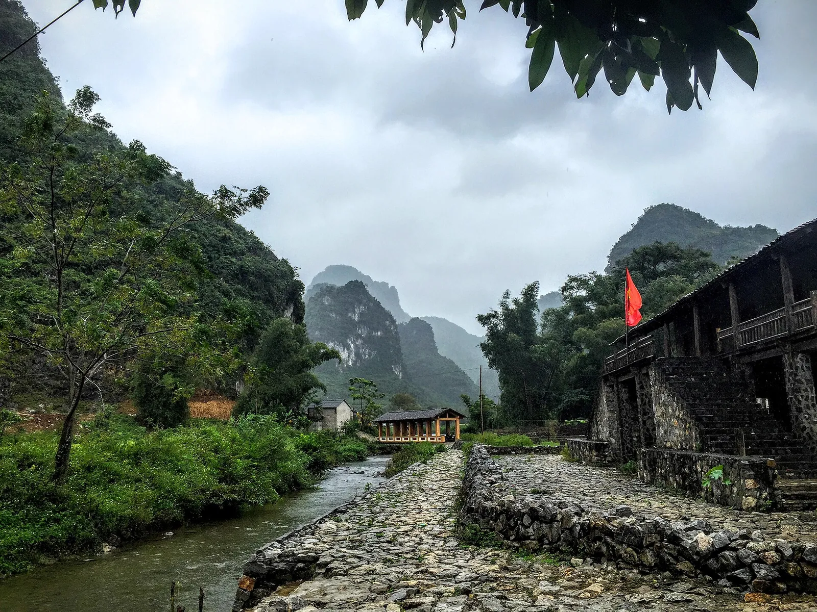
Khuoi Ky sits between the cave and the falls on provincial road 206. The houses are stilt houses built of stone, with walls more than 30 centimetres thick, and stand with their backs to the mountain above the Khuoi Ky stream. According to the geopark management board, as reported by VietnamPlus, their history goes back to the late 16th century. Spending a night here makes the area more than a waterfall stop. Remember that these are family homes: ask before you photograph inside, and keep to the paths.
Thang Hen lakes and the Eye of the Mountain God
The Thang Hen lakes are a chain of 36 small lakes linked by caves and underground passages. In the rainy season the water rises and joins them into a single lake, as Vietnam Tourism describes. The lakes themselves are pleasant enough, but the reason to stop is the karst scenery and the farming life around them.
About 2 kilometres away is the Eye of the Mountain God, known locally as Phja Piót, the 'pierced mountain'. The provincial portal describes a round hole more than 50 metres across that goes right through the mountain, about 50 metres above Nam Cha lake at its foot. It became a national scenic site in 2021. The portal says it is at its best in the dry season, from September, when the water recedes and leaves grassy banks. Vietnam Tourism suggests hiring a local guide to get there.
Further east, around 70 kilometres from the provincial centre in Vinh Quy commune, Ba Quang grass hill is green from May to October and turns orange and gold from October to February, according to the portal. It only fits if you have a car and an extra half-day.
Pac Bo and the road north
Pac Bo, in Truong Ha commune 52 kilometres north of the provincial centre, is where Nguyen Ai Quoc, later President Ho Chi Minh, returned to Vietnam on 28 January 1941 after thirty years abroad. From here he led the revolutionary movement. The special national relic site covers more than 295 hectares and, according to the provincial portal, includes Coc Bo Cave, where he lived, Lenin Stream, Karl Marx Mountain and border marker No. 108. For Vietnamese visitors it is a place of pilgrimage. Go for the history and the clear stream valley, and dress and behave as you would at a memorial.
If you are carrying on west towards the high passes, National Highway 4A climbs Khau Coc Cha pass: about 2.5 kilometres with 14 hairpin bends, between Xuan Truong and Bao Lac communes, as the portal describes. It is a road for experienced riders or a hired driver, not for a first day on a scooter.
A workable three-night route
This is an editorial suggestion, not a timetable. Driving times on mountain roads vary with weather and roadworks, so confirm them with your driver or tour operator.
- Day 1 — Hanoi to Cao Bang city: a day bus from My Dinh bus station. Have dinner in the city and try phở chua or bánh cuốn.
- Day 2 — Ban Gioc and Nguom Ngao: drive out to Dam Thuy, walk Nguom Ngao Cave, check in to a homestay in Khuoi Ky, then see the falls and the Truc Lam pagoda viewpoint late in the afternoon.
- Day 3 — Falls early, lakes on the way back: a bamboo raft at the falls in the morning, then Thang Hen lakes and the Eye of the Mountain God on the return to Cao Bang city.
- Day 4 — Pac Bo or onward: a morning at Pac Bo before an afternoon or overnight bus to Hanoi, or a hired car west along Highway 4A.
Practical questions
How many days do I need for Cao Bang and Ban Gioc?
Three nights is comfortable: one in Cao Bang city, one in a homestay near Ban Gioc and one more for the lakes or Pac Bo. Two nights is the minimum that makes the eight-hour bus journey from Hanoi worthwhile.
Can I visit Ban Gioc Waterfall as a day trip from Hanoi?
Not sensibly. Vietnam Tourism puts the falls about 340 kilometres from Hanoi, and the bus to Cao Bang city alone takes around eight hours. Plan to stay in the province at least two nights.
When is the best time to see Ban Gioc?
For the biggest flow, the rainy season from about June to September. For clear turquoise water, harvest colours and drier roads, October and November. Late in the dry season, Vietnam Tourism notes a daily water release between 10:30 and 13:00 that brings the falls up to full flow.
Is Ban Gioc on the border with China?
Yes. According to the provincial tourism portal, the three-tier main waterfall runs along the Vietnam–China border and the secondary waterfall is entirely in Vietnam. Stay within the marked visitor areas and on the rafts' set routes.
Where should I sleep near Ban Gioc Waterfall?
In Dam Thuy commune, near the falls. The Khuoi Ky stone village, about 2 kilometres away on the road to Nguom Ngao Cave, has community homestays. Sleep in Cao Bang city for more choice of hotels and for bus connections.
What else is worth seeing besides the waterfall?
Nguom Ngao Cave, just over 3 kilometres from the falls, the Truc Lam pagoda viewpoint above them, the Thang Hen lakes and the Eye of the Mountain God, and the Pac Bo historical site in the north of the province.
Sources and checks before you travel
Reference sources for the version dated 3 October 2026. Confirm opening times, access, transport and conditions for your travel dates.
- Vietnam Tourism: Ban Gioc Waterfall, majestic beauty on the northern border ↗ — opens in a new tab
- Vietnam Tourism: Discovering Cao Bang, 7 must-do experiences ↗ — opens in a new tab
- Cao Bang tourism portal: Ban Gioc Waterfall ↗ — opens in a new tab
- Cao Bang tourism portal: Nguom Ngao Cave ↗ — opens in a new tab
- Cao Bang tourism portal: Eye of the Mountain God (Mắt Thần Núi) ↗ — opens in a new tab
- Cao Bang tourism portal: Pac Bo Special National Historical Site ↗ — opens in a new tab
- Cao Bang tourism portal: Khau Coc Cha pass ↗ — opens in a new tab
- Cao Bang tourism portal: Ba Quang grass hill ↗ — opens in a new tab
- Cao Bang tourism portal: Trung Khanh chestnuts ↗ — opens in a new tab
- Global Geoparks Network: Non Nuoc Cao Bang UNESCO Global Geopark ↗ — opens in a new tab
- VietnamPlus: UNESCO reaffirms Non Nuoc Cao Bang as global geopark ↗ — opens in a new tab
- VietnamPlus: Khuoi Ky ancient stone village (Vietnamese) ↗ — opens in a new tab
- Bao Cao Bang: phở chua Cao Bang (Vietnamese) ↗ — opens in a new tab
- Bao Cao Bang: bánh cuốn Cao Bang (Vietnamese) ↗ — opens in a new tab
- Bao Cao Bang: roast duck with mac mat leaves (Vietnamese) ↗ — opens in a new tab
- Vietnam Tourism: a traveller's guide to Vietnam's airports ↗ — opens in a new tab
Does this experience fit your route?
If you are staying in Cao Bang city without a car, a guided day to Ban Gioc saves you arranging transport. Check what is included, the pick-up time and how long you get at the falls before you book.
Check dates and details on Viator ↗ — opens in a new tabAffiliate link · Book with ViatorPhoto credits
Ban Gioc Waterfall on the Quay Son River, Cao Bang province
Photograph: Original uploader was Caobangpro at vi.wikipedia — opens in a new tab · CC BY 3.0 — opens in a new tab
Changes: Resized and converted to WebP; displayed with responsive crops. · Original photograph and licence details ↗ — opens in a new tab
A raft on the Quay Son River below Ban Gioc Waterfall
Photograph: Phạm Quang Sơn — opens in a new tab · CC BY-SA 2.0 — opens in a new tab
Changes: Resized and converted to WebP; displayed with responsive crops. · Original photograph and licence details ↗ — opens in a new tab
The view from Phat Tich Truc Lam Ban Gioc pagoda across the karst valley
Photograph: Phạm Quang Sơn — opens in a new tab · CC BY-SA 2.0 — opens in a new tab
Changes: Resized and converted to WebP; displayed with responsive crops. · Original photograph and licence details ↗ — opens in a new tab
Inside Nguom Ngao Cave, a few kilometres from Ban Gioc Waterfall
Photograph: Bùi Thụy Đào Nguyên — opens in a new tab · CC BY-SA 4.0 — opens in a new tab
Changes: Resized and converted to WebP; displayed with responsive crops. · Original photograph and licence details ↗ — opens in a new tab
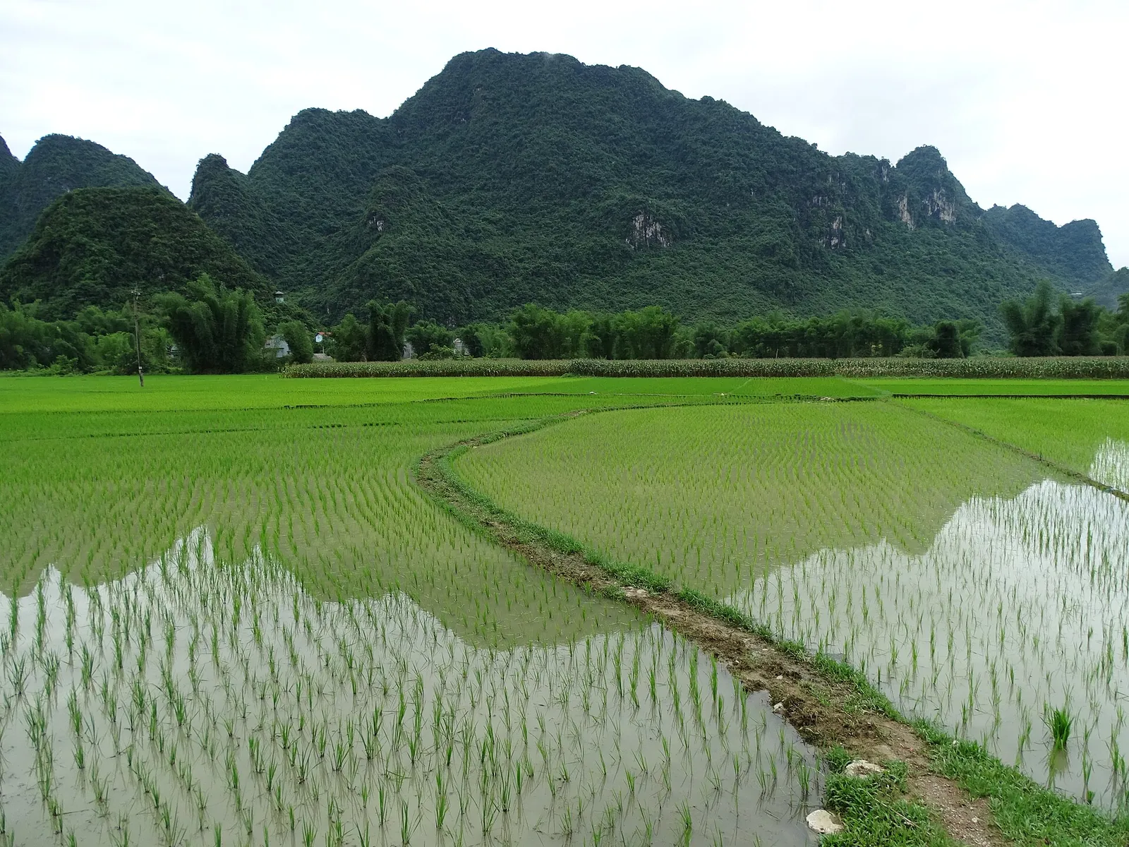
Rice fields and karst hills in the countryside around Nguom Ngao Cave
Photograph: Adam Jones from Kelowna, BC, Canada — opens in a new tab · CC BY-SA 2.0 — opens in a new tab
Changes: Resized and converted to WebP; displayed with responsive crops. · Original photograph and licence details ↗ — opens in a new tab
A Tay cultural village of stone houses in Dam Thuy commune, near Ban Gioc
Photograph: trungydang — opens in a new tab · CC BY 3.0 — opens in a new tab
Changes: Resized and converted to WebP; displayed with responsive crops. · Original photograph and licence details ↗ — opens in a new tab