Central Taiwan · Nantou County
Yushan travel guide: Tataka views, walks and summit permits
Yushan rewards two very different kinds of visit. Tataka offers a visitor center, forest scenery and views into the mountain range, while the high peaks demand an approved hiking plan and the ability to travel safely at altitude. Keeping those experiences separate is the key to a good first visit: the scenery does not depend on a summit reservation, and a scenic day does not become a climbing permit.
- Suggested time
- 1 mountain day from an Alishan overnight; summit hikes need a separate approved itinerary
- Where to stay
- A confirmed Alishan accommodation with separately arranged Tataka transport; approved mountain lodging for a separately planned summit hike
- Season and timing
- Check mountain weather, road controls and individual trail status close to departure. Winter ice and summer afternoon rain or mist can change access; a permit is not valid during an official emergency closure.
The short answer
Spend one night in Alishan, then give a mountain day to Tataka’s visitor center, forest scenery and Yushan views; arrange a summit climb separately with permits and confirmed lodging. Keep the scenic outing modest and settle the Tataka transfer before booking accommodation. The visitor center is already at altitude, so weather, health and current access should determine the walk. Check road controls and the park’s route status again before departure; an open main-peak listing does not make every trail or lodge available.
Choose a scenic Tataka day before choosing a summit
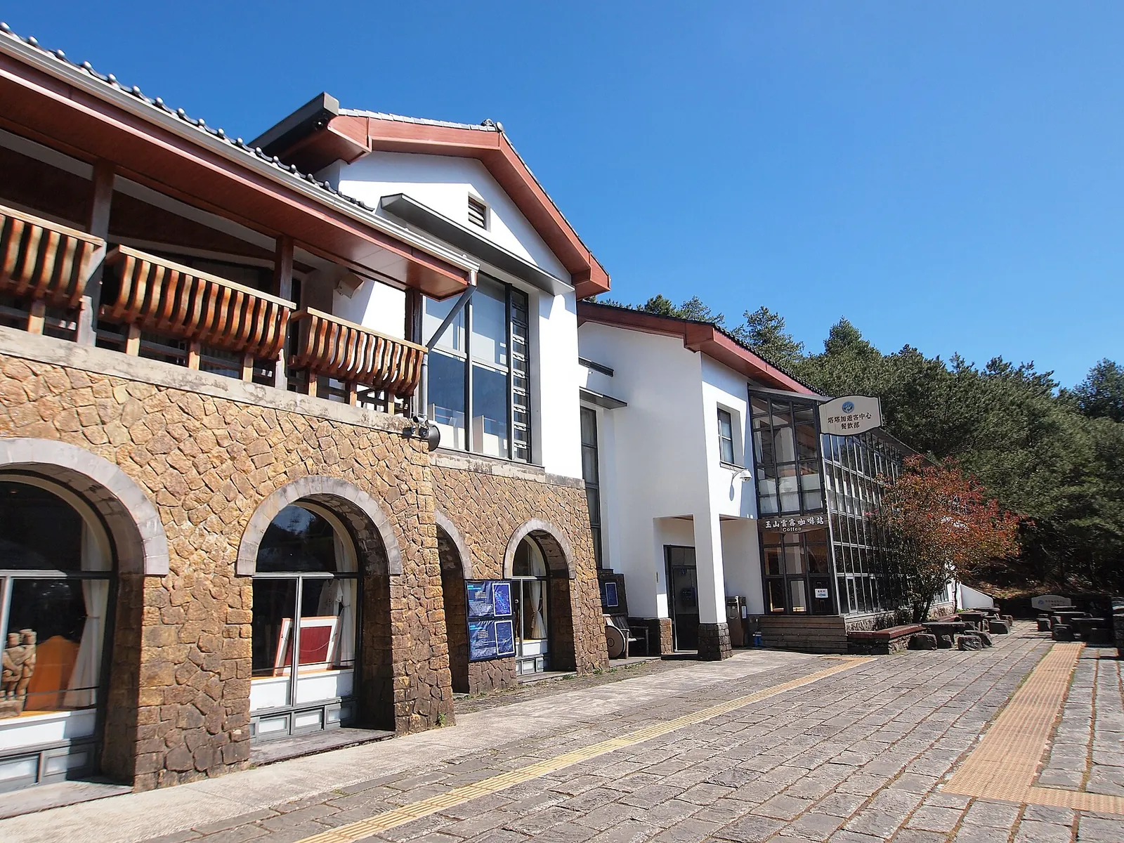
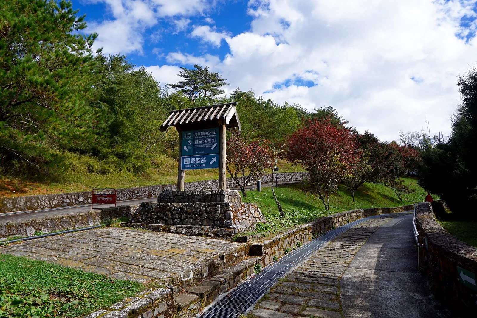
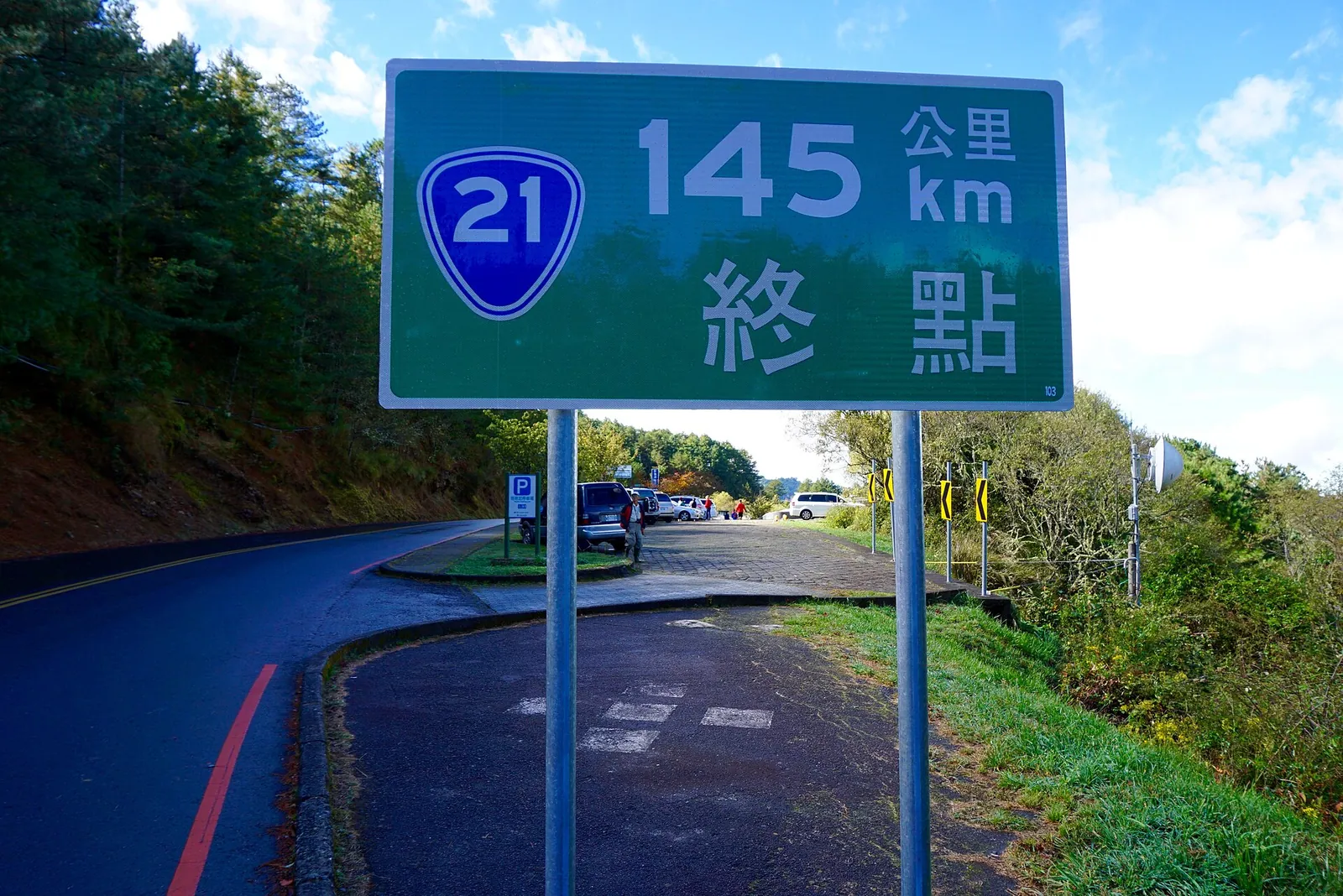
Tataka Visitor Center stands at the junction of Highways 18 and 21, at an elevation of 2,610 metres. Its exhibits introduce the park’s landscape, ecology and Bunun and Tsou histories before you decide how much outdoor walking suits the day. The center and its separately operated restaurant are different from a mountain lodge or a summit trail reservation.
A confirmed Alishan overnight can give the outing a mountain-side starting point, but the journey to Tataka still needs arranging separately. The national tourism administration describes buses to Alishan from Chiayi’s HSR and railway stations; it does not promise that those services automatically continue to your chosen Tataka walk. Keep a clear return plan, and let the center, open viewpoints and a suitable short walk carry the day.
Keep the forest outing within the day’s conditions
The park identifies the giant hemlock as a Tataka landmark, with mosses, ferns and other plants using the tree as habitat. Ask the visitor center which local route is appropriate and open before heading out. Being near the Yushan trailhead does not make every path a casual walk, and entering the high-peak route is a separate decision with its own requirements.
Shishan is a Highway 18 overlook with parking and toilets, where macaques may be present. The park warns that animals accustomed to visitors can grab food and bags; leave food secured in the vehicle rather than carrying it into the macaque area, close car windows and never feed wildlife. Clouds and rain can alter the view quickly. If the weather or your health makes walking uncomfortable, the exhibits and a shorter scenic stop are a complete visit in their own right.
Make time for the local food
What to eat and where to look
A prepared rice meal
The park’s own mountain-food guidance includes rice as a staple. This is a practical meal choice to arrange before the outing, not a claim about a Tataka restaurant’s current menu.
- Where to look
- Your accommodation, a confirmed meal provider or a shop before entering the mountain area.
- Fit it into your day
- Settle lunch arrangements before the transfer so the day does not depend on finding an unverified kitchen.
Check ingredients and safe storage; keep food secured from wildlife and use only permitted eating areas.
A noodle meal or a suitable packed alternative
Dried noodles and bread are among the staples named in the park’s food-planning guidance; preparation needs depend on your route and facilities.
- Where to look
- A confirmed gateway meal or supplies chosen for the approved plan; no restaurant dish is guaranteed.
- Fit it into your day
- A meal before departure or after returning can keep the scenic day simple.
Do not assume cooking is allowed along a trail. The park specifies designated cooking areas and prohibits campfires; ask about broth ingredients and allergens.
Dried fruit and light snacks
The park recommends easily carried foods, including dried fruit, biscuits and other packaged snacks, as part of a considered mountain food plan.
- Where to look
- Buy suitable supplies before the mountain transfer and carry enough for your actual route.
- Fit it into your day
- Useful as a small break alongside an arranged meal and an appropriate water plan.
Check allergy labels, carry out packaging, avoid feeding wildlife and do not use snacks as a substitute for proper planning.
Treat summit access as a different mountain plan
The current official permit table distinguishes ordinary Tataka trails from the Yushan peak routes: the former do not require park and mountain entry permits, while the summit routes require both. Paiyun accommodation is allocated through an application process rather than a walk-in promise. A same-day main- or west-peak ascent also requires evidence of previous hiking experience above 3,000 metres.
For a climbing trip, confirm the approved route, permits, bed arrangements and the equipment and experience needed for the conditions. Altitude illness can develop well before a summit, and fitness does not remove that risk. The park advises gradual ascent and retreat when symptoms persist or worsen. Seek emergency medical help for serious symptoms rather than continuing uphill, and follow any closure or staff instruction even if a permit was previously issued.
Check roads, visitor days and the actual trail
When checked on 8 October 2026, the park listed the Yushan Peaks Trail as open but the Batongguan Traversing Trail as closed. That is a dated snapshot, not blanket access to the whole park. Lulin Lodge is another useful distinction: its scenic record is labelled open, yet the description explicitly says the building is not open to the public. Do not use it as a promised overnight stop.
The same road check listed a nightly Highway 21 closure between Caopingtou and Tataka, from 17:30 to 07:00, with dated construction controls continuing through 30 October 2026. Highway 18 also has current construction notices. Check the applicable approach and return before travel. The visitor center lists closure on Lunar New Year’s Eve and the second Tuesday of each month, so confirm its calendar before making an indoor visit the anchor of the day.
Practical questions
Can I see Yushan without climbing the main peak?
Yes. A Tataka day can center on the visitor exhibits, forest scenery and open viewpoints, with walking chosen for current conditions. The high-peak climb is a separate permitted itinerary rather than an automatic extension of the scenic outing.
Do all Tataka trails need a climbing permit?
The official table distinguishes ordinary Tataka trails, which do not need park or mountain entry permits, from Yushan high-peak routes, which need both. Ask the visitor center about your exact route and current access rather than applying that exemption to the summit.
Is Paiyun Lodge guaranteed if the trail is open?
No. An open trail listing does not provide a bed or approved entry. The lodge uses an advance application process, and any climbing plan must have the necessary permits and confirmed accommodation arrangements.
What access restrictions were checked for this guide?
On 8 October 2026, Batongguan Traversing Trail was listed closed; Highway 21 had nightly closure between Caopingtou and Tataka and dated construction controls. Check both Highway 18 and Highway 21 notices, the visitor calendar and your exact trail again before travel.
Sources and checks before you travel
Reference sources for the version dated 8 October 2026. Confirm opening times, access, transport and conditions for your travel dates.
- Yushan National Park: Tataka Visitor Center ↗ — opens in a new tab
- Hike Smart Taiwan: Yushan park-entry notices ↗ — opens in a new tab
- Yushan National Park: Yushan Peaks Trail ↗ — opens in a new tab
- Yushan National Park: current trail status ↗ — opens in a new tab
- Yushan National Park: road conditions ↗ — opens in a new tab
- Alishan National Scenic Area: current roadworks notice ↗ — opens in a new tab
- Yushan National Park: Lulin Lodge ↗ — opens in a new tab
- Yushan National Park: giant hemlock ↗ — opens in a new tab
- Yushan National Park: Shishan ↗ — opens in a new tab
- Yushan National Park: altitude illness guidance ↗ — opens in a new tab
- Yushan National Park: food planning ↗ — opens in a new tab
- Yushan National Park: Upper Dongpu Parking Lot ↗ — opens in a new tab
- Taiwan Tourism Administration: Alishan National Forest Recreation Area ↗ — opens in a new tab
- Taiwan Forest Recreation: Alishan lodging ↗ — opens in a new tab
- Taoyuan Metro: Airport MRT map ↗ — opens in a new tab
- Wikimedia Commons: Tataka Visitor Center geotag ↗ — opens in a new tab
Photo credits
The visitor center introduces the mountain landscape before a conditions-appropriate outdoor visit.
Photograph: rheins — opens in a new tab · CC BY 3.0 — opens in a new tab
Changes: Resized and converted to WebP; displayed with responsive crops. · Original photograph and licence details ↗ — opens in a new tab
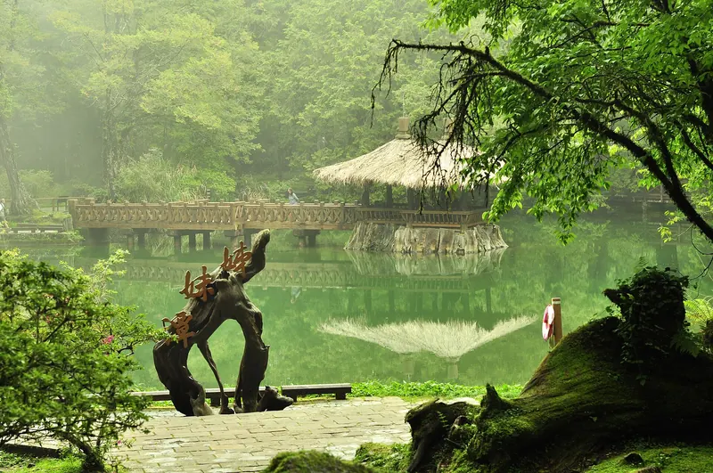
Choose a local walk after checking current access and weather with the visitor center.
Photograph: 禮名畫的生活旅遊日記 FB — opens in a new tab · CC0 — opens in a new tab
Changes: Resized and converted to WebP; displayed with responsive crops. · Original photograph and licence details ↗ — opens in a new tab
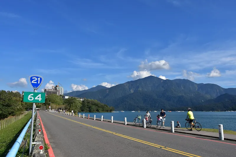
Tataka lies at a mountain-road junction; check the approach and return against current controls.
Photograph: 禮名畫的生活旅遊日記 FB — opens in a new tab · CC0 — opens in a new tab
Changes: Resized and converted to WebP; displayed with responsive crops. · Original photograph and licence details ↗ — opens in a new tab
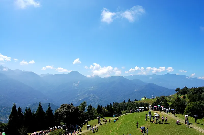
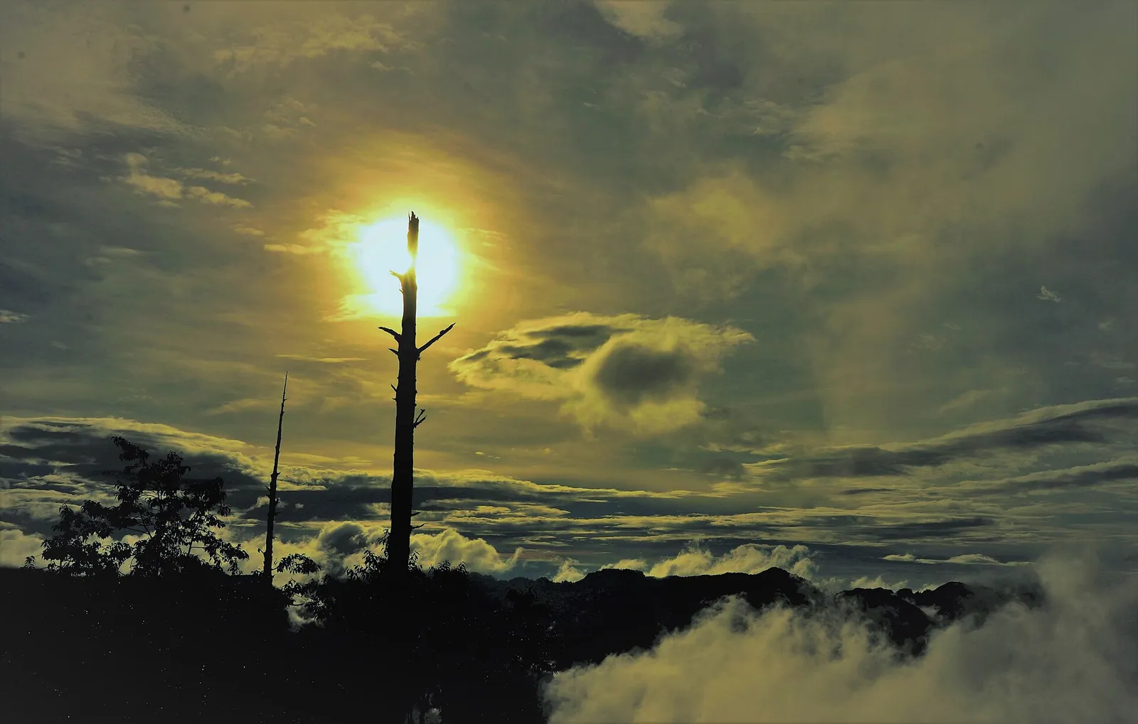
Clouds and light change quickly in the Tataka mountain landscape; no particular view is guaranteed.
Photograph: 邱文強 — opens in a new tab · CC BY-SA 4.0 — opens in a new tab
Changes: Resized and converted to WebP; displayed with responsive crops. · Original photograph and licence details ↗ — opens in a new tab