Central Singapore · Singapore
Southern Ridges guide: Henderson Waves and a realistic walking plan
The Southern Ridges are a network of green spaces, not one short bridge visit. Henderson Waves may be the photograph you want, but the approach, gradients and onward route decide what kind of outing you are buying into. Choose one stretch you can comfortably walk, check the current park notices and plan where you will finish. Seeing a smaller section properly is a better nature day than racing to connect every park in the heat.
- Suggested time
- A half-day for a selected route
- Where to stay
- HarbourFront for the southern city; a central hotel for a wider Singapore trip
- Season and timing
- Walk in manageable sections in year-round humidity. Follow NParks notices and keep a different day plan when heavy rain or lightning makes the route unsuitable.
The short answer
Allow a half-day for a selected stretch rather than committing to the whole network. Choose Henderson Waves with Mount Faber or a HortPark-led visit according to your interests and fitness. Stay in a central city base or near HarbourFront for a wider southern-city trip; you do not need accommodation beside a trail entrance. Check closures, your approach and the return connection before setting out.
A hotel base is different from a trail entrance
HarbourFront can suit a trip that also visits Sentosa, while a central hotel can work for one Southern Ridges outing. Choose accommodation for the whole trip and plan the specific park access separately. The name Southern Ridges does not identify a single arrival point.
Choose the section before the distance
NParks describes the Southern Ridges as connected green spaces including Mount Faber, Telok Blangah Hill Park, HortPark and Kent Ridge Park. Henderson Waves links parts of this landscape, but a bridge photograph does not convey the walking needed to reach it. Use the official map to choose a section and its exit.
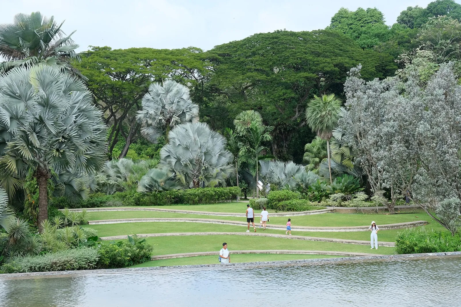
A HortPark visit focuses on cultivated gardens; a hill walk towards Henderson Waves and Mount Faber is a different outing. Do not combine both simply because they belong to the same network. Current closures can interrupt connections, so the route must remain conditional.
Make time for the local food
What to eat and where to look
Kaya toast
Toast with a coconut-and-egg spread.
- Where to look
- Coffee shops before travelling to the chosen entrance.
- Fit it into your day
- Breakfast before a later walk.
Commonly contains egg.
Chicken rice
Chicken served with savoury rice and condiments.
- Where to look
- Current menus near your exit or hotel.
- Fit it into your day
- A main meal after the walk.
Check sauces and soup ingredients.
Laksa
Noodles in a spiced coconut-based broth.
- Where to look
- Current food-court or restaurant menus after returning from the parks.
- Fit it into your day
- A seated lunch with a proper rest.
Often contains shellfish or fish products.
Henderson Waves is part of the walk
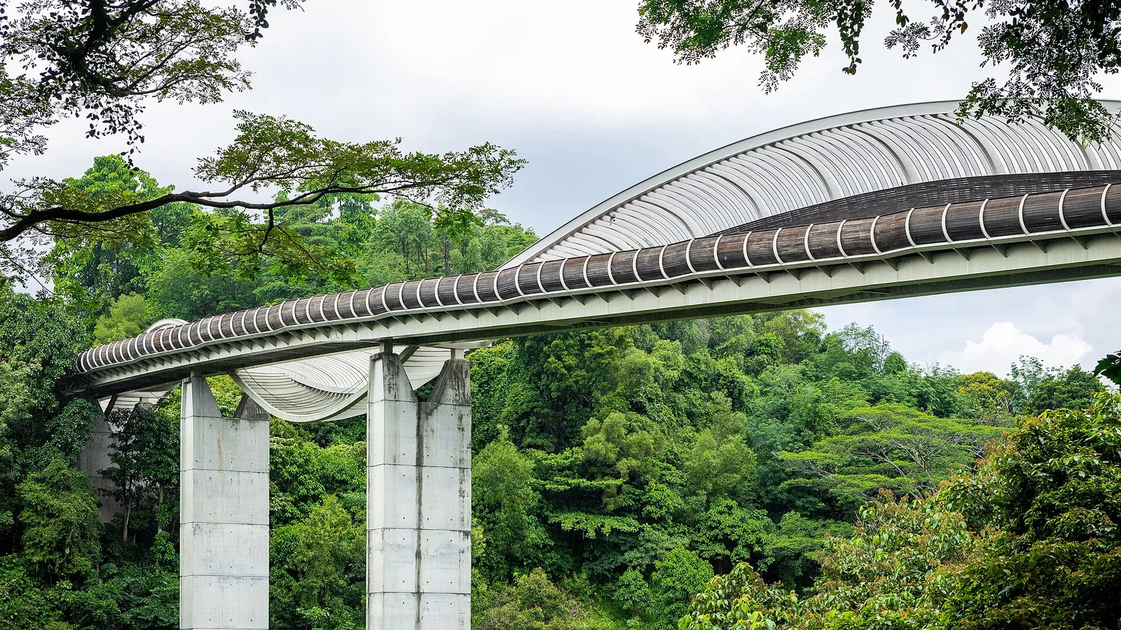
The park authority identifies Henderson Waves by its distinctive wave-like pedestrian-bridge structure. Pause there if it is part of your selected open route, then continue only if you still have time and energy. Keep other walkers moving and avoid turning the bridge into a long photo queue.
The indexed guided tour covers HortPark, Telok Blangah Hill Park, Henderson Waves and Mount Faber. Check its current route, steps and start and finish points. A guided walk helps with interpretation; it does not remove gradients or humidity.
Food before and after, not an assumed trail service
Have a meal before the walk and carry water. Do not base the day on finding a particular food outlet halfway along an unfamiliar trail. Choose your post-walk restaurant by the exit you have planned, whether near HarbourFront or back in the central city.
The foods below are citywide options around that wider journey, not claimed specialities of a nature trail. Keep the final meal simple if the walk takes longer than expected.
Practical questions
Do I need to walk the whole network?
No. Choose a manageable section and a practical exit from the current official map.
Is Henderson Waves the whole Southern Ridges walk?
No. It is a pedestrian bridge within a wider linked park landscape; the approach and onward route add walking.
What should I check before leaving?
Current park notices, the exact entrance and exit, weather and the connection back to your hotel.
Does a guide make it an easy flat walk?
No such guarantee is made. Check gradients, steps and the current route with the operator.
Sources and checks before you travel
Reference sources for the version dated 3 October 2026. Confirm opening times, access, transport and conditions for your travel dates.
Does this experience fit your route?
Check the guided route and walking demands before booking, especially when a bridge visit is your main goal.
Check dates and details on Viator ↗ — opens in a new tabAffiliate link · Book with ViatorPhoto credits
Henderson Waves in the Southern Ridges.
Photograph: This Photo was taken by Supanut Arunoprayote . Feel free to use any of my images, but please mention me as the author and may send me a message. (สามารถใช้ภาพได้อิสระ แต่กรุณาใส่เครดิตผู้ถ่ายและอาจส่ง ข้อความบอกกล่าวด้วย ) Please do not upload an updated image here without consultation with the Author. The author would like to make corrections only at his own source. This ensures that the changes are preserved. Please if you think that any changes should be required, please inform the author. Otherwise you can upload a new image with a new name. Please use one of the templates derivative or extract . — opens in a new tab · CC BY 4.0 — opens in a new tab
Changes: Resized and converted to WebP; displayed with responsive crops. · Original photograph and licence details ↗ — opens in a new tab
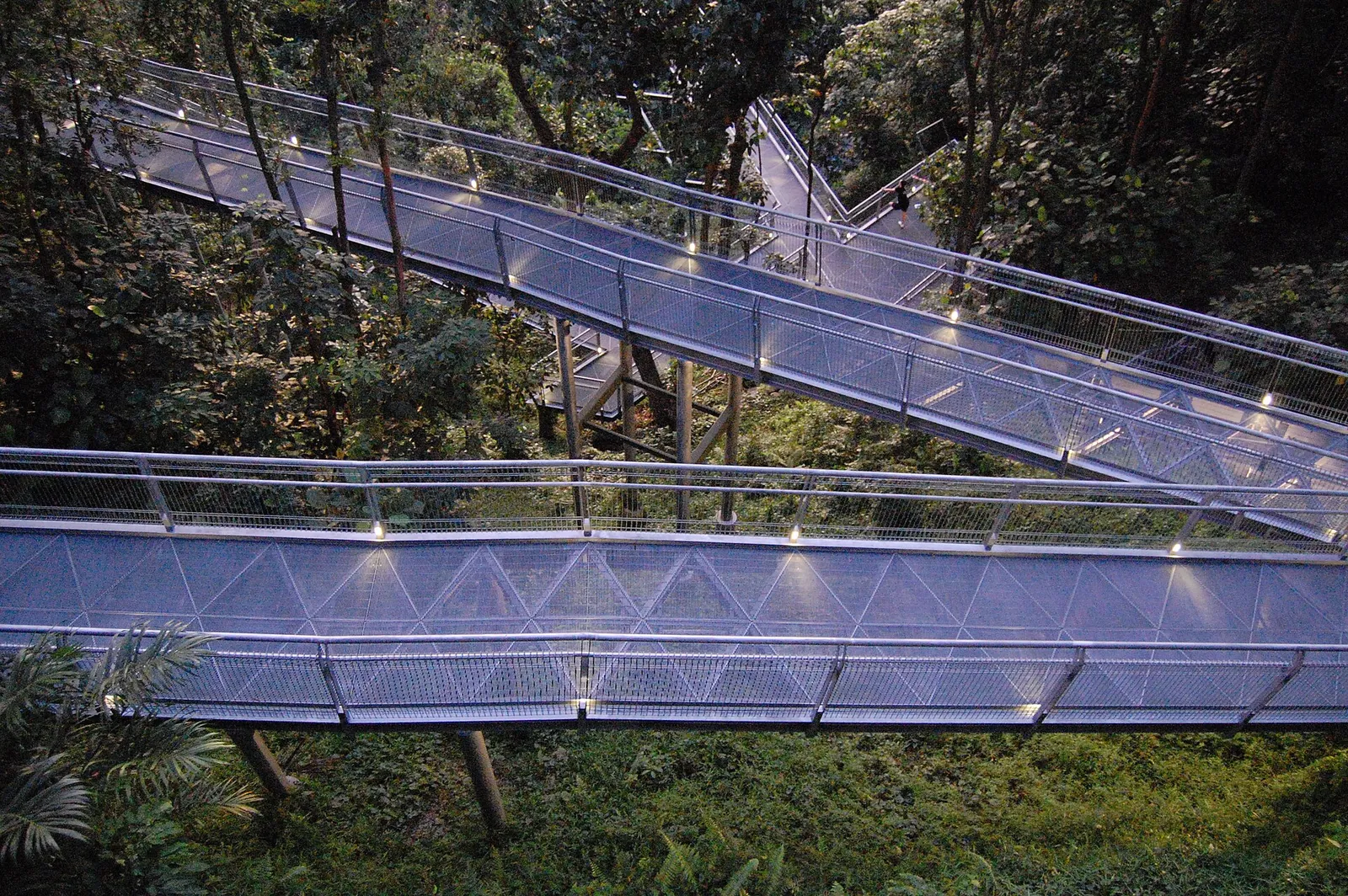
The Forest Walk, photographed historically; check current access.
Photograph: edwin.11 . — opens in a new tab · CC BY 2.0 — opens in a new tab
Changes: Resized and converted to WebP; displayed with responsive crops. · Original photograph and licence details ↗ — opens in a new tab
The Silver Garden at HortPark.
Photograph: kallerna — opens in a new tab · CC BY-SA 4.0 — opens in a new tab
Changes: Resized and converted to WebP; displayed with responsive crops. · Original photograph and licence details ↗ — opens in a new tab
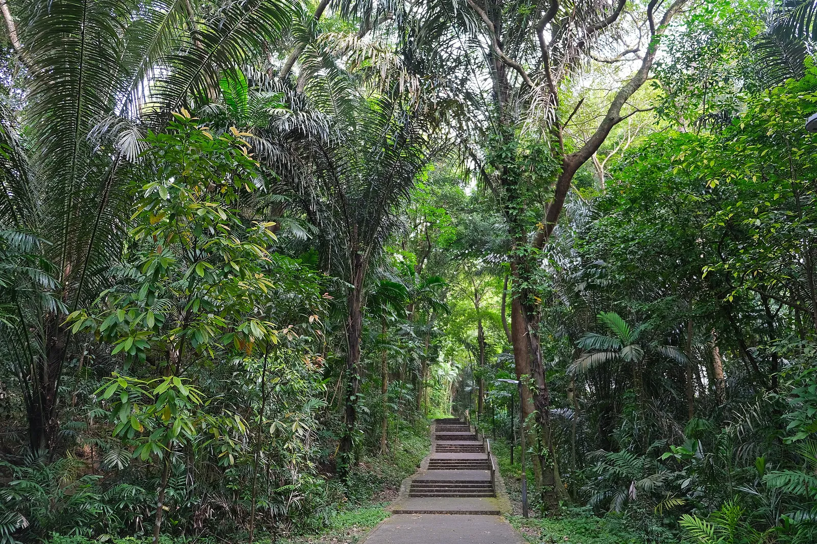
A trail at Mount Faber.
Photograph: kallerna — opens in a new tab · CC BY-SA 4.0 — opens in a new tab
Changes: Resized and converted to WebP; displayed with responsive crops. · Original photograph and licence details ↗ — opens in a new tab